1960s Maps of Chaves County, New Mexico
Explore 59 historic maps of Chaves County from the 1960s. These maps offer a rare glimpse into what life looked like during the 1960s — showing old roads, neighborhoods, homes, and landmarks that have changed or disappeared over time.
Whether you're researching your family's past, planning a metal detecting trip, or studying how Chaves County's landscape evolved across the 1960s, these high-resolution maps are a powerful tool for exploring the history of this region.
- Focus on a specific era: All maps on this page are from the 1960s, giving you a focused view of this time period.
- See what’s changed: Compare century-old streets, trails, and buildings to today's modern landscape using overlays and satellite layers.
- Research with precision: Use these maps for genealogy, historical research, land use analysis, or educational projects.
- View, download, or print: Maps are fully viewable online in high resolution, and can be downloaded or printed for your own records.
Start exploring Chaves County's history through authentic maps from the 1960s. This is your window into the past.
Chaves County, NM maps
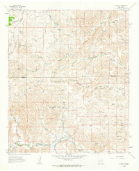
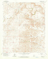
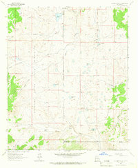
(59)- 1960 Map of Teel Ranch, 1964 Print
 1960 Teel Ranch1964 Print · USGSThe Chaves and Eddy county borderlands in the early sixties reveal a landscape of resilient family ranching and vital water infrastructure. Genealogists and historians can trace holdings like Teel Ranch, Harris Ranch, and the Schauer Landing Strip along the winding Rio Peñasco.
 - 1961 Map of Flying H, 1963 Print
 1961 Flying H1963 Print · USGSHigh-desert ranching culture in the early sixties centers on the cattle-and-water economy of the Flying H region. Genealogists and historians can trace family-named landmarks like Cedar Hill Ranch, Mc Knight Ranch, and the Salt BM House Well.2 unique versions available
 - 1961 Map of Indian Bluff, 1964 Print
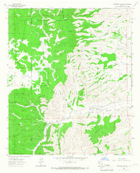
 1961 Indian Bluff1964 Print · USGSRanching life on the Chaves and Lincoln County line is captured in the early sixties, showing a network of remote outposts and vital water improvements. Genealogists and local historians can trace family lands like Corn Ranch and McGee Ranch or locate old camps such as Buck Camp.
 - 1962 Map of Roswell
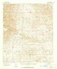
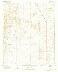
 1962 Roswell1962 Print · USGSSoutheastern New Mexico in the early sixties shows a landscape defined by high mountain peaks and a growing military presence at Roswell. Genealogists and historians can trace the roads connecting Fort Stanton, Capitan, and the Mescalero Apache Indian Reservation.
 - 1962 Map of Brownfield
 1962 Brownfield1962 Print · USGSThe High Plains of Texas and New Mexico are captured in the early sixties as a thriving hub of oil production and ranching. Researchers can trace the industrial footprint of the Levelland and Slaughter Oil and Gas Field or locate smaller towns like Sundown and Littlefield.
 - 1962 Map of Roswell South, 1964 Print
 1962 Roswell South1964 Print · USGSSouthern New Mexico in the early sixties reveals a landscape shaped by military aviation and family-owned ranching. Genealogists and historians can trace property boundaries of the Sacra Farm and Kerr Ranch alongside the sprawling Walker Air Force Base.2 unique versions available
 - 1962 Map of Roswell North, 1964 Print
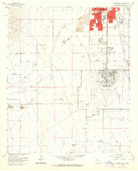
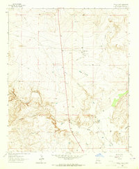
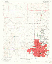 1962 Roswell North1964 Print · USGSRoswell was evolving from a ranching hub into a modern city in the early 1960s. Genealogists and local historians can trace family-named lands like Marley Farm or locate institutional landmarks including the New Mexico Military Institute and St Marys Hospital.3 unique versions available
 - 1962 Map of Dunken, 1964 Print
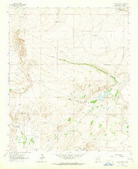
 1962 Dunken1964 Print · USGSDunken and the surrounding Chaves County ranchlands are captured here in the early sixties, as the Rio Peñasco sustained a network of remote family homesteads. Genealogists can trace property roots at the Old Higginbotham Ranch or find the community heart at Peñasco Sch and the Dunken PO.3 unique versions available
 - 1962 Map of South Spring, 1964 Print
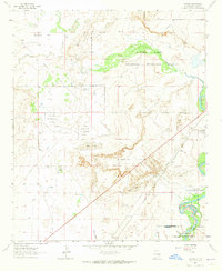
 1962 South Spring1964 Print · USGSChaves County in the early sixties is captured here as a landscape of irrigation canals, military aviation, and riverside ranching. Genealogists and historians can trace the foundations of South Spring Ranch, the rail stop at Orchard Park Station, and the footprint of Walker Air Force Base.2 unique versions available
 - 1962 Map of Horseshoe Bend, 1964 Print
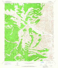
 1962 Horseshoe Bend1964 Print · USGSRanching and water management define this Chaves County landscape during the early sixties as the regional economy centers on the river. Researchers can trace the legacy of family operations at Mennecke Ranch and Nunez Ranch or locate the Francisco Cordova Homestead (Ruins).
 - 1962 Map of Eightmile Draw, 1964 Print
 1962 Eightmile Draw1964 Print · USGSChaves County ranching life is preserved here as it stood in the early sixties along the winding Pecos River. Genealogists and local historians can trace family landholdings like the Circle SE Ranch, Crawford Ranch, and landmarks near Railroad Mountain.3 unique versions available
 - 1962 Map of Rock House Canyon, 1964 Print
 1962 Rock House Canyon1964 Print · USGSHigh desert ranching in Chaves County is captured here in the early sixties, showing a landscape shaped by seasonal water and remote outposts. Researchers can trace historic property footprints at Irwin Corn Ranch, the Macho Ranch, and the Eddleman settlement.2 unique versions available
 - 1962 Map of Bitter Lake, 1964 Print
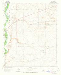
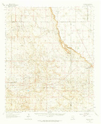
 1962 Bitter Lake1964 Print · USGSEastern Chaves County is shown in the early 1960s as the suburbs of Roswell reached toward the Pecos River wetlands. Researchers can trace the Atchison Topeka and Santa Fe rail line, the St Marys Cem, and the early South Bitter Lake Oil Field.4 unique versions available
 - 1962 Map of Panther Hill, 1965 Print
 1962 Panther Hill1965 Print · USGSChaves County in the early 1960s reveals a working landscape where early space exploration history meets high-desert ranching. Trace the Dr Robert Goddard Original Rocket Tower Site or locate local landmarks like Salt Creek Ch and Panther Hill.2 unique versions available
 - 1962 Map of Acme, 1965 Print
 1962 Acme1965 Print · USGSThe Pecos Valley ranching country comes into focus in the early sixties as the railroad reaches toward the river. Genealogists and historians can locate family landmarks like the Frazier Cem, the settlement of Acme, and old cattle operations including Kitchen Ranch.2 unique versions available
 - 1962 Map of Melena, 1965 Print
 1962 Melena1965 Print · USGSThe Pecos River valley in the early sixties reveals a landscape of high-desert hydrology and rail-driven transport. Genealogists and researchers can trace the routes of the Atchison Topeka and Santa Fe past the settlement of Melena and the pools of Ink Pots.2 unique versions available
 - 1962 Map of Marley Draw, 1965 Print
 1962 Marley Draw1965 Print · USGSChaves County ranching country is mapped here in the early sixties, showing the vital water and transit networks of the high plains. Researchers can locate the Eden Valley Cem, the central Corn Ranch, and topographic markers like Chalk Bluff or Round Top.
 - 1963 Map of Barn Draw, 1964 Print
 1963 Barn Draw1964 Print · USGSChaves County ranching life is captured in the early sixties, showing a landscape of scattered water tanks and draws. Genealogists and historians can locate specific sites like Corn Ranch, Marley Well, and Berts Well.
 - 1963 Map of Coyote Draw, 1964 Print
 1963 Coyote Draw1964 Print · USGSChaves County ranchlands are documented here in the early sixties, showing a landscape defined by desert water sources and cattle infrastructure. Researchers can trace land use through named landmarks like Red Bluff Ranch, Cocklebur Lakes, and Milner Well.2 unique versions available
 - 1963 Map of Cornucopia Canyon, 1965 Print
 1963 Cornucopia Canyon1965 Print · USGSRemote ranching life in Chaves County is captured in the early sixties, showing a landscape defined by desert water management and livestock outposts. Genealogists and historians can trace the operations of Cornucopia Ranch, the Runyan Line Shack, and numerous stock tanks like Lake Tank.
 - 1963 Map of Maljamar, 1965 Print
 1963 Maljamar1965 Print · USGSSoutheast New Mexico’s oil and ranching landscape is captured here in the early sixties, centered on the dramatic rise of The Caprock. Genealogists and historians can trace the footprint of early energy workers at Booker Camp and rural life at Bond Ranch or Youngs.2 unique versions available
 - 1963 Map of Clements Ranch, 1966 Print
 1963 Clements Ranch1966 Print · USGSRanching and tribal lands meet in the high country during the early sixties, showing the vital network of wells and tanks sustaining this arid landscape. Genealogists and historians can trace family-named outposts like Clements Ranch, Pendergrass Wells, and Mc Carty Well along the old Lincoln Road.2 unique versions available
 - 1963 Map of Deadman Lake, 1966 Print
 1963 Deadman Lake1966 Print · USGSHigh-desert ranching and tribal lands meet in the early 1960s along the Otero and Lincoln county lines. Researchers can trace historic water sources and ranch sites like Joyce Ranch, Whitetail Windmill, and Big Flying H Lake.
 - 1963 Map of Robertson Canyon, 1967 Print
 1963 Robertson Canyon1967 Print · USGSSoutheast New Mexico in the early sixties reveals a landscape of high-altitude ranching and rugged drainages along the Chaves and Otero county line. Researchers can locate remote landmarks like the Cox Cem, Jernigan Ranch, and the waters of Gowen Lake.2 unique versions available
 - 1963 Map of Elk, 1967 Print
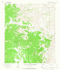
 1963 Elk1967 Print · USGSChaves and Otero counties are captured in the early sixties as ranching and forestry defined the rhythm of life in the southern mountains. Genealogists and historians can trace family roots through the Crockett Ranch, Elk Cemetery, and family-named landmarks like Mathews Canyon.2 unique versions available
Showing maps 1-25 of 59
Top cities of Chaves County
Frequently asked questions
- What are the different types of historical maps available for Chaves County?
- What is the oldest map of Chaves County?
- Where can I purchase historical maps of Chaves County for my home or office?
- Where can I download high-res historical maps of Chaves County?
- Are there historical topographic maps available for Chaves County?
- Is there historical aerial imagery available for Chaves County?
- Where are historical maps of Chaves County sourced from?