1940s Maps of Chaves County, New Mexico
Explore 10 historic maps of Chaves County from the 1940s. These maps offer a rare glimpse into what life looked like during the 1940s — showing old roads, neighborhoods, homes, and landmarks that have changed or disappeared over time.
Whether you're researching your family's past, planning a metal detecting trip, or studying how Chaves County's landscape evolved across the 1940s, these high-resolution maps are a powerful tool for exploring the history of this region.
- Focus on a specific era: All maps on this page are from the 1940s, giving you a focused view of this time period.
- See what’s changed: Compare century-old streets, trails, and buildings to today's modern landscape using overlays and satellite layers.
- Research with precision: Use these maps for genealogy, historical research, land use analysis, or educational projects.
- View, download, or print: Maps are fully viewable online in high resolution, and can be downloaded or printed for your own records.
Start exploring Chaves County's history through authentic maps from the 1940s. This is your window into the past.
Chaves County, NM maps
(10)- 1949 Map of Sardine Mountain
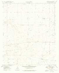
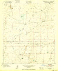 1949 Sardine Mountain1949 Print · USGSChaves County ranching and military history converge in the desert landscape of the late 1940s. Researchers can trace the water infrastructure of the L-E Ranch or locate the Air Force Bombing Range (Aban'd) and the unique Devils Race Track.2 unique versions available
 - 1949 Map of Wade Ranch
 1949 Wade Ranch1949 Print · USGSChaves County ranching lands are captured here in the late 1940s, showing the intersection of livestock operations and early oil exploration. Researchers can trace the Old Pipeline Road and find remote water sources like Horse Pasture Tank and Annaya Well.2 unique versions available
 - 1949 Map of Hondo Reservoir
 1949 Hondo Reservoir1949 Print · USGSChaves County's high desert landscape appears in the late 1940s as a study in water management and ancient history. Local researchers can trace the Hondo Reservoir and Hondo Irrigation Project alongside the Missouri Plaza Indian Ruins.2 unique versions available
 - 1949 Map of Peters Lake
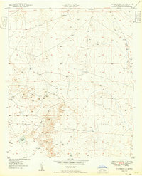
 1949 Peters Lake1949 Print · USGSThe high plains of Chaves County are seen here in the late 1940s as military aviation and ranching shaped the New Mexico landscape. Genealogists and historians can locate family landmarks like Jenkins Ranch or trace the early military history of Walker Air Base Auxiliary Landing Field No 1.2 unique versions available
 - 1949 Map of Roswell North
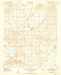
 1949 Roswell North1949 Print · USGSPost-war Roswell was a growing aviation and educational hub at the edge of the Pecos Valley. Genealogists and local historians can trace the foundations of the city through the New Mexico Military Institute, the Poor Clares Monastery, and outlying family sites like the Forsite Homestead.
 - 1949 Map of Roswell South
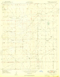
 1949 Roswell South1949 Print · USGSThe southern periphery of Roswell is captured here in the late 1940s, showcasing a landscape shaped by the Rio Hondo and early ranching. Genealogists and historians can trace family landmarks like Mayes Ranch and schools like Mountain View Sch.
 - 1949 Map of Malstrom Ranch
 1949 Malstrom Ranch1949 Print · USGSChaves County ranching and military history are preserved here just after World War II. Researchers can locate remote water sources like Chuck Box Well and Douthett Tank or trace the perimeter of the Air Force Bombing Range.
 - 1949 Map of Juan Lake
 1949 Juan Lake1949 Print · USGSChaves County ranching and military history meet on the arid plains of the late 1940s. Researchers can locate named water sources like Humphrys Well and Haney Well or trace the early footprint of Walker Air Base Auxiliary Landing Field No 1.
 - 1949 Map of L-E Ranch, 1976 Print
 1949 L-E Ranch1976 Print · USGSChaves County ranching lands are captured here in the late 1940s, highlighting the isolated outposts of this arid landscape. Researchers can trace historic property markers and water infrastructure including the L-E Ranch, Petty Windmill, and Arroyo Long.2 unique versions available
 - 1949 Map of Corn Ranch, 1977 Print
 1949 Corn Ranch1977 Print · USGSRanching life in Chaves County is captured here just after the war, showing the essential water and road networks of the high plains. Researchers can trace the layout of Corn Ranch and the isolated landmarks that defined the local geography during this era.
End of results
Showing maps 1-10 of 10
Top cities of Chaves County
Frequently asked questions
- What are the different types of historical maps available for Chaves County?
- What is the oldest map of Chaves County?
- Where can I purchase historical maps of Chaves County for my home or office?
- Where can I download high-res historical maps of Chaves County?
- Are there historical topographic maps available for Chaves County?
- Is there historical aerial imagery available for Chaves County?
- Where are historical maps of Chaves County sourced from?