Old Maps of Colfax County, New Mexico for Metal Detecting
Plan your next treasure hunt with 465 historic maps of Colfax County. Find old homesites, ghost towns, trails, and gathering spots that may be lost to time — perfect for identifying promising metal detecting locations.
- Locate forgotten sites: Uncover places like long-lost settlements, abandoned rail lines, or gathering spots.
- Plan better hunts: Use map overlays combined with LiDAR or satellite views to narrow in on historically rich areas.
- Made for detectorists: Thousands of hobbyists use these maps to discover relics, coins, and hidden history.
Use these historic maps to boost your research and find new opportunities beneath the surface of Colfax County.
Colfax County, NM maps
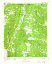
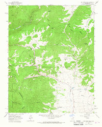
(465)- 1912 Map of Raton, 1958 Print
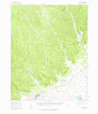
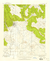 1912 Raton1958 Print · USGSRaton and the high mesas of the Colorado-New Mexico border are captured here just as the railroad era reached its peak. Researchers can trace the early industrial landscape of coal towns like Gardiner and Blossburg or locate the historic Clifton House and Raton Tunnel.2 unique versions available
 - 1914 Map of Raton
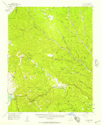
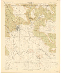 1914 Raton1914 Print · USGSRaton served as a vital mountain gateway during the early twentieth century as railroads and early highways crested the Colorado border. Researchers can trace the industrial spurs of the Wagon Mine or locate vanished stops like Blossburg, Gardiner, and Clifton House.5 unique versions available
 - 1915 Map of Brilliant
 1915 Brilliant1915 Print · USGSColfax County, New Mexico, was a hub of coal and rail activity in the years before the Great War. Researchers can trace the spur lines of the Atchison Topeka and Santa Fe into mining camps like Brilliant and Van Houten.3 unique versions available
 - 1915 Map of Koehler, 1966 Print
 1915 Koehler1966 Print · USGSColfax County at the height of its rail and ranching era reveals a landscape of massive land grants and early irrigation systems. Genealogists can trace family connections to ranching outposts like Crow Creek Ranch or early schools such as Red River School and Grand Valley School.
 - 1917 Map of Koehler
 1917 Koehler1917 Print · USGSColfax County at the time of the Great War shows a transition from high desert canyons to a landscape transformed by large-scale ranching and irrigation. Genealogists and historians can trace the foundations of Maxwell, the cattle operations of C S Ranch, and early rural education at Red River School.2 unique versions available
 - 1954 Map of Raton, 1963 Print
 1954 Raton1963 Print · USGSNorthern New Mexico's high-country and plains are documented here in the early sixties, showing the region's ranching and mining infrastructure. Trace the legacy of the Maxwell Land Grant, locate remote rural sites like Tafoya School, and follow the Atchison Topeka and Santa Fe Railway through the heart of Raton.3 unique versions available
 - 1955 Map of Cimarron
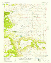
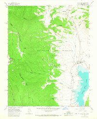
 1955 Cimarron1955 Print · USGSNorthern New Mexico's ranching and mining heartland is captured here in the mid-fifties, centered on the historic Maxwell Grant. Researchers can trace early infrastructure like the Old Railroad Grade and Dawson Trail, or locate the Umbrella Mine near Dawson.3 unique versions available
 - 1955 Map of Ute Park, 1957 Print
 1955 Ute Park1957 Print · USGSColfax County in the mid-1950s shows a landscape of storied land grants and high-country mining. You can trace the legacy of the Maxwell Grant and locate old workings at the Aztec Mine or the historic Virginia City site.5 unique versions available
 - 1956 Map of Tooth Of Time
 1956 Tooth Of Time1956 Print · USGSThe high Sangre de Cristo foothills come alive in the mid-fifties, featuring the early development of the Philmont Scout Ranch. Trace the old trails and backcountry outposts like Cyphers Mine Trail Camp, the Old Cartwright Mill Site, and Old Abreu Lodge.4 unique versions available
 - 1956 Map of Miami, 1957 Print
 1956 Miami1957 Print · USGSColfax County ranch lands and scout camps come into focus in the mid-1950s, showing the intersection of the Maxwell Grant and early tourism. Trace local genealogy and landmarks at Miami, the Sacred Heart Ch, and the historic Philmont Scout Ranch.4 unique versions available
 - 1958 Map of Raton
 1958 Raton1958 Print · USGSNorthern New Mexico and the Colorado borderlands are mapped here in the late fifties, showcasing a landscape of high peaks and historic land grants. Genealogists and historians can trace families across Picuris Pueblo, find old schoolhouses like Piedra Lumbre School, or follow the Atchison Topeka and Santa Fe rail line.3 unique versions available
 - 1962 Map of Ash Mountain, 1964 Print
 1962 Ash Mountain1964 Print · USGSThe Sangre de Cristo Mountains and the historic Maxwell Land Grant are captured here in the early sixties. Researchers can trace high-altitude ranching and mining history through sites like the Van Lint Mine, Penatlor Ruins, and family-named landmarks like Banning Place.3 unique versions available
 - 1962 Map of Casa Grande, 1965 Print
 1962 Casa Grande1965 Print · USGSThe Maxwell land grant area of Colfax County is shown in the early sixties as a rugged network of ranching camps and old timber routes. Researchers can locate the Catskill (Site), trace the Old Railroad Grade, and find historic Charcoal Kilns.2 unique versions available
 - 1963 Map of Wheeler Peak, 1967 Print
 1963 Wheeler Peak1967 Print · USGSThe Sangre de Cristo Mountains rise to their highest New Mexico point in the early 1960s, revealing a landscape of high-altitude mining and wilderness. Trace the old mining operations at Twining and the Bull of the Woods Pasture Mines or locate remote outposts like Ditch Cabin.2 unique versions available
 - 1963 Map of Eagle Nest, 1967 Print
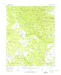
 1963 Eagle Nest1967 Print · USGSThe Moreno Valley and the Sangre de Cristo high country come into focus during the early sixties, centered on the waters of Eagle Nest Lake. Local historians can trace the Maxwell Grant boundaries and find remote sites like the Klondike Mine and Idlewild.3 unique versions available
 - 1963 Map of Red River Pass, 1967 Print
 1963 Red River Pass1967 Print · USGSHigh in the Sangre de Cristo range during the early sixties, this area shows a landscape of mountain passes and mining history. Researchers can locate remote high-altitude sites like Memphis, explore mines near Bitter Creek, and trace the early roads through Red River Pass.2 unique versions available
 - 1964 Map of Stony Lake, 1966 Print
 1964 Stony Lake1966 Print · USGSThe high plateau of Mora and Colfax counties comes to life in the mid-1960s, showing a landscape defined by ranching and historic passage. Researchers can trace the legendary Santa Fe Trail and locate family-owned landmarks like the Red River Ranch near Ocate Creek.
 - 1964 Map of Colmor, 1966 Print
 1964 Colmor1966 Print · USGSMora County ranching and rail activity are captured here in the mid-sixties, dominated by the Atchison Topeka and Santa Fe corridor. Researchers can trace local roots at the Sweetwater Cem or locate the old stations at Colmor and Nolan.
 - 1964 Map of Pinon Hills, 1967 Print
 1964 Pinon Hills1967 Print · USGSColfax County's high plains and rugged uplands are captured here in the mid-1960s, showing the intersection of historic land grants and modern transport. Trace the legacy of the Beaubien and Miranda (Maxwell) grant alongside the Atchison Topeka and Santa Fe railroad and the Charette Lake Canal.
 - 1965 Map of Sauble Circle Dot Ranch, 1967 Print
 1965 Sauble Circle Dot Ranch1967 Print · USGSRanching life in Colfax County is captured here in the mid-sixties, showing an era of open grazing and isolated homesteads. Researchers can locate family-named landmarks like Sauble Circle Dot Ranch, Langely Ranch, and the Jumping Divide.
 - 1965 Map of Abbott NW, 1967 Print
 1965 Abbott NW1967 Print · USGSColfax County's high plains and land grant territories are captured here in the mid-1960s, showing a landscape defined by water and ranching. Researchers can trace the winding Rio del Plano and locate landmarks like the Drill Hole or Alkali Arroyo across the historic Beaubien and Maxwell grant.
 - 1965 Map of French, 1967 Print
 1965 French1967 Print · USGSColfax County's high plains landscape is captured in the mid-1960s, showing the intersection of rail history and river systems. Genealogists and historians can trace the tracks of the Atchison Topeka and Santa Fe through French or locate the State Boys School and local Cemetery.
 - 1965 Map of Springer Lake, 1967 Print
 1965 Springer Lake1967 Print · USGSColfax County's ranching and irrigation systems are frozen in time here during the mid-sixties. Researchers can trace the massive Beaubien and Miranda (Maxwell) grant boundaries alongside the TX Ranch and the A T & S F Ry rail line.
 - 1965 Map of Taylor Springs, 1967 Print
 1965 Taylor Springs1967 Print · USGSNorthern New Mexico in the mid-1960s reveals a landscape defined by historic routes and river valleys. Researchers can trace the Santa Fe Trail as it crosses Chico Creek and locate early sites like Taylor Springs and a remote Cem.
 - 1965 Map of Abbott, 1967 Print
 1965 Abbott1967 Print · USGSColfax County's high plains ranching country is captured here in the mid-1960s as a landscape of historic transit and seasonal water. Genealogists and historians can trace the path of the SANTA FE TRAIL and locate the Abbott Cem or the basin of East Lake.
Showing maps 1-25 of 465
Top cities of Colfax County
- Raton historical maps
- Angel Fire historical maps
- Springer historical maps
- Cimarron historical maps
- Eagle Nest historical maps
Frequently asked questions
- What are the different types of historical maps available for Colfax County?
- What is the oldest map of Colfax County?
- Where can I purchase historical maps of Colfax County for my home or office?
- Where can I download high-res historical maps of Colfax County?
- Are there historical topographic maps available for Colfax County?
- Is there historical aerial imagery available for Colfax County?
- Where are historical maps of Colfax County sourced from?