1980s Maps of Lincoln County, New Mexico
Explore 78 historic maps of Lincoln County from the 1980s. These maps offer a rare glimpse into what life looked like during the 1980s — showing old roads, neighborhoods, homes, and landmarks that have changed or disappeared over time.
Whether you're researching your family's past, planning a metal detecting trip, or studying how Lincoln County's landscape evolved across the 1980s, these high-resolution maps are a powerful tool for exploring the history of this region.
- Focus on a specific era: All maps on this page are from the 1980s, giving you a focused view of this time period.
- See what’s changed: Compare century-old streets, trails, and buildings to today's modern landscape using overlays and satellite layers.
- Research with precision: Use these maps for genealogy, historical research, land use analysis, or educational projects.
- View, download, or print: Maps are fully viewable online in high resolution, and can be downloaded or printed for your own records.
Start exploring Lincoln County's history through authentic maps from the 1980s. This is your window into the past.
Lincoln County, NM maps
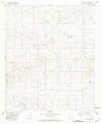
(78)- 1980 Map of Corona, 1981 Print
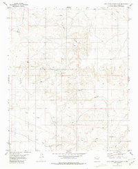
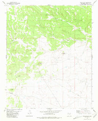
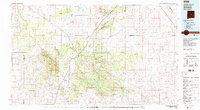 1980 Corona1981 Print · USGSThe high-desert ranching and rail country of Lincoln County is documented here during the early eighties. Genealogists and local historians can trace the Southern Pacific line through Corona, locate the Old Railroad Grade, and find remote outposts like Claunch and Gallinas.
 - 1981 Map of Gallo Spring Canyon
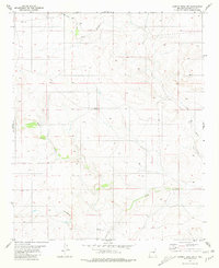
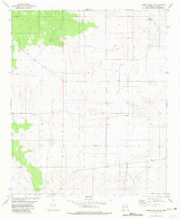
 1981 Gallo Spring Canyon1981 Print · USGSLincoln County rangeland and desert canyons are meticulously detailed in this early 1980s survey. Genealogists and researchers can trace land features like Gallo Spring, Rattlesnake Hill, and the remote Jeep Trail across this arid terrain.
 - 1981 Map of Loco Draw
 1981 Loco Draw1981 Print · USGSLincoln County ranch lands are captured here in the early 1980s, showing a landscape defined by water management and open range. Researchers can trace the layout of the Mile High Ranch and locate remote livestock features like Barvel Lake and Twin Windmills.
 - 1981 Map of Cowboy Mesa NE
 1981 Cowboy Mesa NE1981 Print · USGSLincoln County ranching life in the late twentieth century was defined by isolated outposts and high-desert water management. Researchers can trace family-named landmarks and essential infrastructure like Kuykendall Well, the local Cem, and Ditch Lake.
 - 1981 Map of Rough Mountain
 1981 Rough Mountain1981 Print · USGSLincoln County mining and ranching are documented here during the early eighties, centered on the high ridges of the Cibola National Forest. Researchers can trace railroad history along the Southern Pacific and locate family sites near Gallinas, the Cem, or the Corona Queen Mine.
 - 1981 Map of Capitan Pass
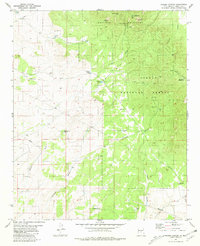
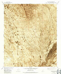
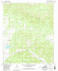 1981 Capitan Pass1981 Print · USGSThe Lincoln National Forest and Capitan Mountains appear here in the early eighties as a rugged landscape of deep canyons and mountain springs. Researchers can trace remote history through the Griego Cem, the settlement at Double Crossing, and numerous jeep trails through Rio Bonito.2 unique versions available
 - 1981 Map of Pedernal Arroyo
 1981 Pedernal Arroyo1981 Print · USGSLincoln County ranching country is captured here in the early eighties, defined by its complex network of desert washes. Trace the paths of Pedernal Arroyo and Arroyo del Macho or locate historic watering spots like Old Hogadero Well.
 - 1981 Map of Gacho Hill SW
 1981 Gacho Hill SW1981 Print · USGSThe high desert of Lincoln and Guadalupe counties is captured here in the early eighties, showing a landscape shaped by water and ranching. Researchers can locate remote watering points like Shinery Well and Boggie Well or trace the early path of a local Pipeline.
 - 1981 Map of Progresso SW
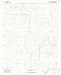
 1981 Progresso SW1981 Print · USGSHigh desert ranching in Torrance County comes into focus during the early eighties as the borders of three counties meet. Genealogists and historians can locate isolated ranching outposts like Atkinson Ranch and essential water features such as Wire Lake or Three Way Well.
 - 1981 Map of Camaleon Draw West
 1981 Camaleon Draw West1981 Print · USGSIn the early 1980s, the border between Torrance and Lincoln counties was a landscape of high mesas and isolated water wells. Trace the remote history of this desert region through landmarks like Trinchera Mesa, Little Five Wire Well, and Cola.
 - 1981 Map of Polecat Draw
 1981 Polecat Draw1981 Print · USGSCentral New Mexico ranching land in the early 1980s reveals a landscape of necessity along the Socorro and Lincoln County border. Researchers can trace vital water sources like Johnson Tank and Sacate Well amidst the winding paths of Polecat Draw.
 - 1981 Map of Pajaro Canyon
 1981 Pajaro Canyon1981 Print · USGSLincoln County, New Mexico, is shown here in the early eighties as a rugged territory of mountain peaks and essential water wells. Researchers can trace land use through landmarks like School Section Windmill, the Landing Strip, and high-country Mines.
 - 1981 Map of Camaleon Draw East
 1981 Camaleon Draw East1981 Print · USGSRanching life in central New Mexico is documented here in the early 1980s, centered on the tri-county intersection and vital water sources. Trace historical livestock infrastructure through sites like Telephone Lake, Old Five Wire Well, and Rivera Well.
 - 1981 Map of Huff Hill
 1981 Huff Hill1981 Print · USGSLincoln County ranching country is captured here in the early eighties, showcasing a landscape shaped by seasonal water management and desert navigation. Researchers can trace the network of vital water sources including South Well, Huff Tank, and the Double Windmills.
 - 1981 Map of Cowboy Mesa SW
 1981 Cowboy Mesa SW1981 Print · USGSLincoln County’s arid mesa country is documented here in the late seventies, showing a landscape defined by seasonal watercourses. Researchers can trace the paths of Arroyo del Gallo, Hackberry Draw, and find the location of a local Gravel Pit.
 - 1981 Map of Cowboy Mesa
 1981 Cowboy Mesa1981 Print · USGSLincoln County’s high mesa country is captured in the early eighties, showing a landscape shaped by ranching and natural drainage. Trace the names of essential water sources like Arroyo Gallo, Clarence Tank, and Buck Tank across the terrain.
 - 1981 Map of Little Black Peak
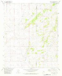
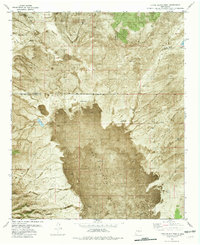 1981 Little Black Peak1981 Print · USGSThe Tularosa Basin in the early 1980s reveals a harsh yet managed landscape centered on the massive basalt flows of The Malpais. Local historians can trace ranching infrastructure through family-named sites like Brock Ranch and critical water points such as Duck Lake and the Malpais Windmill.2 unique versions available
 - 1981 Map of Gacho Hill SE
 1981 Gacho Hill SE1981 Print · USGSNew Mexico's high-desert ranching country is captured here in the early 1980s as the state managed water and energy across the county line. Researchers can trace land use through named features like Roadrunner Ranch, Manzanita Lake, and Mc Lemore Well.
 - 1981 Map of Juan Largo Canyon East
 1981 Juan Largo Canyon East1981 Print · USGSLincoln County ranching life is documented here in the early 1980s, showcasing the remote desert canyons and essential water infrastructure of the day. Researchers can locate family landmarks like Corn Ranch and water sources such as Lower Windmill and Ingram Windmill.
 - 1981 Map of Encinoso
 1981 Encinoso1981 Print · USGSLincoln County ranching and forest lands are captured here during the early 1980s as they reach toward the high peaks. Researchers can locate the Encinoso settlement and Las Tablas, alongside family-named landmarks like Block Ranch and Minckey Ridge.
 - 1981 Map of Bull Gap SW
 1981 Bull Gap SW1981 Print · USGSLincoln County ranching history meets Cold War military infrastructure in the early eighties. Trace the desert landscape from Dillard Tank to the Oscura Range Center and the volcanic reaches of The Malpais.
 - 1981 Map of Kyle Harrison Canyon
 1981 Kyle Harrison Canyon1981 Print · USGSLincoln County in the early eighties shows a rugged landscape of national forest and seasonal watersheds. Genealogists and hikers can trace old routes along the Pack Trail and locate family landmarks like Kyle Harrison Spring and Pleasant View Cem.
 - 1981 Map of Tecolote Peak
 1981 Tecolote Peak1981 Print · USGSLincoln County’s high-desert terrain is captured here in the early 1980s, showcasing a landscape of utility corridors and water management. Researchers can trace the Southern Pacific rail line and locate ranching infrastructure like Victoriana Tank and the Lincoln Pumping Sta.
 - 1981 Map of Pelon Hill
 1981 Pelon Hill1981 Print · USGSLincoln County ranching country is captured here in the early eighties, showing a landscape defined by high ridges and deep canyon drainages. Researchers can trace land use through features like Lovelace Ranch, the isolated Landing Strip, and the summits of Pelon Hill and Monte Alto.
 - 1981 Map of Cowboy Mesa NW
 1981 Cowboy Mesa NW1981 Print · USGSThe Lincoln County high desert appears in the early eighties as a landscape of remote ranching outposts and ephemeral drainages. Researchers can locate specific water sources like Middle Well and Arroyo del Gallo alongside the original township lines.
Showing maps 1-25 of 78
Top cities of Lincoln County
- Ruidoso historical maps
- Alto historical maps
- Ruidoso Downs historical maps
- Capitan historical maps
- Carrizozo historical maps
- Corona historical maps
Frequently asked questions
- What are the different types of historical maps available for Lincoln County?
- What is the oldest map of Lincoln County?
- Where can I purchase historical maps of Lincoln County for my home or office?
- Where can I download high-res historical maps of Lincoln County?
- Are there historical topographic maps available for Lincoln County?
- Is there historical aerial imagery available for Lincoln County?
- Where are historical maps of Lincoln County sourced from?