1960s Maps of Lincoln County, New Mexico
Explore 17 historic maps of Lincoln County from the 1960s. These maps offer a rare glimpse into what life looked like during the 1960s — showing old roads, neighborhoods, homes, and landmarks that have changed or disappeared over time.
Whether you're researching your family's past, planning a metal detecting trip, or studying how Lincoln County's landscape evolved across the 1960s, these high-resolution maps are a powerful tool for exploring the history of this region.
- Focus on a specific era: All maps on this page are from the 1960s, giving you a focused view of this time period.
- See what’s changed: Compare century-old streets, trails, and buildings to today's modern landscape using overlays and satellite layers.
- Research with precision: Use these maps for genealogy, historical research, land use analysis, or educational projects.
- View, download, or print: Maps are fully viewable online in high resolution, and can be downloaded or printed for your own records.
Start exploring Lincoln County's history through authentic maps from the 1960s. This is your window into the past.
Lincoln County, NM maps
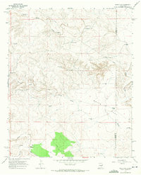
(17)- 1961 Map of Flying H, 1963 Print
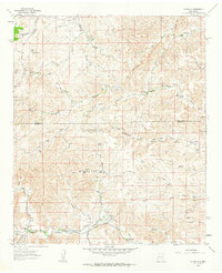 1961 Flying H1963 Print · USGSHigh-desert ranching culture in the early sixties centers on the cattle-and-water economy of the Flying H region. Genealogists and historians can trace family-named landmarks like Cedar Hill Ranch, Mc Knight Ranch, and the Salt BM House Well.2 unique versions available
 - 1961 Map of Lincoln, 1964 Print
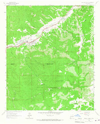
 1961 Lincoln1964 Print · USGSThe valleys of the Bonito and Ruidoso rivers come alive in this early 1960s survey of south-central New Mexico. Genealogists can trace family holdings and local landmarks like San Patricio, Glencoe, and the Le Roy McKnight Ranch.
 - 1961 Map of Indian Bluff, 1964 Print
 1961 Indian Bluff1964 Print · USGSRanching life on the Chaves and Lincoln County line is captured in the early sixties, showing a network of remote outposts and vital water improvements. Genealogists and local historians can trace family lands like Corn Ranch and McGee Ranch or locate old camps such as Buck Camp.
 - 1961 Map of Tinnie, 1964 Print
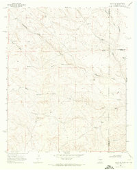
 1961 Tinnie1964 Print · USGSRanching life and riverbank settlements define this Lincoln County landscape in the early sixties. Researchers can trace family holdings like Nelson Ranch and Purcell Ranch or locate the old Cem at Tinnie and Picacho along the Rio Hondo.2 unique versions available
 - 1962 Map of Roswell
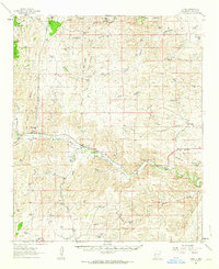
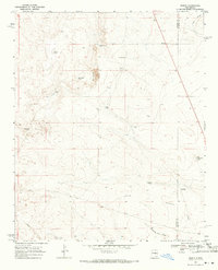
 1962 Roswell1962 Print · USGSSoutheastern New Mexico in the early sixties shows a landscape defined by high mountain peaks and a growing military presence at Roswell. Genealogists and historians can trace the roads connecting Fort Stanton, Capitan, and the Mescalero Apache Indian Reservation.
 - 1962 Map of Horseshoe Bend, 1964 Print
 1962 Horseshoe Bend1964 Print · USGSRanching and water management define this Chaves County landscape during the early sixties as the regional economy centers on the river. Researchers can trace the legacy of family operations at Mennecke Ranch and Nunez Ranch or locate the Francisco Cordova Homestead (Ruins).
 - 1963 Map of Fort Stanton, 1966 Print
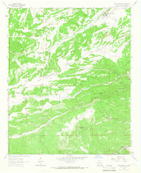 1963 Fort Stanton1966 Print · USGSThe Lincoln County high country is captured here in the early 1960s, showing the intersection of military history and mountain ranching. Trace the grounds of Fort Stanton, the San Ysidro Ch and Cem, and the high reaches of the Lincoln National Forest.2 unique versions available
 - 1963 Map of Deadman Lake, 1966 Print
 1963 Deadman Lake1966 Print · USGSHigh-desert ranching and tribal lands meet in the early 1960s along the Otero and Lincoln county lines. Researchers can trace historic water sources and ranch sites like Joyce Ranch, Whitetail Windmill, and Big Flying H Lake.
 - 1963 Map of Ruidoso Downs, 1967 Print
 1963 Ruidoso Downs1967 Print · USGSRuidoso Downs in the early sixties sits at the intersection of forest and reservation lands as the valley begins to develop. Genealogists and historians can trace family-named sites like Herrera Lane and find landmarks like the Drive-in Theater or Baston Spring.2 unique versions available
 - 1963 Map of Ruidoso, 1967 Print
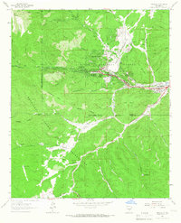 1963 Ruidoso1967 Print · USGSRuidoso and the surrounding mountain canyons are shown here in the early sixties, as recreation and infrastructure expanded in the Lincoln National Forest. Researchers can trace old mountain roads and landmarks like Forest Lawn Cem, the Drive-in Theater, and Jose Second Dam No 1.3 unique versions available
 - 1963 Map of Angus, 1967 Print
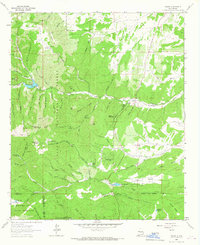 1963 Angus1967 Print · USGSLincoln County mountain life in the early sixties centers on high-altitude ranching and the critical waters of the Rio Bonito. Genealogists and researchers can trace family-named sites like Loma Grande Ranch, find the Coal Mine at Little Creek, and locate Eagle Creek Lodge.4 unique versions available
 - 1967 Map of North Lake, 1971 Print
 1967 North Lake1971 Print · USGSLincoln County ranchlands are captured here in the late sixties as the high desert economy relied on scattered water tanks and remote outposts. Researchers can trace land use through family-named sites like McNally Ranch, Lafferty Well, and Johnson Ranch.2 unique versions available
 - 1967 Map of White Flat, 1971 Print
 1967 White Flat1971 Print · USGSLincoln County ranching country is documented here in the late sixties, showing the vital water systems of the high desert. Researchers can trace historic property boundaries and water rights at Middle Arroyo Ranch, White Flat Ranch, and Miller Well No 1.2 unique versions available
 - 1967 Map of Chivata Canyon, 1971 Print
 1967 Chivata Canyon1971 Print · USGSLincoln County ranchlands are captured here in the late sixties, showing a high-desert landscape defined by water tanks and remote outposts. Researchers can trace the path of the Old Military Road and locate sites like the Circle F Ranch and Antelope Wells.
 - 1967 Map of Elsie Canyon, 1971 Print
 1967 Elsie Canyon1971 Print · USGSNew Mexico's high desert ranchlands are captured here in the late sixties, showing the remote border between Lincoln and Chaves counties. Genealogists and historians can locate legacy homesteads like Salt Creek Ranch and trace the vital water sources at Antelope Lake and Sand Windmill.
 - 1967 Map of Ramon, 1971 Print
 1967 Ramon1971 Print · USGSRanching life on the high plains of Lincoln County was defined by water and isolation in the late sixties. Researchers can trace the legacy of families at the Simpson Ranch, Merritt Ranch, and Ramon, or locate remote water sites like Corona Well and Schoolhouse Tank.2 unique versions available
 - 1967 Map of Ramon SW, 1971 Print
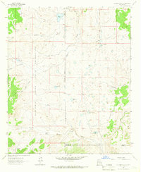
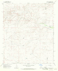
 1967 Ramon SW1971 Print · USGSRanching life on the New Mexico high plains is recorded here in the late sixties, where Lincoln, De Baca, and Chaves counties converge. Local history researchers can trace water rights and grazing outposts through features like West Camp, Shearing Shed Camp, and Old Ball Well.2 unique versions available
End of results
Showing maps 1-17 of 17
Top cities of Lincoln County
- Ruidoso historical maps
- Alto historical maps
- Ruidoso Downs historical maps
- Capitan historical maps
- Carrizozo historical maps
- Corona historical maps
Frequently asked questions
- What are the different types of historical maps available for Lincoln County?
- What is the oldest map of Lincoln County?
- Where can I purchase historical maps of Lincoln County for my home or office?
- Where can I download high-res historical maps of Lincoln County?
- Are there historical topographic maps available for Lincoln County?
- Is there historical aerial imagery available for Lincoln County?
- Where are historical maps of Lincoln County sourced from?