Old Maps of Mora County, New Mexico for Metal Detecting
Plan your next treasure hunt with 342 historic maps of Mora County. Find old homesites, ghost towns, trails, and gathering spots that may be lost to time — perfect for identifying promising metal detecting locations.
- Locate forgotten sites: Uncover places like long-lost settlements, abandoned rail lines, or gathering spots.
- Plan better hunts: Use map overlays combined with LiDAR or satellite views to narrow in on historically rich areas.
- Made for detectorists: Thousands of hobbyists use these maps to discover relics, coins, and hidden history.
Use these historic maps to boost your research and find new opportunities beneath the surface of Mora County.
Mora County, NM maps
(342)- 1889 Map of Las Vegas, 1953 Print
 1889 Las Vegas1953 Print · USGSNorthern New Mexico in the late nineteenth century is documented here as the railroad brought new life to the high plains. Researchers can trace the early layout of Las Vegas, find the strategic site of Fort Union, and locate vanished plazas like Loma Parda.
 - 1889 Map of Santa Fe, 1963 Print
 1889 Santa Fe1963 Print · USGSSanta Fe and the surrounding high country appear here in the late nineteenth century as the railroad began transforming the territory. Genealogists and historians can trace early settlements like Santuario, identify family sites at Gonzales Ranch, and locate the historic Old Fort Marcy.
 - 1891 Map of Las Vegas
 1891 Las Vegas1891 Print · USGSNorthern New Mexico's transition from frontier outposts to a rail-connected territory is visible in this survey from the late nineteenth century. Genealogists and historians can trace the foundations of Las Vegas and its connection to Fort Union and Hot Springs.
 - 1892 Map of Watrous
 1892 Watrous1892 Print · USGSNortheastern New Mexico comes into focus during the expansion of the western frontier, showing the critical junction of the railroad and the river. Trace nineteenth-century ranching life and travel stops at Watrous, the O. K. Ranch, and a remote Blacksmith Shop.
 - 1893 Map of Las Vegas
 1893 Las Vegas1893 Print · USGSSan Miguel and Mora counties are captured here in the final decade of the nineteenth century as the railroad transformed the territory. Trace early travel routes through Las Vegas and locate historic outposts like Fort Union and La Cueva.5 unique versions available
 - 1894 Map of Watrous
 1894 Watrous1894 Print · USGSNorthern New Mexico at the end of the nineteenth century was a landscape of pioneering rail lines and cattle ranches. You can trace the Atchison Topeka and Santa Fe Railroad as it services Watrous and Shoemaker or locate the remote O.K. Ranch.5 unique versions available
 - 1894 Map of Santa Fe
 1894 Santa Fe1894 Print · USGSSanta Fe and its surrounding high-country villages appear here during the territorial era of the late nineteenth century. Genealogists and historians can trace the routes of early railroads and locate specific landmarks like Old Fort Marcy, Gonzales Ranch, and Tesuque Pueblo.5 unique versions available
 - 1954 Map of Santa Fe, 1963 Print
 1954 Santa Fe1963 Print · USGSNew Mexico's high mountains and eastern plains meet in the mid-fifties, showing a landscape defined by the Sangre de Cristo Mountains and the Pecos River. Trace family roots and local history through San Christobal Church, Sena School, and the historic Las Vegas rail corridor.4 unique versions available
 - 1954 Map of Raton, 1963 Print
 1954 Raton1963 Print · USGSNorthern New Mexico's high-country and plains are documented here in the early sixties, showing the region's ranching and mining infrastructure. Trace the legacy of the Maxwell Land Grant, locate remote rural sites like Tafoya School, and follow the Atchison Topeka and Santa Fe Railway through the heart of Raton.3 unique versions available
 - 1956 Map of Tooth Of Time
 1956 Tooth Of Time1956 Print · USGSThe high Sangre de Cristo foothills come alive in the mid-fifties, featuring the early development of the Philmont Scout Ranch. Trace the old trails and backcountry outposts like Cyphers Mine Trail Camp, the Old Cartwright Mill Site, and Old Abreu Lodge.4 unique versions available
 - 1956 Map of Miami, 1957 Print
 1956 Miami1957 Print · USGSColfax County ranch lands and scout camps come into focus in the mid-1950s, showing the intersection of the Maxwell Grant and early tourism. Trace local genealogy and landmarks at Miami, the Sacred Heart Ch, and the historic Philmont Scout Ranch.4 unique versions available
 - 1958 Map of Raton
 1958 Raton1958 Print · USGSNorthern New Mexico and the Colorado borderlands are mapped here in the late fifties, showcasing a landscape of high peaks and historic land grants. Genealogists and historians can trace families across Picuris Pueblo, find old schoolhouses like Piedra Lumbre School, or follow the Atchison Topeka and Santa Fe rail line.3 unique versions available
 - 1958 Map of Santa Fe
 1958 Santa Fe1958 Print · USGSThe Sangre De Cristo Mountains meet the high plains in the late 1950s, showing a landscape defined by rail corridors and ranching. Genealogists can trace family-named sites like Upton Ranch or visit the Fort Union (Ruins) and Tuloso School.
 - 1961 Map of Cowles, 1966 Print
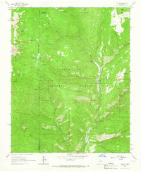 1961 Cowles1966 Print · USGSThe Sangre de Cristo foothills near the San Miguel and Santa Fe county lines appear here in the early sixties, centered on the Pecos River. You can trace alpine trails to Spirit Lake or locate the historic Panchuela Ranger Station and Cowles settlement.4 unique versions available
 - 1963 Map of Lake Isabel, 1964 Print
 1963 Lake Isabel1964 Print · USGSThe Mora and San Miguel county line in the early 1960s reveals a quiet landscape of ranch land and river valleys. Genealogists and researchers can locate Our Lady of Guadalupe Ch, Sapello Cem, and the old Las Vegas Grant Boundary.
 - 1963 Map of Fort Union, 1964 Print
 1963 Fort Union1964 Print · USGSMora, New Mexico, during the early sixties preserves the legacy of the western frontier near the Mora River. Researchers can trace the path of the Santa Fe Trail past the Fort Union National Monument and the Fort Union Cem.2 unique versions available
 - 1963 Map of Rainsville, 1965 Print
 1963 Rainsville1965 Print · USGSNorthern New Mexico's ranching and irrigation landscapes are preserved here as they were in the early sixties. Genealogists and local historians can trace family locations near Rainsville, the Salman Ranch, and the Golondrinas Cem.2 unique versions available
 - 1963 Map of Truchas Peak, 1965 Print
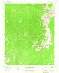 1963 Truchas Peak1965 Print · USGSThe Sangre de Cristo high country is surveyed here in the early sixties, showing the intersection of three counties among alpine peaks and glacial lakes. Hikers and historians can trace old routes to Brazas Cabin, Jose Vigil Lake, and the remote Horsethief Meadow.2 unique versions available
 - 1963 Map of Pecos Falls, 1965 Print
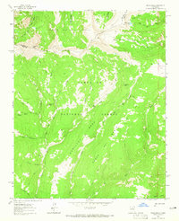 1963 Pecos Falls1965 Print · USGSThe high wilderness of Mora County is captured here in the early sixties, showing the convergence of major national forests. Backcountry travelers can trace the pack trails leading to Beatty Cabin, Pecos Falls, and the summit of Chimayosos Peak.2 unique versions available
 - 1963 Map of Loma Parda, 1965 Print
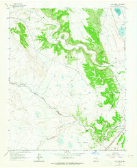 1963 Loma Parda1965 Print · USGSThe Mora and Sapello River valleys were vital corridors for western expansion in the mid-twentieth century. Researchers can trace the path of the Old Santa Fe Trail past the Stage Station and the historic Loma Parda (Site).
 - 1963 Map of Elk Mountain, 1966 Print
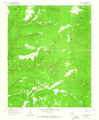 1963 Elk Mountain1966 Print · USGSSan Miguel and Mora counties are shown here in the 1960s, documenting a remote high-country landscape of the Sangre de Cristo mountains. Researchers can trace historic access routes via the Pack Trail to reach isolated Mines, Mora Flats, and Lost Lake.2 unique versions available
 - 1964 Map of Stony Lake, 1966 Print
 1964 Stony Lake1966 Print · USGSThe high plateau of Mora and Colfax counties comes to life in the mid-1960s, showing a landscape defined by ranching and historic passage. Researchers can trace the legendary Santa Fe Trail and locate family-owned landmarks like the Red River Ranch near Ocate Creek.
 - 1964 Map of Wagon Mound, 1966 Print
 1964 Wagon Mound1966 Print · USGSWagon Mound and the surrounding Mora County mesas are captured here in the mid-1960s at the intersection of rail and ranch land. Researchers can trace the historic Santa Fe Trail, locate the Hillside Cem, and explore the rail stop at Levy.
 - 1964 Map of Alto De Hormiga, 1966 Print
 1964 Alto De Hormiga1966 Print · USGSMora County ranching country and high mesas are captured here in the mid-1960s, showing a remote landscape of arroyos and plateaus. Researchers can locate the Piedra Lumbre Ch and the settlement at Ensinosa near Alto de Hormiga.
 - 1964 Map of Frutosa Lake, 1966 Print
 1964 Frutosa Lake1966 Print · USGSThe ranching country of the Mora River canyon was captured in the mid-1960s just as traditional land use patterns remained intact. Researchers can trace historic family holdings and remote landmarks like Wiggins Ranch, Escondido Cem, and Frutosa Lake.2 unique versions available
Showing maps 1-25 of 342
Top cities of Mora County
Frequently asked questions
- What are the different types of historical maps available for Mora County?
- What is the oldest map of Mora County?
- Where can I purchase historical maps of Mora County for my home or office?
- Where can I download high-res historical maps of Mora County?
- Are there historical topographic maps available for Mora County?
- Is there historical aerial imagery available for Mora County?
- Where are historical maps of Mora County sourced from?