1900s (20th Century) Maps of Beaufort County, North Carolina
Explore 49 historic maps of Beaufort County from the 1900s (20th Century). These maps offer a rare glimpse into what life looked like during the 1900s — showing old roads, neighborhoods, homes, and landmarks that have changed or disappeared over time.
Whether you're researching your family's past, planning a metal detecting trip, or studying how Beaufort County's landscape evolved across the 1900s, these high-resolution maps are a powerful tool for exploring the history of this region.
- Focus on a specific era: All maps on this page are from the 1900s, giving you a focused view of this time period.
- See what’s changed: Compare century-old streets, trails, and buildings to today's modern landscape using overlays and satellite layers.
- Research with precision: Use these maps for genealogy, historical research, land use analysis, or educational projects.
- View, download, or print: Maps are fully viewable online in high resolution, and can be downloaded or printed for your own records.
Start exploring Beaufort County's history through authentic maps from the 1900s. This is your window into the past.
Beaufort County, NC maps
(49)- 1902 Map of Vanceboro, 1968 Print
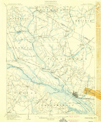
 1902 Vanceboro1968 Print · USGSCoastal North Carolina at the turn of the century was a landscape of deep swamps and river landings. Genealogists and historians can trace timber tramroads through the Big Pocoson and locate family-named landings like Heath Ldg. and Ipock Ldg. along the Neuse River.
 - 1903 Map of Chocowinity, 1968 Print
 1903 Chocowinity1968 Print · USGSCoastal North Carolina comes alive in the early 1900s as steam power and rail lines intersect along the banks of the Tar River. Researchers can trace old river landings like Yankee Hall Ldg. and family-named landmarks including Woolard Crossroads and Shepherd Millpond.
 - 1904 Map of Vanceboro, 1936 Print
 1904 Vanceboro1936 Print · USGSCoastal North Carolina at the turn of the century shows a landscape dominated by vast wetlands and the early timber industry. Researchers can trace historic river landings like Vanceboro Ldg. and Wilkes Ldg. or follow the old Tramroad routes through the Big Pocoson.
 - 1905 Map of Chocowinity
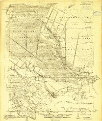
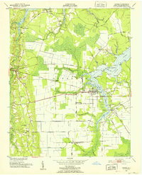
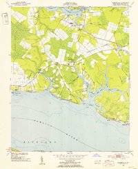
 1905 Chocowinity1905 Print · USGSCoastal North Carolina during the early 1900s centered on the busy waterways of the Tar River and the growing town of Washington. Genealogists and historians can trace old river landings such as Yankee Hall Ldg. and rural sites like Leggetts Crossroads or Pactolus.3 unique versions available
 - 1905 Map of Vanceboro, 1945 Print
 1905 Vanceboro1945 Print · USGSEastern North Carolina at the turn of the century is a landscape of expansive wetlands and river commerce. Genealogists and historians can trace the early timber industry through networks of Tramroad routes and find long-established river landings like Heath Ldg. and Ipock Ldg. along the Neuse River.
 - 1914 Map of Belhaven
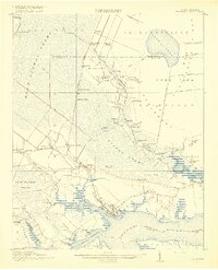
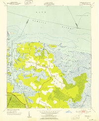
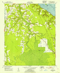
 1914 Belhaven1914 Print · USGSIn the decade before the Great War, the North Carolina coast was a landscape of timber trams and swamp landings. Researchers can trace the John L. Roper Lumber Co. Tram and locate family landmarks like Morrisons Store and Lower Pungo School.
 - 1916 Map of Belhaven
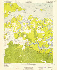
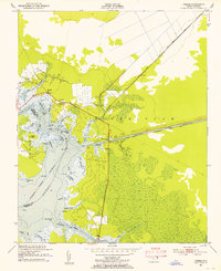
 1916 Belhaven1916 Print · USGSCoastal Beaufort County comes to life in the years before World War I, when the Pungo River landings were essential hubs. Genealogists can trace family roots through rural schools like Haslin School and rail stops like Bishops Cross or Pungo P.O.3 unique versions available
 - 1943 Map of Columbia
 1943 Columbia1943 Print · USGSCoastal Tyrrell and Hyde Counties are captured in the early 1940s, showing a landscape defined by timber industry and federal land projects. Researchers can trace the industrial docks at the Richmond Cedar Works Lumber Mill or locate the rural Scuppernong Farms (F.S.A.).
 - 1943 Map of Plymouth
 1943 Plymouth1943 Print · USGSThe coastal plains and swamps of eastern North Carolina are captured here during the wartime era, showing a landscape defined by river navigation and drainage canals. Genealogists can trace family roots through rural landmarks like Ellis Store, St Lukes Ch, and small rail stops such as Acre Sta.
 - 1950 Map of Vandemere, 1952 Print
 1950 Vandemere1952 Print · USGSCoastal Pamlico County is captured here in the early fifties, showing a landscape shaped by the Bay River and the local timber rail line. Genealogists and historians can locate numerous rural landmarks like Maribel Sch, St Galilee Ch, and the old settlement at Cash Corner.4 unique versions available
 - 1950 Map of Lowland, 1952 Print
 1950 Lowland1952 Print · USGSThe remote marshlands of Pamlico County are captured here in the mid-century, centered on the isolated community of Lowland. Researchers can trace old family roots at Watson Cem and locate historic rural congregations such as Antioch Ch and Shiloh Ch.4 unique versions available
 - 1950 Map of South Creek, 1952 Print
 1950 South Creek1952 Print · USGSCoastal Beaufort County at the start of the 1950s reveals a landscape of tidal guts, remote landings, and small rural parishes. Genealogists and local researchers can locate family landmarks such as Alliance Ldg or trace the early boundaries of the Goose Creek State Game Refuge.4 unique versions available
 - 1950 Map of Pinetown, 1952 Print
 1950 Pinetown1952 Print · USGSCoastal North Carolina's timbered lowlands and small rail-side hamlets appear here in the early fifties. Researchers can trace family-named crossroads and rural landmarks such as Everetts Crossroads, Oden Mill, and Rodmans Quarter Sch.2 unique versions available
 - 1950 Map of Jones Bay, 1952 Print
 1950 Jones Bay1952 Print · USGSCoastal Pamlico County comes alive in this mid-century survey of the waterways and marshes where Hobucken meets the Intracoastal Waterway. Genealogists and historians can trace the US Coast Guard Reservation, the local Cem, and traditional sites like Bills Creek Landing.4 unique versions available
 - 1950 Map of Aurora, 1952 Print
 1950 Aurora1952 Print · USGSMid-century Beaufort County lives at the intersection of the Atlantic Coast Line and the brackish reaches of South Creek. Trace local family history through community anchors like Guilford Station, Peedtown, and Weeping Rachel Ch.4 unique versions available
 - 1950 Map of Edward, 1953 Print
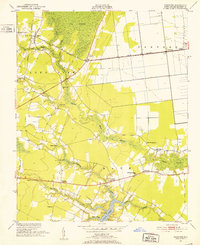
 1950 Edward1953 Print · USGSCoastal North Carolina's rural interior comes into focus during the early fifties, showing the rail-dependent hamlets of Beaufort and Craven counties. Genealogists can locate family landmarks like Smyrna Ch, Coxs Crossroads, and the post office at Blounts Creek.3 unique versions available
 - 1951 Map of Bunyan, 1952 Print
 1951 Bunyan1952 Print · USGSBeaufort County in the early fifties reveals a rural landscape shaped by the vast J & W Dismal Swamp and a network of agrarian crossroads. Genealogists and local historians can trace old family settlements and rural churches like Douglas Crossroads, Asbury Ch, and Pineygrove.3 unique versions available
 - 1951 Map of Bath, 1952 Print
 1951 Bath1952 Print · USGSThe Beaufort County waterfront in the early fifties is mapped here with exceptional detail on its historic shoreline and colonial-era outposts. Genealogists can locate family landmarks like Core Point Chapel, Bayside Sch, and the landings at Hawkins Landing.5 unique versions available
 - 1951 Map of Ransomville, 1953 Print
 1951 Ransomville1953 Print · USGSCoastal Beaufort County in the early fifties shows a landscape of tidal creeks and quiet crossroads. Genealogists and local historians can trace the foundations of Ransomville, locate Holly Grove Ch, or explore the reaches of Tarkiln Neck.3 unique versions available
 - 1951 Map of Pamlico Beach, 1953 Print
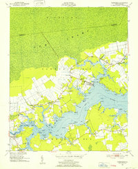
 1951 Pamlico Beach1953 Print · USGSThe Pungo and Pamlico Rivers meet in this early 1950s coastal survey, revealing a landscape of tide-water guts and isolated fishing villages. Researchers can trace family roots in Makleyville or Pamlico Beach and locate landmarks like St Mahala Chapel and Schoolhouse Landing.2 unique versions available
 - 1951 Map of Belhaven, 1953 Print
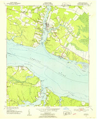
 1951 Belhaven1953 Print · USGSThe coastal port of Belhaven and the surrounding marshes are shown in detail during the early fifties. Genealogists and historians can trace old family sites at Hoophole Landing, Haslin Corner, and Leechville, or follow the Norfolk Southern rail line to the water's edge.4 unique versions available
 - 1951 Map of Pantego, 1953 Print
 1951 Pantego1953 Print · USGSThe coastal lowlands of Beaufort County come to life in the early fifties, showing a landscape shaped by rail, river, and reclaimed swamp. Genealogists can trace family roots through landmarks like Oddfellows Cem, Broad Creek Ch, and the small settlement of Yeatesville.2 unique versions available
 - 1951 Map of Hackney, 1953 Print
 1951 Hackney1953 Print · USGSEastern North Carolina coastal plains are captured here in the early fifties, showing a landscape of pocosin wetlands and drainage canals. Trace rural family roots at Edwards Cem or locate old school sites like Maple Grove Sch and Claybottom Sch.3 unique versions available
 - 1951 Map of Ponzer, 1953 Print
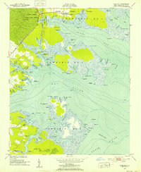
 1951 Ponzer1953 Print · USGSThe coastal marshlands of Hyde County are captured here in the early fifties, showing the interplay between tidal waters and local settlement. Genealogists can locate family landmarks such as Mt Olive Ch, the Wilkerson Creek Bridge, and the community of Ponzer.3 unique versions available
 - 1951 Map of Washington, 1959 Print
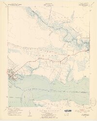
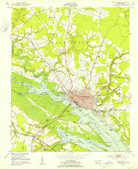 1951 Washington1959 Print · USGSThe riverfront and rail crossroads of eastern North Carolina come alive in the early fifties, showing the growth of WASHINGTON and Chocowinity. Genealogists and historians can trace family locations near Cedar Grove Cem, Marsden Station, and numerous rural schools and chapels.3 unique versions available
Showing maps 1-25 of 49
Top cities of Beaufort County
- Washington historical maps
- Belhaven historical maps
- Chocowinity historical maps
- Aurora historical maps
- Washington Park historical maps
- Bath historical maps
See more
Frequently asked questions
- What are the different types of historical maps available for Beaufort County?
- What is the oldest map of Beaufort County?
- Where can I purchase historical maps of Beaufort County for my home or office?
- Where can I download high-res historical maps of Beaufort County?
- Are there historical topographic maps available for Beaufort County?
- Is there historical aerial imagery available for Beaufort County?
- Where are historical maps of Beaufort County sourced from?