1950s Maps of Williams County, North Dakota
Explore 12 historic maps of Williams County from the 1950s. These maps offer a rare glimpse into what life looked like during the 1950s — showing old roads, neighborhoods, homes, and landmarks that have changed or disappeared over time.
Whether you're researching your family's past, planning a metal detecting trip, or studying how Williams County's landscape evolved across the 1950s, these high-resolution maps are a powerful tool for exploring the history of this region.
- Focus on a specific era: All maps on this page are from the 1950s, giving you a focused view of this time period.
- See what’s changed: Compare century-old streets, trails, and buildings to today's modern landscape using overlays and satellite layers.
- Research with precision: Use these maps for genealogy, historical research, land use analysis, or educational projects.
- View, download, or print: Maps are fully viewable online in high resolution, and can be downloaded or printed for your own records.
Start exploring Williams County's history through authentic maps from the 1950s. This is your window into the past.
Williams County, ND maps
(12)- 1953 Map of Williston, 1968 Print
 1953 Williston1968 Print · USGSThe North Dakota high plains meet the waters of Sakakawea Lake in this mid-century survey of the northern borderlands. Trace the rail-and-ranch economy through sites like Anderson Sky Ranch, Sevenmile Corner, and the strip mines near Columbus.2 unique versions available
 - 1953 Map of Watford City, 1968 Print
 1953 Watford City1968 Print · USGSNorth Dakota's badlands and the Missouri River basin are captured here during the 1950s and 60s as the Garrison Dam changed the landscape. Researchers can trace old rail lines like the Great Northern or find rural outposts such as Grassy Butte and Halliday.3 unique versions available
 - 1954 Map of Glendive, 1967 Print
 1954 Glendive1967 Print · USGSEastern Montana at mid-century shows a landscape of river-valley commerce and remote prairie ranching. Researchers can trace the legacy of rural education and transport through sites like Prairie Elk School, the Great Northern rail lines, and Circle.2 unique versions available
 - 1954 Map of Wolf Point, 1967 Print
 1954 Wolf Point1967 Print · USGSNortheastern Montana and the North Dakota borderlands are shown here in the mid-fifties, dominated by the Missouri River and the Fort Peck Indian Reservation. Genealogists and historians can trace the Great Northern rail line through river towns like Poplar and Culbertson or locate northern border outposts like the U S Custom Office at Raymond.2 unique versions available
 - 1957 Map of Glendive
 1957 Glendive1957 Print · USGSEastern Montana in the mid-1950s is defined by its deep river valleys and a sprawling network of rural school districts. You can trace the path of the Great Northern railroad and locate vanished local landmarks like Breezy Flat School and Newton Junction.
 - 1957 Map of Williston
 1957 Williston1957 Print · USGSNorthwestern North Dakota is shown here during the mid-fifties, dominated by the sweeping plains and the Missouri River valley. Genealogists and local historians can trace the paths of the Great Northern railroad through Williston, Tioga, and Ray, or locate early industry like the coal strip mines near Lignite.
 - 1957 Map of Watford City
 1957 Watford City1957 Print · USGSWestern North Dakota's landscape is captured here during the mid-fifties as the Missouri River valley undergoes massive change following the creation of Garrison Reservoir. Genealogists and historians can trace dozens of rural schools like Divide School and early settlements such as Arnegard and Grassy Butte.
 - 1958 Map of Wolf Point
 1958 Wolf Point1958 Print · USGSNortheastern Montana is shown during the mid-fifties, featuring the extensive Fort Peck Indian Reservation and the Missouri River valley. Researchers can trace the Great Northern railroad through Wolf Point or locate sites like Slab Crossing and the Coal Mine near Medicine Lake.
 - 1958 Map of Glendive
 1958 Glendive1958 Print · USGSEastern Montana and the North Dakota borderlands come alive in the late fifties, showing the agricultural heart of the Yellowstone valley. Trace the legacy of rural education through Kimmel School and Ridgelawn School or locate rail hubs in Glendive and Sidney.
 - 1959 Map of Marmon SE, 1960 Print
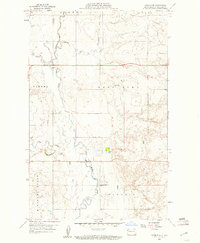 1959 Marmon SE1960 Print · USGSThe rural Williams County landscape comes into focus during the late fifties, showing the confluence of the Little Muddy River and its tributaries. Local history researchers can pinpoint rural landmarks like East Fork Sch and the Levee near Pherrin.3 unique versions available
 - 1959 Map of Williston West, 1960 Print
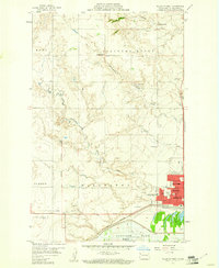 1959 Williston West1960 Print · USGSWilliston was expanding into a regional hub during the late fifties, poised between the Missouri River and the high plains. Genealogists and local historians can trace school sites like Tandy Y-Sch, the grounds of Riverview Cemetery, and early aviation at Sloulin Field.2 unique versions available
 - 1959 Map of Williston East, 1960 Print
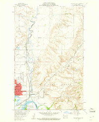 1959 Williston East1960 Print · USGSWilliston and the Missouri River valley appear at a moment of transition in the late fifties as the Garrison Lake reservoir begins to fill. Genealogists and historians can locate numerous rural schoolhouses like Palmer Sch and Stony Creek Sch or trace the development of Williston near the Wright Airport.2 unique versions available
End of results
Showing maps 1-12 of 12
Top cities of Williams County
- Williston historical maps
- Tioga historical maps
- Trenton historical maps
- Ray historical maps
- Grenora historical maps
- Buford historical maps
See more
Frequently asked questions
- What are the different types of historical maps available for Williams County?
- What is the oldest map of Williams County?
- Where can I purchase historical maps of Williams County for my home or office?
- Where can I download high-res historical maps of Williams County?
- Are there historical topographic maps available for Williams County?
- Is there historical aerial imagery available for Williams County?
- Where are historical maps of Williams County sourced from?