Old Maps of Williams County, North Dakota for Metal Detecting
Plan your next treasure hunt with 404 historic maps of Williams County. Find old homesites, ghost towns, trails, and gathering spots that may be lost to time — perfect for identifying promising metal detecting locations.
- Locate forgotten sites: Uncover places like long-lost settlements, abandoned rail lines, or gathering spots.
- Plan better hunts: Use map overlays combined with LiDAR or satellite views to narrow in on historically rich areas.
- Made for detectorists: Thousands of hobbyists use these maps to discover relics, coins, and hidden history.
Use these historic maps to boost your research and find new opportunities beneath the surface of Williams County.
Williams County, ND maps
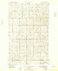
(404)- 1909 Map of Glendive
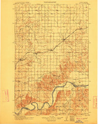
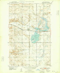
 1909 Glendive1909 Print · USGSThe confluence of the Missouri and Yellowstone rivers in the first decade of the twentieth century shows a region of scattered ranches and emerging river towns. Genealogists can trace family landmarks like Cavanaughs Ranch or Nortons Ranch and find early resource sites like the Coal Mine.
 - 1911 Map of Ray
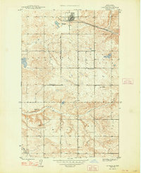
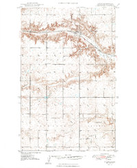
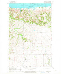
 1911 Ray1911 Print · USGSNorthwest North Dakota at the height of the homesteading era reveals a landscape defined by the iron rails and the wide Missouri. Genealogists and researchers can trace the early rail stops like Wheelock and Epping or locate river landmarks such as Nesson Ferry and Banks.2 unique versions available
 - 1946 Map of Brush Lake, 1955 Print
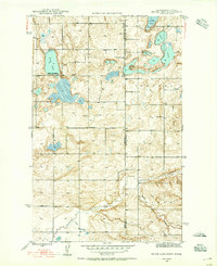 1946 Brush Lake1955 Print · USGSThe Montana and North Dakota borderlands come alive in the mid-1940s, showing a landscape of prairie potholes and remote homesteads. Genealogists can locate the St Olaf Cem and rural landmarks like Brush Lake Resort or Liberty Sch.3 unique versions available
 - 1948 Map of Grenora
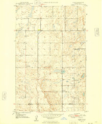
 1948 Grenora1948 Print · USGSThe northern plains of Williams County appear here in the late 1940s as a well-ordered network of railroads and rural schools. Genealogists and researchers can locate landmarks like Barr Butte Sch, the Great Northern rail line, and the Fulves Mine.
 - 1948 Map of Smoky Butte
 1948 Smoky Butte1948 Print · USGSDivide County is captured here in the late 1940s, showing a prairie landscape of isolated farmsteads and rural schoolhouses. Genealogists can locate family landmarks like the Herman Cem or trace local history through Roseville No 2 Sch and Musta Lake.
 - 1948 Map of Alamo N.E.
 1948 Alamo N.E.1948 Print · USGSNorthwestern North Dakota is captured here just after the war, showing a landscape of prairie potholes and township sections. Genealogists can locate the East Opdal Cem (Old), Liberty Sch, and the Great Northern rail line.
 - 1948 Map of Hanks
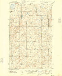
 1948 Hanks1948 Print · USGSWilliams County's northern prairie is captured here in the late 1940s, centered on the railroad town of Hanks. Genealogists and historians can trace the locations of rural schools like Poling Sch, the Hanks Cem, and local coal operations such as the Bobittz Mine.2 unique versions available
 - 1948 Map of Stady
 1948 Stady1948 Print · USGSDivide County farming life in the late forties is recorded here, where isolated schoolhouses and country churches formed the backbone of the community. Genealogists can locate family landmarks like Stady, Rudser Ch, and Elmgren No. 3 Sch.
 - 1948 Map of Brush Lake
 1948 Brush Lake1948 Print · USGSThe high plains of Sheridan County meet the North Dakota border in the late 1940s, revealing a landscape of prairie lakes and isolated schoolhouses. Trace local history at the St Olaf Cem or the lakeside Brush Lake Resort.
 - 1948 Map of Bright Water Lake
 1948 Bright Water Lake1948 Print · USGSDivide County farming country is documented here just after the war, showing the precise grid of North Dakota's rural townships. Genealogists can locate specific homestead sites near Skabo Ch and several local schools like Outlook No 1 Sch.
 - 1948 Map of Zahl
 1948 Zahl1948 Print · USGSNorthwestern North Dakota's prairie landscape is captured here in the late 1940s, centered on the rail-side settlement of Zahl. Genealogists and historians can trace local farmsteads near the Eureka Sch or explore the wetlands of Lake Zahl.
 - 1953 Map of Williston, 1968 Print
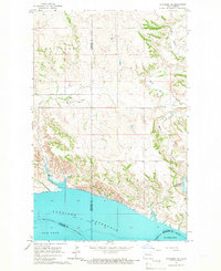
 1953 Williston1968 Print · USGSThe North Dakota high plains meet the waters of Sakakawea Lake in this mid-century survey of the northern borderlands. Trace the rail-and-ranch economy through sites like Anderson Sky Ranch, Sevenmile Corner, and the strip mines near Columbus.2 unique versions available
 - 1953 Map of Watford City, 1968 Print
 1953 Watford City1968 Print · USGSNorth Dakota's badlands and the Missouri River basin are captured here during the 1950s and 60s as the Garrison Dam changed the landscape. Researchers can trace old rail lines like the Great Northern or find rural outposts such as Grassy Butte and Halliday.3 unique versions available
 - 1954 Map of Glendive, 1967 Print
 1954 Glendive1967 Print · USGSEastern Montana at mid-century shows a landscape of river-valley commerce and remote prairie ranching. Researchers can trace the legacy of rural education and transport through sites like Prairie Elk School, the Great Northern rail lines, and Circle.2 unique versions available
 - 1954 Map of Wolf Point, 1967 Print
 1954 Wolf Point1967 Print · USGSNortheastern Montana and the North Dakota borderlands are shown here in the mid-fifties, dominated by the Missouri River and the Fort Peck Indian Reservation. Genealogists and historians can trace the Great Northern rail line through river towns like Poplar and Culbertson or locate northern border outposts like the U S Custom Office at Raymond.2 unique versions available
 - 1957 Map of Glendive
 1957 Glendive1957 Print · USGSEastern Montana in the mid-1950s is defined by its deep river valleys and a sprawling network of rural school districts. You can trace the path of the Great Northern railroad and locate vanished local landmarks like Breezy Flat School and Newton Junction.
 - 1957 Map of Williston
 1957 Williston1957 Print · USGSNorthwestern North Dakota is shown here during the mid-fifties, dominated by the sweeping plains and the Missouri River valley. Genealogists and local historians can trace the paths of the Great Northern railroad through Williston, Tioga, and Ray, or locate early industry like the coal strip mines near Lignite.
 - 1957 Map of Watford City
 1957 Watford City1957 Print · USGSWestern North Dakota's landscape is captured here during the mid-fifties as the Missouri River valley undergoes massive change following the creation of Garrison Reservoir. Genealogists and historians can trace dozens of rural schools like Divide School and early settlements such as Arnegard and Grassy Butte.
 - 1958 Map of Wolf Point
 1958 Wolf Point1958 Print · USGSNortheastern Montana is shown during the mid-fifties, featuring the extensive Fort Peck Indian Reservation and the Missouri River valley. Researchers can trace the Great Northern railroad through Wolf Point or locate sites like Slab Crossing and the Coal Mine near Medicine Lake.
 - 1958 Map of Glendive
 1958 Glendive1958 Print · USGSEastern Montana and the North Dakota borderlands come alive in the late fifties, showing the agricultural heart of the Yellowstone valley. Trace the legacy of rural education through Kimmel School and Ridgelawn School or locate rail hubs in Glendive and Sidney.
 - 1959 Map of Marmon SE, 1960 Print
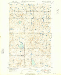
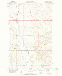 1959 Marmon SE1960 Print · USGSThe rural Williams County landscape comes into focus during the late fifties, showing the confluence of the Little Muddy River and its tributaries. Local history researchers can pinpoint rural landmarks like East Fork Sch and the Levee near Pherrin.3 unique versions available
 - 1959 Map of Williston West, 1960 Print
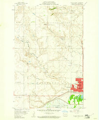 1959 Williston West1960 Print · USGSWilliston was expanding into a regional hub during the late fifties, poised between the Missouri River and the high plains. Genealogists and local historians can trace school sites like Tandy Y-Sch, the grounds of Riverview Cemetery, and early aviation at Sloulin Field.2 unique versions available
 - 1959 Map of Williston East, 1960 Print
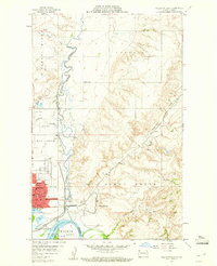 1959 Williston East1960 Print · USGSWilliston and the Missouri River valley appear at a moment of transition in the late fifties as the Garrison Lake reservoir begins to fill. Genealogists and historians can locate numerous rural schoolhouses like Palmer Sch and Stony Creek Sch or trace the development of Williston near the Wright Airport.2 unique versions available
 - 1965 Map of Charlson SW, 1967 Print
 1965 Charlson SW1967 Print · USGSMcKenzie County was undergoing an industrial transformation in the mid-1960s as petroleum extraction expanded across the Missouri River breaks. Genealogists and historians can locate the Good Hope Ch and trace the early development of the Charlson Oil Field and Hawkeye Valley Oil Field.
 - 1965 Map of Charlson NE, 1967 Print
 1965 Charlson NE1967 Print · USGSMountrail and Williams Counties meet at the edge of the Garrison Reservoir during the mid-sixties. Researchers can trace the original path of the Missouri River and explore terrain features like Dry Fork and Elm Tree.
Showing maps 1-25 of 404
Top cities of Williams County
- Williston historical maps
- Tioga historical maps
- Trenton historical maps
- Ray historical maps
- Grenora historical maps
- Buford historical maps
See more
Frequently asked questions
- What are the different types of historical maps available for Williams County?
- What is the oldest map of Williams County?
- Where can I purchase historical maps of Williams County for my home or office?
- Where can I download high-res historical maps of Williams County?
- Are there historical topographic maps available for Williams County?
- Is there historical aerial imagery available for Williams County?
- Where are historical maps of Williams County sourced from?