1970s Maps of Williams County, North Dakota
Explore 39 historic maps of Williams County from the 1970s. These maps offer a rare glimpse into what life looked like during the 1970s — showing old roads, neighborhoods, homes, and landmarks that have changed or disappeared over time.
Whether you're researching your family's past, planning a metal detecting trip, or studying how Williams County's landscape evolved across the 1970s, these high-resolution maps are a powerful tool for exploring the history of this region.
- Focus on a specific era: All maps on this page are from the 1970s, giving you a focused view of this time period.
- See what’s changed: Compare century-old streets, trails, and buildings to today's modern landscape using overlays and satellite layers.
- Research with precision: Use these maps for genealogy, historical research, land use analysis, or educational projects.
- View, download, or print: Maps are fully viewable online in high resolution, and can be downloaded or printed for your own records.
Start exploring Williams County's history through authentic maps from the 1970s. This is your window into the past.
Williams County, ND maps
(39)- 1974 Map of Blacktail Lake, 1977 Print
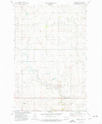
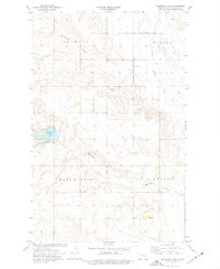 1974 Blacktail Lake1977 Print · USGSWilliams County's rolling prairie and coulees are captured here in the mid-1970s, showcasing the rural landscape north of Williston. Genealogists can trace family roots at Bethel Cem or Faith Cem and locate the former community of Marmon.
 - 1974 Map of Wildrose, 1977 Print
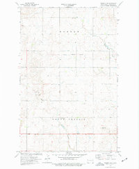
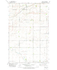
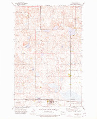 1974 Wildrose1977 Print · USGSWildrose and the Divide-Williams county line appear here in the mid-seventies, showing a landscape shaped by rail and agriculture. Researchers can trace the Burlington Northern corridor and find local landmarks like Grace Cem and Willow Lake.
 - 1974 Map of Bonetraill, 1977 Print
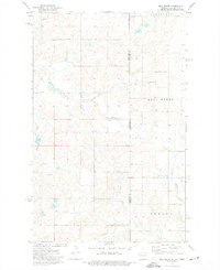
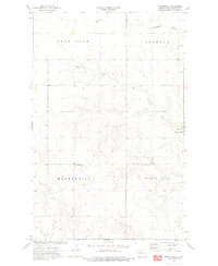 1974 Bonetraill1977 Print · USGSNorthwestern North Dakota in the mid-seventies shows a landscape of steady agricultural and industrial use. Researchers can locate the small settlements of Gladys and Bonetraill, alongside local landmarks like Blacktail Lake and a rural Mine.
 - 1974 Map of Tom Berg Lake, 1977 Print
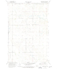
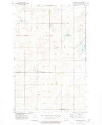 1974 Tom Berg Lake1977 Print · USGSWilliams County's prairie landscape is captured here in the mid-seventies, showing a network of sloughs and rural townships. Genealogists can locate family landmarks like Bethel Ch Cem, St Pauls Cem, and the old Skistad Sch.
 - 1974 Map of Brush Mountain, 1977 Print
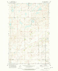
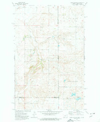 1974 Brush Mountain1977 Print · USGSThe high plains of the Montana and North Dakota border are captured here during the mid-seventies, showing a landscape of remote drainage basins and rural homesteads. Genealogists can locate family landmarks such as Scandia Ch and the neighboring Cem, or trace the path of Dead Horse Spring.2 unique versions available
 - 1974 Map of Otter Tail Creek, 1977 Print
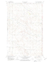 1974 Otter Tail Creek1977 Print · USGSWilliams County in the mid-1970s reveals a landscape of high ridges and township centers during a period of steady prairie life. Researchers can locate the local Townhall and trace the winding paths of Otter Tail Creek and Cow Creek across the township lines.
 - 1974 Map of West Bonetraill, 1977 Print
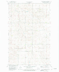 1974 West Bonetraill1977 Print · USGSThe northwestern North Dakota prairie appears in the mid-1970s as a landscape of rural townships and family-named landmarks. Genealogists can trace local roots through the Scandia Valley Ch Cem, St Petri Ch, and the settlement at West Bonetraill.
 - 1974 Map of Red Bank Creek, 1977 Print
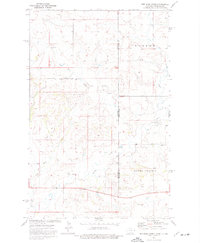 1974 Red Bank Creek1977 Print · USGSThe high plains of the North Dakota and Montana border appear in the mid-1970s as a landscape shaped by water and history. Researchers can trace the Old Military Reservation Boundary and locate small-scale industrial sites like Scoria Pits and Flume.2 unique versions available
 - 1974 Map of Bonetraill SW, 1977 Print
 1974 Bonetraill SW1977 Print · USGSWestern North Dakota's high plains are documented here during the mid-1970s, showing a landscape of townships and scattered agricultural industry. Researchers can locate genealogical landmarks like St Lucas Ch and Williston Cem near the prominent Bull Butte.
 - 1974 Map of Hamlet, 1977 Print
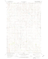
 1974 Hamlet1977 Print · USGSThe northwestern prairie of North Dakota near the Divide and Williams county line is shown here in the mid-1970s. Researchers can locate the railroad settlement of Hamlet, the Trinity Cem, and early energy landmarks like an Oil Well and Burlington Northern infrastructure.
 - 1974 Map of Twin Lakes, 1977 Print
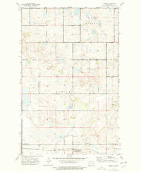
 1974 Twin Lakes1977 Print · USGSWilliams County's prairie landscape is recorded here during the mid-seventies, showing the rural townships of Winner, Ellisville, Athens, and Dublin. Researchers can pinpoint early landmarks like Twin Lakes Sch, East Fork Cem, and the waters of Lone Tree Lake.
 - 1974 Map of McGregor, 1977 Print
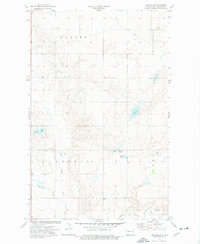
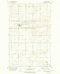
 1974 McGregor1977 Print · USGSIn the mid-1970s, this portion of Williams County saw a landscape of prairie agriculture meeting a growing energy sector. Genealogists and historians can locate Zion Cem, the Lindahl Ch, and the rail infrastructure of McGregor near the Burlington Northern line.
 - 1974 Map of Trenton NE, 1977 Print
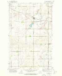
 1974 Trenton NE1977 Print · USGSWilliams County uplands are documented here in the mid-1970s, showcasing the agricultural and military survey lines north of the Missouri River. Genealogists can locate family landmarks such as St Paul Ch, the Painted Woods Cem, and the Johnson Sch.
 - 1974 Map of Trenton NW, 1977 Print
 1974 Trenton NW1977 Print · USGSWilliams County's high plains are shown in the mid-seventies, capturing a landscape where ranching and early energy development coexist. Researchers can locate community landmarks like Round Prairie Ch and trace the historic Old Military Reservation Boundary.
 - 1974 Map of Bull Butte, 1977 Print
 1974 Bull Butte1977 Print · USGSThe high plains along the Montana and North Dakota border are captured here in the mid-1970s. Genealogists and historians can locate the Seventh-day Adventist Ch and trace the drainage of Little Muddy Creek near the landmark Bull Butte.2 unique versions available
 - 1974 Map of Bonetraill SE, 1977 Print
 1974 Bonetraill SE1977 Print · USGSNorth Dakota's high plains near the Montana border are captured here in the mid-1970s, showcasing a landscape of intermittent creeks and isolated buttes. Genealogists and local historians can locate the St George Cem, Cow Creek Cem, and landmarks like Bull Butte.
 - 1974 Map of Bush Lake, 1978 Print
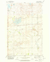
 1974 Bush Lake1978 Print · USGSNorthwestern North Dakota's prairie landscape is shown during the mid-seventies energy boom. Genealogists and local historians can trace rural landmarks like Our Saviors Ch, the local Town Hall, and the expanding Stoneview Oil and Gas Field.
 - 1974 Map of Big Meadow, 1978 Print
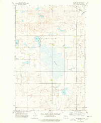 1974 Big Meadow1978 Print · USGSWilliams County, North Dakota, is depicted in the mid-1970s as a landscape of prairie wetlands and rising energy development. Genealogists and local historians can locate rural landmarks like Stordahl Ch, Grong Cem, and Town Hall.
 - 1977 Map of Appam, 1978 Print
 1977 Appam1978 Print · USGSWilliams County's high prairie reaches are captured here in the late seventies, centered on the rail-stop settlement of Appam. Researchers can trace old family sites and burial grounds at Bethany Cem and Hauge Ch or follow the path of the Burlington Northern railroad.
 - 1977 Map of Alamo, 1978 Print
 1977 Alamo1978 Print · USGSAlamo and the surrounding prairie of Williams County are captured here in the late seventies as a hub of rail and agriculture. Researchers can trace the town's layout near Cottonwood Lake and locate the Alamo Cem or the Ellisville Community Bldg to the south.
 - 1978 Map of Corinth
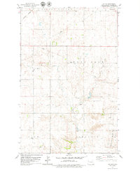
 1978 Corinth1978 Print · USGSCorinth and the surrounding Williams County prairie are documented here during the late 1970s, at the height of the modern grain-storage era. Researchers can trace the Burlington Northern rail line and locate rural landmarks like Big Stone and New Home.
 - 1978 Map of Lake Jessie
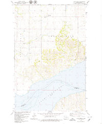 1978 Lake Jessie1978 Print · USGSThe Missouri River and the northern reaches of Lake Sakakawea dominate this Williams County landscape in the late 1970s. Local history researchers can locate rural landmarks like Our Savior Ch, Hauge Ch, and the rugged terrain of the Badlands.
 - 1978 Map of Ray, 1979 Print
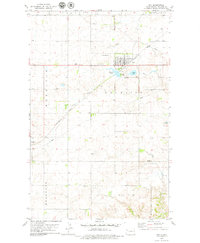 1978 Ray1979 Print · USGSThe Williams County prairie in the late seventies is centered on Ray and the Burlington Northern rail line. Researchers can trace local genealogy and land use through landmarks like St Michaels Cem, Wheelock, and McLeod Lake.
 - 1978 Map of Ray SE, 1979 Print
 1978 Ray SE1979 Print · USGSWilliams County township divisions like Golden Valley and View are captured here during a period of active energy development. Genealogists and historians can locate the German Cem and trace the influence of the Beaver Lodge Oil and Gas Field.
 - 1978 Map of Epping NW, 1979 Print
 1978 Epping NW1979 Print · USGSWilliams County's high plains and river bottoms are documented here in the late seventies. Researchers can trace family roots at the Bethany Valley Cem or follow the winding Little Muddy River through the Dublin and Ellisville areas.
Showing maps 1-25 of 39
Top cities of Williams County
- Williston historical maps
- Tioga historical maps
- Trenton historical maps
- Ray historical maps
- Grenora historical maps
- Buford historical maps
See more
Frequently asked questions
- What are the different types of historical maps available for Williams County?
- What is the oldest map of Williams County?
- Where can I purchase historical maps of Williams County for my home or office?
- Where can I download high-res historical maps of Williams County?
- Are there historical topographic maps available for Williams County?
- Is there historical aerial imagery available for Williams County?
- Where are historical maps of Williams County sourced from?