Old Maps of Deschutes County, Oregon
Explore 514 old maps of Deschutes County, spanning from 1925 to today. These high-resolution historic maps reveal how streets, neighborhoods, landmarks, and natural features evolved over time — perfect for genealogy, metal detecting, research, and local history exploration.
What you can do with these maps:
- See how Deschutes County changed over time: Compare historical maps to modern-day views to trace roads, homesites, rail lines & more.
- View detailed metadata: Each map includes creators, publishers, year, scale, and archive source.
- Overlay maps with satellite & LiDAR: Visualize the past alongside modern tools to explore terrain & human change.
- Trusted historical sources: Maps sourced from the USGS, Library of Congress, and other archives.
- Access maps your way: View online, download high-res files, or order prints for personal or research use.
Start exploring old maps of Deschutes County to uncover forgotten places, hidden landmarks, and the deep history beneath your feet.
Deschutes County, OR maps
(514)- 1925 Map of Waldo Lake
 1925 Waldo Lake1925 Print · USGSThe High Cascades near the Lane and Klamath county line are shown here in the mid-1920s as a frontier of forestry and high-country ranching. Trace early landmarks like the State Fish Hatchery, the High Prairie School, and the remote Hills Ranch.4 unique versions available
 - 1926 Map of Bend, 1963 Print
 1926 Bend1963 Print · USGSCentral Oregon in the mid-1920s was a landscape of emerging irrigation districts and busy timber rails centered around the growing hub of Bend. Researchers can trace early rural life through family-named landmarks like Gales Ranch and numerous country schoolhouses including Young Sch and Pine Ridge Sch.
 - 1929 Map of Bend
 1929 Bend1929 Print · USGSCentral Oregon in the late twenties shows a landscape shaped by irrigation and the expansion of the rail lines. Genealogists can locate family-named sites like Gates Ranch and numerous rural schoolhouses including Arnold Sch and Lava Rock Sch.5 unique versions available
 - 1929 Map of Three Sisters, 1956 Print
 1929 Three Sisters1956 Print · USGSThe High Cascades meet the Deschutes plateau in the late 1920s, a time when fire lookouts and cow camps dotted the volcanic peaks. Genealogists and historians can trace the early footprints of Sisters, Camp Sherman, and the historic Old Toll Station.2 unique versions available
 - 1930 Map of Maiden Peak
 1930 Maiden Peak1930 Print · USGSThe high volcanic plateau of central Oregon is captured in the early 1930s as a landscape of new reservoirs and forest outposts. Genealogists and historians can trace family-named sites like Caldwell Ranch or follow early travel routes like Century Drive and the Southern Pacific rail line.3 unique versions available
 - 1931 Map of Newberry Crater, 1960 Print
 1931 Newberry Crater1960 Print · USGSDeschutes County was a landscape of timber camps and volcanic wonders in the early 1930s, during a period of heavy logging. Researchers can trace the Logging RR networks, find the Vandevert Sch, and locate industrial sites like Brooks-Scanlon Camp 3.
 - 1932 Map of Three Sisters
 1932 Three Sisters1932 Print · USGSThe eastern Cascades and the high desert meet in the early 1930s as the regional highway system begins to pierce the mountains. Genealogists and historians can trace early settlements like Camp Polk and Sisters or locate old forest landmarks such as Camp Sherman and Black Butte.3 unique versions available
 - 1934 Map of Maiden Peak
 1934 Maiden Peak1934 Print · USGSCentral Oregon’s high desert and timberlands are captured here in the early thirties, centered on the Crane Prairie Reservoir. Researchers can find isolated outposts like Caldwell Ranch, the Log Cabin, and Lapine at the highway junction.3 unique versions available
 - 1935 Map of Newberry Crater
 1935 Newberry Crater1935 Print · USGSDeschutes County in the mid-1930s is a landscape of volcanic wonders and active timber camps. Researchers can locate remote logging outposts like Brooks-Scanlon Camp 2, rural schools including Little River Sch, and geological landmarks like Lava River Cave.3 unique versions available
 - 1955 Map of Crescent, 1963 Print
 1955 Crescent1963 Print · USGSCentral Oregon in the mid-1950s was a landscape of dense national forests and high desert expanses. Researchers can trace timber-era settlements like Gilchrist and Crescent or locate remote outposts such as Stauffer and Millican near the Wagontire Mountains.3 unique versions available
 - 1955 Map of Bend, 1964 Print
 1955 Bend1964 Print · USGSCentral Oregon was undergoing significant growth in the mid-1960s as irrigation and infrastructure transformed the high desert. Researchers can trace the path of the Oregon Trunk Line, locate old stops like Gateway, and find landmarks like Lava Butte or the Grange.3 unique versions available
 - 1955 Map of Burns, 1964 Print
 1955 Burns1964 Print · USGSHarney County's high desert ranching and timber heartland is captured here in the mid-fifties, centered on the hub of Burns and Hines. Genealogists and researchers can locate remote landmarks like the Suntex School, New Princeton P. O., and the Lumber Mill.3 unique versions available
 - 1956 Map of Waldo Lake, 1958 Print
 1956 Waldo Lake1958 Print · USGSThe high Cascades at the mid-point of the century were a realm of alpine lakes and steam-age rail routes. Genealogists and historians can trace old camps and stations along the Southern Pacific Railroad, from Beamer Ranch to the Cascade Summit overlook.3 unique versions available
 - 1957 Map of Crescent
 1957 Crescent1957 Print · USGSCentral Oregon’s high desert and volcanic rim are captured here in the late fifties, showing the region before the modernization of its wilderness corridors. Genealogists and local historians can trace rail-line outposts like Chemult and the early boundaries of the Klamath Indian Reservation.
 - 1957 Map of Bend
 1957 Bend1957 Print · USGSCentral Oregon in the mid-fifties is a landscape of transition between the high Cascades and the arid volcanic plateau. Local historians can trace the rail corridors of the Oregon Trunk and locate early settlements like Ashwood, Odin Falls, and Camp Sherman.
 - 1958 Map of Crescent
 1958 Crescent1958 Print · USGSCentral Oregon’s volcanic high desert and timber country are captured here in the mid-fifties, from the peaks of the Cascades to the arid basins. Researchers can trace the lines of the Southern Pacific RR, the northern reaches of the Klamath Indian Reservation, and remote outposts like Fort Rock.
 - 1958 Map of Burns
 1958 Burns1958 Print · USGSHarney County ranching and timber lands are captured here in the late fifties. Genealogists and local historians can trace family holdings and rural institutions, from the Kimball Flat School to remote outposts like Crow Camp Ranch and the Sutton Ranch.
 - 1958 Map of Bend
 1958 Bend1958 Print · USGSCentral Oregon in the late fifties was a land of high desert ranching and growing mountain towns. Researchers can trace the rail lines of the Oregon Trunk Railroad, find established settlements like Madras and Sisters, or locate landmarks such as Smith Rock and Lava Butte.
 - 1958 Map of Roseburg, 1960 Print
 1958 Roseburg1960 Print · USGSThe timber valleys and high volcanic peaks of Southern Oregon are captured here in the late fifties. Researchers can trace the Southern Pacific rail line through historic settlements like Cottage Grove, Yoncalla, and Oakridge near the Cascade Range crest.4 unique versions available
 - 1959 Map of Burns
 1959 Burns1959 Print · USGSHarney County in the late fifties remains a landscape of high-desert ranching and timber production, centered on the hubs of Burns and Hines. Researchers can locate remote rural institutions like the Suntex School or trace family landholdings such as the Stallard Ranch and O'Keefe Homestead.
 - 1959 Map of Roseburg
 1959 Roseburg1959 Print · USGSThe Umpqua and Willamette valleys meet the high Cascades in this late-fifties study of Southern Oregon's timber and rail corridors. Genealogists and researchers can trace the Southern Pacific RR through historic towns like Roseburg, Yoncalla, and Cottage Grove.
 - 1959 Map of Broken Top, 1961 Print
 1959 Broken Top1961 Print · USGSDeschutes County reaches its alpine peaks during the late fifties, showcasing a landscape of glaciers and backcountry outposts. Trace the locations of high-country shelters and camps like Egan Memorial Lodge, Swede Ridge Shelter, and Driftwood Forest Camp.3 unique versions available
 - 1959 Map of Three Sisters, 1961 Print
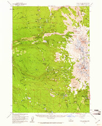 1959 Three Sisters1961 Print · USGSThe Oregon Cascades appear here in the late fifties, showcasing a high-wilderness landscape shaped by volcanic flows and glaciers. Trace the historical routes of the Oregon Skyline Trail and locate isolated outposts like Sunshine Shelter or the Scott Mtn VABM Lookout.3 unique versions available
 - 1959 Map of Three Fingered Jack, 1961 Print
 1959 Three Fingered Jack1961 Print · USGSThe Oregon High Cascades meet in the late fifties at the junction of the Willamette and Deschutes forests. Outdoor historians and genealogists can trace early passage routes like the Cache Creek Toll Station, the Old Santiam Railroad Grade, and the Oregon Skyline Trail.4 unique versions available
 - 1959 Map of Sisters, 1961 Print
 1959 Sisters1961 Print · USGSThe high-desert ranching and logging country around Sisters is captured here in the late fifties, just as recreational forest use was expanding. Researchers can trace historic routes like the Santiam Wagon Road, find the Black Butte Sch, or locate family sites at the Sisters Cem and Black Butte Ranch.2 unique versions available
Showing maps 1-25 of 514
Top cities of Deschutes County
Frequently asked questions
- What are the different types of historical maps available for Deschutes County?
- What is the oldest map of Deschutes County?
- Where can I purchase historical maps of Deschutes County for my home or office?
- Where can I download high-res historical maps of Deschutes County?
- Are there historical topographic maps available for Deschutes County?
- Is there historical aerial imagery available for Deschutes County?
- Where are historical maps of Deschutes County sourced from?