
1955 Map of Crescent
USGS Topo · Published 1963About this map
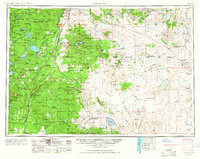
Silver Lake and the high desert outposts of Central Oregon define this mid-century landscape at a time when timber and high-altitude ranching dominated the local economy. The western half of the sheet is dominated by the dense timberlands of the Deschutes National Forest and Fremont National Forest, dotted with prominent volcanic features like Bachelor Butte and Lava Butte. This area serves as a critical water source, shown through the network of the Crane Prairie Reservoir, Wickiup Reservoir, and Odell Lake. Moving eastward, the terrain opens into the expansive Christmas Lake Valley, where the transition from forest to desert is marked by isolated settlements such as Stauffer and Brothers. Transportation through these remote corridors relied heavily on the Southern Pacific and Great Northern railroads, which parallel the modern path of Highway 97, connecting timber towns like Gilchrist and Crescent to broader markets.
Find a feature on this map
56 named features on this map. Tap any name to fly to it.
Don’t see what you’re looking for? This feature index may not catch every label — zoom into the map to look around manually.
Map Details
Editions of this 1955 Crescent Map
3 editions found
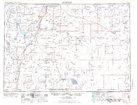
Other maps of this area

1889 · Klamath
USGS Topo · 1:250,000

1891 · Ashland
USGS Topo · 1:250,000

1893 · Ashland
USGS Topo · 1:250,000

1894 · Klamath
USGS Topo · 1:250,000

1897 · Ashland
USGS Topo · 1:250,000

1917 · Diamond Lake
USGS Topo · 1:125,000

1925 · Waldo Lake
USGS Topo · 1:125,000

1926 · Bend
USGS Topo · 1:125,000

1929 · Bend
USGS Topo · 1:125,000

1929 · Three Sisters
USGS Topo · 1:125,000