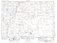
1955 Map of Crescent
USGS Topo · Published 1966About this map
The high lava plains and volcanic peaks of Central Oregon dominate this landscape, where the Little Deschutes River winds through a complex of national forests including the Deschutes National Forest and Winema National Forest. In the mid-1950s, the regional economy was tied closely to timber and transportation, evidenced by the Sawmill at Gilchrist and the presence of both the Southern Pacific RR and Great Northern RR. The map captures a moment of transition for the military presence in the area, noting an Army camp (abandoned) near Stearns.
Find a feature on this map
318 named features on this map. Tap any name to fly to it.
Don’t see what you’re looking for? This feature index may not catch every label — zoom into the map to look around manually.
Map Details
Editions of this 1955 Crescent Map
3 editions found

Other maps of this area

1889 · Klamath
USGS Topo · 1:250,000

1891 · Ashland
USGS Topo · 1:250,000

1893 · Ashland
USGS Topo · 1:250,000

1894 · Klamath
USGS Topo · 1:250,000

1897 · Ashland
USGS Topo · 1:250,000

1917 · Diamond Lake
USGS Topo · 1:125,000

1925 · Waldo Lake
USGS Topo · 1:125,000

1926 · Bend
USGS Topo · 1:125,000

1929 · Bend
USGS Topo · 1:125,000

1929 · Three Sisters
USGS Topo · 1:125,000