1990s Maps of Deschutes County, Oregon
Explore 13 historic maps of Deschutes County from the 1990s. These maps offer a rare glimpse into what life looked like during the 1990s — showing old roads, neighborhoods, homes, and landmarks that have changed or disappeared over time.
Whether you're researching your family's past, planning a metal detecting trip, or studying how Deschutes County's landscape evolved across the 1990s, these high-resolution maps are a powerful tool for exploring the history of this region.
- Focus on a specific era: All maps on this page are from the 1990s, giving you a focused view of this time period.
- See what’s changed: Compare century-old streets, trails, and buildings to today's modern landscape using overlays and satellite layers.
- Research with precision: Use these maps for genealogy, historical research, land use analysis, or educational projects.
- View, download, or print: Maps are fully viewable online in high resolution, and can be downloaded or printed for your own records.
Start exploring Deschutes County's history through authentic maps from the 1990s. This is your window into the past.
Deschutes County, OR maps
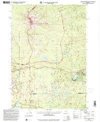
(13)- 1992 Map of Steelhead Falls, 1997 Print
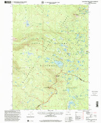
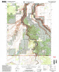 1992 Steelhead Falls1997 Print · USGSThe high desert canyons of Jefferson County were evolving in the early 1990s as the Crooked River and Deschutes River met at Lake Billy Chinook. Researchers can locate the Grandview Cemetery, the site of Holmes Ranch, and canyon landmarks like Opal Springs.2 unique versions available
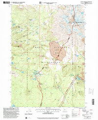
 - 1992 Map of Opal City, 1997 Print
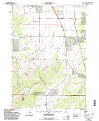
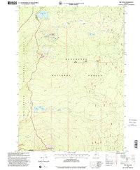
 1992 Opal City1997 Print · USGSCentral Oregon's high desert landscape comes alive in the early nineties, showcasing the intersection of irrigation, ranching, and geology. Trace the winding Crooked River Gorge and locate landmarks like Opal City, Haystack Reservoir, and the rail lines of the Burlington Northern Pacific.
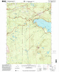
 - 1992 Map of Gray Butte, 1997 Print
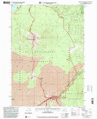
 1992 Gray Butte1997 Print · USGSJefferson and Deschutes counties are captured here in the early 1990s, where the high desert meets irrigated ranchlands. You can trace early settlement roots at the Gray Butte Cem, the Lone Pine Sch, and family landmarks like Rodman Spring.
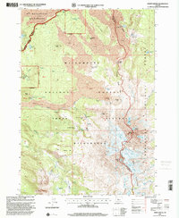
 - 1993 Map of Burns
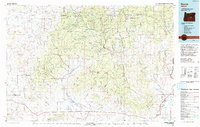 1993 Burns1993 Print · USGSThe Harney County high desert and timbered uplands are captured here in the early nineties, centered on the ranching hubs of Burns and Hines. Trace the vital water systems of the Silvies River and Chickahominy Reservoir alongside landmarks like Wagontire Mountain.
 - 1997 Map of Waldo Lake, 1998 Print
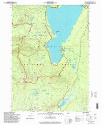 1997 Waldo Lake1998 Print · USGSThe Willamette National Forest in the late nineties offered a remote wilderness experience centered around the massive basin of Waldo Lake. Backcountry travelers can trace the Pacific Crest National Scenic Trail past high peaks and remote campsites like the South Waldo Shelter and Fuji Shelter.
 - 1997 Map of Packsaddle Mountain, 2001 Print
 1997 Packsaddle Mountain2001 Print · USGSHigh in the Oregon Cascades during the late 1990s, this area spans the crest where the Willamette and Deschutes National Forests meet. Trace the high-altitude Pacific Crest National Scenic Trail as it passes Packsaddle Mountain, Horse Mountain, and Mc Bee Lake.
 - 1997 Map of The Twins, 2001 Print
 1997 The Twins2001 Print · USGSHigh in the central Cascades during the late nineties, this landscape shows the intersection of major volcanic peaks and the iconic Pacific Crest National Scenic Trail. Trace the routes between Charlton Lake, The Twins, and Maiden Peak to understand the wilderness geography of this high-elevation region.
 - 1997 Map of Mount Washington, 2001 Print
 1997 Mount Washington2001 Print · USGSOregon’s high volcanic spine at the close of the century reveals a landscape where historic pioneer routes meet modern wilderness protection. Trace the Santiam Wagon Road past the Cache Creek Toll Station and the Dee Wright Observatory near Mc Kenzie Pass.
 - 1997 Map of Irish Mountain, 2001 Print
 1997 Irish Mountain2001 Print · USGSThe high Cascades at the turn of the millennium reveal a landscape of dense wilderness and alpine basins along the Deschutes and Lane County line. Backcountry researchers can trace the Pacific Crest National Scenic Trail past Irish Mountain and find remote spots like Harralson Horse Camp.
 - 1997 Map of Three Fingered Jack, 2001 Print
 1997 Three Fingered Jack2001 Print · USGSThe Oregon Cascades at the end of the twentieth century showcase a landscape of wilderness management and alpine recreation. Researchers can trace historic routes like the Old Santiam Wagon Road, explore the Hoodoo Ski Bowl, and locate remote landmarks such as Brandenburg Shelter or Corbett Memorial State Park.
 - 1997 Map of South Sister, 2001 Print
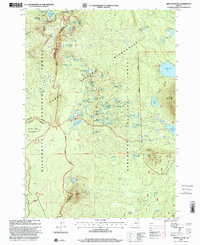
 1997 South Sister2001 Print · USGSThe high Cascade peaks of Lane and Deschutes counties are captured here in the late nineties, documenting a landscape of active glaciers and volcanic fields. Researchers can trace the Pacific Crest National Scenic Trail as it skirts Three Sisters Rock Mesa and the Eugene Glacier.
 - 1997 Map of Willamette Pass, 2001 Print
 1997 Willamette Pass2001 Print · USGSThe high Cascades at Willamette Pass are shown in detail during the late nineties, showcasing the intersection of mountain recreation and rail history. Trace the Southern Pacific tracks past Cascade Summit or explore the numerous alpine lakes like Odell Lake and Midnight Lake.
 - 1997 Map of North Sister, 2001 Print
 1997 North Sister2001 Print · USGSThe Oregon Cascades high country is shown here in the late nineties, centered on the glacial peaks of the Three Sisters Wilderness. Mountaineers and hikers can trace the Pacific Crest National Scenic Trail past Collier Cone and the Bronaugh Memorial Plaque.
End of results
Showing maps 1-13 of 13
Top cities of Deschutes County
Frequently asked questions
- What are the different types of historical maps available for Deschutes County?
- What is the oldest map of Deschutes County?
- Where can I purchase historical maps of Deschutes County for my home or office?
- Where can I download high-res historical maps of Deschutes County?
- Are there historical topographic maps available for Deschutes County?
- Is there historical aerial imagery available for Deschutes County?
- Where are historical maps of Deschutes County sourced from?