1960s Maps of Deschutes County, Oregon
Explore 54 historic maps of Deschutes County from the 1960s. These maps offer a rare glimpse into what life looked like during the 1960s — showing old roads, neighborhoods, homes, and landmarks that have changed or disappeared over time.
Whether you're researching your family's past, planning a metal detecting trip, or studying how Deschutes County's landscape evolved across the 1960s, these high-resolution maps are a powerful tool for exploring the history of this region.
- Focus on a specific era: All maps on this page are from the 1960s, giving you a focused view of this time period.
- See what’s changed: Compare century-old streets, trails, and buildings to today's modern landscape using overlays and satellite layers.
- Research with precision: Use these maps for genealogy, historical research, land use analysis, or educational projects.
- View, download, or print: Maps are fully viewable online in high resolution, and can be downloaded or printed for your own records.
Start exploring Deschutes County's history through authentic maps from the 1960s. This is your window into the past.
Deschutes County, OR maps
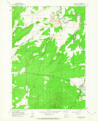
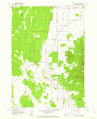
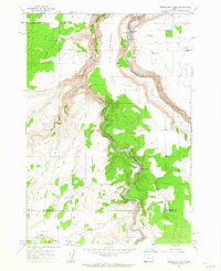
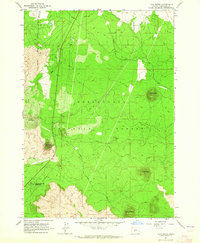
(54)- 1961 Map of Redmond, 1977 Print
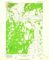
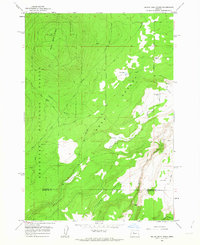
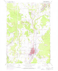 1961 Redmond1977 Print · USGSCentral Oregon's high desert landscape comes into focus at the dawn of the sixties, showcasing the expansion of Redmond and the nearby agricultural hub of Terrebonne. Trace the development of irrigation canals, family-named roads, and rail junctions like Prineville Junction near the banks of the Crooked River.
 - 1962 Map of Opal City, 1963 Print
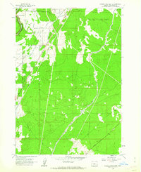
 1962 Opal City1963 Print · USGSCentral Oregon's high desert landscape and vital irrigation systems are documented here during the early sixties. Researchers can trace the path of the Crooked River and the development of the Oregon Trunk railway near Opal City and Peter Skene Ogden State Park.2 unique versions available
 - 1962 Map of Forked Horn Butte, 1963 Print
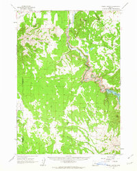
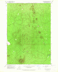
 1962 Forked Horn Butte1963 Print · USGSThe high desert landscape outside Redmond comes to life in the early 1960s, showing the intersection of vital irrigation canals and aviation growth. Trace family roots at the Redmond Cem or explore the mid-century footprint of Roberts Field and the Redmond Cave.2 unique versions available
 - 1962 Map of Bend, 1963 Print
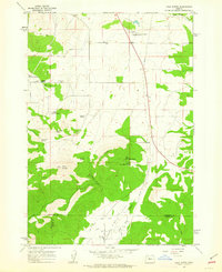
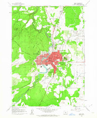 1962 Bend1963 Print · USGSBend and its neighboring volcanic buttes appear in the early sixties as a bustling hub of irrigation, rail, and early high-desert development. Researchers can trace the town's growth through landmarks like Mirror Pond, the Kenwood Sch, and the extensive Central Oregon Canal system.6 unique versions available
 - 1962 Map of Oneil, 1963 Print
 1962 Oneil1963 Print · USGSCrook County ranch lands were defined by irrigation and river crossings in the early sixties as the high desert landscape began to modernize. Researchers can trace historic family routes along Huston Road and identify specific landmarks like the Crooked River Gorge and Forest Crossing.2 unique versions available
 - 1962 Map of Bend Airport, 1963 Print
 1962 Bend Airport1963 Print · USGSHigh desert agriculture and aviation intersect in Central Oregon during the early sixties. Genealogists and local historians can trace rural school locations like Young Sch, the vital Central Oregon Canal, and the early footprint of the Bend Airport.3 unique versions available
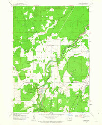
 - 1962 Map of Redmond, 1963 Print
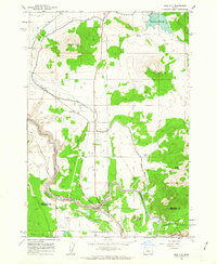
 1962 Redmond1963 Print · USGSRedmond and Terrebonne are captured in the early sixties as agricultural and rail hubs. Trace the development of Roberts Field or locate family sites near Redmond Cemetery and Edwin Brown Sch.2 unique versions available
 - 1962 Map of Alfalfa, 1963 Print
 1962 Alfalfa1963 Print · USGSIn the early 1960s, the high desert near Alfalfa, Oregon, was defined by its irrigation canals and remote family homesteads. Genealogists and historians can trace the development of this landscape through local landmarks like the Grange Hall, the Central Oregon Canal, and Abernathy Rd.2 unique versions available
 - 1962 Map of Cline Falls, 1963 Print
 1962 Cline Falls1963 Print · USGSThe Deschutes River corridor in the early sixties reveals a landscape of industrial utility and dramatic terrain. Researchers can trace mid-century mining operations at the Oremite Mine, hydropower sites near Cline Falls, and family landmarks like La Follette Butte.3 unique versions available
 - 1962 Map of Tumalo, 1963 Print
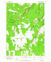
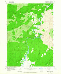
 1962 Tumalo1963 Print · USGSThe Deschutes River corridor comes into sharp focus during the early sixties, revealing a landscape defined by irrigation and volcanic geology. Researchers can trace the Columbia Southern Canal, family-named routes like Connarn Road, and the community of Tumalo.3 unique versions available
 - 1962 Map of Powell Buttes, 1963 Print
 1962 Powell Buttes1963 Print · USGSThe Crooked River valley in the early sixties shows a landscape transformed by water management and ranching. Genealogists and historians can locate established holdings like Red Cloud Ranch, the new Prineville Reservoir, and the complex Central Oregon Canal system.2 unique versions available
 - 1962 Map of Powell Butte, 1963 Print
 1962 Powell Butte1963 Print · USGSThe high desert plains of Crook County are captured here in the early sixties as irrigation transformed the landscape. Researchers can trace historic water routes like the Central Oregon Canal and find family-named landmarks such as Shumway Lake and Picket Spring.3 unique versions available
 - 1962 Map of Squaw Back Ridge, 1963 Print
 1962 Squaw Back Ridge1963 Print · USGSJefferson and Deschutes counties in the early 1960s reveal a landscape of remote ranches and high-desert canyons. Genealogists and local historians can locate the Geneva (Site) or trace family landmarks like the Squaw Flat Ranch and Rim Rock Ranch.2 unique versions available
 - 1962 Map of Gray Butte, 1963 Print
 1962 Gray Butte1963 Print · USGSJefferson County ranching and water management are mapped in the early sixties as irrigation reaches the high desert. Local researchers can trace family-named water sources like Rodman Spring and visit the site of the Lone Pine Sch or Gray Butte Cem.2 unique versions available
 - 1962 Map of Henkle Butte, 1964 Print
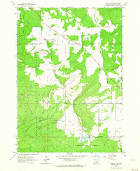
 1962 Henkle Butte1964 Print · USGSDeschutes County land use in the early sixties is defined by a blend of forest management and high-desert irrigation near Cloverdale. Genealogists and historians can trace local landmarks like Henkle Butte, the McKenzie Canyon Reservoir, and several family-named roads.4 unique versions available
 - 1962 Map of Shevlin Park, 1964 Print
 1962 Shevlin Park1964 Print · USGSThe Deschutes National Forest west of Bend is shown here in the early sixties as a hub of timber history and water management. You can trace the Old Railroad Grade, locate the Check Tower, and follow the path of the Tumalo Canal.4 unique versions available
 - 1962 Map of Steelhead Falls, 1964 Print
 1962 Steelhead Falls1964 Print · USGSHigh desert canyons and river confluences define this central Oregon landscape in the early sixties. Researchers can trace ranching footprints and water development near Grandview, the Lower Bridge Sch (Aban'd), and Steelhead Falls.2 unique versions available
 - 1962 Map of Tumalo Dam, 1964 Print
 1962 Tumalo Dam1964 Print · USGSThe ranch lands of Deschutes County are documented here in the early sixties, showing a landscape defined by irrigation and high-desert agriculture. Genealogists and researchers can trace the roads around Plainview, the Plainview Sch, and the engineering of the Tumalo Dam.4 unique versions available
 - 1963 Map of Elk Lake
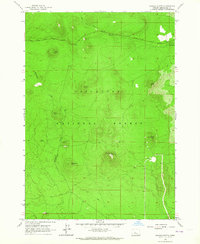
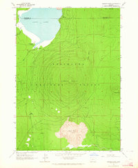
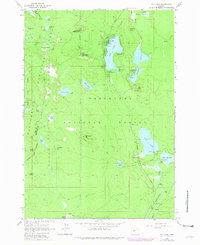 1963 Elk Lake1963 Print · USGSThe high Cascades come into focus during the early 1960s, showing a landscape of volcanic craters and alpine lakes. Researchers can locate established forest sites like Beach Campground, trace the Oregon Skyline Trail, and find local landmarks such as Red Crater.4 unique versions available
 - 1963 Map of Lava Cast Forest, 1964 Print
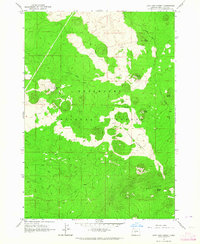 1963 Lava Cast Forest1964 Print · USGSThe Deschutes National Forest in the early sixties remains a primitive landscape of recent volcanic activity and sparse access. You can trace the rugged topography of the Lava Cast Forest and locate specific peaks like Sugar Pine Butte and Kawak Butte.3 unique versions available
 - 1963 Map of Lava Butte, 1964 Print
 1963 Lava Butte1964 Print · USGSDeschutes County was a landscape of volcanic cones and heavy timber in the early sixties, as shown in this detailed 1963 survey. Researchers can trace the Great Northern railroad and locate local landmarks like the Fire Lookout and Lava River Caves State Park.5 unique versions available
 - 1963 Map of Round Mountain, 1964 Print
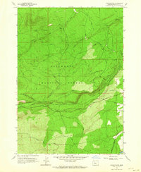
 1963 Round Mountain1964 Print · USGSThe Deschutes National Forest in the early sixties reveals a landscape of volcanic buttes and active forestry research. Trace the development of new mountain roads and find landmarks like Fall River Guard Station and the Pringle Falls Experimental Forest.3 unique versions available
 - 1963 Map of Benham Falls, 1964 Print
 1963 Benham Falls1964 Print · USGSThe Deschutes River cascades through volcanic landscapes south of Bend in the early sixties. Researchers can locate the historic Camp Abbot (Site), trace the Great Northern Trail, and explore riverside features like Dillon Falls and Lava Island.2 unique versions available
 - 1963 Map of Wanoga Butte, 1964 Print
 1963 Wanoga Butte1964 Print · USGSThe Oregon Cascades in the early sixties reveal a landscape of volcanic buttes and forest management routes. Explore the high country to find the Edison Ice Cave, the Lookout Tower atop Wanoga Butte, and the winding Cascade Lakes Highway.2 unique versions available
 - 1963 Map of Hamner Butte, 1964 Print
 1963 Hamner Butte1964 Print · USGSThe Deschutes and Klamath county line ran through a wild volcanic landscape in the early sixties. Researchers can trace remote recreational sites like West Davis Lake Campground and local landmarks such as Black Rock Ranch and the Cinder Pit.3 unique versions available
Showing maps 1-25 of 54
Top cities of Deschutes County
Frequently asked questions
- What are the different types of historical maps available for Deschutes County?
- What is the oldest map of Deschutes County?
- Where can I purchase historical maps of Deschutes County for my home or office?
- Where can I download high-res historical maps of Deschutes County?
- Are there historical topographic maps available for Deschutes County?
- Is there historical aerial imagery available for Deschutes County?
- Where are historical maps of Deschutes County sourced from?