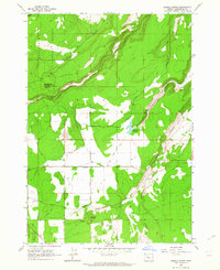
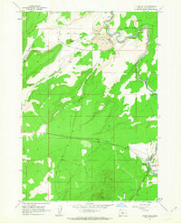
1962 Map of Henkle Butte
USGS Topo · Published 1964About this map
Cloverdale serves as the central hub of this Central Oregon landscape, where early 1960s irrigation and land management are clearly visible. The network of water management features, including the Goodrich Ditch, a Canal, and the McKenzie Canyon Reservoir, illustrates the area's transition from the wild terrain of the Deschutes National Forest to productive agricultural use. Notable volcanic landmarks like Henkle Butte, topped with a Lookout Tower, and Fryrear Butte break the horizon, while Squaw Creek carves a path through the northern section.
Find a feature on this map
27 named features on this map. Tap any name to fly to it.
Don’t see what you’re looking for? This feature index may not catch every label — zoom into the map to look around manually.
Map Details
Editions of this 1962 Henkle Butte Map
4 editions found
Other maps of this area

1926 · Bend
USGS Topo · 1:125,000

1929 · Bend
USGS Topo · 1:125,000

1929 · Three Sisters
USGS Topo · 1:125,000

1932 · Three Sisters
USGS Topo · 1:125,000

1955 · Bend
USGS Topo · 1:250,000

1957 · Bend
USGS Topo · 1:250,000

1958 · Bend
USGS Topo · 1:250,000

1959 · Broken Top
USGS Topo · 1:62,500

1959 · Sisters
USGS Topo · 1:62,500
1962 · Cline Falls
USGS Topo · 1:24,000