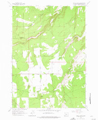
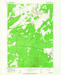
1962 Map of Henkle Butte
USGS Topo · Published 1975About this map
Henkle Butte and its Lookout Tower dominate the northwestern skyline of this high-desert plateau, providing a vantage point over the complex water management systems of central Oregon. The landscape is defined by the transition from the Deschutes National Forest to an arid basin carved by deep drainages like McKenzie Canyon and Deep Canyon. Agricultural development in the mid-20th century is evident through the extensive network of irrigation features, including the Goodrich Ditch, Squaw Creek Canal, and the McKenzie Canyon Reservoir. The settlement of Cloverdale serves as a local hub, connected by a grid of named thoroughfares such as Cloverdale Road and Slayton Road. This survey documents a period when historic routes like the Fremont Trail remained visible alongside the ranching and irrigation infrastructure that transformed the Deschutes County terrain.
Find a feature on this map
28 named features on this map. Tap any name to fly to it.
Don’t see what you’re looking for? This feature index may not catch every label — zoom into the map to look around manually.
Map Details
Editions of this 1962 Henkle Butte Map
4 editions found
Other maps of this area

1926 · Bend
USGS Topo · 1:125,000

1929 · Bend
USGS Topo · 1:125,000

1929 · Three Sisters
USGS Topo · 1:125,000

1932 · Three Sisters
USGS Topo · 1:125,000

1955 · Bend
USGS Topo · 1:250,000

1957 · Bend
USGS Topo · 1:250,000

1958 · Bend
USGS Topo · 1:250,000

1959 · Broken Top
USGS Topo · 1:62,500

1959 · Sisters
USGS Topo · 1:62,500
1962 · Cline Falls
USGS Topo · 1:24,000