1910s Maps of Lane County, Oregon
Explore 6 historic maps of Lane County from the 1910s. These maps offer a rare glimpse into what life looked like during the 1910s — showing old roads, neighborhoods, homes, and landmarks that have changed or disappeared over time.
Whether you're researching your family's past, planning a metal detecting trip, or studying how Lane County's landscape evolved across the 1910s, these high-resolution maps are a powerful tool for exploring the history of this region.
- Focus on a specific era: All maps on this page are from the 1910s, giving you a focused view of this time period.
- See what’s changed: Compare century-old streets, trails, and buildings to today's modern landscape using overlays and satellite layers.
- Research with precision: Use these maps for genealogy, historical research, land use analysis, or educational projects.
- View, download, or print: Maps are fully viewable online in high resolution, and can be downloaded or printed for your own records.
Start exploring Lane County's history through authentic maps from the 1910s. This is your window into the past.
Lane County, OR maps
(6)- 1910 Map of Eugene
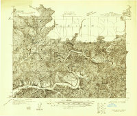
 1910 Eugene1910 Print · USGSThe upper Willamette Valley comes to life in the years before the Great War, centered on the growing campus of the University of Oregon. Genealogists can trace family footprints across dozens of local school districts like Santa Clara and Deadman, or follow the early tracks of the Oregon Electric RR.2 unique versions available
 - 1911 Map of Monroe
 1911 Monroe1911 Print · USGSThe Willamette Valley foothills meet the river bottomlands in the early twentieth century near the Benton and Lane county border. Genealogists and researchers can trace early settlements at Bellfountain and Alpine or locate rural landmarks like Irish Bend School and Ferguson Bridge.
 - 1912 Map of Halsey
 1912 Halsey1912 Print · USGSThe Willamette Valley’s fertile floor and expanding rail networks are documented here just before the era of modern highways. Local historians can locate numerous vanished rural landmarks, from the Ingram Ferry crossing to schoolhouses like Bell Plain School and Harris School.3 unique versions available
 - 1917 Map of Diamond Lake
 1917 Diamond Lake1917 Print · USGSThe high Cascades of Douglas and Klamath Counties are captured here just before the First World War. Local historians and hikers can trace early forest service outposts like Higdon Ranger Sta and remote routes including the Ft Klamath Road and Bradley Trail.3 unique versions available
 - 1918 Map of Mapleton
 1918 Mapleton1918 Print · USGSCoastal Oregon at the end of the Great War was defined by its timber operations and river-bound settlements. Researchers can trace the path of the Southern Pacific railroad as it winds past Swisshome and the Minerva PO.
 - 1919 Map of Earl
 1919 Earl1919 Print · USGSThe Oregon Coast Range in the years after the Great War shows a landscape of isolated homesteads and river-carved canyons. Researchers can trace early family sites like Fiske Ranch and Stokes Ranch or locate remote rural schoolhouses such as Sulphur Springs School.
End of results
Showing maps 1-6 of 6
Top cities of Lane County
- Eugene historical maps
- Springfield historical maps
- Cottage Grove historical maps
- Florence historical maps
- Junction City historical maps
- Creswell historical maps
See more
Frequently asked questions
- What are the different types of historical maps available for Lane County?
- What is the oldest map of Lane County?
- Where can I purchase historical maps of Lane County for my home or office?
- Where can I download high-res historical maps of Lane County?
- Are there historical topographic maps available for Lane County?
- Is there historical aerial imagery available for Lane County?
- Where are historical maps of Lane County sourced from?