1980s Maps of Lane County, Oregon
Explore 112 historic maps of Lane County from the 1980s. These maps offer a rare glimpse into what life looked like during the 1980s — showing old roads, neighborhoods, homes, and landmarks that have changed or disappeared over time.
Whether you're researching your family's past, planning a metal detecting trip, or studying how Lane County's landscape evolved across the 1980s, these high-resolution maps are a powerful tool for exploring the history of this region.
- Focus on a specific era: All maps on this page are from the 1980s, giving you a focused view of this time period.
- See what’s changed: Compare century-old streets, trails, and buildings to today's modern landscape using overlays and satellite layers.
- Research with precision: Use these maps for genealogy, historical research, land use analysis, or educational projects.
- View, download, or print: Maps are fully viewable online in high resolution, and can be downloaded or printed for your own records.
Start exploring Lane County's history through authentic maps from the 1980s. This is your window into the past.
Lane County, OR maps
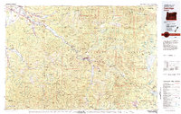
(112)- 1980 Map of Eugene
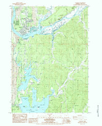
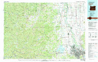 1980 Eugene1980 Print · USGSThe southern Willamette Valley and Coast Range are captured in the early eighties as the urban centers of Eugene and Springfield expanded. Researchers can trace the legacy of family estates and regional infrastructure through landmarks like Mahlon Sweet Airport, Fern Ridge Lake, and Junction City.
 - 1980 Map of Waldport
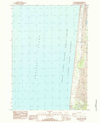
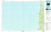 1980 Waldport1980 Print · USGSCoastal Oregon at the start of the 1980s reveals a landscape of rugged headlands and timbered ridges between Waldport and the Siuslaw River. Researchers can trace old beach communities and landmarks like the US Coast Guard Res Lighthouse at Heceta Head and Cape Perpetua.2 unique versions available
 - 1980 Map of Reedsport, 1987 Print
 1980 Reedsport1987 Print · USGSThe Oregon coast at the dawn of the 1980s reveals a landscape defined by timber, tourism, and the shifting sands of the Oregon Dunes. Local historians can trace the rail-and-river economy through Reedsport, the historic timber town of Gardiner, and the lakeside community of Lakeside.
 - 1980 Map of Bend, 1993 Print
 1980 Bend1993 Print · USGSCentral Oregon was evolving rapidly in the early eighties as outdoor recreation and transit hubs like Bend and Redmond expanded. Trace the historical footprints of Sisters, the Metolius River basin, and the Oregon Trunk Railway through the high desert.2 unique versions available
 - 1983 Map of Oakridge
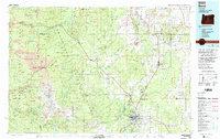
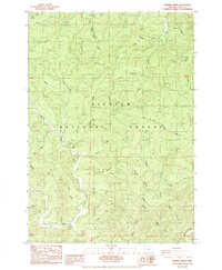
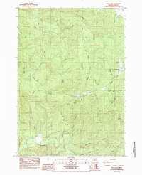
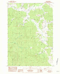
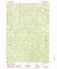
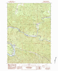
 1983 Oakridge1983 Print · USGSThe Cascades of Lane County are shown in the early eighties, centered on the timber and rail corridors of the Willamette. Genealogists and historians can trace the Southern Pacific line through Oakridge or find old mining sites like Mayflower Mine.
 - 1983 Map of Mc Kenzie River, 1984 Print
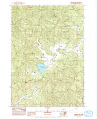
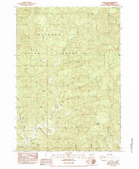
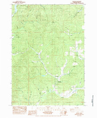
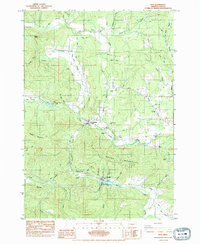
 1983 Mc Kenzie River1984 Print · USGSLinn and Lane Counties are shown in the early 1980s as a hub of hydroelectric power and timber production. Researchers can trace the development of river-valley towns like Sweet Home and Marcola or locate recreation sites at Foster Lake and Cougar Reservoir.
 - 1984 Map of Herman Creek
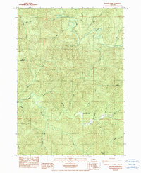
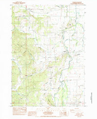
 1984 Herman Creek1984 Print · USGSLane County in the early 1980s is defined here by the dense timberlands and watercourses of the Siuslaw National Forest. Researchers can locate old settlements at Reed and Gibson or trace family landmarks like the Indian Cr Com.
 - 1984 Map of Tahkenitch Creek
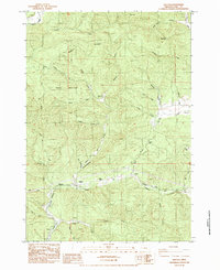
 1984 Tahkenitch Creek1984 Print · USGSThe Oregon coast in the mid-1980s reveals a wild landscape of shifting sands and interconnected lakes between the ocean and the national forest. Researchers can trace the path of the Oregon Coast Highway past the Kroll (Site) and explore the varied arms of Tahkenitch Lake.
 - 1984 Map of Triangle Lake
 1984 Triangle Lake1984 Print · USGSThe Coast Range of western Oregon is captured here in the mid-eighties, centered on the vital waters of Triangle Lake. Researchers can trace rural settlement patterns and local infrastructure near Blachly, Horton, and the Triangle Lake Sch.
 - 1984 Map of Goose Pasture
 1984 Goose Pasture1984 Print · USGSThe Lane County coast in the mid-eighties shows a landscape of shifting dunes and protected wildlife habitats. Researchers can trace the drainage of the Siltcoos River past the Concrete Dam or locate the Waxmyrtle Campground.
 - 1984 Map of Mercer Lake
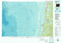
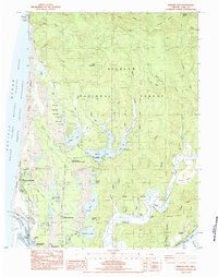 1984 Mercer Lake1984 Print · USGSThe Central Oregon coast in the mid-eighties shows a landscape of shifting dunes and deep evergreen forests between the Pacific and the Siuslaw River. You can trace the development of Florence and Heceta Beach, locate the Haring Cem, or follow the Southern Pacific rail line.
 - 1984 Map of High Point
 1984 High Point1984 Print · USGSLane County in the mid-1980s shows a landscape of timber management and river valleys deep in the Siuslaw National Forest. Researchers can trace old logging routes like the Mainline or locate settlements at Alma and Wolf Creek.
 - 1984 Map of Windy Peak
 1984 Windy Peak1984 Print · USGSWestern Oregon's timber country is documented here in the mid-1980s, showcasing the dense drainage systems of the Coast Range. Researchers can trace the rugged topography of the Siuslaw National Forest through local landmarks like Windy Peak, Buck Ridge, and Deadwood Creek.2 unique versions available
 - 1984 Map of Florence
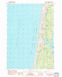
 1984 Florence1984 Print · USGSThe Oregon coast at the mid-eighties reveals a landscape defined by the winding Siuslaw River and its industrial rail connections. Trace the heritage of river towns like Cushman and Acme, or locate family landmarks near Drew Cem and Siltcoos.2 unique versions available
 - 1984 Map of Cottage Grove
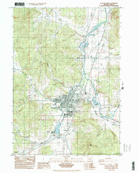 1984 Cottage Grove1984 Print · USGSCottage Grove and the southern Willamette Valley are captured in the mid-1980s as the regional timber and rail economy remained central to the landscape. Researchers can trace family sites at Shields Cem, locate neighborhood schools like Bohemia Sch, and follow the Southern Pacific line through Saginaw.
 - 1984 Map of Crow
 1984 Crow1984 Print · USGSIn the mid-1980s, the rural hills of western Lane County supported a network of family farms and schools centered around Crow. Researchers can trace old homesteads and burial grounds like Liles Cem and McCulloch Cem or follow the historic Territorial Highway corridor.
 - 1984 Map of Creswell
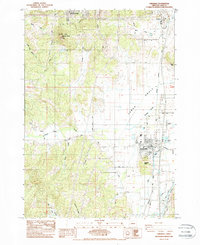 1984 Creswell1984 Print · USGSThe southern Willamette Valley transitions from agricultural flats to the foothills of the Cascades in the early 1980s. Researchers can trace family history at the Moxley Cem, locate rural homesteads along Kuni Rd, and follow the Southern Pacific rail line through Creswell.2 unique versions available
 - 1984 Map of Roman Nose Mtn
 1984 Roman Nose Mtn1984 Print · USGSThe Oregon Coast Range near the Lane and Douglas county line shows a landscape of timber and topography in the early eighties. Genealogists and researchers can trace the Southern Pacific rail line, find a remote Cem, or locate landmarks like Roman Nose Mtn.
 - 1984 Map of Horton
 1984 Horton1984 Print · USGSLane County in the mid-eighties shows a landscape of timber ridges and winding river valleys. Genealogists and hikers can locate Horton, the Goldson Cem, and landmarks like Crenshaw Hill or Burp Hollow.
 - 1984 Map of Gunter
 1984 Gunter1984 Print · USGSThe Oregon Coast Range at the Douglas and Lane county line comes alive in the mid-eighties. Genealogists and historians can trace the remote settlement at Gunter, locating the local Cem, a Quarry, and the winding banks of the Smith River.
 - 1984 Map of Beaver Creek
 1984 Beaver Creek1984 Print · USGSCoastal Oregon timberlands and the Lane-Douglas border are captured in this mid-1980s survey. Researchers can trace remote landmarks like the Beaver Creek School and the headwaters of the Suislaw River and Smith River.
 - 1984 Map of Walton
 1984 Walton1984 Print · USGSThe rail-and-timber corridor of western Lane County is captured here in the mid-1980s, centered on the community of Walton. Family researchers can locate Lyons Sch, the Chickahominy Cem, and the path of the Southern Pacific line through the hills.
 - 1984 Map of Mapleton
 1984 Mapleton1984 Print · USGSCoastal mountains and river valleys define this mid-1980s portrait of Lane County, where timber and rail infrastructure met the water. Trace the Southern Pacific tracks through Mapleton or locate old community markers like the Nekoma site and the local Cem.
 - 1984 Map of Noti
 1984 Noti1984 Print · USGSMid-century Lane County comes into focus through this survey of the river valleys and rail lines west of Eugene. Researchers can trace early family history at the Sailor Pioneer Cem or locate industrial sites like Vaughn Station and the Long Tom Site.
 - 1984 Map of Cheshire
 1984 Cheshire1984 Print · USGSCheshire and the Long Tom River valley appear here in the mid-1980s, showcasing a landscape of rural crossroads and river-bottom farms. Researchers can trace family history at the Franklin Cem or follow the old Southern Pacific Railroad Grade through Goldson and Franklin.
Showing maps 1-25 of 112
Top cities of Lane County
- Eugene historical maps
- Springfield historical maps
- Cottage Grove historical maps
- Florence historical maps
- Junction City historical maps
- Creswell historical maps
See more
Frequently asked questions
- What are the different types of historical maps available for Lane County?
- What is the oldest map of Lane County?
- Where can I purchase historical maps of Lane County for my home or office?
- Where can I download high-res historical maps of Lane County?
- Are there historical topographic maps available for Lane County?
- Is there historical aerial imagery available for Lane County?
- Where are historical maps of Lane County sourced from?