1990s Maps of Lane County, Oregon
Explore 53 historic maps of Lane County from the 1990s. These maps offer a rare glimpse into what life looked like during the 1990s — showing old roads, neighborhoods, homes, and landmarks that have changed or disappeared over time.
Whether you're researching your family's past, planning a metal detecting trip, or studying how Lane County's landscape evolved across the 1990s, these high-resolution maps are a powerful tool for exploring the history of this region.
- Focus on a specific era: All maps on this page are from the 1990s, giving you a focused view of this time period.
- See what’s changed: Compare century-old streets, trails, and buildings to today's modern landscape using overlays and satellite layers.
- Research with precision: Use these maps for genealogy, historical research, land use analysis, or educational projects.
- View, download, or print: Maps are fully viewable online in high resolution, and can be downloaded or printed for your own records.
Start exploring Lane County's history through authentic maps from the 1990s. This is your window into the past.
Lane County, OR maps
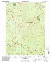
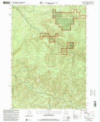
(53)- 1992 Map of Eugene
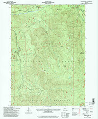
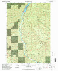
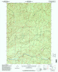
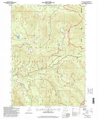
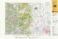 1992 Eugene1992 Print · USGSThe Willamette Valley and Coast Range are captured in the early nineties, showing the growth of Eugene and Springfield. Researchers can trace timber history in the Siuslaw National Forest or locate valley settlements like Junction City and Harrisburg.
 - 1994 Map of Tidbits Mountain, 1998 Print
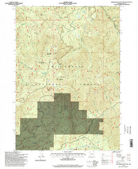
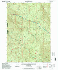
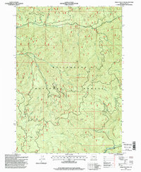
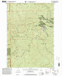
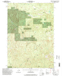 1994 Tidbits Mountain1998 Print · USGSLinn County’s high timber country in the mid-1990s is captured here just as modern Forest Service management was evolving. Researchers can trace the rugged drainages of the Calapooia River and find specific landmarks like Gordon Meadows, Tidbits Mountain, and Lost Lake.
 - 1997 Map of Waldo Mountain, 1998 Print
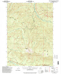
 1997 Waldo Mountain1998 Print · USGSThe Cascades high country of Lane County is shown here in the late 1990s, where two major wilderness areas meet. Researchers can trace the drainage of Moolack Creek and locate remote landmarks like Taylor Burn, Waldo Meadows, and the Lower Erma Bell Lake chain.
 - 1997 Map of Westfir East, 1998 Print
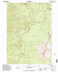
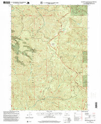
 1997 Westfir East1998 Print · USGSThe convergence of the North and Middle Forks of the Willamette River defines this 1990s look at timber and transit hubs in the Cascades. Researchers can locate the Oakridge Airport, the Rigdon Work Center, and local landmarks like Buckhead Shelter and High Prairie.
 - 1997 Map of Rigdon Point, 1998 Print
 1997 Rigdon Point1998 Print · USGSThe Oregon backcountry near the Lane and Douglas county line is captured here in the late 1990s. Researchers can trace forest development and water resources through landmarks like Indigo Springs, Lighthouse Rock, and several industrial Quarry sites.
 - 1997 Map of Waldo Lake, 1998 Print
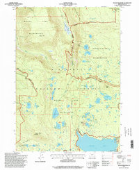
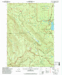
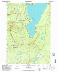 1997 Waldo Lake1998 Print · USGSThe Willamette National Forest in the late nineties offered a remote wilderness experience centered around the massive basin of Waldo Lake. Backcountry travelers can trace the Pacific Crest National Scenic Trail past high peaks and remote campsites like the South Waldo Shelter and Fuji Shelter.
 - 1997 Map of Mount June, 1998 Print
 1997 Mount June1998 Print · USGSIn the Cascades during the late nineties, this survey captures the intersection of the Willamette National Forest and Umpqua National Forest. Researchers can trace the topography around Mount June and Hardesty Mountain or locate numerous ridge-side Quarry sites and the Ash Swale Shelter.
 - 1997 Map of Chucksney Mountain, 1998 Print
 1997 Chucksney Mountain1998 Print · USGSThe Oregon Cascades at the end of the century are captured here through the river systems of the Willamette National Forest. Researchers can trace forest management history at the Box Canyon Forest Service Station and the Rebel Rock Lookout.
 - 1997 Map of Warner Mountain, 1998 Print
 1997 Warner Mountain1998 Print · USGSThe upper Willamette National Forest in the late nineties shows a landscape of timber management and river infrastructure. Researchers can trace the river corridor through Hills Creek Lake past Sand Prairie and the high lookout at Warner Mountain.
 - 1997 Map of Groundhog Mountain, 1998 Print
 1997 Groundhog Mountain1998 Print · USGSThe Oregon Cascades within Lane County are shown in the late nineties, documenting a landscape of timber management and high-country peaks. Researchers can locate remote fire watch sites at Warner Mountain Lookout and trace resource roads near Logger Butte and Waterdog Lake.
 - 1997 Map of Grasshopper Mountain, 1998 Print
 1997 Grasshopper Mountain1998 Print · USGSThe Willamette National Forest in the late nineties is documented here during a period of active timber management and wilderness preservation. Map collectors can trace the South Fork McKenzie River past a Homestead or locate sites like Lowell Mountain and Grasshopper Mountain.
 - 1997 Map of Diamond Peak, 1998 Print
 1997 Diamond Peak1998 Print · USGSThe Oregon Cascades at the end of the century reveal a landscape of volcanic peaks and alpine lakes. Hikers and researchers can trace the Pacific Crest National Scenic Trail past Diamond Peak or find the remote Salt Creek Falls and Too Much Bear Lake.
 - 1997 Map of Sardine Butte, 1998 Print
 1997 Sardine Butte1998 Print · USGSThe central Oregon Cascades appear in detail in the late nineties, showcasing the timber and water networks of the Willamette National Forest. Researchers can trace old forest routes along the North Fork Middle Fork Willamette River or locate summits like Sardine Butte and Battle Peak.
 - 1997 Map of Mc Credie Springs, 1998 Print
 1997 Mc Credie Springs1998 Print · USGSThe Oregon Cascades are captured here in the late nineties, focusing on the thermal waters and timbered ridges of the upper Willamette region. Researchers can locate remote mountain settlements and springs like McCredie Hot Springs, Kitson Hot Springs, and Wicopee.
 - 1997 Map of Oakridge, 1998 Print
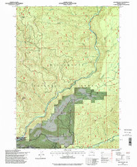
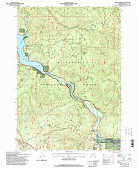
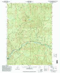
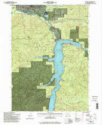 1997 Oakridge1998 Print · USGSOakridge and the Middle Fork Willamette River valley are shown here in the late nineties, documenting a landscape shaped by forest management and water control. Researchers can trace the reservoir's footprint from Hills Creek Dam and locate local facilities like the Willamette Fish Hatchery and Rigdon Work Center.
 - 1997 Map of Emigrant Butte, 1998 Print
 1997 Emigrant Butte1998 Print · USGSThe high Cascade Range is captured in the late 1990s at a complex intersection of national forests and wilderness areas. Map collectors and hikers can trace the Pacific Crest National Scenic Trail past Summit Lake or locate remote landmarks like Diamond Rockpile and Big Swamp.
 - 1997 Map of Staley Ridge, 1998 Print
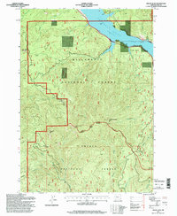
 1997 Staley Ridge1998 Print · USGSThe high Cascade country of Lane and Douglas County appears here in the late nineties, documenting a landscape of timber management and wilderness. Researchers can map out remote clearings and water sources like Bristow Prairie, Loletta Lakes, and Campers Flat.
 - 1997 Map of Sinker Mountain, 1998 Print
 1997 Sinker Mountain1998 Print · USGSThe Oregon Cascades within the Willamette National Forest are shown here in the late 1990s as a landscape of timber management and mountain recreation. Trace the remote trails near Elk Camp Shelter and Sinker Mountain, or locate industrial landmarks like Elephant Rock and several local quarries.
 - 1997 Map of Westfir West, 1998 Print
 1997 Westfir West1998 Print · USGSThe Middle Fork Willamette River corridor in the late nineties shows a landscape defined by forestry and river-based industry. Genealogists and hikers can trace the growth of Westfir near the Northern tracks or locate remote spots like Shady Dell and Hampton.
 - 1997 Map of Mount David Douglas, 1998 Print
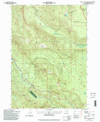 1997 Mount David Douglas1998 Print · USGSThe Oregon Cascades in the late nineties come into focus here, showing the heavy mountain infrastructure needed to manage the descent into the Willamette Valley. Researchers can trace the engineering of the high passes through snowsheds near Cruzatte and the geological landmarks of Verdun Rock and Hells Half Acre.
 - 1997 Map of Blair Lake, 1998 Print
 1997 Blair Lake1998 Print · USGSThe Willamette National Forest in the late 1990s was a landscape of secluded alpine meadows and high timber. Researchers can trace the drainage of Salmon Creek and locate remote landmarks like Blair Lake, Devils Lake, and Spring Prairie.
 - 1997 Map of Huckleberry Mountain, 1998 Print
 1997 Huckleberry Mountain1998 Print · USGSThe Willamette National Forest in the late 1990s is defined by the high peaks and creek drainages of the Cascades. Map collectors and researchers can trace the rugged topography around Huckleberry Mountain, locating Mehaloose Lake and the Salmon Creek Falls.
 - 1997 Map of Bearbones Mountain, 1999 Print
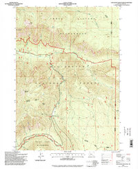
 1997 Bearbones Mountain1999 Print · USGSThe Calapooya Mountains high country comes into focus in the late nineties, documenting a landscape defined by deep forests and mining history. Trace legacy sites like the Noonday Mine, or locate remote waypoints such as Skeeter Camp and Gertrude Shelter.
 - 1997 Map of Fairview Peak, 2000 Print
 1997 Fairview Peak2000 Print · USGSThe Calapooya Divide and the Umpqua National Forest are shown in the late 1990s as a landscape shaped by historical mining. You can trace the legacy of the Bohemia Mining District through locations like Bohemia City, the Wildhog Mine, and the Lookout Tower atop Fairview Peak.
 - 1997 Map of Farmers Butte, 2001 Print
 1997 Farmers Butte2001 Print · USGSLinn County timberlands and the southern reaches of the Willamette National Forest are shown here during the late 1990s. Researchers can trace forest management roads and hydrology from Farmers Butte down to the Calapooia River and Cascada Falls.
Showing maps 1-25 of 53
Top cities of Lane County
- Eugene historical maps
- Springfield historical maps
- Cottage Grove historical maps
- Florence historical maps
- Junction City historical maps
- Creswell historical maps
See more
Frequently asked questions
- What are the different types of historical maps available for Lane County?
- What is the oldest map of Lane County?
- Where can I purchase historical maps of Lane County for my home or office?
- Where can I download high-res historical maps of Lane County?
- Are there historical topographic maps available for Lane County?
- Is there historical aerial imagery available for Lane County?
- Where are historical maps of Lane County sourced from?