Old Maps of Lane County, Oregon
Explore 282 old maps of Lane County, spanning from 1909 to today. These high-resolution historic maps reveal how streets, neighborhoods, landmarks, and natural features evolved over time — perfect for genealogy, metal detecting, research, and local history exploration.
What you can do with these maps:
- See how Lane County changed over time: Compare historical maps to modern-day views to trace roads, homesites, rail lines & more.
- View detailed metadata: Each map includes creators, publishers, year, scale, and archive source.
- Overlay maps with satellite & LiDAR: Visualize the past alongside modern tools to explore terrain & human change.
- Trusted historical sources: Maps sourced from the USGS, Library of Congress, and other archives.
- Access maps your way: View online, download high-res files, or order prints for personal or research use.
Start exploring old maps of Lane County to uncover forgotten places, hidden landmarks, and the deep history beneath your feet.
Lane County, OR maps
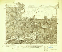
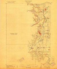
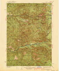
(282)- 1909 Map of Harrisburg
 1909 Harrisburg1909 Print · USGSCovers Lane County, including Harrisburg, Lancaster, and other nearby areas
 - 1909 Map of Elmira
 1909 Elmira1909 Print · USGSCovers Lane County, including Veneta, Elmira, and other nearby areas
 - 1910 Map of Eugene
 1910 Eugene1910 Print · USGSCovers Lane County, including Eugene, Springfield, and other nearby areas2 unique versions available
 - 1911 Map of Monroe
 1911 Monroe1911 Print · USGSCovers Lane County, including Monroe, Bellfountain, and other nearby areas
 - 1912 Map of Halsey
 1912 Halsey1912 Print · USGSCovers Lane County, including Harrisburg, Halsey, and other nearby areas3 unique versions available
 - 1917 Map of Diamond Lake
 1917 Diamond Lake1917 Print · USGSCovers Lane County, including Clearwater Village, Toketee Village, and other nearby areas3 unique versions available
 - 1918 Map of Mapleton
 1918 Mapleton1918 Print · USGSCovers Lane County, including Tiernan, Minerva, and other nearby areas
 - 1919 Map of Earl
 1919 Earl1919 Print · USGSCovers Lane County, including North Fork, Douglas County, and other nearby areas
 - 1920 Map of Siltcoos Lake
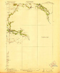
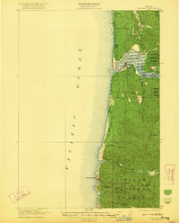
 1920 Siltcoos Lake1920 Print · USGSCovers Lane County, including Florence, Dunes City, and other nearby areas3 unique versions available
 - 1920 Map of Heceta Head
 1920 Heceta Head1920 Print · USGSCovers Lane County, including Florence, Searose Beach, and other nearby areas4 unique versions available
 - 1921 Map of Brownsville
 1921 Brownsville1921 Print · USGSCovers Lane County, including Sweet Home, Brownsville, and other nearby areas4 unique versions available
 - 1921 Map of Cottage Grove
 1921 Cottage Grove1921 Print · USGSCovers Lane County, including Eugene, Cottage Grove, and other nearby areas3 unique versions available
 - 1922 Map of Monroe
 1922 Monroe1922 Print · USGSCovers Lane County, including Monroe, Bellfountain, and other nearby areas4 unique versions available
 - 1922 Map of Waldport
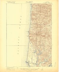
 1922 Waldport1922 Print · USGSCovers Lane County, including Waldport, Yachats, and other nearby areas2 unique versions available
 - 1922 Map of Elmira
 1922 Elmira1922 Print · USGSCovers Lane County, including Veneta, Elmira, and other nearby areas3 unique versions available
 - 1925 Map of Waldo Lake
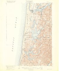
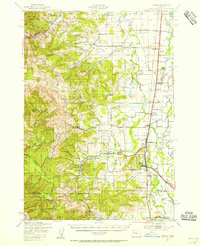
 1925 Waldo Lake1925 Print · USGSCovers Lane County, including Oakridge, Westfir, and other nearby areas4 unique versions available
 - 1929 Map of Three Sisters, 1956 Print
 1929 Three Sisters1956 Print · USGSCovers Lane County, including Sisters, Camp Sherman, and other nearby areas2 unique versions available
 - 1930 Map of Maiden Peak
 1930 Maiden Peak1930 Print · USGSCovers Lane County, including La Pine, Crescent Lake, and other nearby areas3 unique versions available
 - 1932 Map of Three Sisters
 1932 Three Sisters1932 Print · USGSCovers Lane County, including Sisters, Camp Sherman, and other nearby areas3 unique versions available
 - 1934 Map of Maiden Peak
 1934 Maiden Peak1934 Print · USGSCovers Lane County, including La Pine, Crescent Lake, and other nearby areas3 unique versions available
 - 1934 Map of Mc Kenzie Bridge
 1934 Mc Kenzie Bridge1934 Print · USGSCovers Lane County, including McKenzie Bridge, Finn Rock, and other nearby areas
 - 1935 Map of Lowell
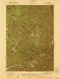
 1935 Lowell1935 Print · USGSCovers Lane County, including Creswell, Lowell, and other nearby areas
 - 1939 Map of Monroe, 1956 Print
 1939 Monroe1956 Print · USGSCovers Lane County, including Monroe, Bellfountain, and other nearby areas
 - 1940 Map of Mapleton
 1940 Mapleton1940 Print · USGSCovers Lane County, including Tiernan, Minerva, and other nearby areas
 - 1940 Map of Mc Kenzie Bridge
 1940 Mc Kenzie Bridge1940 Print · USGSCovers Lane County, including McKenzie Bridge, Finn Rock, and other nearby areas3 unique versions available
Showing maps 1-25 of 282
Top cities of Lane County
- Eugene historical maps
- Springfield historical maps
- Cottage Grove historical maps
- Florence historical maps
- Junction City historical maps
- Creswell historical maps
See more
Frequently asked questions
- What are the different types of historical maps available for Lane County?
- What is the oldest map of Lane County?
- Where can I purchase historical maps of Lane County for my home or office?
- Where can I download high-res historical maps of Lane County?
- Are there historical topographic maps available for Lane County?
- Is there historical aerial imagery available for Lane County?
- Where are historical maps of Lane County sourced from?