Old Maps of Morrow County, Oregon for Genealogy
Trace your family roots with 384 historic maps of Morrow County. These high-res maps reveal old neighborhoods, homesites, landmarks, and streets — helping you uncover where your ancestors lived and how the area evolved over time.
- Explore historic neighborhoods: Identify where your relatives may have lived in the 1800s or 1900s.
- Compare maps over time: Trace the changes in streets, buildings, and landmarks for multi-generational research.
- Perfect for genealogy & ancestry research: Used by family historians and researchers to map out lineage and migration.
These maps are an incredible resource for exploring your personal connection to Morrow County's past.
Morrow County, OR maps
(384)- 1906 Map of Blalock Island, 1954 Print
 1906 Blalock Island1954 Print · USGSThe Columbia River corridor in the early twentieth century served as a vital nexus for Pacific Northwest rail and river trade. Researchers can trace the routes of three major railroads and locate early settlements and landmarks like Irrigon, Blalock Island, and Castle Rock.2 unique versions available
 - 1908 Map of Blalock Island
 1908 Blalock Island1908 Print · USGSThe Columbia River frontier of Oregon and Washington is captured here in the years before massive dam projects altered the basin. Researchers can trace the path of the Emigrant Road and locate early settlements like Douglas Morgan P.O., Cecil, and Irrigon.3 unique versions available
 - 1908 Map of Umatilla
 1908 Umatilla1908 Print · USGSEastern Oregon at the turn of the century shows a landscape being transformed by early irrigation and competing rail lines. Genealogists and researchers can trace the growth of Hermiston, Echo, and Pine City or follow the path of the Stage Road and the Furnish Ditch.3 unique versions available
 - 1916 Map of Arlington
 1916 Arlington1916 Print · USGSThe Columbia River frontier of the mid-1910s reveals a world where the Oregon Trail and early railroads met the water. Genealogists can trace family roots through rural landmarks like Stegeman Ranch, Shutler, and the Locust Grove School.4 unique versions available
 - 1916 Map of Condon
 1916 Condon1916 Print · USGSNorth-central Oregon at the start of the twentieth century was a land of high plateaus and deep canyons centered on the Condon wheat country. Genealogists can trace a vast network of rural schoolhouses like Linville School and Buckhorn School, alongside early rail stops at Mikkalo and Gwendolen.3 unique versions available
 - 1950 Map of Ritter, 1964 Print
 1950 Ritter1964 Print · USGSThe river forks of Grant County are documented here mid-century, showing the isolated ranching and timber communities of the Blue Mountains. Genealogists and local historians can trace family-named landmarks like Ritter Cemetery, Threemile School, and the local Lumber Mill.2 unique versions available
 - 1951 Map of Monument, 1953 Print
 1951 Monument1953 Print · USGSThe Grant and Morrow County borderlands in the early 1950s center on the vital confluence of the John Day River forks. Genealogists and historians can trace old homestead sites near the Top School (Aband) or explore the remote canyon reaches of Monument and Kimberly.3 unique versions available
 - 1952 Map of Ritter
 1952 Ritter1952 Print · USGSThe Ritter community and the North Fork John Day River corridor are frozen in time during the early fifties. Genealogists and local historians can locate rural landmarks like Ritter Hot Springs, Threemile School, and Ritter Cemetery.2 unique versions available
 - 1953 Map of Kimberly, 1955 Print
 1953 Kimberly1955 Print · USGSThe high desert of Grant and Wheeler counties comes into focus in the early 1950s, centered on the John Day River and its rugged basins. Researchers can locate remote landmarks like the Haystack Cem, the Bull Prairie Guard Sta, and the settlement of Kimberly.2 unique versions available
 - 1953 Map of Spray, 1955 Print
 1953 Spray1955 Print · USGSCentral Oregon ranching and river life are captured here in the early fifties, centered on the Spray settlement along the John Day River. Researchers can trace old family sites and mountain landmarks like Winlock, Hoogie Doogie Mtn, and the Corncob Ranch.2 unique versions available
 - 1953 Map of Pendleton, 1957 Print
 1953 Pendleton1957 Print · USGSNortheastern Oregon and the Columbia River frontier are captured here in the early fifties, a time of massive federal infrastructure projects. Researchers can trace the historic route of The Old Oregon Trail as it passes near the Umatilla Ordnance Depot and the new McNary Dam.4 unique versions available
 - 1953 Map of The Dalles, 1965 Print
 1953 The Dalles1965 Print · USGSThe Columbia River Gorge at mid-century shows a region being transformed by massive hydroelectric dams and a growing highway network. Researchers can trace the development of The Dalles Dam, locate the Maryhill Museum, and find old rail stops in Rufus, Wishram, and Arlington.3 unique versions available
 - 1955 Map of Canyon City, 1966 Print
 1955 Canyon City1966 Print · USGSCentral Oregon's high desert and timber country are captured here in the mid-fifties, showing the rugged ranching and logging landscape. Trace the path of the Sumpter Valley Ry or locate remote settlements like Izee, Whitney, and Ritter.4 unique versions available
 - 1956 Map of The Dalles
 1956 The Dalles1956 Print · USGSThe Columbia River Gorge and the high Cascades are captured in the mid-1950s, showing a vital corridor of rail and road. Researchers can trace the original path of The Old Oregon Trail or locate historical landmarks like the Maryhill Museum and Mount Hood.
 - 1956 Map of Pendleton
 1956 Pendleton1956 Print · USGSNortheastern Oregon’s high plateau and timbered peaks appear here in the mid-fifties, during a time of major military and hydroelectric development. Trace the path of The Old Oregon Trail alongside modern landmarks like McNary Dam and the Umatilla Ordnance Depot.
 - 1957 Map of The Dalles
 1957 The Dalles1957 Print · USGSThe Columbia River Gorge and the high plateaus of the mid-1950s come alive on this detailed survey of northern Oregon and southern Washington. Researchers can trace the path of the Oregon Trail and The Old Barlow Road alongside river towns like The Dalles and Wishram.
 - 1959 Map of Canyon City
 1959 Canyon City1959 Print · USGSEastern Oregon in the late fifties was a landscape of high timber and remote river valleys shaped by the cattle and mining trades. Genealogists and historians can trace the paths of the Sumpter Valley RR and find early settlements like Antone, Richmond, and Dayville.2 unique versions available
 - 1962 Map of Alderdale, 1963 Print
 1962 Alderdale1963 Print · USGSThe Columbia River corridor is captured here in the early sixties, showing the rail-dominated landscape of the Oregon-Washington border. Researchers can trace the dual rail lines of the Spokane Portland and Seattle and Union Pacific through Alderdale and past Thanksgiving Island.2 unique versions available
 - 1962 Map of Blalock Island, 1963 Print
 1962 Blalock Island1963 Print · USGSThe Columbia River corridor in the early sixties reveals a landscape of high ridges and mid-river islands. Researchers can trace the Portland Seattle and Spokane railway past Telegraph Island and the rugged cuts of Glade Creek.2 unique versions available
 - 1962 Map of Ordnance, 1963 Print
 1962 Ordnance1963 Print · USGSEastern Oregon in the early sixties is captured here, centered on the specialized military and irrigation landscape of the Columbia Basin. Researchers can trace the extensive Umatilla Ordnance Depot complex and find local markers like Munley, the Union Pacific rail line, and Lost Lake.2 unique versions available
 - 1962 Map of Paterson, 1963 Print
 1962 Paterson1963 Print · USGSThe Columbia River corridor is captured here in the early 1960s, showing the vital rail and water links between Washington and Oregon. Researchers can trace the legacy of the Paterson Ferry, the Spokane Portland and Seattle line, and the Irrigon Cemetery.2 unique versions available
 - 1962 Map of Boardman, 1963 Print
 1962 Boardman1963 Print · USGSBoardman and the Columbia River islands are shown in detail during the early sixties, highlighting the era's critical rail and water transport networks. Researchers can trace family history through rural landmarks like Riverview Cem or explore the vast Boardman Bombing Range and the nearby Fairgrounds.3 unique versions available
 - 1962 Map of Clarke, 1963 Print
 1962 Clarke1963 Print · USGSMorrow County was a landscape of military reserves and rail junctions during the early sixties. Researchers can trace the perimeter of the Umatilla Ordnance Depot, locate the settlement of Clarke, and find historic water sources like Coyote Spring.3 unique versions available
 - 1962 Map of Irrigon, 1963 Print
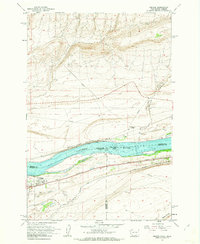 1962 Irrigon1963 Print · USGSIrrigon and the Columbia River riverfront are captured here in the early sixties, showing the vital intersection of rail and water. Researchers can trace the town's development through Houghton Sch, the local Cem, and the path of the Union Pacific line.3 unique versions available
 - 1962 Map of Crow Butte, 1963 Print
 1962 Crow Butte1963 Print · USGSThe Columbia River serves as a busy transport corridor in the early sixties, marking the border between Washington and Oregon. Researchers can trace historic river landings and military footprints through sites like Toms Camp, Castle Rock, and the Boardman Bombing Range.4 unique versions available
Showing maps 1-25 of 384
Top cities of Morrow County
- Boardman historical maps
- Irrigon historical maps
- Heppner historical maps
- Ione historical maps
- Lexington historical maps
Frequently asked questions
- What are the different types of historical maps available for Morrow County?
- What is the oldest map of Morrow County?
- Where can I purchase historical maps of Morrow County for my home or office?
- Where can I download high-res historical maps of Morrow County?
- Are there historical topographic maps available for Morrow County?
- Is there historical aerial imagery available for Morrow County?
- Where are historical maps of Morrow County sourced from?