1990s Maps of Morrow County, Oregon
Explore 31 historic maps of Morrow County from the 1990s. These maps offer a rare glimpse into what life looked like during the 1990s — showing old roads, neighborhoods, homes, and landmarks that have changed or disappeared over time.
Whether you're researching your family's past, planning a metal detecting trip, or studying how Morrow County's landscape evolved across the 1990s, these high-resolution maps are a powerful tool for exploring the history of this region.
- Focus on a specific era: All maps on this page are from the 1990s, giving you a focused view of this time period.
- See what’s changed: Compare century-old streets, trails, and buildings to today's modern landscape using overlays and satellite layers.
- Research with precision: Use these maps for genealogy, historical research, land use analysis, or educational projects.
- View, download, or print: Maps are fully viewable online in high resolution, and can be downloaded or printed for your own records.
Start exploring Morrow County's history through authentic maps from the 1990s. This is your window into the past.
Morrow County, OR maps
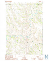
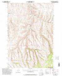
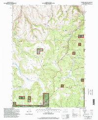
(31)- 1990 Map of Turner Mountain
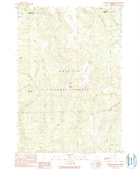 1990 Turner Mountain1990 Print · USGSThe southern Blue Mountains of Grant County appear in the late twentieth century as a complex of high ridges and forest canyons. Researchers can trace land-use patterns through features like CCC Spring, Happy Jack Ridge, and the Gravel Pit at Wilson Prairie.
 - 1990 Map of Johnny Cake Mtn
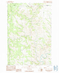 1990 Johnny Cake Mtn1990 Print · USGSNortheastern Oregon’s high timber country is captured here during the late 1980s, documenting the remote reaches of the Umatilla National Forest. Researchers can trace the steep drainage into the North Fork John Day River and locate secluded landmarks like Johnny Cake Mtn and Buckhorn Spring.
 - 1990 Map of Ritter
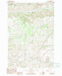 1990 Ritter1990 Print · USGSThe rugged river forks of Grant County are captured in the 1990s, centered on the settlement of Ritter. Researchers can locate the Ritter Cem and trace the complex drainages of Sixmile Creek and Eightmile Creek.
 - 1990 Map of Whitetail Butte
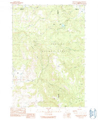 1990 Whitetail Butte1990 Print · USGSThe high timberlands and volcanic peaks of the Oregon interior are documented in this late twentieth-century survey. Forest researchers and local historians can trace the remote drainage networks of Big Wall Creek and locate family-named landmarks like Stalling Butte and Bull Prairie Lake.
 - 1990 Map of Slickear Mtn
 1990 Slickear Mtn1990 Print · USGSThe confluence of the John Day River forks and the high ridges of the Blue Mountains are captured in this 1990 survey. Researchers can trace the rugged terrain through Fourmile Gap and identify landmarks like Slickear Mtn and Potamus Creek.
 - 1990 Map of Collins Butte
 1990 Collins Butte1990 Print · USGSThe Oregon high country during the 1980s reveals a landscape of isolated springs and remote ridges. Genealogists and researchers can trace land use at the Corncob Ranch or locate family-named features like Davenport Spring and Ricks Ridge.
 - 1993 Map of Clarke
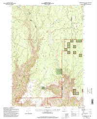
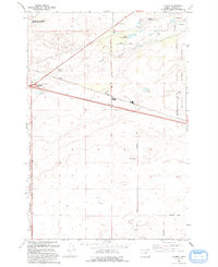 1993 Clarke1993 Print · USGSMorrow County high desert in the early nineties reveals a landscape defined by military training and irrigation. Trace the intersection of Clarke and Boardman Junction near the Naval Weapons Systems Training Facility and Coyote Spring.
 - 1993 Map of West of Paterson
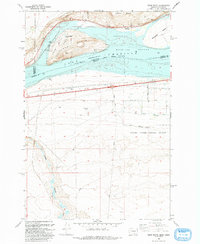
 1993 West of Paterson1993 Print · USGSThe Columbia River frontier of the 1990s reveals a rugged landscape of wildlife refuges and island chains along the Oregon-Washington border. Researchers can trace the river channels around Blalock Islands National Wildlife Refuge, Whitcomb Island, and the ridges above Glade Creek.2 unique versions available
 - 1993 Map of Crow Butte
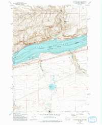
 1993 Crow Butte1993 Print · USGSThe Columbia River frontier of the early nineties is captured here as a landscape of recreation and defense. Trace the development of Crow Butte State Park or the military boundaries of the Naval Weapons Systems Training Facility.
 - 1993 Map of Ella
 1993 Ella1993 Print · USGSMorrow County's high-desert landscape in the early nineties shows a fascinating mix of historic pioneer trails and modern power infrastructure. You can trace the historic Immigrant Road past the settlement of Ella or locate industrial sites like the Powerplant and Carty Reservoir.
 - 1993 Map of Ordnance
 1993 Ordnance1993 Print · USGSThe high desert of Umatilla County is seen here in the early nineties, centered on the sprawling military infrastructure of the Umatilla Depot Activity. Researchers can trace irrigation networks like the Irrigon Canal and locate the small communities of Ordnance and Westland.
 - 1993 Map of Paterson
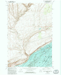
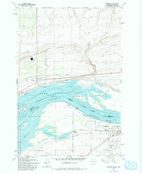 1993 Paterson1993 Print · USGSThe Columbia River shoreline near Paterson and Irrigon is captured in the early nineties, showing a landscape defined by wildlife refuges and river management. Researchers can trace the path of the Old Railroad Grade and explore the islands of the Umatilla National Wildlife Refuge.
 - 1993 Map of Irrigon
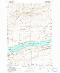 1993 Irrigon1993 Print · USGSIrrigon and the Columbia River frontier are captured here in the early nineties as the region balanced agriculture, conservation, and military land use. Genealogists and local historians can locate Houghton Sch, the Desert Lawn Memorial Cem, and the expansive Umatilla Depot Activity.
 - 1993 Map of Boardman
 1993 Boardman1993 Print · USGSBoardman sits along the Columbia River shoreline in the early nineties, where industrial port development meets agricultural irrigation. Trace local genealogy at Riverview Cem or follow the Union Pacific rail lines through Messner and Boardman Junction.
 - 1993 Map of Golgotha Butte
 1993 Golgotha Butte1993 Print · USGSThe Columbia River frontier along the Washington and Oregon border is captured here in the early nineties. Researchers can trace the isolated settlement of Sixprong, find the Landing Strip near the canyon floors, and locate the Gravel Pit and riverfront Boat Ramp.
 - 1995 Map of Ritter, 1998 Print
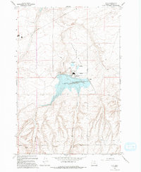
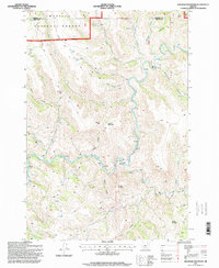
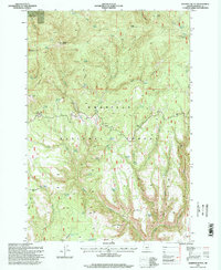
 1995 Ritter1998 Print · USGSCentral Oregon in the mid-nineties shows a remote landscape where the Middle Fork John Day River meets local thermal features. Researchers can locate the Ritter Cem, the Ritter Hot Springs resort area, and the rugged Devils Backbone ridge.
 - 1995 Map of Slickear Mountain, 1998 Print
 1995 Slickear Mountain1998 Print · USGSThe confluence of the North and Middle Forks of the John Day River highlights this 1990s look at the Grant and Morrow County border. Researchers can trace remote backcountry access routes and water resources like Potamus Creek, Fourmile Gap, and Slickear Mountain.
 - 1995 Map of Big Rock Flat, 1998 Print
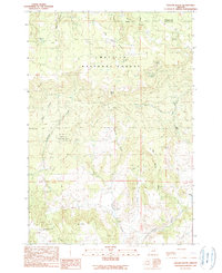
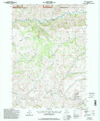
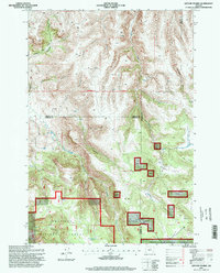
 1995 Big Rock Flat1998 Print · USGSMorrow County's high country is documented in the mid-1990s, showing a landscape defined by timber history and numerous mountain springs. Genealogists and historians can trace old sites like Reeds Mill, Parkers Mill, and the Anson Wright Memorial Park.
 - 1995 Map of Balm Canyon, 1998 Print
 1995 Balm Canyon1998 Print · USGSMorrow County’s high forest and canyon country are shown here in the mid-nineties, documenting the rugged drainage systems of the Blue Mountains. Genealogists and researchers can locate family landmarks such as the Rhea Creek Cem and the Corral at Spring Hollow Creek.
 - 1995 Map of Lefevre Prairie, 1998 Print
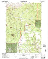
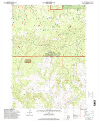
 1995 Lefevre Prairie1998 Print · USGSThe high plateau of the Blue Mountains in the mid-nineties shows a landscape of timber and isolated prairies at the meeting of three Oregon counties. Researchers can trace land boundaries near Lonerock Cemetery or locate remote water features like Brandenburg Reservoir and The Frog.
 - 1995 Map of Collins Butte, 1998 Print
 1995 Collins Butte1998 Print · USGSWheeler County ranching and forest lands are captured here in the mid-1990s, showing the intersection of public forest and private holdings. Researchers can locate remote landmarks like Corncob Ranch and trace water sources such as Yellowjacket Spring and Collins Butte Spring.
 - 1995 Map of Johnny Cake Mountain, 1998 Print
 1995 Johnny Cake Mountain1998 Print · USGSThe high timber and deep canyons of the Oregon Blue Mountains are detailed here in the mid-1990s, spanning the border of Grant and Morrow counties. Genealogists and hikers can trace the remote settlement of Loulatt or follow the waters of the North Fork John Day River past Neal Butte.
 - 1995 Map of Chapin Creek, 1998 Print
 1995 Chapin Creek1998 Print · USGSMorrow County's high-country prairies and forest lands are documented here in the mid-nineties. Trace the location of historic springs and camps like Indian Camp, Twin Cabins Spring, and the high vistas of Shingle Mill Butte.
 - 1995 Map of Thompson Flat, 1998 Print
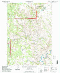
 1995 Thompson Flat1998 Print · USGSThe Oregon backcountry of the mid-nineties is documented here along the divide between Morrow and Umatilla counties. Researchers can trace forest history through isolated landmarks like Florence Cabin, Thompson Corral, and remote water sources like Sparta Spring.
 - 1995 Map of Madison Butte, 1998 Print
 1995 Madison Butte1998 Print · USGSThe Oregon backcountry of the mid-nineties reveals a landscape of high buttes and isolated forest outposts within the Umatilla National Forest. Researchers can trace old mountain trails and locate sites like the Morphine Ranch (Site), Tupper Guard Station, and the Skookum Game Enclosure.
Showing maps 1-25 of 31
Top cities of Morrow County
- Boardman historical maps
- Irrigon historical maps
- Heppner historical maps
- Ione historical maps
- Lexington historical maps
Frequently asked questions
- What are the different types of historical maps available for Morrow County?
- What is the oldest map of Morrow County?
- Where can I purchase historical maps of Morrow County for my home or office?
- Where can I download high-res historical maps of Morrow County?
- Are there historical topographic maps available for Morrow County?
- Is there historical aerial imagery available for Morrow County?
- Where are historical maps of Morrow County sourced from?