1940s Maps of South Carolina
Explore 178 historic maps of South Carolina from the 1940s. These maps offer a rare glimpse into what life looked like during the 1940s — showing old roads, neighborhoods, homes, and landmarks that have changed or disappeared over time.
Whether you're researching your family's past, planning a metal detecting trip, or studying how South Carolina's landscape evolved across the 1940s, these high-resolution maps are a powerful tool for exploring the history of this region.
- Focus on a specific era: All maps on this page are from the 1940s, giving you a focused view of this time period.
- See what’s changed: Compare century-old streets, trails, and buildings to today's modern landscape using overlays and satellite layers.
- Research with precision: Use these maps for genealogy, historical research, land use analysis, or educational projects.
- View, download, or print: Maps are fully viewable online in high resolution, and can be downloaded or printed for your own records.
Start exploring South Carolina's history through authentic maps from the 1940s. This is your window into the past.
South Carolina maps
(178)- 1940 Map of Florence West
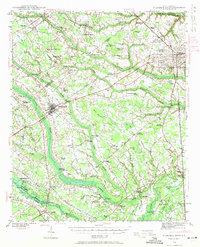 1940 Florence West1940 Print · USGSThe rural landscapes and rail towns west of Florence appear here just before the mid-century, as the local economy revolved around the river and the tracks. Genealogists can trace family roots through numerous country churches like Snow Hill Ch and old settlements like Timmonsville and Ebenezer.2 unique versions available
 - 1940 Map of Melgrove
 1940 Melgrove1940 Print · USGSThe South Carolina lowcountry near Charleston appears here just before the mid-century industrial boom. Researchers can locate community anchors like St Johns Ch, the No 6 School, and the rail stop at Inness Sta along the SOUTHERN line.
 - 1940 Map of Myrtle Beach
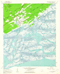
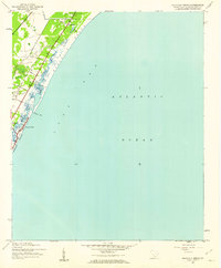
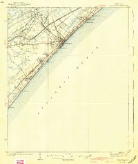 1940 Myrtle Beach1940 Print · USGSBefore the rise of modern resorts, the Grand Strand was a network of swashes and small coastal outposts. Genealogists and historians can trace the early footprints of Socastee, Myrtle Ridge, and the Ocean Forest Club along the historic Kings Highway.3 unique versions available
 - 1940 Map of Florence East, 1971 Print
 1940 Florence East1971 Print · USGSThe Pee Dee region just before the Second World War shows a landscape defined by riverside landings and rural rail stops. Genealogists can locate family-named landmarks and community hubs like Browns Old Mill, Tabernacle Sch, and Hewitt Cem.
 - 1941 Map of Charlotte
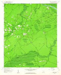
 1941 Charlotte1941 Print · USGSMecklenburg and its surrounding counties are captured here at a pivotal moment in the early 1940s. Genealogists and local historians can trace the rail-driven growth of Charlotte or locate smaller rural landmarks like Alexanders Store, Wesley Chapel, and the community at Stallings.
 - 1941 Map of Spartanburg
 1941 Spartanburg1941 Print · USGSSouth Carolina’s Piedmont and Sandhills regions are shown here during the mid-century peak of the rail era. Researchers can trace the sprawling Fort Jackson Military Reservation and the industrial growth of hubs like Spartanburg and Rock Hill.
 - 1941 Map of Clarks Hill, 1957 Print
 1941 Clarks Hill1957 Print · USGSThe Savannah River valley remained a landscape of ferries and river-to-rail commerce just before the era of major dam construction. Genealogists and historians can trace family roots through numerous rural landmarks like Cary Hill Ch, Modoc, and Gilchrist Ferry.2 unique versions available
 - 1942 Map of Charlotte
 1942 Charlotte1942 Print · USGSCharlotte and its surrounding Piedmont communities are captured here during the early years of the Second World War. Researchers can trace the rail corridors of the Southern and Seaboard Air Line or locate family-named sites like Alexanders Store, Hoods Cross Road, and Wesley Chapel.2 unique versions available
 - 1942 Map of Clarks Hill
 1942 Clarks Hill1942 Print · USGSThe Savannah River valley along the South Carolina and Georgia border comes alive in this survey from the era of river ferries and local rail. Genealogists can trace family landmarks like Hosannah Church, Dents Ferry, and the Flat Rock School.
 - 1942 Map of Savannah
 1942 Savannah1942 Print · USGSCoastal Georgia and the South Carolina borderlands come alive in this wartime survey of the Savannah riverfront. Genealogists and historians can trace industrial housing at Port Wentworth Colored Village, river landmarks like Fort Jackson, and the footprint of the Ogeechee Canal.
 - 1942 Map of Okatie
 1942 Okatie1942 Print · USGSCoastal South Carolina at the height of the Second World War shows a landscape of tidal marshes and strategic river landings. Genealogists and historians can trace family locations through named sites like Grahamville, Old House, and the Civil War Entrenchment north of Ridgeland.
 - 1942 Map of Camden
 1942 Camden1942 Print · USGSMid-century South Carolina comes into focus along the Wateree River as the region's rail and agricultural networks reached their peak. Genealogists and historians can trace old community hubs like Boykin Mill, Friends Neck Ch, and the grounds of the Sand Hill Experimental Station.
 - 1942 Map of Nixonville
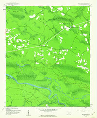
 1942 Nixonville1942 Print · USGSCoastal South Carolina was a landscape of river landings and remote wetlands in the late thirties. Researchers can trace family roots through numerous local landmarks like Hickory Grove Sch, Mt Calvary Ch, and Reeves Log along the Waccamaw River.2 unique versions available
 - 1942 Map of Rockingham, 1944 Print
 1942 Rockingham1944 Print · USGSThe North Carolina and South Carolina borderlands come alive in this wartime survey of the Pee Dee River valley. Researchers can trace historic mill sites like Burnt Factory Pond or locate family landmarks such as Roberdell and Old Sneedsboro.
 - 1942 Map of Cedar Creek, 1962 Print
 1942 Cedar Creek1962 Print · USGSThe coastal plains of Georgetown and Berkeley counties are documented here in the early 1940s, showcasing a landscape of dense swamps and scattered landings. Genealogists and historians can trace rail-side life in Lambert or explore the riverfront at Price Landing and Trinity Ch.2 unique versions available
 - 1942 Map of Cape Romain, 1962 Print
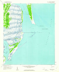
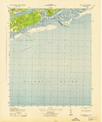
 1942 Cape Romain1962 Print · USGSThe South Carolina coast near the Santee Delta is shown here in the early 1940s, capturing a pristine network of barrier islands and salt marshes. Maritime researchers can trace the historic Intracoastal Waterway and locate landmarks like Lighthouse Island and Deepwater Point.4 unique versions available
 - 1942 Map of Mc Clellanville, 1962 Print
 1942 Mc Clellanville1962 Print · USGSThe South Carolina Lowcountry during the early war years is captured here through the intricate marshes and waterways of the McClellanville coast. Genealogists and historians can trace local landmarks like Lincoln Sch, Rhems Ch, and the outlying Moores Corner settlement.5 unique versions available
 - 1942 Map of Santee Point, 1962 Print
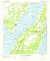
 1942 Santee Point1962 Print · USGSThe Georgetown County coastline at the start of the 1940s reveals a wild marshland landscape dominated by Winyah Bay and its ocean entrance. Genealogists and maritime historians can trace the grounds of Cat Island Plantation and the historic Quarantine station.3 unique versions available
 - 1942 Map of North Island, 1962 Print
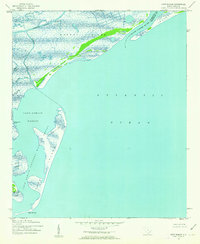
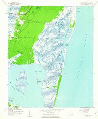 1942 North Island1962 Print · USGSThe Georgetown coast during the early 1940s is a world of sprawling rice plantations and tidal estuaries. Genealogists and historians can trace the grounds of Bellefield Plantation, find the landing at Clambank, or navigate the winding reaches of Old Man Creek.3 unique versions available
 - 1942 Map of Honey Hill, 1962 Print
 1942 Honey Hill1962 Print · USGSBerkeley County was still largely defined by its river-and-swamp geography during the early 1940s. Local researchers can trace old crossroads like Honey Hill and Charley Bridges, or locate river access points including Pleasant Hill Landing and Pitch Landing.3 unique versions available
 - 1942 Map of Magnolia Beach, 1962 Print
 1942 Magnolia Beach1962 Print · USGSThe Georgetown County coast in the early 1940s shows a landscape of tidal creeks and rising beach communities. Genealogists and local researchers can trace the early footprints of Georgieville, Annieville, and the historic barrier of Pawleys Island.2 unique versions available
 - 1942 Map of Waverly Mills, 1962 Print
 1942 Waverly Mills1962 Print · USGSThe Waccamaw and Pee Dee rivers meet in this wartime survey, showing a landscape of riverfront estates and early coastal settlements. Genealogists and historians can trace the grounds of Arundel Plantation, locate All Saints Ch, and see Marysville before the era of modern development.3 unique versions available
 - 1943 Map of Pages Mill
 1943 Pages Mill1943 Print · USGSThe Carolina borderlands come alive in the 1940s, showing a landscape shaped by the Lumber River and the Atlantic Coast Line railroad. Genealogists can trace family names through numerous rural landmarks like Oliver Cross Roads, Tabernacle Ch, and White Pond Ch & Sch.
 - 1943 Map of Pineland
 1943 Pineland1943 Print · USGSCoastal South Carolina settlements between Hampton and Jasper counties are captured here in the early 1940s. Genealogists can trace family footprints through numerous rural landmarks like Highsmith Sawmill, Pineland Club, and Nixville Sch.2 unique versions available
 - 1943 Map of Little River
 1943 Little River1943 Print · USGSThe coastal border between Horry County and Brunswick County is captured here in the early 1940s, highlighting a landscape of tidal marshes and barrier islands. Researchers can trace the early layout of Little River and find landmarks like The Battery, Goat Island, and Futch Beach.
Showing maps 1-25 of 178
Top cities of South Carolina
- Charleston historical maps
- Columbia historical maps
- North Charleston historical maps
- Rock Hill historical maps
- Greenville historical maps
- Mount Pleasant historical maps
See more
Top counties of South Carolina
- Greenville County historical maps
- Richland County historical maps
- Charleston County historical maps
- Horry County historical maps
- Spartanburg County historical maps
- Lexington County historical maps
See more
Frequently asked questions
- What are the different types of historical maps available for South Carolina?
- What is the oldest map of South Carolina?
- Where can I purchase historical maps of South Carolina for my home or office?
- Where can I download high-res historical maps of South Carolina?
- Are there historical topographic maps available for South Carolina?
- Is there historical aerial imagery available for South Carolina?
- Where are historical maps of South Carolina sourced from?