1980s Maps of South Carolina
Explore 169 historic maps of South Carolina from the 1980s. These maps offer a rare glimpse into what life looked like during the 1980s — showing old roads, neighborhoods, homes, and landmarks that have changed or disappeared over time.
Whether you're researching your family's past, planning a metal detecting trip, or studying how South Carolina's landscape evolved across the 1980s, these high-resolution maps are a powerful tool for exploring the history of this region.
- Focus on a specific era: All maps on this page are from the 1980s, giving you a focused view of this time period.
- See what’s changed: Compare century-old streets, trails, and buildings to today's modern landscape using overlays and satellite layers.
- Research with precision: Use these maps for genealogy, historical research, land use analysis, or educational projects.
- View, download, or print: Maps are fully viewable online in high resolution, and can be downloaded or printed for your own records.
Start exploring South Carolina's history through authentic maps from the 1980s. This is your window into the past.
South Carolina maps
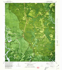
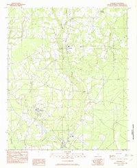
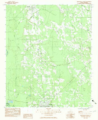
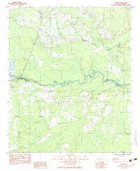
(169)- 1980 Map of Pinewood
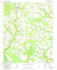 1980 Pinewood1980 Print · USGSCoastal plain agriculture and wetlands define the Sumter and Clarendon county border in the early 1980s. Genealogists and historians can trace rail-side communities like Pinewood and Rimini or locate rural landmarks such as St Peters Ch and Elliott Millpond.2 unique versions available
 - 1980 Map of Cottageville
 1980 Cottageville1980 Print · USGSThe Lowcountry landscape of the 1970s is captured here as the Edisto River winds past historical landings and the settlement of Cottageville. Researchers can trace family history through numerous sites like Church Hill Cem, Macedonia Ch, and the Sullivans Ferry crossing.2 unique versions available
 - 1980 Map of Saint Paul
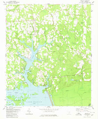
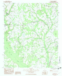
 1980 Saint Paul1980 Print · USGSThe Santee River basin is shown here in the early eighties as a hub of conservation and rural heritage. Genealogists and historians can trace local landmarks like St Phillips Ch, the Liberty Hill Sch, and the ancient Indian Mound near Cantey Bay.2 unique versions available
 - 1980 Map of Jordan
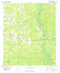
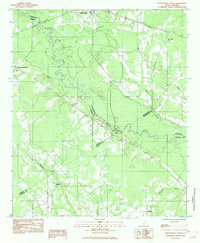
 1980 Jordan1980 Print · USGSClarendon County in the early eighties shows a landscape of rural crossroads and growing lakeside recreation along the Santee. Genealogists and historians can locate several country churches like St Matthews Ch and trace the Old RR Grade near Jordan.2 unique versions available
 - 1980 Map of Limehouse
 1980 Limehouse1980 Print · USGSJasper County tidelands and the edges of the Savannah riverfront appear here in the early eighties. Genealogists can trace local roots through sites like Chisolm Cem, Jonesville Ch, and the landings at Cook Landing.2 unique versions available
 - 1980 Map of Manning
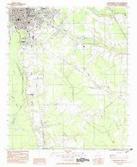
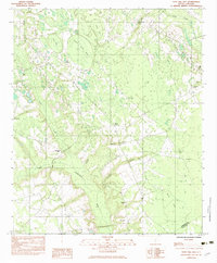
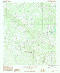
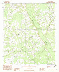
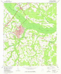 1980 Manning1980 Print · USGSClarendon County's lowcountry landscape is frozen in time during the late twentieth century as the city of Manning expands near Ox Swamp. Researchers can trace rural lineages through local landmarks like Alcolu, Baggette Crossroads, and Emmanuel Ch.
 - 1980 Map of Port Wentworth
 1980 Port Wentworth1980 Print · USGSCoastal Georgia in the late seventies is captured here at the intersection of heavy industry and wilderness. Trace the rail lines of the Central of Georgia or find family landmarks like Mt Marriah Ch and Cherokee Hill Cem.2 unique versions available
 - 1980 Map of Clark Hill Lake, 1981 Print
 1980 Clark Hill Lake1981 Print · USGSThe Georgia and South Carolina borderlands in the early eighties were defined by the expansive Clark Hill Lake and the winding Savannah River. Genealogists and historians can trace rail lines like the Georgia Railroad, find the De La Howe State School, and locate rural centers like Tignall and Appling.
 - 1981 Map of Savannah, 1982 Print
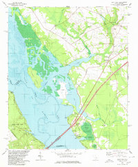
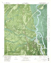
 1981 Savannah1982 Print · USGSCoastal Georgia and the South Carolina borderlands are captured here in the early eighties, showing the region's complex network of riverine islands and military installations. Researchers can trace the rail lines of the Central of Georgia and explore sites like Fort Stewart Military Reservation and Garden City.
 - 1981 Map of Toccoa, 1982 Print
 1981 Toccoa1982 Print · USGSThe tri-state mountain region where Georgia meets the Carolinas is shown here in the early eighties. Genealogists and historians can trace family-named locations and settlements from Dahlonega to Tallulah Falls, along with the Southern rail corridor.2 unique versions available
 - 1981 Map of Sylvania, 1982 Print
 1981 Sylvania1982 Print · USGSThe Georgia and South Carolina borderlands appear in the early 1980s, centered on the river-fed swamps and railroad towns between Sylvania and Estill. Trace family roots and vanished infrastructure along the Central of Georgia line or near Magnolia Springs State Park.
 - 1982 Map of Williams
 1982 Williams1982 Print · USGSColleton County in the early eighties remains a rural landscape defined by small crossroads settlements and slow-moving water. Trace the family lands and local paths connecting Smoaks, Williams, and Ruffin along the banks of Buckhead Creek.
 - 1982 Map of Orangeburg South
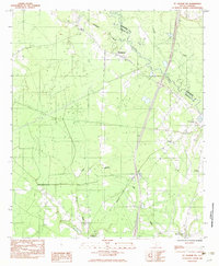
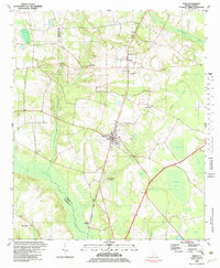
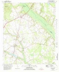
 1982 Orangeburg South1982 Print · USGSThe city of Orangeburg and its southern reaches come into focus in the early eighties, showing a landscape defined by education and rail. Researchers can trace the grounds of Claflin College, locate family sites at Sunnyside Cem, or follow the path of the Southern railroad down to Rowesville.2 unique versions available
 - 1982 Map of Branchville South, 1983 Print
 1982 Branchville South1983 Print · USGSThe Edisto River lowlands were still defined by traditional river crossings and rural church communities in the early 1980s. Researchers can locate family landmarks like Mc Alhany Cem and the river-crossing at Sandy Island Bridge near Branchville.
 - 1982 Map of Felderville, 1983 Print
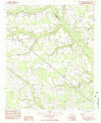
 1982 Felderville1983 Print · USGSOrangeburg and Calhoun counties in the early eighties are mapped here as a network of rural settlements and extensive wetlands. Researchers can trace family history through local landmarks like Dantzler Sch, Bochette Cem, and the crossroads at Felderville.
 - 1982 Map of Branchville North, 1983 Print
 1982 Branchville North1983 Print · USGSThe rural stretches of Orangeburg County are captured here in the early eighties, centered on the railroad corridor between Rowesville and Branchville. Genealogists can locate several family and church landmarks like Peter Bowman Cem, Byrd Cem, and Cattle Creek Ch.
 - 1982 Map of Tony Hill Bay, 1983 Print
 1982 Tony Hill Bay1983 Print · USGSBamberg and Colleton Counties are captured in the early eighties as a landscape of rural congregations and distinct Carolina bays. Researchers can trace family roots at Prospect Cem and locate numerous local landmarks like Hunters Chapel and Woodlawn Ch.
 - 1982 Map of St. George SW, 1983 Print
 1982 St. George SW1983 Print · USGSColleton and Dorchester counties are captured here in the early 1980s as the river-and-rail economy defined the landscape. Researchers can trace family roots through numerous sites like Spell Cem, Springtown, and the Seaboard Coast Line Railroad.
 - 1982 Map of Olar, 1983 Print
 1982 Olar1983 Print · USGSThe town of Olar and its rural surroundings are captured here in the early eighties, showcasing a landscape defined by the Seaboard Coast Line. Genealogists can trace family landmarks like Sweet Branch Ch, Starr Cem, and the small settlement of Govan.2 unique versions available
 - 1982 Map of Grover, 1983 Print
 1982 Grover1983 Print · USGSDorchester and Colleton counties are captured in the early eighties as the river-bound communities maintained their rural character. Researchers can trace family history through numerous landmarks like Utsey Cem, St Lukes Ch, and the crossing at Stokes Bridge.
 - 1982 Map of Clear Pond, 1983 Print
 1982 Clear Pond1983 Print · USGSBamberg County’s riverine landscape is captured in the early eighties as a complex network of swamps and rural community hubs. Researchers can trace family ties and local history through landmarks like Andrew Jackson Academy, Union Ch, and Mitchell Cem.
 - 1982 Map of Sycamore, 1983 Print
 1982 Sycamore1983 Print · USGSThe rural Lowcountry comes into focus in the early 1980s where the Salkehatchie River separates several South Carolina counties. Genealogists and historians can trace rail-side communities like Ulmer and Sycamore or find remote landmarks such as Tutens Millpond and Mizpah Ch.
 - 1982 Map of Reevesville, 1983 Print
 1982 Reevesville1983 Print · USGSReevesville and the surrounding rural communities of Dorchester County are captured here in the early eighties. Researchers can trace family roots through numerous local landmarks, including Magnolia Cemetery, Sugar Hill, and the tracks of the SOUTHERN railroad.
 - 1982 Map of Indian Camp Branch, 1983 Print
 1982 Indian Camp Branch1983 Print · USGSThe swampy lowlands of the Calhoun and Orangeburg county line come into focus during the early 1980s. Local researchers can locate rural landmarks such as Oaks Crossroads, Brookland Boys Home, and the Pineville Cem amidst the waters of Four Holes Swamp.
 - 1982 Map of Lodge, 1983 Print
 1982 Lodge1983 Print · USGSThe rural Lowcountry of Colleton and Bamberg counties is captured here in the early 1980s, centered on the village of Lodge. Researchers can trace old family sites and rural landmarks like Goodwin Cem, the Seaboard Coast Line railroad, and Little Swamp Ch.
Showing maps 1-25 of 169
Top cities of South Carolina
- Charleston historical maps
- Columbia historical maps
- North Charleston historical maps
- Rock Hill historical maps
- Greenville historical maps
- Mount Pleasant historical maps
See more
Top counties of South Carolina
- Greenville County historical maps
- Richland County historical maps
- Charleston County historical maps
- Horry County historical maps
- Spartanburg County historical maps
- Lexington County historical maps
See more
Frequently asked questions
- What are the different types of historical maps available for South Carolina?
- What is the oldest map of South Carolina?
- Where can I purchase historical maps of South Carolina for my home or office?
- Where can I download high-res historical maps of South Carolina?
- Are there historical topographic maps available for South Carolina?
- Is there historical aerial imagery available for South Carolina?
- Where are historical maps of South Carolina sourced from?