1980s Maps of Cherokee County, Texas
Explore 17 historic maps of Cherokee County from the 1980s. These maps offer a rare glimpse into what life looked like during the 1980s — showing old roads, neighborhoods, homes, and landmarks that have changed or disappeared over time.
Whether you're researching your family's past, planning a metal detecting trip, or studying how Cherokee County's landscape evolved across the 1980s, these high-resolution maps are a powerful tool for exploring the history of this region.
- Focus on a specific era: All maps on this page are from the 1980s, giving you a focused view of this time period.
- See what’s changed: Compare century-old streets, trails, and buildings to today's modern landscape using overlays and satellite layers.
- Research with precision: Use these maps for genealogy, historical research, land use analysis, or educational projects.
- View, download, or print: Maps are fully viewable online in high resolution, and can be downloaded or printed for your own records.
Start exploring Cherokee County's history through authentic maps from the 1980s. This is your window into the past.
Cherokee County, TX maps
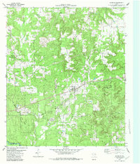
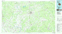
(17)- 1981 Map of Palestine
 1981 Palestine1981 Print · USGSEast Texas was a crossroads of timber, rail, and energy in the early eighties, centered on the bustling junction at Palestine. Researchers can trace family roots through rural landmarks like Old Pioneer Cem, Lynch Academy, and Hudson Chapel.
 - 1982 Map of Maydelle
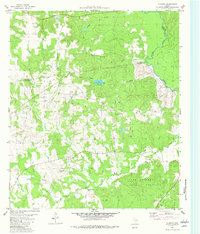
 1982 Maydelle1982 Print · USGSCherokee County at the start of the eighties shows a landscape deeply integrated with the timber industry and historic rail lines. Researchers can trace the path of the Texas State Railroad through Maydelle or locate local landmarks like Roach Town and Holleman Chapel.
 - 1982 Map of Jacksonville West
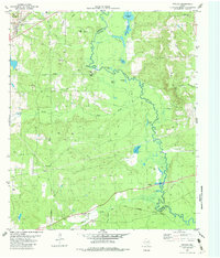
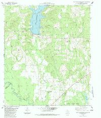
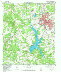 1982 Jacksonville West1982 Print · USGSJacksonville and the central Cherokee County countryside are captured here in the early eighties, showing a landscape shaped by rail, water, and oil. Researchers can trace the town's growth alongside historic sites like Lon Morris College, Earles Chapel, and the vast Lake Jacksonville.
 - 1982 Map of Denson Springs
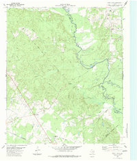
 1982 Denson Springs1982 Print · USGSAnderson and Cherokee Counties are captured here in the early 1980s, centered on the winding Neches River. Genealogists and local historians can trace the timber and rail history of the era via the Old Railroad Grade and the Wilson-Powell Cem.
 - 1982 Map of Todd City
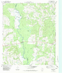
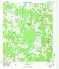 1982 Todd City1982 Print · USGSCherokee and Anderson counties are shown in the early eighties as the regional oil industry peaked. Genealogists can locate family landmarks like Miller Cem, Early Chapel, and the community of Todd City along the Missouri Pacific line.
 - 1982 Map of Neches
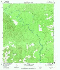
 1982 Neches1982 Print · USGSThe Neches River bottomlands and the Anderson-Cherokee county line are captured here in the early eighties. Researchers can trace the paths of the Texas State Railroad, find the Fields Chapel church, and locate family sites like Caldwell Cem.2 unique versions available
 - 1982 Map of Augusta
 1982 Augusta1982 Print · USGSHouston County and the western edge of the Davy Crockett National Forest appear here in the early 1980s. Researchers can locate community centers like Augusta and Waneta, alongside family landmarks such as Bobbitt Cem and Brewington Ch.
 - 1983 Map of Durst Lakes
 1983 Durst Lakes1983 Print · USGSCherokee and Nacogdoches Counties come alive in the early eighties as the Angelina River meanders through bottomlands. Researchers can trace family history at Mount Hope Cem or follow the old St Louis Southwestern rail line through Wells.
 - 1983 Map of Douglass
 1983 Douglass1983 Print · USGSNacogdoches and Cherokee Counties are captured here in the early 1980s, divided by the winding path of the Angelina River. Researchers can trace old family burial sites like Blackjack Cem and King Cem or locate the active OIL FIELD and the small community of Stillhouse.
 - 1983 Map of Lake Nacogdoches South
 1983 Lake Nacogdoches South1983 Print · USGSNacogdoches County in the early eighties shows the intersection of the new Lake Nacogdoches with traditional forest and river life. Researchers can locate family landmarks like Watson Cem or follow the route of Loco Bayou down to the Angelina River.
 - 1984 Map of Tyler
 1984 Tyler1984 Print · USGSEast Texas at the peak of its reservoir-building era shows a landscape defined by new lakes and established rail corridors. Trace the path of the St Louis Southwestern RR or locate industrial sites like the Longhorn Ordnance Works.3 unique versions available
 - 1984 Map of Palestine
 1984 Palestine1984 Print · USGSEast Texas in the mid-eighties reveals a landscape of massive reservoirs and protected timberlands between Palestine and Nacogdoches. Researchers can trace old routes like the Missouri Pacific RR and locate rural communities such as Tennessee Colony, Latexo, and Etoile.3 unique versions available
 - 1985 Map of Crockett
 1985 Crockett1985 Print · USGSEast Texas timber and river country are captured here during the mid-eighties, showing the region's transition into the modern era. Genealogists and historians can trace the Old San Antonio Road and locate rural landmarks like Hazel Chapel or Weldon Cem.2 unique versions available
 - 1985 Map of Tyler
 1985 Tyler1985 Print · USGSEast Texas in the mid-eighties centers on the growth of Tyler and the expansive waters of Lake Palestine. Genealogists and researchers can trace family landmarks like Henry's Chapel and Browning Cem alongside the routes of the Southern Pacific RR.
 - 1986 Map of Lufkin
 1986 Lufkin1986 Print · USGSDeep in the Piney Woods during the mid-eighties, this map documents a landscape shaped by vast national forests and the waters of the Sam Rayburn Reservoir. Researchers can trace the legacy of timber and rail through settlements like Diboll, Herty, and Ewing alongside the St Louis Southwestern railroad.
 - 1986 Map of Henderson
 1986 Henderson1986 Print · USGSEast Texas and the Louisiana borderlands come into focus in the 1980s as industrial energy production meets quiet rural townships. Researchers can trace family sites and local landmarks from Elysian Fields to Old Panola, alongside major features like the Strip Mine and Martin Lake State Park.2 unique versions available
 - 1986 Map of Nacogdoches
 1986 Nacogdoches1986 Print · USGSDeep in the East Texas Piney Woods during the mid-eighties, this landscape centers on Nacogdoches and the sprawling Toledo Bend Reservoir. Genealogists can trace family footprints at Sulphur Springs Cem, Oak Grove Ch, and the many small settlements like Reklaw and Sacul.
End of results
Showing maps 1-17 of 17
Top cities of Cherokee County
- Jacksonville historical maps
- Rusk historical maps
- Alto historical maps
- New Summerfield historical maps
- Wells historical maps
- Gallatin historical maps
See more
Frequently asked questions
- What are the different types of historical maps available for Cherokee County?
- What is the oldest map of Cherokee County?
- Where can I purchase historical maps of Cherokee County for my home or office?
- Where can I download high-res historical maps of Cherokee County?
- Are there historical topographic maps available for Cherokee County?
- Is there historical aerial imagery available for Cherokee County?
- Where are historical maps of Cherokee County sourced from?