Old Maps of Spur, Texas for Metal Detecting
Plan your next treasure hunt with 14 historic maps of Spur. Find old homesites, ghost towns, trails, and gathering spots that may be lost to time — perfect for identifying promising metal detecting locations.
- Locate forgotten sites: Uncover places like long-lost settlements, abandoned rail lines, or gathering spots.
- Plan better hunts: Use map overlays combined with LiDAR or satellite views to narrow in on historically rich areas.
- Made for detectorists: Thousands of hobbyists use these maps to discover relics, coins, and hidden history.
Use these historic maps to boost your research and find new opportunities beneath the surface of Spur.
Spur, TX maps
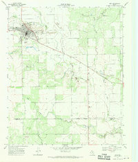
(14)- 1954 Map of Lubbock, 1958 Print
 1954 Lubbock1958 Print · USGSThe High Plains and Caprock region of West Texas come alive in the mid-1950s, showing a landscape defined by oil discovery and the Brazos River headwaters. Genealogists and historians can trace rail-connected towns like Roaring Springs, find the Pleasant Valley church, or locate family-named landmarks such as Soldier Mound.4 unique versions available
 - 1967 Map of Spur, 1970 Print
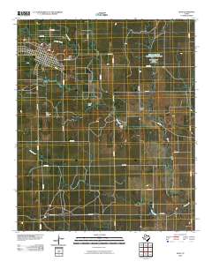
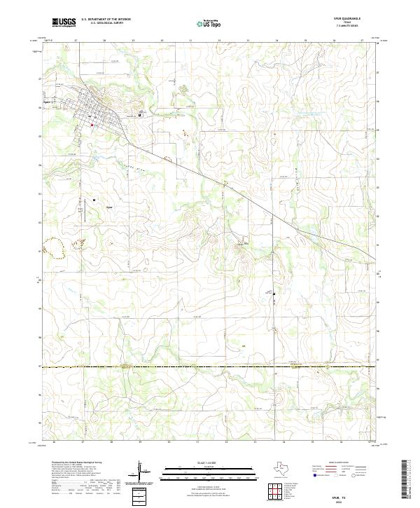
 1967 Spur1970 Print · USGSSpur was a thriving West Texas hub in the late 1960s, showing its fully developed town grid and infrastructure. Researchers can trace local landmarks like Swenson Park, the town Cem, and the path of the Aqueduct crossing Spade Draw.
 - 1967 Map of Spur NW, 1971 Print
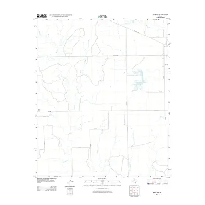
 1967 Spur NW1971 Print · USGSThe West Texas landscape at the Dickens and Kent County line reveals a sophisticated network of 1960s water infrastructure. Researchers can trace the path of an AQUEDUCT near the Rolling Plains Research Station and locate landmarks like Red Mud Creek.
 - 1985 Map of Aspermont, 1994 Print
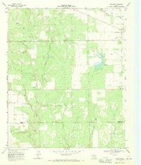
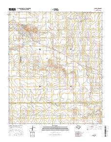
 1985 Aspermont1994 Print · USGSStonewall and Kent counties are shown in the mid-1980s as the river-cut plains of West Texas supported scattered ranching and oil communities. Genealogists and historians can trace the Railroad Grade and locate smaller locales like Old Glory and Girard.
 - 2010 Map of Spur NW, 2010 Print
 2010 Spur NW2010 Print · USGSCovers Spur, including Red Mud, Dickens County, and other nearby areas
 - 2010 Map of Spur, 2010 Print
 2010 Spur2010 Print · USGSCovers Spur, including Steele Hill, Dickens County, and other nearby areas
 - 2012 Map of Spur NW, 2012 Print
 2012 Spur NW2012 Print · USGSCovers Spur, including Red Mud, Dickens County, and other nearby areas
 - 2012 Map of Spur, 2012 Print
 2012 Spur2012 Print · USGSCovers Spur, including Steele Hill, Dickens County, and other nearby areas
 - 2016 Map of Spur, 2016 Print
 2016 Spur2016 Print · USGSCovers Spur, including Steele Hill, Dickens County, and other nearby areas
 - 2016 Map of Spur NW, 2016 Print
 2016 Spur NW2016 Print · USGSCovers Spur, including Red Mud, Dickens County, and other nearby areas
 - 2019 Map of Spur NW, 2019 Print
 2019 Spur NW2019 Print · USGSCovers Spur, including Red Mud, Dickens County, and other nearby areas
 - 2019 Map of Spur, 2019 Print
 2019 Spur2019 Print · USGSCovers Spur, including Steele Hill, Dickens County, and other nearby areas
 - 2022 Map of Spur, 2022 Print
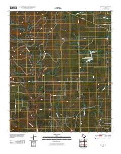
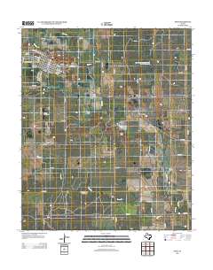
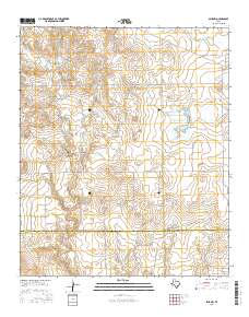
 2022 Spur2022 Print · USGSThe West Texas cattle and cotton lands near the Dickens and Kent county line are shown here in the contemporary era. Researchers can trace the layout of Spur or locate rural landmarks like Steele Hill Cem, Travis Field, and the banks of Duck Cr.
 - 2022 Map of Spur NW, 2022 Print
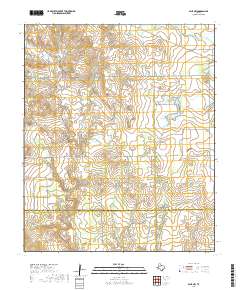
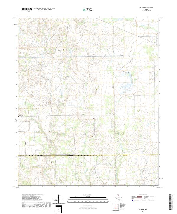 2022 Spur NW2022 Print · USGSThe town of Spur and the surrounding ranchlands of Dickens and Kent counties are captured in this modern survey. Researchers can trace land boundaries along Red Mud Cr or locate family sites near the Red Mud Cem.
End of results
Showing maps 1-14 of 14
Top cities near Spur
Frequently asked questions
- What are the different types of historical maps available for Spur?
- What is the oldest map of Spur?
- Where can I purchase historical maps of Spur for my home or office?
- Where can I download high-res historical maps of Spur?
- Are there historical topographic maps available for Spur?
- Is there historical aerial imagery available for Spur?
- Where are historical maps of Spur sourced from?