Old Maps of Hartley County, Texas for Academic Research
Study the evolution of Hartley County with 229 high-resolution historic maps. Whether you're teaching, researching, or modeling changes in land use, these maps provide essential visual documentation of urban, environmental, and geographic change.
- Analyze long-term change: Track patterns in development, transportation, and natural features.
- Ideal for environmental or urban studies: Support academic projects with primary historical map data.
- Use in the classroom or lab: Educators and researchers rely on these maps to bring historical context to life.
These maps are a powerful tool for teaching, research, and visualizing how Hartley County has changed over the decades.
Hartley County, TX maps
(229)- 1954 Map of Tucumcari, 1965 Print
 1954 Tucumcari1965 Print · USGSThe high plains along the New Mexico and Texas border come alive in this mid-century survey, just as the regional highway network was maturing. Trace the historic route of U.S. 66 through Glenrio and San Jon or locate remote rail sidings like Rehm Station and Obar.2 unique versions available
 - 1954 Map of Dalhart, 1967 Print
 1954 Dalhart1967 Print · USGSThe High Plains at the junction of four states come alive in the mid-fifties, showing a landscape of rail-hub towns and cattle country. Trace the Old Santa Fe Trail or locate mid-century industrial sites like the Dry ice plant and Carbon Dioxide Works.2 unique versions available
 - 1958 Map of Tucumcari
 1958 Tucumcari1958 Print · USGSEastern New Mexico and the Texas Panhandle meet in this mid-century survey of the high plains ranching and rail corridor. Researchers can trace the path of Mother Road travelers through Tucumcari and Glenrio or locate remote rail stops like Nara Visa Station and Hartley Station.
 - 1958 Map of Dalhart
 1958 Dalhart1958 Print · USGSThe High Plains of the tri-state border region come alive in this mid-century survey of the ranching and rail territory around the Texas Panhandle. Genealogists and historians can trace the paths of the Atchison Topeka & Santa Fe Ry, military outposts like Dalhart Air Force No 1, and early settlements such as Pasamonte and Texline.2 unique versions available
 - 1962 Map of Dalhart
 1962 Dalhart1962 Print · USGSThe High Plains and volcanic peaks of the tri-state area are shown in detail during the early sixties. Genealogists and historians can trace the rail corridors of the Fort Worth and Denver and find industrial sites like the Cactus Ordnance Works or the Beaver Meade & Englewood Grain Elevator.
 - 1963 Map of Hartley SE, 1966 Print
 1963 Hartley SE1966 Print · USGSHartley County ranching and the Texas Panhandle rail corridor are captured here in the early sixties. Researchers can trace the diagonal route of the Fort Worth and Denver past family-named sites like Bryant Ranch and Edlin Ranch.
 - 1963 Map of Hartley NE, 1966 Print
 1963 Hartley NE1966 Print · USGSThe northern High Plains of the Texas Panhandle come into focus in the early sixties, showing a landscape defined by water and energy. Researchers can trace rural infrastructure through mapped Wells and a prominent Pipeline crossing the terrain.
 - 1963 Map of Bird Ranch Store, 1966 Print
 1963 Bird Ranch Store1966 Print · USGSThe Texas Panhandle at the Hartley and Moore county line shows a specialized ranching and energy landscape in the early sixties. Researchers can trace the development of local resources through labeled landmarks like Bird Ranch Store and Oil Well 3825.
 - 1963 Map of Moran Ranch, 1966 Print
 1963 Moran Ranch1966 Print · USGSThe high plains of the Texas Panhandle are captured here in the early sixties, showing the remote intersection of two counties. Researchers can trace the infrastructure of the local cattle and energy economy through the Moran Ranch, its Landing Strip, and a cross-country Pipeline.
 - 1965 Map of Wilco, 1966 Print
 1965 Wilco1966 Print · USGSThe high plains of the Texas Panhandle in the mid-1960s reveal a landscape of long-distance rail and remote community centers. Researchers can trace the Chicago Rock Island and Pacific railroad and locate local social hubs like Coloney Community House.
 - 1965 Map of Exum, 1966 Print
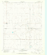 1965 Exum1966 Print · USGSThe Texas Panhandle plains meet at a four-county junction during the mid-1960s, showing a landscape defined by grain transport and emerging energy. You can trace the CHICAGO ROCK ISLAND AND PACIFIC rail line to the Storage Bins at Exum and follow the seasonal waters of North Palo Duro Creek.
 - 1970 Map of Sedan SE, 1973 Print
 1970 Sedan SE1973 Print · USGSThe high plains along the border of New Mexico and Texas are captured here during the 1970 field check. Researchers can locate the isolated Shaha Cem and trace the path of Tramperos Creek across the county lines of Union, Dallam, and Hartley.
 - 1971 Map of Koger Ranch, 1973 Print
 1971 Koger Ranch1973 Print · USGSThe high-plains ranching country along the New Mexico and Texas border comes into focus in the early seventies. Genealogists and historians can trace essential water sources and family-named landmarks like Koger Ranch, Daughty Well, and the fishing spots at Bass Hole.
 - 1971 Map of Middle Water, 1973 Print
 1971 Middle Water1973 Print · USGSHartley County ranching country is shown here in the early seventies, centered on the vital rail stop at Middle Water. Trace the local water infrastructure and land use through features like Dammier Ranch, Punta de Agua Creek, and the Red Windmill.
 - 1971 Map of Romero SE, 1973 Print
 1971 Romero SE1973 Print · USGSThe Texas Panhandle breaks along the Canadian River are documented here in the early seventies, showing a ranching landscape centered on remote water sources. Researchers can trace the ranching infrastructure of the era through sites like Old Santa Fe Windmill, East Chavez Windmill, and Horseshoe Tank.
 - 1971 Map of Doyle Hill, 1973 Print
 1971 Doyle Hill1973 Print · USGSThe high plains of the New Mexico-Texas border come into focus in the early seventies, showing a ranching landscape tied to the railroad. Genealogists and historians can trace family-named water sources like Patterson Well or Millican Well and locate isolated landmarks such as the Grave near the SAND HILLS.
 - 1971 Map of Amistad SE, 1973 Print
 1971 Amistad SE1973 Print · USGSHigh plains ranching life at the New Mexico and Texas border comes into focus in the early 1970s. Trace old family water sources like Poteet Well and Whatley Well near the small settlement of Centerville.
 - 1971 Map of Syndicate Hills, 1973 Print
 1971 Syndicate Hills1973 Print · USGSHartley County ranching land is documented here in the early seventies, showcasing a high-plains landscape dependent on deep wells. Researchers can locate specific water points and homesteads like McCrory Ranch, Mildred Lake, and the C R I & P railroad line.
 - 1971 Map of Bivins Channing Ranch, 1973 Print
 1971 Bivins Channing Ranch1973 Print · USGSTexas Panhandle ranching and energy production intersect in the early seventies at the junction of Hartley, Moore, and Oldham Counties. Researchers can trace land use at the Bivins Channing Ranch, the settlement of Heldon, and numerous Gas Wells.2 unique versions available
 - 1971 Map of Beck Ranch, 1973 Print
 1971 Beck Ranch1973 Print · USGSHartley County ranching operations are documented here in the early 1970s, showing a landscape of scattered camps and essential water sources. Genealogists and historians can trace the sites of Beck Ranch and U Bar Camp or locate dozens of named wells like Reynolds Well and T O Well.
 - 1971 Map of Proctor Ranch, 1973 Print
 1971 Proctor Ranch1973 Print · USGSThe Texas Panhandle ranching landscape comes into focus in the early seventies, centered on the Proctor Ranch. Genealogists and researchers can trace local landmarks like Punta de Agua Creek and family-named sites such as Cruz Windmill.
 - 1971 Map of Nara Visa, 1973 Print
 1971 Nara Visa1973 Print · USGSThe ranching landscape of Quay County is documented here in the early 1970s, as the railroad still shaped the high plains. Genealogists and historians can trace family-named water sources like Jones Well and McAlister Well near Nara Visa.
 - 1971 Map of Whiteaker Ranch, 1973 Print
 1971 Whiteaker Ranch1973 Print · USGSHartley County ranching country is captured here during the early seventies, showing a landscape shaped by water rights and the rail lines. You can trace the Chicago Rock Island and Pacific railroad and locate named water sources like Little Sandy Well and Whiteaker Ranch.
 - 1971 Map of Knoblaw, 1973 Print
 1971 Knoblaw1973 Print · USGSThe high plains of the Texas Panhandle were a landscape of managed water and vast ranches in the early 1970s. Researchers can trace land use through a network of named sites like Thousand Dollar Dam, Chisum Spring, and the Trujillo Well.2 unique versions available
 - 1971 Map of Channing NW, 1973 Print
 1971 Channing NW1973 Print · USGSHartley County at the start of the 1970s reveals a ranching landscape structured by its water sources and county lines. Genealogists and historians can trace old landmarks like Flats Windmill and the drainage of Rita Blanca Creek across the high plains.
Showing maps 1-25 of 229
Top cities of Hartley County
Frequently asked questions
- What are the different types of historical maps available for Hartley County?
- What is the oldest map of Hartley County?
- Where can I purchase historical maps of Hartley County for my home or office?
- Where can I download high-res historical maps of Hartley County?
- Are there historical topographic maps available for Hartley County?
- Is there historical aerial imagery available for Hartley County?
- Where are historical maps of Hartley County sourced from?