Old Maps of Sutton County, Texas for Metal Detecting
Plan your next treasure hunt with 200 historic maps of Sutton County. Find old homesites, ghost towns, trails, and gathering spots that may be lost to time — perfect for identifying promising metal detecting locations.
- Locate forgotten sites: Uncover places like long-lost settlements, abandoned rail lines, or gathering spots.
- Plan better hunts: Use map overlays combined with LiDAR or satellite views to narrow in on historically rich areas.
- Made for detectorists: Thousands of hobbyists use these maps to discover relics, coins, and hidden history.
Use these historic maps to boost your research and find new opportunities beneath the surface of Sutton County.
Sutton County, TX maps
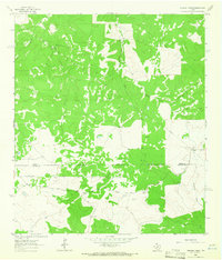
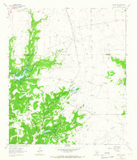
(200)- 1893 Map of Rock Springs
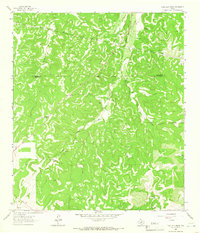
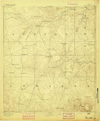 1893 Rock Springs1893 Print · USGSThe Edwards Plateau in the early 1890s was a remote ranching frontier defined by isolated outposts and limestone river breaks. Researchers can locate early family holdings such as Marsh & Taylor's Ranch and landmarks like the Devils Sink Hole.5 unique versions available
 - 1893 Map of Fort McKavett
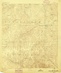 1893 Fort McKavett1893 Print · USGSCentral West Texas ranching life is frozen in time during the 1890s as the frontier era transitions to established livestock spreads. Trace family landholdings and early outposts like Fort McKavett, S.S.S. Ranch, and Henderson Brothers Ranch.4 unique versions available
 - 1954 Map of Sonora, 1965 Print
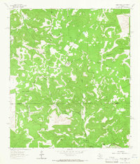
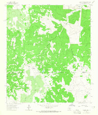
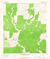
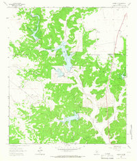
 1954 Sonora1965 Print · USGSThe Edwards Plateau and West Texas ranching country come alive in this mid-century survey of the canyons and plateaus. Genealogists and historians can trace the remote settlements of Pandale and Loma Alta or follow the path of the Panhandle and Santa Fe RR.2 unique versions available
 - 1958 Map of Sonora
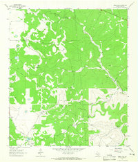
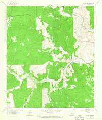
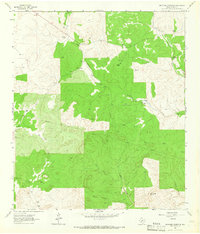
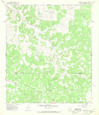
 1958 Sonora1958 Print · USGSThe Edwards Plateau and Trans-Pecos region come alive in the late fifties, showing a landscape of remote ranchlands and historic frontier outposts. Trace the legacy of Fort Lancaster Ruins, the limestone depths of Devils Sinkhole Cavern, and the path of the Pecos River.
 - 1962 Map of Hill Ranch, 1965 Print
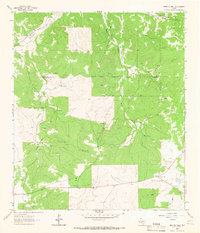
 1962 Hill Ranch1965 Print · USGSTexas ranching culture is well-documented in this early 1960s survey of the Kimble and Edwards County lines. Genealogists can locate specific family lands like Cardwell Ranch, Nethery Ranch, and Jetton Ranch along the waters of Knust Draw.2 unique versions available
 - 1962 Map of Roosevelt, 1966 Print
 1962 Roosevelt1966 Print · USGSThe Texas Hill Country ranching landscape comes into focus during the early sixties, centered on the settlement of Roosevelt. Genealogists and historians can trace family landholdings like Maynard Ranch and Wilson Place along the banks of the North Llano River.2 unique versions available
 - 1962 Map of Stewart Ranch, 1966 Print
 1962 Stewart Ranch1966 Print · USGSThe West Texas ranchlands along the Sutton and Edwards county line are documented here in the early 1960s. Genealogists and historians can trace family landholdings like Stewart Ranch and Miers Ranch or locate the path of Bond Road.2 unique versions available
 - 1962 Map of Bundy Ranch, 1966 Print
 1962 Bundy Ranch1966 Print · USGSRanching outposts and river valleys define this West Texas landscape in the early sixties. Researchers can trace family-named lands like Sawyer Ranch and Mayfield Ranch or locate the remote Landing Strip and Eagle Well.2 unique versions available
 - 1963 Map of Steen Lake, 1965 Print
 1963 Steen Lake1965 Print · USGSRanching and energy extraction intersect in central Texas during the early sixties. Researchers can trace family legacies at the Gene Wallace Ranch and Miers Wilson Ranch or locate industrial sites like the Miers Wilson Gas Field.2 unique versions available
 - 1963 Map of Buffalo Well, 1965 Print
 1963 Buffalo Well1965 Print · USGSThe high plateau country along the Schleicher and Sutton county line comes into focus in the early sixties. Researchers can trace the footprint of the energy industry and cattle ranching through landmarks like Wardlaw Ranch, Humble Camp, and Buffalo Well.2 unique versions available
 - 1963 Map of Harrison Ranch, 1965 Print
 1963 Harrison Ranch1965 Print · USGSRanching and early energy development meet in the 1960s along the Sutton and Edwards county line. Local historians can trace the operations of Harrison Ranch and Brockman Ranch or locate the Miers Wilson Gas Field and its early wells.2 unique versions available
 - 1963 Map of Live Oak Draw, 1966 Print
 1963 Live Oak Draw1966 Print · USGSSutton County ranch lands are shown in the early 1960s, focusing on the drainage basins and vital waterholes of the plateau. Researchers can trace remote property features like the Evans ranch site, the Landing Strip, and Tenmile Waterhole.2 unique versions available
 - 1963 Map of Buffalo Well NW, 1966 Print
 1963 Buffalo Well NW1966 Print · USGSThe Sutton and Schleicher county line in the early sixties was a landscape of remote ranching outposts and deep limestone draws. Genealogists and researchers can trace family-named estates like Mcintosh Ranch, Cauthorn Ranch, and the small settlement of Allison.2 unique versions available
 - 1963 Map of McKegan Draw, 1966 Print
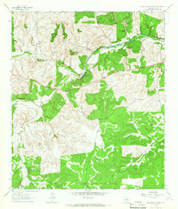
 1963 McKegan Draw1966 Print · USGSKimble and Sutton Counties are captured here in the early sixties, showing a landscape defined by large family holdings and the headwaters of the Llano River. Genealogists and historians can trace the boundaries of the Chadwick Ranch, locate the remote Joy Ranch, and follow the path of Copperas Creek.
 - 1963 Map of Buffalo Well SE, 1966 Print
 1963 Buffalo Well SE1966 Print · USGSSutton County ranching culture is preserved in this mid-century survey of the Edwards Plateau. Researchers can trace historic family holdings like the Allison Ranch and Schulz Ranch or locate landmarks like the Little Ogden Waterhole.2 unique versions available
 - 1963 Map of Fort Terrett Ranch, 1966 Print
 1963 Fort Terrett Ranch1966 Print · USGSSutton County ranching life is well-documented in the early sixties, showing the vast family holdings along the North Llano River. Genealogists and historians can trace the Fort Terrett Ranch (Historical Site) and several family landmarks like the Anderson Ranch and Bundy Ranch.2 unique versions available
 - 1963 Map of Brokeleg Mountain, 1966 Print
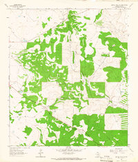
 1963 Brokeleg Mountain1966 Print · USGSSutton County ranching country is captured here in the early 1960s, showing a landscape of scattered family holdings and limestone drainages. Researchers can locate specific sites like the Schwiening Ranch, Brokeleg Mountain, and Peach Springs.2 unique versions available
 - 1963 Map of Buffalo Well SW, 1966 Print
 1963 Buffalo Well SW1966 Print · USGSSutton County ranch lands are documented here in the early sixties, showing a landscape defined by large family holdings and early energy exploration. Researchers can trace the exact locations of the Halbert Ranch, Stites Ranch, and a remote Landing Field.2 unique versions available
 - 1963 Map of Coal Kiln Draw, 1966 Print
 1963 Coal Kiln Draw1966 Print · USGSThe Schleicher and Sutton county line divides this West Texas ranching country in the early sixties, as mapped by photogrammetric methods. Genealogists and local historians can locate several family holdings including Pope Ranch, U X Ranch, and the Morales Cem.
 - 1963 Map of McKegan Draw NE, 1966 Print
 1963 McKegan Draw NE1966 Print · USGSThe ranchlands at the intersection of Kimble and Menard Counties are captured here in the early sixties. Researchers can trace family legacies at the Lehne Ranch, Graham Ranch, and Johnston Ranch, or locate the Murr Ch at the edge of the creek draws.2 unique versions available
 - 1964 Map of Sonora, 1966 Print
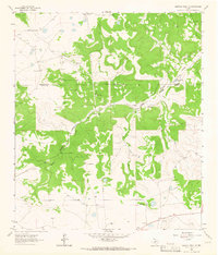
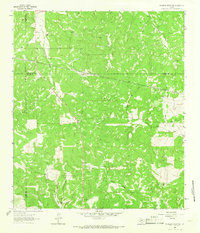
 1964 Sonora1966 Print · USGSSutton County in the mid-1960s shows a landscape of rail-driven commerce and early aviation. Local researchers can trace the old Atchison Topeka and Santa Fe line, the original layout of Sonora, and landmarks like the Drive-in Theater.2 unique versions available
 - 1964 Map of Sonora SE, 1966 Print
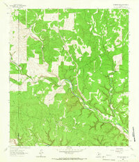
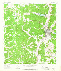
 1964 Sonora SE1966 Print · USGSSutton County ranching country is captured here in the mid-sixties, showing the sprawling family estates and transit lines of West Texas. Genealogists and researchers can trace local holdings like Miers Ranch or follow the Atchison Topeka and Santa Fe rail line past Lowrey.2 unique versions available
 - 1964 Map of Sonora NE, 1966 Print
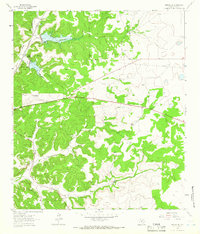
 1964 Sonora NE1966 Print · USGSThe West Texas ranchlands in the mid-1960s are captured here as a network of family estates and water management projects. Researchers can trace land holdings like Logan Ranch and the industrial footprint of the Atchison Topeka and Santa Fe railroad.2 unique versions available
 - 1964 Map of Sonora NW, 1966 Print
 1964 Sonora NW1966 Print · USGSSchleicher and Sutton counties are captured in the mid-sixties during a period of expanding energy infrastructure and flood control. Researchers can trace family ranching history at the Nixon Ranch and Jones Ranch or locate early industrial features like the Gas Field.2 unique versions available
 - 1967 Map of Dunbar Draw SW, 1969 Print
 1967 Dunbar Draw SW1969 Print · USGSSutton and Edwards Counties are shown here in the late sixties as a landscape of working ranches and oil production. Genealogists and researchers can locate family properties like Rex Cusenbary Ranch and the Texas A and M Experimental Station.3 unique versions available
Showing maps 1-25 of 200
Top cities of Sutton County
Frequently asked questions
- What are the different types of historical maps available for Sutton County?
- What is the oldest map of Sutton County?
- Where can I purchase historical maps of Sutton County for my home or office?
- Where can I download high-res historical maps of Sutton County?
- Are there historical topographic maps available for Sutton County?
- Is there historical aerial imagery available for Sutton County?
- Where are historical maps of Sutton County sourced from?