Old Maps of Throckmorton County, Texas for Genealogy
Trace your family roots with 161 historic maps of Throckmorton County. These high-res maps reveal old neighborhoods, homesites, landmarks, and streets — helping you uncover where your ancestors lived and how the area evolved over time.
- Explore historic neighborhoods: Identify where your relatives may have lived in the 1800s or 1900s.
- Compare maps over time: Trace the changes in streets, buildings, and landmarks for multi-generational research.
- Perfect for genealogy & ancestry research: Used by family historians and researchers to map out lineage and migration.
These maps are an incredible resource for exploring your personal connection to Throckmorton County's past.
Throckmorton County, TX maps
(161)- 1890 Map of Breckenridge
 1890 Breckenridge1890 Print · USGSStephens County was a landscape of budding settlements and cattle country in the late nineteenth century. Genealogists can trace early homesteads near Breckenridge or follow the Texas and Pacific R.R. past peaks like Steal Easy Mt. and Gunsight Mt..6 unique versions available
 - 1892 Map of Albany
 1892 Albany1892 Print · USGSShackelford County in the late 1880s was a landscape of emerging rail lines and river outposts. Local historians can trace the early path of the Texas Central Railroad through Albany and locate early landmarks like Fort Griffen and Mankins Mill.
 - 1893 Map of Albany
 1893 Albany1893 Print · USGSShackelford County and the surrounding cattle country are captured in the late nineteenth century during the expansion of the Texas Central Railroad. Researchers can locate the frontier site of Fort Griffen, early schools like Shady Grove Ch., and the milling operations at Mankins Mill.5 unique versions available
 - 1954 Map of Abilene, 1966 Print
 1954 Abilene1966 Print · USGSThe Texas Big Country comes into focus in the mid-1950s as petroleum and new water projects reshape the landscape. Local historians can trace the Butterfield Trail, find the Fort Phantom Hill Ruins, and locate numerous small communities along the Texas & Pacific line.2 unique versions available
 - 1954 Map of Wichita Falls, 1966 Print
 1954 Wichita Falls1966 Print · USGSNorth Texas in the mid-fifties is captured here as a landscape of expanding oil fields and vital rail corridors. Genealogists and historians can trace family roots through rural landmarks like Bacon Chapel and the rail-side growth of Seymour and Archer City.3 unique versions available
 - 1958 Map of Wichita Falls
 1958 Wichita Falls1958 Print · USGSNorth Texas during the late fifties reveals a landscape defined by the booming petroleum industry and established rail hubs. Researchers can trace the development of Wichita Falls and discover rural landmarks like Barton's Chapel or the Hull-Silk Oil Field.
 - 1958 Map of Abilene
 1958 Abilene1958 Print · USGSMid-century West Texas comes alive in this survey of the Abilene and Stephenville region during a period of steady oil expansion and military growth. Genealogists and local historians can trace the paths of the Texas & Pacific RR through historic towns, locate the Fort Griffin Ruins, and find smaller settlements like Desdemona and Lueders.
 - 1962 Map of Antelope Creek SW, 1965 Print
 1962 Antelope Creek SW1965 Print · USGSThe Haskell and Throckmorton County line in the early sixties reveals a landscape shaped by petroleum and water. Trace the Swenson Oil Field and scattered Oil Wells along the winding banks of Millers Creek and Squaw Creek.
 - 1962 Map of Antelope Creek SE, 1965 Print
 1962 Antelope Creek SE1965 Print · USGSThrockmorton County ranching and energy land are captured here in the early sixties, showing the infrastructure of the North Central Texas plains. Researchers can trace the layout of Swenson Field, locate a remote Landing Strip, and follow the path of Antelope Creek.3 unique versions available
 - 1962 Map of Antelope Creek NE, 1965 Print
 1962 Antelope Creek NE1965 Print · USGSBaylor and Throckmorton counties meet along the breaks of the Brazos River in the early sixties. Petroleum researchers and genealogists can trace the footprint of the local Oil Field and family-named watercourses like Millers Creek and Louise Run.
 - 1962 Map of Antelope Creek NW, 1965 Print
 1962 Antelope Creek NW1965 Print · USGSThe Baylor and Knox County line in the early sixties shows a landscape where ranching met the growing oil industry. Researchers can trace family ties at the Bomarton Cem or follow the path of the Fort Worth and Denver railroad and Millers Creek.2 unique versions available
 - 1963 Map of Megargel, 1967 Print
 1963 Megargel1967 Print · USGSMegargel was a bustling center of oil production and rural life in North Texas during the early sixties. Genealogists and historians can locate the High Sch, the local PO, and numerous Oil Wells scattered along Kickapoo Creek.
 - 1964 Map of Padgett, 1967 Print
 1964 Padgett1967 Print · USGSYoung and Throckmorton Counties are captured in the mid-sixties as the winding Brazos River carves through the central plains. Genealogists and researchers can locate family sites at Padgett Cem and Reynolds Cem or trace the early oil economy at Daniels.2 unique versions available
 - 1965 Map of Collins Creek, 1967 Print
 1965 Collins Creek1967 Print · USGSThe rural border of Shackelford and Throckmorton counties is documented here in the mid-sixties, showcasing a landscape of cattle ranching and oil extraction. Researchers can locate Matthews Ranch, trace the winding Collins Creek, and find numerous Oil Wells and a private Landing Strip.
 - 1965 Map of Lusk, 1967 Print
 1965 Lusk1967 Print · USGSThe rural borderlands of Stephens and Throckmorton counties come into focus in the mid-1960s as the Brazos River winds through cattle and oil country. Genealogists and researchers can trace local landmarks like Lusk, numerous rural Drill Holes, and the quiet Roadside Park along the highway.
 - 1965 Map of Antelope Hills, 1967 Print
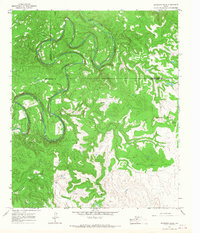 1965 Antelope Hills1967 Print · USGSShackelford County in the mid-1960s is defined by the winding course of the river and a landscape transformed by the oil industry. Researchers can trace the era's petroleum development through numerous Oil Wells and Drill Hole sites near the Antelope Hills.
 - 1965 Map of Fort Griffin, 1967 Print
 1965 Fort Griffin1967 Print · USGSShackelford and Throckmorton counties are shown in the mid-sixties, centered on the frontier history of the Brazos River valley. Researchers can find old family sites like Reynolds Cem, the stone Ruins of the old fort, and winding watercourses like Lambshead Creek.2 unique versions available
 - 1965 Map of Throckmorton NE, 1969 Print
 1965 Throckmorton NE1969 Print · USGSThrockmorton County ranching and oil country are captured here in the mid-sixties, showing a landscape shaped by petroleum extraction and winding waterways. Researchers can trace the path of an Old RR Grade and locate various Oil Wells near landmarks like Bush Knob.
 - 1965 Map of Reynolds Bend NW, 1970 Print
 1965 Reynolds Bend NW1970 Print · USGSThrockmorton and Haskell Counties are captured in the mid-sixties, showcasing a landscape defined by ranching and resource extraction. Researchers can map early petroleum activity through numerous Oil Wells and trace the winding course of North Paint Creek.
 - 1966 Map of Westover SE, 1968 Print
 1966 Westover SE1968 Print · USGSThrockmorton County in the mid-1960s was a landscape of ranching and resource extraction defined by the winding Brazos River. Local historians can trace the early petroleum footprint through the Lendra Oil Field and the rural settlement at Elbert.2 unique versions available
 - 1966 Map of Rock Canyon, 1968 Print
 1966 Rock Canyon1968 Print · USGSThe Brazos River valley along the Baylor and Throckmorton county line is captured here in the mid-1960s. Researchers can trace land boundaries and industrial sites like Oil Wells, Horseshoe Bend, and the distinctive Twin Mountain.2 unique versions available
 - 1966 Map of Hoover Mountain, 1968 Print
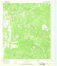 1966 Hoover Mountain1968 Print · USGSThe Clear Fork Brazos River valley along the Haskell and Throckmorton county line is shown here in the mid-1960s. Researchers can locate early river crossings like Goody Crossing, family landmarks like Sloan Ranch, and numerous petroleum sites.
 - 1966 Map of Woodson, 1968 Print
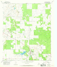 1966 Woodson1968 Print · USGSWoodson and the surrounding Throckmorton County prairie are captured here in the mid-sixties, dominated by a busy oil and ranching economy. Researchers can trace the local Old Railroad Grade and find family landmarks like the Dickie Landing Strip and Woodson Sch.2 unique versions available
 - 1966 Map of Westover SW, 1968 Print
 1966 Westover SW1968 Print · USGSThrockmorton County ranching and oil production are captured here in the mid-1960s. Genealogists and historians can trace the Travis Oil Field, numerous oil wells, and the paths of South Wagon Creek and Boggy Creek.2 unique versions available
 - 1966 Map of Reynolds Bend, 1968 Print
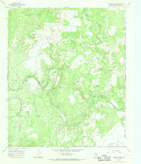 1966 Reynolds Bend1968 Print · USGSThrockmorton County ranch land and river bottoms are captured here in the mid-1960s as the oil industry expanded across the plains. Genealogists and historians can trace family-named sites like Reynolds Bend Cem, Matthews Landing Area, and the Indian Village Ruins.2 unique versions available
Showing maps 1-25 of 161
Top cities of Throckmorton County
Frequently asked questions
- What are the different types of historical maps available for Throckmorton County?
- What is the oldest map of Throckmorton County?
- Where can I purchase historical maps of Throckmorton County for my home or office?
- Where can I download high-res historical maps of Throckmorton County?
- Are there historical topographic maps available for Throckmorton County?
- Is there historical aerial imagery available for Throckmorton County?
- Where are historical maps of Throckmorton County sourced from?