1970s Maps of Val Verde County, Texas
Explore 60 historic maps of Val Verde County from the 1970s. These maps offer a rare glimpse into what life looked like during the 1970s — showing old roads, neighborhoods, homes, and landmarks that have changed or disappeared over time.
Whether you're researching your family's past, planning a metal detecting trip, or studying how Val Verde County's landscape evolved across the 1970s, these high-resolution maps are a powerful tool for exploring the history of this region.
- Focus on a specific era: All maps on this page are from the 1970s, giving you a focused view of this time period.
- See what’s changed: Compare century-old streets, trails, and buildings to today's modern landscape using overlays and satellite layers.
- Research with precision: Use these maps for genealogy, historical research, land use analysis, or educational projects.
- View, download, or print: Maps are fully viewable online in high resolution, and can be downloaded or printed for your own records.
Start exploring Val Verde County's history through authentic maps from the 1970s. This is your window into the past.
Val Verde County, TX maps
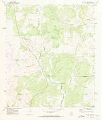
(60)- 1970 Map of Everett Canyon, 1973 Print
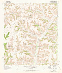
 1970 Everett Canyon1973 Print · USGSVal Verde County ranching country is captured here during the 1970s, as the network of canyons meets the winding Pecos River. Trace family landholdings like Everett Ranch and Ward Ranch alongside remote Landing Strips and local landmarks.
 - 1970 Map of Antone Canyon, 1973 Print
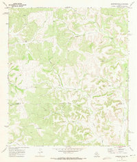
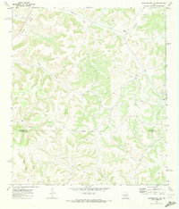
 1970 Antone Canyon1973 Print · USGSRanching life on the Crockett and Val Verde county line during the late 1960s centered on deep canyons and critical water sources. Researchers can trace land boundaries and livestock infrastructure at Blakeney Ranch, Mitchell Ranch, and Lemmon Windmill.
 - 1970 Map of Aermotor Draw, 1973 Print
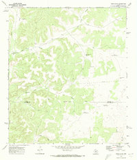
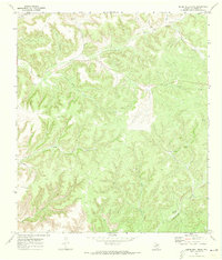
 1970 Aermotor Draw1973 Print · USGSCrockett and Val Verde counties were centers of isolated West Texas ranching and water-scouting in the early seventies. Trace the distribution of family-named water sources like the Aermotor Windmill and remote outposts such as Haryik Ranch.
 - 1970 Map of Juno, 1973 Print
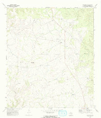
 1970 Juno1973 Print · USGSThe high ranch country of West Texas comes into focus in the 1970s, where life centered on the Devils River. Researchers can trace the water sources and ranch boundaries of the era, from the Beaver Lake Ranch to the remote White Well.
 - 1970 Map of Pandale, 1973 Print
 1970 Pandale1973 Print · USGSThe Pecos River canyonlands of Val Verde County are captured here in the early seventies, detailing a remote ranching landscape. Genealogists can trace family holdings like Bunger Ranch and Mills Ranch near the waters of Howard Draw.
 - 1970 Map of Steel Star Draw, 1973 Print
 1970 Steel Star Draw1973 Print · USGSRanching life in rural Val Verde County is captured here at the start of the seventies. Genealogists and historians can trace family operations like Oberkampf Ranch, Nettleford Ranch, and Carson Ranch among the many draws.
 - 1970 Map of Little Fielder Draw, 1973 Print
 1970 Little Fielder Draw1973 Print · USGSThe Pecos River breaks of Val Verde County are shown here in the early seventies as a landscape of isolated ranching outposts. Researchers can trace the rugged access trails connecting Cash Ranch and White Ranch or locate water sources like Tardy Spring and Scott Spring.
 - 1970 Map of Indian Draw, 1973 Print
 1970 Indian Draw1973 Print · USGSRanching and water rights define this West Texas landscape at the turn of the 1970s. Researchers can trace the ranching economy through names like the Marley Ranch and vital water stops like Quien Sabe Windmill and Big Indian Waterhole Windmill.
 - 1970 Map of Sycamore Canyon, 1973 Print
 1970 Sycamore Canyon1973 Print · USGSDevils River canyon country is captured here during the late sixties and early seventies, showing a land of deep draws and remote ranching. Researchers can trace the holdings at Jarrett Ranch or locate the Spring near Hudspeth River Ranch.
 - 1970 Map of Blue Hills, 1973 Print
 1970 Blue Hills1973 Print · USGSRanching outposts and rugged West Texas terrain define this Val Verde County landscape in the early seventies. Researchers can trace family-named holdings like Albers Ranch and Mayfield Ranch or locate isolated features such as Landing Strips and Duncan Draw.2 unique versions available
 - 1970 Map of Bee Canyon, 1973 Print
 1970 Bee Canyon1973 Print · USGSVal Verde County ranching life in the 1970s was defined by the search for water across a network of deep limestone draws. Researchers can trace the footprints of remote family holdings like Mason West Ranch and the vital network of wells including Star Windmill and High Lonesome Windmill.
 - 1970 Map of Brushy Draw, 1973 Print
 1970 Brushy Draw1973 Print · USGSRanching and oil exploration intersect in Crockett County during the 1970s, where the landscape is marked by remote water stations and early energy development. Researchers can trace family-named landmarks like the Baggett Ranch and vital water sources like the Post Office Windmill and Noelke Windmills.
 - 1970 Map of Howards Well SW, 1973 Print
 1970 Howards Well SW1973 Print · USGSRanching and early energy development meet in West Texas around 1970, where the high plateau is deeply dissected by dry washes. Researchers can locate established sites like Watson Ranch or trace natural landmarks like Howard Draw and Jesus Canyon.
 - 1970 Map of Deaton Draw, 1973 Print
 1970 Deaton Draw1973 Print · USGSVal Verde County ranching life is preserved here as it stood in the early seventies, centered on the canyons east of the Devils River. Researchers can locate family landmarks such as the Virgil Cauthorn Ranch, Brown Ranch Windmill, and the remote Phillips Trail.
 - 1970 Map of Divide Well Draw, 1973 Print
 1970 Divide Well Draw1973 Print · USGSVal Verde County ranching country is captured here in the early seventies, showing a landscape defined by remote outposts and vital water sources. Genealogists and historians can locate family holdings like Arledge Ranch and Mills Ranch or trace drainage paths through Soto Canyon and Divide Well Draw.2 unique versions available
 - 1972 Map of Zuberbueler Bend NW, 1975 Print
 1972 Zuberbueler Bend NW1975 Print · USGSThe Texas-Mexico borderlands come into focus in the early 1970s as the rising waters of the Rio Grande Amistad Reservoir reshape the canyon. Researchers can trace the path of the Old Railroad Grade and the international line within the Amistad National Recreation Area.
 - 1972 Map of Amistad Dam, 1975 Print
 1972 Amistad Dam1975 Print · USGSThe Texas-Mexico border underwent a massive transformation in the early seventies following the impoundment of the Amistad Reservoir. Genealogists and historians can trace the new shoreline and infrastructure around Amistad Dam, Amistad Village, and the Southern Pacific rail line.
 - 1972 Map of California Creek, 1975 Print
 1972 California Creek1975 Print · USGSThe West Texas borderlands transformed in the early 1970s as the waters of the Amistad Reservoir backed into the canyons. Researchers can trace the legacy of the rails along the Southern Pacific and an Old Railroad Grade near Evans Creek.
 - 1972 Map of Miers Ranch, 1975 Print
 1972 Miers Ranch1975 Print · USGSVal Verde County ranchland in the early 1970s is revealed here as a landscape of deep limestone draws and isolated holdings. Researchers can trace the path of the Old Railroad Grade and locate family landmarks like Miers Ranch and Big Satan Creek.
 - 1972 Map of Del Rio SW, 1975 Print
 1972 Del Rio SW1975 Print · USGSThe Texas-Mexico border at Del Rio comes into sharp focus during the early 1970s, as the town expanded toward the river. Genealogists and local historians can trace family locations near San Felipe Sprs, the Old San Felipe Cem, and Sacred Heart Academy.
 - 1972 Map of Seminole Canyon, 1975 Print
 1972 Seminole Canyon1975 Print · USGSThe Val Verde borderlands are captured here in the early seventies as the waters of the Amistad Reservoir reshaped the canyon landscape. Trace the path of the Southern Pacific and an Old Railroad Grade near Seminole Canyon.
 - 1972 Map of Rough Canyon SE, 1975 Print
 1972 Rough Canyon SE1975 Print · USGSVal Verde County’s canyonlands are captured here in the early seventies as the federal recreation area began to define the region. You can trace the Old Railroad Grade through the hills or locate the reach of the Amistad Res National Recreation Area.
 - 1972 Map of Zuberbueler Bend, 1975 Print
 1972 Zuberbueler Bend1975 Print · USGSThe international borderlands of Val Verde County are captured here in the early seventies, just as the Amistad Reservoir transformed the desert landscape. Trace the submerged path of the Rio Grande around the massive Zuberbueler Bend.
 - 1972 Map of Del Rio SE, 1975 Print
 1972 Del Rio SE1975 Print · USGSThe Texas-Mexico borderlands come into sharp focus in the early seventies, centered on the strategic presence of Laughlin Air Force Base. Trace the rugged drainages of Zorro Creek and Sacatosa Creek as they meet the Rio Grande.
 - 1972 Map of Del Rio NW, 1975 Print
 1972 Del Rio NW1975 Print · USGSDel Rio and the neighboring settlement of Cantu are captured in the early 1970s just as the newly formed Amistad Reservoir reshaped the local landscape. Genealogists and historians can locate specific properties along Bedell Ave or trace landmarks like Val Verde Memorial Hospital and the Fish Hatchery.
Showing maps 1-25 of 60
Top cities of Val Verde County
- Del Rio historical maps
- Val Verde Park historical maps
- Comstock historical maps
- Lake View historical maps
Frequently asked questions
- What are the different types of historical maps available for Val Verde County?
- What is the oldest map of Val Verde County?
- Where can I purchase historical maps of Val Verde County for my home or office?
- Where can I download high-res historical maps of Val Verde County?
- Are there historical topographic maps available for Val Verde County?
- Is there historical aerial imagery available for Val Verde County?
- Where are historical maps of Val Verde County sourced from?