1980s Maps of Zapata County, Texas
Explore 17 historic maps of Zapata County from the 1980s. These maps offer a rare glimpse into what life looked like during the 1980s — showing old roads, neighborhoods, homes, and landmarks that have changed or disappeared over time.
Whether you're researching your family's past, planning a metal detecting trip, or studying how Zapata County's landscape evolved across the 1980s, these high-resolution maps are a powerful tool for exploring the history of this region.
- Focus on a specific era: All maps on this page are from the 1980s, giving you a focused view of this time period.
- See what’s changed: Compare century-old streets, trails, and buildings to today's modern landscape using overlays and satellite layers.
- Research with precision: Use these maps for genealogy, historical research, land use analysis, or educational projects.
- View, download, or print: Maps are fully viewable online in high resolution, and can be downloaded or printed for your own records.
Start exploring Zapata County's history through authentic maps from the 1980s. This is your window into the past.
Zapata County, TX maps
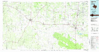
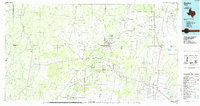
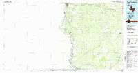
(17)- 1980 Map of Arroyo Huisache
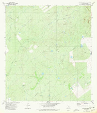
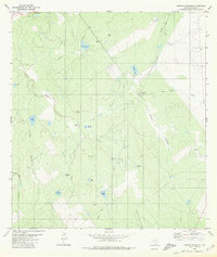 1980 Arroyo Huisache1980 Print · USGSZapata County ranching and energy exploration are captured here in the late seventies. Family-named landmarks like Lobitas Tank and Adame Tank can be traced alongside the rural settlement of Bustamante and its local Cem.
 - 1980 Map of Mogotes Hill
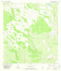 1980 Mogotes Hill1980 Print · USGSZapata County at the start of the eighties shows a landscape shaped by energy exploration and rugged brush country. Trace the footprint of the local gas industry alongside isolated landmarks like a lone Grave and the heights of Mogotes Hill.
 - 1980 Map of Escobas
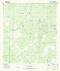 1980 Escobas1980 Print · USGSThe ranching and energy landscape of Zapata County, Texas, is captured here during the 1980s. Researchers can trace remote family burial grounds at Gracia Cem and Camaron Cem or locate the numerous water catchments like Rancho Viejo Tank that supported the local cattle industry.
 - 1980 Map of Agua Azul Creek East
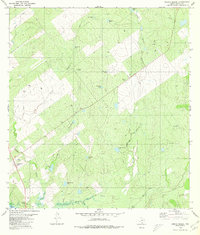
 1980 Agua Azul Creek East1980 Print · USGSThe brushlands of South Texas appear at the height of their energy development in the early eighties. Genealogists and researchers can trace family-named landmarks and infrastructure like Agua Azul Creek, the Oil Field, and the Webb Co Zapata Co line.
 - 1980 Map of Arroyo Miguel
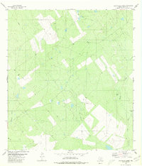
 1980 Arroyo Miguel1980 Print · USGSZapata County rangeland in the early eighties was a landscape of cattle ranching and energy extraction. Researchers can trace the network of ranching tanks like San Antonio Tank and find local landmarks such as Chihuahua Farm and the Rodeo Ground.
 - 1980 Map of Agua Azul Creek West
 1980 Agua Azul Creek West1980 Print · USGSWebb and Zapata counties appear here during the early eighties, showcasing a landscape of South Texas ranching and energy production. Researchers can trace land use through features like the Landing Strip, Oil Wells, and water sources like Los Lasos Tank.
 - 1980 Map of Arroyo Veleno
 1980 Arroyo Veleno1980 Print · USGSCoastal ranching and energy extraction define this Zapata County landscape as it appeared in the late seventies. Researchers can trace intricate water systems from Falcon Reservoir to local landmarks like Arroyo Veleno and Ranchito Tank.
 - 1980 Map of Blancas Creek South
 1980 Blancas Creek South1980 Print · USGSThe South Texas brush country along the Webb and Zapata county line is captured in the late seventies just as energy exploration was intensifying. Researchers can trace land divisions and drainage systems like Dolores Creek, George hill, and scattered Gas Wells.
 - 1980 Map of Arroyo Salado East
 1980 Arroyo Salado East1980 Print · USGSZapata County ranchland is captured here during the late twentieth-century energy expansion in South Texas. Researchers can trace the winding course of Arroyo Salado and locate regional infrastructure like the local Gas Well and Cañada Creek.2 unique versions available
 - 1980 Map of Las Ovejas Creek
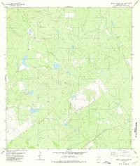
 1980 Las Ovejas Creek1980 Print · USGSZapata County ranchlands and energy infrastructure are recorded here as they appeared in the early eighties. Genealogists and historians can locate family sites like Las Ovejas Ranch, a solitary Grave, and several named water sources including Tortuga Tank.
 - 1980 Map of Arroyo Burro
 1980 Arroyo Burro1980 Print · USGSSouth Texas ranchlands meet the northeastern shores of the Rio Grande during the late twentieth century. Genealogists and historians can trace the reach of Falcon Reservoir and identify local landmarks like the Refugio Ramirez Tank and Arroyo Burro.
 - 1980 Map of Chargos Creek
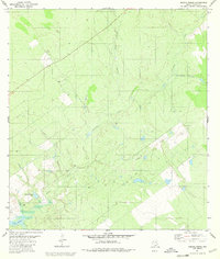
 1980 Chargos Creek1980 Print · USGSZapata County ranchlands were undergoing an energy boom by the mid-1970s, as shown on this survey of the South Texas brush country. Researchers can trace the footprint of the Jennings West Oil and Gas Field alongside local landmarks like Rodriguez Tank and Arroyos Dos Creek.
 - 1983 Map of Mc Allen, 1984 Print
 1983 Mc Allen1984 Print · USGSThe Lower Rio Grande Valley is captured here during the early 1980s, showcasing the intense cross-border connectivity and agricultural expansion of the era. Researchers can trace the sprawling irrigation networks around Mc Allen and Mission, or locate landmarks like the Zapata Aircraft Control and Warning Station and Falcon State Park.
 - 1985 Map of Falfurrias
 1985 Falfurrias1985 Print · USGSThe ranchlands of South Texas were an active hub for rail and petroleum at the height of the mid-eighties. Researchers can trace the path of the Texas Mexican RR through Hebbronville or locate the Thanksgiving Oil Field and Sejita crossroads.2 unique versions available
 - 1985 Map of Encino
 1985 Encino1985 Print · USGSThe ranching and oil country of South Texas comes to life in the mid-1980s as the energy industry expanded across Starr and Brooks Counties. Family historians can trace ancestral lands near San Antonio Viejo, old rail stops like Encino, and the sprawling Alta Mesa Oil Field.
 - 1985 Map of San Ygnacio
 1985 San Ygnacio1985 Print · USGSThe Rio Grande borderlands and South Texas ranch country are captured here in the mid-eighties as the energy industry expanded inland. Researchers can trace historic river settlements like San Ygnacio or the industrial footprints of Mirando City and the Jennings West Oil and Gas Field.3 unique versions available
 - 1985 Map of Zapata
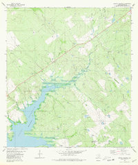
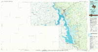 1985 Zapata1985 Print · USGSThe Rio Grande borderlands in the mid-eighties show a landscape transformed by the waters of the Falcon Reservoir. Genealogists and historians can trace the growth of Zapata and locate border communities like Lopeño, Salineño, and Falcon Village.2 unique versions available
End of results
Showing maps 1-17 of 17
Top cities of Zapata County
Frequently asked questions
- What are the different types of historical maps available for Zapata County?
- What is the oldest map of Zapata County?
- Where can I purchase historical maps of Zapata County for my home or office?
- Where can I download high-res historical maps of Zapata County?
- Are there historical topographic maps available for Zapata County?
- Is there historical aerial imagery available for Zapata County?
- Where are historical maps of Zapata County sourced from?