Old Maps of Zapata County, Texas for Metal Detecting
Plan your next treasure hunt with 196 historic maps of Zapata County. Find old homesites, ghost towns, trails, and gathering spots that may be lost to time — perfect for identifying promising metal detecting locations.
- Locate forgotten sites: Uncover places like long-lost settlements, abandoned rail lines, or gathering spots.
- Plan better hunts: Use map overlays combined with LiDAR or satellite views to narrow in on historically rich areas.
- Made for detectorists: Thousands of hobbyists use these maps to discover relics, coins, and hidden history.
Use these historic maps to boost your research and find new opportunities beneath the surface of Zapata County.
Zapata County, TX maps
(196)- 1933 Map of Becerra Creek, 1956 Print
 1933 Becerra Creek1956 Print · USGSSouth Texas ranching country along the border comes into focus in the early twentieth century. Genealogists and local historians can trace family landholdings like the Dario Sanchez Pasture or search for roots near the Johnson Settlement and Mann Ranch.
 - 1938 Map of Falcon, 1956 Print
 1938 Falcon1956 Print · USGSThe Rio Grande valley of South Texas appears here in the decades before the creation of Falcon Lake, revealing a landscape of historic river crossings and family ranches. Genealogists can trace ancestral sites like Falcon (Ramireño), Salineño, and Lopeño, or locate river landmarks such as Las Piedras Island.
 - 1938 Map of El Sauz, 1958 Print
 1938 El Sauz1958 Print · USGSSouth Texas ranching territory in the late thirties is defined by a dense network of family-held estates and cattle outposts. Local historians and genealogists can trace ancestral holdings through landmarks like La Presurosa Store, Las Escobas Ranch, and Agua Dulce Ranch.
 - 1938 Map of Cuevitas, 1959 Print
 1938 Cuevitas1959 Print · USGSSouth Texas ranching and the nascent oil industry define this borderlands region in the late nineteen-thirties. Researchers can trace ancestral family lands through dozens of named sites like San Antonio Viejo Ranch, Cuevitas, and the Sun Oil Co Camp.
 - 1939 Map of Bruni, 1958 Print
 1939 Bruni1958 Print · USGSSouth Texas brush country was a hub of energy and ranching in the late thirties as the oil boom transformed the landscape. Genealogists and historians can trace family landholdings like Santa Cruz Ranch and the early industrial footprint of Mirando City or the Valdez Oil Field.2 unique versions available
 - 1939 Map of Randado, 1959 Print
 1939 Randado1959 Print · USGSSouth Texas ranching and the rise of the oil industry intersect in the late 1930s across Jim Hogg County. Genealogists and local historians can trace legacy family holdings like Lopez Ranch and De la Garza Ranch alongside infrastructure for the Randado Oil Field.
 - 1940 Map of Aguilares
 1940 Aguilares1940 Print · USGSSouth Texas ranching and the early oil industry meet in the late 1930s along the Texas Mexican Railroad. Local historians can trace family landholdings from Zapata Ranch to Dodier Ranch, or locate commerce hubs like Pullin Store and the Magnolia Pump Station.
 - 1940 Map of Randado
 1940 Randado1940 Print · USGSJim Hogg County ranchlands and oil fields are captured here in the late thirties just before the war. Researchers can trace family landholdings like De La Garza Ranch and Armstrong Ranch or locate early industrial sites at the Randado Oil Field.
 - 1940 Map of Mogotes Hill
 1940 Mogotes Hill1940 Print · USGSZapata County ranching and early petroleum discovery meet in the brush country during the 1940s. Genealogists and historians can trace family landholdings from Trinidad Ranch to Bella Vista Ranch, while locating early industry at Escobas Field and the Cuellar Store.
 - 1942 Map of San Ygnacio, 1956 Print
 1942 San Ygnacio1956 Print · USGSZapata County ranchlands along the Mexican border appear here just as the region’s traditional ways were being documented by military surveyors. You can trace early family holdings and river life at San Ygnacio, the Ferry crossing, and the historic Dolores Ruins.
 - 1949 Map of Mc Allen, 1954 Print
 1949 Mc Allen1954 Print · USGSThe Rio Grande Valley at mid-century reveals a bustling international corridor of citrus groves, rail lines, and growing border towns. Genealogists and historians can trace the Missouri Pacific RR through McAllen or locate rural landmarks like the Santa Fe School and Arkansas City.
 - 1954 Map of McAllen
 1954 McAllen1954 Print · USGSThe Lower Rio Grande Valley in the mid-fifties is captured here as a burgeoning hub of agriculture, oil, and international trade. Researchers can trace the extensive rail lines of the St Louis Brownsville and Mexico or locate rural landmarks like Tacubaya School and Clay Dusting Service.
 - 1956 Map of Mogotes Hill
 1956 Mogotes Hill1956 Print · USGSZapata County ranching and early oil exploration define this South Texas landscape during the mid-twentieth century. Genealogists can locate family holdings like Salomoneño and Bustamente, alongside the Cuellar Oil Field and Guellar Store.
 - 1956 Map of Zapata
 1956 Zapata1956 Print · USGSThe ranching country of Zapata County along the Rio Grande is documented here in the mid-1950s. Researchers can trace ancestral lands at Ramireno Ranch and Boleño, or locate the U S Customhouse near the river crossing.
 - 1956 Map of Arroyo Clareno
 1956 Arroyo Clareno1956 Print · USGSSouth Texas ranching life is documented here during the mid-century, showing the vast family pastures along the Rio Grande. Genealogists and historians can trace lineage and land use through labels like San Antonio De La Huerta Ranch, Lajita Ranch, and the Haynes Oil Field.
 - 1956 Map of Laredo, 1960 Print
 1956 Laredo1960 Print · USGSSouth Texas in the mid-fifties reveals a landscape shaped by border commerce, military aviation, and a booming oil industry. Trace the historic Texas and Mexican RR line through Hebbronville or locate the sprawling Mirando City Oil Field and Laredo AFB.3 unique versions available
 - 1957 Map of Mc Allen, 1962 Print
 1957 Mc Allen1962 Print · USGSThe South Texas borderlands emerge in the late fifties as a hub of energy production and military activity. Researchers can trace the river economy through Rio Grande City, find the Brewster School, and locate the Moore Air Force Base.2 unique versions available
 - 1962 Map of McAllen
 1962 McAllen1962 Print · USGSThe Lower Rio Grande Valley in the mid-twentieth century shows a complex landscape of irrigation, oil production, and border commerce. Genealogists and historians can trace family roots through riverside towns like Zapata, Roma-Los Saenz, and Hidalgo, or locate landmarks like Santa Elena Ch and Moore Air Force Base.
 - 1965 Map of Salineno, 1968 Print
 1965 Salineno1968 Print · USGSThe Texas-Mexico borderlands come into focus in the mid-1960s, showing the early infrastructure surrounding the river and the reservoir. Genealogists can trace family sites at Salineño and Los Arrierous Cem or locate old ranching outposts like Margo.2 unique versions available
 - 1965 Map of Falcon Village, 1968 Print
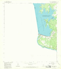 1965 Falcon Village1968 Print · USGSThe mid-sixties Rio Grande borderlands are defined here by the waters of Falcon Reservoir and the rise of Falcon Village. Researchers can trace the international boundary and locate features like Chapeno Cem and the Falcon Dam.
 - 1965 Map of Lopeno, 1968 Print
 1965 Lopeno1968 Print · USGSSouth Texas brush country and the rising waters of the Rio Grande meet in the mid-sixties as energy production reshapes the borderlands. Genealogists and historians can trace the grid of the Lopeño Gas Field and old settlements like Lopeño and Falcon.
 - 1965 Map of Beckwith Arm, 1968 Print
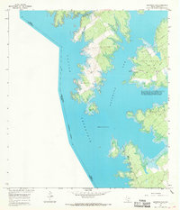 1965 Beckwith Arm1968 Print · USGSFalcon Reservoir defined this borderland in the mid-1960s, its rising waters creating a new landscape for recreation and industry. Researchers can trace the development of the Lopeno Gas Field and find early recreational landmarks like the Marina and Trailer Camp and Landing Strip.2 unique versions available
 - 1972 Map of Albercas Ranch, 1975 Print
 1972 Albercas Ranch1975 Print · USGSThe ranching and energy country of south Texas is captured here in the early seventies as petroleum production transformed the brushland. Genealogists and historians can locate family landmarks like San Jose Ranch, Graves, and the drainage of Arroyo Grande.
 - 1972 Map of Guerra, 1975 Print
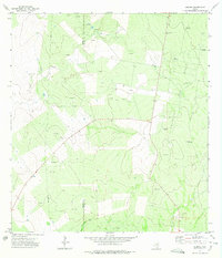 1972 Guerra1975 Print · USGSGuerra and the surrounding South Texas ranch lands are captured here during the early seventies as the energy industry expanded. Genealogists and researchers can locate the Cem near town and trace water sources like Palomas Windmill and Alto Windmill.2 unique versions available
 - 1972 Map of Thompsonville, 1975 Print
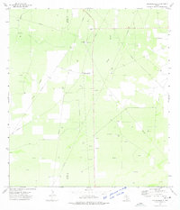 1972 Thompsonville1975 Print · USGSThe South Texas brush country is captured here during the early seventies, showing a landscape defined by ranching and energy. Genealogists and historians can locate Thompsonville and the Vela-Peña Ranch while tracing the extensive network of Oil Wells.2 unique versions available
Showing maps 1-25 of 196
Top cities of Zapata County
Frequently asked questions
- What are the different types of historical maps available for Zapata County?
- What is the oldest map of Zapata County?
- Where can I purchase historical maps of Zapata County for my home or office?
- Where can I download high-res historical maps of Zapata County?
- Are there historical topographic maps available for Zapata County?
- Is there historical aerial imagery available for Zapata County?
- Where are historical maps of Zapata County sourced from?