1930s Maps of Washington
Explore 41 historic maps of Washington from the 1930s. These maps offer a rare glimpse into what life looked like during the 1930s — showing old roads, neighborhoods, homes, and landmarks that have changed or disappeared over time.
Whether you're researching your family's past, planning a metal detecting trip, or studying how Washington's landscape evolved across the 1930s, these high-resolution maps are a powerful tool for exploring the history of this region.
- Focus on a specific era: All maps on this page are from the 1930s, giving you a focused view of this time period.
- See what’s changed: Compare century-old streets, trails, and buildings to today's modern landscape using overlays and satellite layers.
- Research with precision: Use these maps for genealogy, historical research, land use analysis, or educational projects.
- View, download, or print: Maps are fully viewable online in high resolution, and can be downloaded or printed for your own records.
Start exploring Washington's history through authentic maps from the 1930s. This is your window into the past.
Washington maps
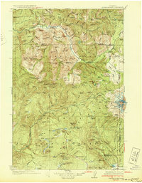
(41)- 1930 Map of Chewelah
 1930 Chewelah1930 Print · USGSStevens County's mining and timber landscape comes alive in the late 1920s, showing the vital rail-to-river corridor. Trace family roots and vanished industrial sites from Springdale to Chewelah, including the United Copper Mine and Bear Creek Sch.2 unique versions available
 - 1930 Map of Grand Coulee Sheet 3
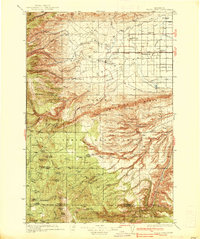
 1930 Grand Coulee Sheet 31930 Print · USGSGrant County is captured during a period of transition in the late twenties, showing the area's complex geology before major development. Researchers can trace local landmarks like the Grand View Sch and the significant geological formation of the Bacon Monocline.
 - 1931 Map of Steamboat Mtn
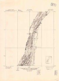
 1931 Steamboat Mtn1931 Print · USGSSkamania and Lewis Counties appear as a managed wilderness of national forests in the years before World War II. Researchers can trace the early footprint of forest management at the Cispus Lookout Sta and remote sites like Graveyard Camp or Buckhorn Camp.2 unique versions available
 - 1933 Map of Colville
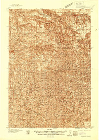
 1933 Colville1933 Print · USGSIn the early thirties, this corner of Washington was a powerhouse of mining and timber activity along the Columbia River. Local historians can trace the foundations of Colville and Northport, and locate historic landmarks like Old Fort Colville or the Electric Point Mine.2 unique versions available
 - 1934 Map of The Dalles
 1934 The Dalles1934 Print · USGSThe Columbia River Gorge in the early thirties reveals a complex network of rapids and river engineering before the completion of major modern dams. Local historians can trace early school districts like Threemile Sch and family landmarks such as Clancy Ranch or Petersburg.4 unique versions available
 - 1934 Map of Troutdale
 1934 Troutdale1934 Print · USGSThe Columbia River shoreline and the wooded hills of Clark County come alive in this mid-1930s survey of the riverfront. Researchers can trace early rural life through Washougal and local landmarks like Fern Prairie Grange, Lackamas Lake, and the Silver Star Mine.
 - 1934 Map of Metaline, 1959 Print
 1934 Metaline1959 Print · USGSThe Pend Oreille River valley was a hub of mining and rail activity in the 1930s as the railroad pushed north toward the Canadian border. Genealogists and historians can trace the foundations of Metaline Falls and Tiger or locate the Bunker Hill Mine and Lincoln Sch.
 - 1935 Map of Pendleton
 1935 Pendleton1935 Print · USGSPendleton and the surrounding Umatilla River valley are captured in the mid-1930s as the region solidified its role as a transportation and agricultural hub. Genealogists can locate numerous named rural schoolhouses such as Campbell Sch and North Yoakum Sch, or trace family sites near the Umatilla Indian Reservation and Cabbage Hill.3 unique versions available
 - 1935 Map of Clallam, 1947 Print
 1935 Clallam1947 Print · USGSThe Olympic Peninsula coast at the start of the mid-century era shows a landscape of isolated homesteads and maritime landings. Researchers can trace the early footprints of coastal ranching at the George Clarke Ranch or locate the historic timber and fishing hubs of Sekiu and Clallam Bay.
 - 1935 Map of Mount Olympus, 1954 Print
 1935 Mount Olympus1954 Print · USGSThe high peaks and glaciers of the Olympic Range are shown here as they appeared in the 1930s. Researchers can locate remote backcountry landmarks like Michaels Ranch, the Olympus Guard Station, and the old Hurricane Hill Lookout.
 - 1935 Map of Ozette Lake, 1957 Print
 1935 Ozette Lake1957 Print · USGSCoastal Clallam County at the mid-thirties reveals a landscape of isolated homesteads and ancient village sites along the Pacific. Researchers can locate family landmarks like Pete Rooses Ranch and the Old Cemetery near the Ozette Indian Reservation.2 unique versions available
 - 1935 Map of Lake Pleasant, 1958 Print
 1935 Lake Pleasant1958 Print · USGSThe Olympic Peninsula's logging and ranching frontier is captured here in the mid-1930s. Genealogists and historians can trace family sites like Klahoose Ranch and timber infrastructure including the Big Creek Shingle Mill and several logging railroads.
 - 1936 Map of Marcus
 1936 Marcus1936 Print · USGSUpper Stevens County was a hub of mining and rail transport in the mid-1930s, where the Kettle River meets the Columbia River. Genealogists can trace family roots through numerous rural landmarks like Napoleon Sch and the Old Catholic Mission.
 - 1936 Map of Newport
 1936 Newport1936 Print · USGSThe Pend Oreille River valley in the 1930s reveals a landscape of railroad towns and timber outposts along the Idaho border. Genealogists can locate family-named school districts like Locke Sch and Otter Creek Sch, alongside settlements at Dalkena, Cusick, and Scotia.2 unique versions available
 - 1936 Map of Yakima East
 1936 Yakima East1936 Print · USGSYakima and the Moxee Valley are shown here in the mid-1930s as the regional irrigation and rail networks were fully established. Genealogists and local historians can trace family locations near Pease Ranch, Moxee City, and schools like Central Sch.
 - 1936 Map of Hog Ranch Buttes
 1936 Hog Ranch Buttes1936 Print · USGSYakima and Kittitas counties are captured here in the mid-thirties, showing a vast ranching landscape defined by high ridges and deep canyons. Family historians can trace homesteads like Holmes Ranch and Meeboer Ranch, or locate local landmarks like Taylor Sch.
 - 1936 Map of Point Misery, 1958 Print
 1936 Point Misery1958 Print · USGSCommunities along the Hood Canal thrived on timber and maritime trade in the mid-1930s. Genealogists and historians can trace local landmarks like Seabeck, the Lewis Lumber Co, and the Brinnon Seabeck Ferry route.3 unique versions available
 - 1937 Map of Olympia
 1937 Olympia1937 Print · USGSThe state capital and the southern inlets of Puget Sound are captured here during the mid-1930s as the region's rail and maritime networks matured. Genealogists and historians can locate vanished schoolhouses like Plainview Sch, old coastal landings at Boston Harbor, and early industry at Union Mills.2 unique versions available
 - 1937 Map of White Swan
 1937 White Swan1937 Print · USGSThe Yakima Indian Reservation in the mid-1930s reveals a landscape of high ridges meeting an emerging irrigation frontier. Genealogists and historians can trace early school sites like Medicine Valley Sch, the rail-stop at Harrah, and the historic grounds of Fort Simcoe.3 unique versions available
 - 1937 Map of Eatonville
 1937 Eatonville1937 Print · USGSThe timber and mining corridors of Pierce and Lewis Counties are captured here in the mid-1930s. Genealogists and historians can trace the early footprints of Eatonville, locate the Ladd Mine, and follow the path of the Chicago Milwaukee St Paul and Pacific RR.3 unique versions available
 - 1937 Map of Pomeroy
 1937 Pomeroy1937 Print · USGSGarfield and Columbia Counties appear in the late thirties as a patchwork of upland farms and forest outposts. Genealogists and historians can locate rural landmarks like Pataha Cem, the Tucannon Guard Sta, and various country schools including Pine Grove Sch.3 unique versions available
 - 1937 Map of Port Orchard, 1960 Print
 1937 Port Orchard1960 Print · USGSBremerton and the Kitsap Peninsula were defined by their deep-water naval facilities and ferry networks in the years preceding World War II. Local historians can trace the early footprints of the Puget Sound Navy Yard, the Port Madison Indian Reservation, and the Fort Ward coastal defenses.2 unique versions available
 - 1937 Map of Port Gamble, 1964 Print
 1937 Port Gamble1964 Print · USGSPuget Sound and the Hood Canal meet in the 1930s, showing a world of timber mills and vital ferry crossings. Trace the old routes of the Port Gamble-Shine Auto Ferry and locate historic landmarks like the Point No Point Lighthouse and Indianola.
 - 1938 Map of Badger Pocket
 1938 Badger Pocket1938 Print · USGSThe Kittitas Valley at the end of the 1930s reveals a landscape of expanding irrigation and rail-connected settlements. Researchers can trace the extensive Cascade Canal system and locate family-history sites like Denmark Hall, Regal, and the Silica Mine.
 - 1938 Map of Cape Disappointment
 1938 Cape Disappointment1938 Print · USGSThe Long Beach Peninsula in the late 1930s was a bustling landscape of oyster docks, coastal ranches, and military outposts. Genealogists can trace family holdings like the Loomis Ranch or find local landmarks including the Moby Dick Hotel and Fort Canby.
Showing maps 1-25 of 41
Top cities of Washington
- Seattle historical maps
- Spokane historical maps
- Tacoma historical maps
- Vancouver historical maps
- Bellevue historical maps
- Kent historical maps
See more
Top counties of Washington
- King County historical maps
- Pierce County historical maps
- Snohomish County historical maps
- Spokane County historical maps
- Clark County historical maps
- Thurston County historical maps
See more
Frequently asked questions
- What are the different types of historical maps available for Washington?
- What is the oldest map of Washington?
- Where can I purchase historical maps of Washington for my home or office?
- Where can I download high-res historical maps of Washington?
- Are there historical topographic maps available for Washington?
- Is there historical aerial imagery available for Washington?
- Where are historical maps of Washington sourced from?