1950s Maps of Washington
Explore 468 historic maps of Washington from the 1950s. These maps offer a rare glimpse into what life looked like during the 1950s — showing old roads, neighborhoods, homes, and landmarks that have changed or disappeared over time.
Whether you're researching your family's past, planning a metal detecting trip, or studying how Washington's landscape evolved across the 1950s, these high-resolution maps are a powerful tool for exploring the history of this region.
- Focus on a specific era: All maps on this page are from the 1950s, giving you a focused view of this time period.
- See what’s changed: Compare century-old streets, trails, and buildings to today's modern landscape using overlays and satellite layers.
- Research with precision: Use these maps for genealogy, historical research, land use analysis, or educational projects.
- View, download, or print: Maps are fully viewable online in high resolution, and can be downloaded or printed for your own records.
Start exploring Washington's history through authentic maps from the 1950s. This is your window into the past.
Washington maps
(468)- 1950 Map of Lincoln
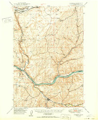
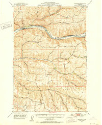
 1950 Lincoln1950 Print · USGSThe Columbia and Spokane Rivers converge here just after the filling of Lake Roosevelt, shaping the borders of two tribal nations. Genealogists and local historians can locate early schools like Rothlisburg Sch, the landmark Fort Spokane, and the community of Lincoln.2 unique versions available
 - 1950 Map of Vancouver
 1950 Vancouver1950 Print · USGSCoastal Oregon and the lower Columbia River valley are captured in detail just after the war. Researchers can trace historic rail routes like the Southern Pacific or locate early settlements such as Vernonia, Gaston, and the Grand Ronde Indian Reservation.
 - 1950 Map of The Brothers
 1950 The Brothers1950 Print · USGSThe Jefferson County coast meets the Olympic peaks in the mid-century, capturing the area's transition from the Hood Canal shoreline to high wilderness. Researchers can trace early backcountry camps and coastal landmarks like John Ahl Sch, Camp Collins, and the Hamma Hamma Guard Sta.2 unique versions available
 - 1950 Map of Mt Christie
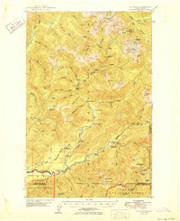 1950 Mt Christie1950 Print · USGSJefferson and Grays Harbor counties appear here during the mid-century, showing a landscape of backcountry shelters and mountain trails. You can trace the routes of early hikers and rangers through Graves Creek Inn, the Muncaster Sch, and Chicago Camp.2 unique versions available
 - 1950 Map of Turtle Lake
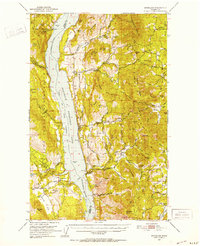
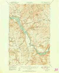 1950 Turtle Lake1950 Print · USGSThe Spokane Indian Reservation and the newly formed reservoir at Franklin D Roosevelt Lake dominate this mid-century survey. Genealogists and historians can locate the Germania Mine, the Church of Our Lady of Lourdes, and rural landmarks like Egypt Ch.2 unique versions available
 - 1950 Map of Wilmont Creek
 1950 Wilmont Creek1950 Print · USGSThe Colville and Spokane Indian Reservations meet here at the newly formed Lake Roosevelt in the years following the Grand Coulee Dam project. Genealogists and historians can locate old landmarks like Kewa, the Kewa Cem, and the Rogers Bar Sch.2 unique versions available
 - 1950 Map of La Crosse
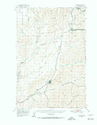 1950 La Crosse1950 Print · USGSWhitman County's wheat-growing heartland is captured here in the mid-twentieth century as the rail-and-river economy flourished. You can trace the Union Pacific line through Winona and La Crosse, or locate rural landmarks like Pampa Pond and the Airway Beacon.2 unique versions available
 - 1950 Map of Mt. Steel
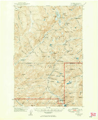 1950 Mt. Steel1950 Print · USGSThe interior Olympic Peninsula at mid-century reveals a high-country wilderness of glaciers and remote outposts. Trace the locations of backcountry sites like Chalet, Hammer Cabin, and the Darky Mine along the North Fork Skokomish River.2 unique versions available
 - 1950 Map of Starbuck
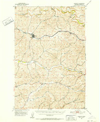
 1950 Starbuck1950 Print · USGSSoutheast Washington during the late 1940s is defined by the winding Snake River and its rugged canyons. Genealogists and historians can trace the rail-and-river network of Starbuck and Riparia, or locate family sites like Gordon Farm and McGregor Ranch.
 - 1950 Map of Wilbur
 1950 Wilbur1950 Print · USGSThe Washington plateau and the newly formed Franklin D Roosevelt Lake appear here in the late 1940s as the regional landscape adjusted to massive hydrological change. Genealogists can locate family landmarks in Wilbur and Creston, or trace rural life through the Potlatch Grange and Keller Ferry.
 - 1950 Map of Hunters
 1950 Hunters1950 Print · USGSStevens County is shown in the early postwar years as a rugged mining and ranching corridor between the Columbia River and the high peaks. Genealogists and researchers can locate family-named landmarks and rural centers like the Greenwood Grange, Enterprise Cemetery, and several remote operations including the Cleveland Mine.2 unique versions available
 - 1950 Map of Haas
 1950 Haas1950 Print · USGSFranklin County at the midpoint of the century reveals a landscape shaped by the Snake River and competing rail lines. Genealogists and local historians can locate early homesteads like Davin Ranch and Nunamaker Farm alongside rail stops at Sperry and McAdam.
 - 1950 Map of Grand Coulee Dam
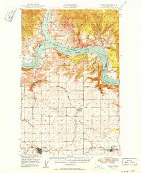
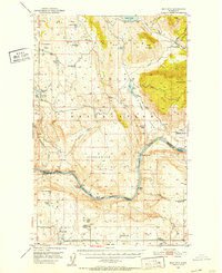
 1950 Grand Coulee Dam1950 Print · USGSThe Grand Coulee region during the late 1940s reveals a landscape transformed by the new reservoir and the massive engineering of the dam. Researchers can trace local history through the Lafollette Cem, the community at Elmer City, and rural sites like the Grand Coulee Grange.2 unique versions available
 - 1950 Map of Vancouver, 1951 Print
 1950 Vancouver1951 Print · USGSThe Pacific Northwest urban corridor meets the rugged coast in the years following the war, showing the expansion of Portland and Vancouver. Genealogists and historians can trace the reach of the Southern Pacific RR and locate coastal communities like Tillamook, Seaside, and Tolovana Park.
 - 1950 Map of Yakima, 1951 Print
 1950 Yakima1951 Print · USGSThe Yakima Valley and the towering Cascades meet in this mid-century survey of South Central Washington. Genealogists and local historians can trace the irrigation-era growth of Yakima, the historic Fort Simcoe outpost, and the White Swan Mission on the Yakima Indian Reservation.
 - 1950 Map of Spokane NE, 1952 Print
 1950 Spokane NE1952 Print · USGSSpokane and its eastern valleys are captured here at a peak of rail and aviation development in the early fifties. Genealogists and local historians can trace family plots and school districts from Hillyard Cemeteries to the Hutton Settlement and Felts Field.2 unique versions available
 - 1950 Map of Nespelem, 1952 Print
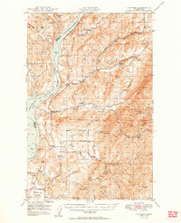
 1950 Nespelem1952 Print · USGSWithin the Colville Indian Reservation at mid-century, this area shows the transition from mountain lakes to the Columbia River shore. You can trace early settlements and agency sites like Nespelem, Koontzville, and the Colville Indian Agency during a period of significant regional change.4 unique versions available
 - 1950 Map of Penawawa, 1952 Print
 1950 Penawawa1952 Print · USGSIn the early 1950s, the Snake River still flowed freely past small riverside settlements and across numerous bars. Genealogists can trace family names and vanished locales such as Penawawa, Gould City, and Rice Bar along the Union Pacific line.2 unique versions available
 - 1950 Map of Spokane SE, 1952 Print
 1950 Spokane SE1952 Print · USGSSpokane and the surrounding prairies and mountains are captured here in the early postwar years as rural crossroads were still the heart of the community. Genealogists and historians can locate Moran Cem, the Grange Hall, and several local schools like Sunnyside Sch and Adams Sch.2 unique versions available
 - 1950 Map of Endicott, 1952 Print
 1950 Endicott1952 Print · USGSWhitman County's wheat country is captured in the early fifties, showing the rural rail-and-creek network that sustained the Palouse. Researchers can locate the Union Pacific line, the small settlement of Dusty, and local landmarks like Lacrosse Grange.3 unique versions available
 - 1950 Map of Mt Spokane, 1952 Print
 1950 Mt Spokane1952 Print · USGSThe Washington-Idaho borderlands in the early fifties reveal a landscape of high summits and quiet lake basins. Genealogists and local historians can trace rural school districts like Kit Carson School and small community hubs such as Inland Grange and Peone.3 unique versions available
 - 1950 Map of Boot Mtn, 1952 Print
 1950 Boot Mtn1952 Print · USGSThe Okanogan highlands meet the Columbia River in the early 1950s within the Colville Indian Reservation. Trace rural life through the Condon Ferry (Site) and several remote schoolhouses like Long Lake Sch.3 unique versions available
 - 1950 Map of Spokane SW, 1952 Print
 1950 Spokane SW1952 Print · USGSThe outskirts of mid-century Spokane reveal a busy intersection of major railroads and rural community life on the edge of Moran Prairie. Genealogists can locate family landmarks like Windsor School, Glenora Church, and several grange halls serving the farms along LATAH CREEK.
 - 1950 Map of Inchelium, 1952 Print
 1950 Inchelium1952 Print · USGSThe Huckleberry Range and the newly formed Franklin D Roosevelt Lake define this mid-century look at the Columbia River valley. Genealogists and historians can trace riverside settlements like Rice and Inchelium, as well as industrial remnants like the Columbia Tungsten Mine.4 unique versions available
 - 1950 Map of Spokane NW, 1952 Print
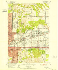
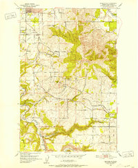
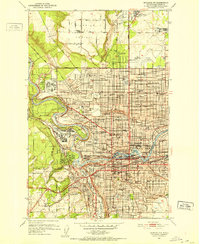 1950 Spokane NW1952 Print · USGSSpokane enters the early fifties as a major military and rail hub, with neighborhoods expanding across the Spokane River. Genealogists and historians can locate legacy institutions like Gonzaga University, George Wright Air Force Base, and Holy Cross Cemetery.2 unique versions available
Showing maps 1-25 of 468
Top cities of Washington
- Seattle historical maps
- Spokane historical maps
- Tacoma historical maps
- Vancouver historical maps
- Bellevue historical maps
- Kent historical maps
See more
Top counties of Washington
- King County historical maps
- Pierce County historical maps
- Snohomish County historical maps
- Spokane County historical maps
- Clark County historical maps
- Thurston County historical maps
See more
Frequently asked questions
- What are the different types of historical maps available for Washington?
- What is the oldest map of Washington?
- Where can I purchase historical maps of Washington for my home or office?
- Where can I download high-res historical maps of Washington?
- Are there historical topographic maps available for Washington?
- Is there historical aerial imagery available for Washington?
- Where are historical maps of Washington sourced from?