2020s Maps of Washington
Explore 1,531 historic maps of Washington from the 2020s. These maps offer a rare glimpse into what life looked like during the 2020s — showing old roads, neighborhoods, homes, and landmarks that have changed or disappeared over time.
Whether you're researching your family's past, planning a metal detecting trip, or studying how Washington's landscape evolved across the 2020s, these high-resolution maps are a powerful tool for exploring the history of this region.
- Focus on a specific era: All maps on this page are from the 2020s, giving you a focused view of this time period.
- See what’s changed: Compare century-old streets, trails, and buildings to today's modern landscape using overlays and satellite layers.
- Research with precision: Use these maps for genealogy, historical research, land use analysis, or educational projects.
- View, download, or print: Maps are fully viewable online in high resolution, and can be downloaded or printed for your own records.
Start exploring Washington's history through authentic maps from the 2020s. This is your window into the past.
Washington maps
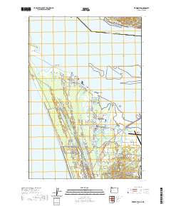
(1,531)- 2020 Map of Clatsop Spit, 2020 Print
 2020 Clatsop Spit2020 Print · USGSCovers Washington, including Clatsop County, Pacific County, and other nearby areas
 - 2020 Map of Rainier, 2020 Print
 2020 Rainier2020 Print · USGSCovers Washington, including Longview, Kelso, and other nearby areas
 - 2020 Map of Tanner Butte, 2020 Print
 2020 Tanner Butte2020 Print · USGSCovers Washington, including Multnomah County, Hood River County, and other nearby areas
 - 2020 Map of The Dalles North, 2020 Print
 2020 The Dalles North2020 Print · USGSCovers Washington, including The Dalles, Chenowith, and other nearby areas
 - 2020 Map of Jim Creek Butte, 2020 Print
 2020 Jim Creek Butte2020 Print · USGSCovers Washington, including Nez Perce County, Asotin County, and other nearby areas
 - 2020 Map of Warrenton, 2020 Print
 2020 Warrenton2020 Print · USGSCovers Washington, including Warrenton, McGowan, and other nearby areas
 - 2020 Map of Paradise, 2020 Print
 2020 Paradise2020 Print · USGSCovers Washington, including Asotin County, Wallowa County, and other nearby areas
 - 2020 Map of Heppner Junction, 2020 Print
 2020 Heppner Junction2020 Print · USGSCovers Washington, including Klickitat County, Gilliam County, and other nearby areas
 - 2020 Map of Quinton, 2020 Print
 2020 Quinton2020 Print · USGSCovers Washington, including Goodnoe, Klickitat County, and other nearby areas
 - 2020 Map of Arlington, 2020 Print
 2020 Arlington2020 Print · USGSCovers Washington, including Arlington, Roosevelt, and other nearby areas
 - 2020 Map of Rufus, 2020 Print
 2020 Rufus2020 Print · USGSCovers Washington, including Rufus, Klickitat County, and other nearby areas
 - 2020 Map of Sundale NW, 2020 Print
 2020 Sundale NW2020 Print · USGSCovers Washington, including Klickitat County, Sherman County, and other nearby areas
 - 2020 Map of The Dalles South, 2020 Print
 2020 The Dalles South2020 Print · USGSCovers Washington, including The Dalles, Dallesport, and other nearby areas
 - 2020 Map of Mount Defiance, 2020 Print
 2020 Mount Defiance2020 Print · USGSCovers Washington, including Cook, Hood River County, and other nearby areas
 - 2020 Map of Bonneville Dam, 2020 Print
 2020 Bonneville Dam2020 Print · USGSCovers Washington, including Stevenson, Cascade Locks, and other nearby areas
 - 2020 Map of Hood River, 2020 Print
 2020 Hood River2020 Print · USGSCovers Washington, including Hood River, White Salmon, and other nearby areas
 - 2020 Map of Multnomah Falls, 2020 Print
 2020 Multnomah Falls2020 Print · USGSCovers Washington, including Warrendale, Dodson, and other nearby areas
 - 2020 Map of Bridal Veil, 2020 Print
 2020 Bridal Veil2020 Print · USGSCovers Washington, including Loudon, Latourell, and other nearby areas
 - 2020 Map of Portland, 2020 Print
 2020 Portland2020 Print · USGSCovers Washington, including Portland, Vancouver, and other nearby areas
 - 2020 Map of Petersburg, 2020 Print
 2020 Petersburg2020 Print · USGSCovers Washington, including The Dalles, Petersburg, and other nearby areas
 - 2020 Map of Mount Tabor, 2020 Print
 2020 Mount Tabor2020 Print · USGSCovers Washington, including Portland, Vancouver, and other nearby areas
 - 2020 Map of Deer Island, 2020 Print
 2020 Deer Island2020 Print · USGSCovers Washington, including Saint Helens, Woodland, and other nearby areas
 - 2020 Map of Elbow Creek, 2020 Print
 2020 Elbow Creek2020 Print · USGSCovers Washington, including Wallowa County, Columbia County, and other nearby areas
 - 2020 Map of Teepee Butte, 2020 Print
 2020 Teepee Butte2020 Print · USGSCovers Washington, including Asotin County, Wallowa County, and other nearby areas
 - 2020 Map of Eden Ridge, 2020 Print
 2020 Eden Ridge2020 Print · USGSCovers Washington, including Wallowa County, Garfield County, and other nearby areas
Showing maps 1-25 of 1,531
Top cities of Washington
- Seattle historical maps
- Spokane historical maps
- Tacoma historical maps
- Vancouver historical maps
- Bellevue historical maps
- Kent historical maps
See more
Top counties of Washington
- King County historical maps
- Pierce County historical maps
- Snohomish County historical maps
- Spokane County historical maps
- Clark County historical maps
- Thurston County historical maps
See more
Frequently asked questions
- What are the different types of historical maps available for Washington?
- What is the oldest map of Washington?
- Where can I purchase historical maps of Washington for my home or office?
- Where can I download high-res historical maps of Washington?
- Are there historical topographic maps available for Washington?
- Is there historical aerial imagery available for Washington?
- Where are historical maps of Washington sourced from?