1960s Maps of Washington
Explore 518 historic maps of Washington from the 1960s. These maps offer a rare glimpse into what life looked like during the 1960s — showing old roads, neighborhoods, homes, and landmarks that have changed or disappeared over time.
Whether you're researching your family's past, planning a metal detecting trip, or studying how Washington's landscape evolved across the 1960s, these high-resolution maps are a powerful tool for exploring the history of this region.
- Focus on a specific era: All maps on this page are from the 1960s, giving you a focused view of this time period.
- See what’s changed: Compare century-old streets, trails, and buildings to today's modern landscape using overlays and satellite layers.
- Research with precision: Use these maps for genealogy, historical research, land use analysis, or educational projects.
- View, download, or print: Maps are fully viewable online in high resolution, and can be downloaded or printed for your own records.
Start exploring Washington's history through authentic maps from the 1960s. This is your window into the past.
Washington maps
(518)- 1960 Map of Mount Si, 1962 Print
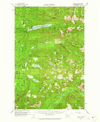 1960 Mount Si1962 Print · USGSThe King County highlands are shown here in the early sixties as a critical water and mineral resource area. Genealogists and researchers can locate Ernies Grove and trace old mining sites like the Lennox Mines or the Apex Mine.3 unique versions available
 - 1960 Map of Bandera, 1962 Print
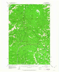
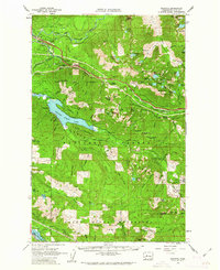 1960 Bandera1962 Print · USGSThe Snoqualmie and Green River watersheds dominate this high-country survey from the early sixties. Researchers can trace the Milwaukee Road rail line and locate mountain outposts like Camp Waskowitz and the Horseshoe Mine.3 unique versions available
 - 1961 Map of Orchards
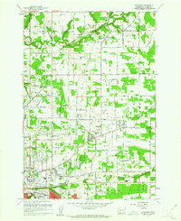 1961 Orchards1961 Print · USGSThe northern reaches of Vancouver and its surrounding plains are seen here in the early sixties, as suburban growth met rural industry. Genealogists and researchers can find many burials at Bethel Cem and Sifton Cem, or trace local landmarks like Scholls Airport.4 unique versions available
 - 1961 Map of Ediz Hook
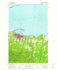
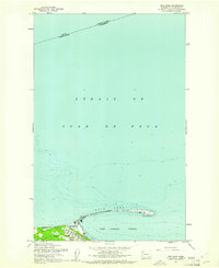 1961 Ediz Hook1961 Print · USGSPort Angeles and its protected harbor are shown in the early 1960s, dominated by the long protective reach of Ediz Hook. Local historians can trace the waterfront development, including the Coast Guard Sta and the Old Railroad Grade that served the city's early industry.2 unique versions available
 - 1961 Map of Washougal
 1961 Washougal1961 Print · USGSThe Columbia River corridor in the early sixties serves as a busy junction for the rail-and-river economy between Washington and Oregon. Genealogists can trace family names at Sunnyside Cem or locate the Columbia Sch and Grange Hall near Corbett.4 unique versions available
 - 1961 Map of Port Angeles
 1961 Port Angeles1961 Print · USGSPort Angeles and its industrial harbor sit at the gateway to the Olympic Peninsula in the early sixties. Genealogists and local historians can trace civic growth through Port Angeles schools and landmarks, while exploring the wilderness around Lake Angeles and the Heart O The Hills Ranger Sta.3 unique versions available
 - 1961 Map of Morse Creek
 1961 Morse Creek1961 Print · USGSClallam County’s rugged coastline and timbered interior are captured here in the early sixties, showing the reach of the Milwaukee Road. Genealogists and local historians can trace the Cameron Homestead, Fairview Sch, and the Port Angeles Dam.4 unique versions available
 - 1961 Map of Yakima
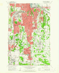
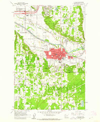
 1961 Yakima1961 Print · USGSCentral Washington thrived in the mid-century as an agricultural powerhouse defined by the Yakima River. Trace local roots through Medicine Valley School, Fort Simcoe, and the rail lines of the Northern Pacific RR.
 - 1961 Map of Portland, 1962 Print
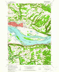
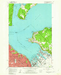
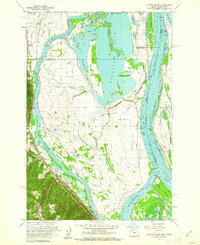
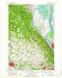
 1961 Portland1962 Print · USGSPortland and Vancouver are captured during a season of rapid postwar change, showing the city's growth along the river before modern freeway expansions. Researchers can trace family roots at Mt Calvary Cemetery or locate the historic Vanport City site.3 unique versions available
 - 1961 Map of Port Angeles, 1962 Print
 1961 Port Angeles1962 Print · USGSPort Angeles and the Olympic coastline are captured here in the early sixties, showing the city's harbor-driven industry and the nearby wilderness. Researchers can trace family ranchlands like Hambly Ranch, find local landmarks like Fairview Sch, or locate the Cameron Homestead.3 unique versions available
 - 1961 Map of Vancouver, 1962 Print
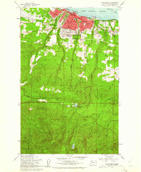
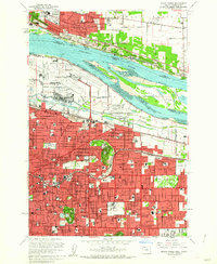
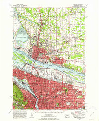
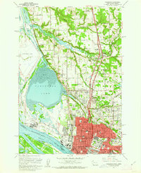 1961 Vancouver1962 Print · USGSThe riverfront and educational heart of Vancouver are captured here in the early sixties, as the city expanded northward from the Columbia. Genealogists can trace family landmarks like Salmon Creek Cem, Providence Academy, and the Washington Sch for the Deaf.5 unique versions available
 - 1961 Map of Tacoma South, 1962 Print
 1961 Tacoma South1962 Print · USGSSouthern Tacoma and its suburbs are shown during a period of rapid mid-century growth. Genealogists and local historians can locate long-standing institutions like Pacific Lutheran University, Oakwood Cem, and the historic Holy Rosary Sch.5 unique versions available
 - 1961 Map of Camas, 1962 Print
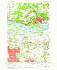 1961 Camas1962 Print · USGSThe Columbia River valley was entering a period of significant post-war growth in the early sixties, bridging the gap between Washington and Oregon. You can trace the development of Camas and Gresham, or locate specific landmarks like the Troutdale Airport and Knight Cem.3 unique versions available
 - 1961 Map of Mount Tabor, 1962 Print
 1961 Mount Tabor1962 Print · USGSEast Portland and Vancouver were rapidly modernizing in the early sixties as new expressways began to reshape the urban landscape. Genealogists and local historians can trace family locations near landmarks like Mount Tabor, Rose City Cem, and the many schools of Montavilla.3 unique versions available
 - 1961 Map of Puyallup, 1962 Print
 1961 Puyallup1962 Print · USGSPierce County at the dawn of the 1960s shows a valley of rail lines and riverside settlements. Genealogists can trace family roots through Woodbine Cem and the many local schools like Firgrove Sch or Collins Sch.5 unique versions available
 - 1961 Map of Tacoma North, 1962 Print
 1961 Tacoma North1962 Print · USGSTacoma's industrial waterfront and the southern tip of Vashon Island are captured here during a period of significant mid-century growth. Researchers can trace the development of neighborhood schools like Lowell Sch or locate maritime landmarks such as the Dash Point Lighthouse and Browns Point.5 unique versions available
 - 1961 Map of Poverty Bay, 1962 Print
 1961 Poverty Bay1962 Print · USGSThe Federal Way plateau and the King-Pierce county line are shown in the early sixties as suburban growth begins to surround historic shoreline communities. Researchers can trace the development of local schools, the Evergreen Airport, and the Auburn Cem alongside the Northern Pacific rail line.5 unique versions available
 - 1961 Map of Sauvie Island, 1962 Print
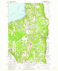
 1961 Sauvie Island1962 Print · USGSAlong the Columbia River in the early sixties, the water-bound culture of the island is documented in high detail. Researchers can trace the Spokane Portland and Seattle RR through Holbrook and find local landmarks like Sauvie Island Ch.4 unique versions available
 - 1961 Map of Portland, 1963 Print
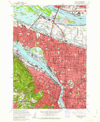
 1961 Portland1963 Print · USGSThe Columbia River waterfront and the growing suburbs of the early sixties come to life in this detailed survey of the Oregon-Washington border. Researchers can trace the legacy of Vanport City, find the St. Johns Cemetery, or locate the Fort Vancouver National Monument.3 unique versions available
 - 1961 Map of Liberty, 1963 Print
 1961 Liberty1963 Print · USGSThe high Cascades of Chelan and Kittitas counties are captured here in the early sixties, showing the transition from mining era to modern recreation. Trace the former Blewett townsite, the historic mining camp of Liberty, and the Mineral Springs Resort.2 unique versions available
 - 1961 Map of Mount Stuart, 1963 Print
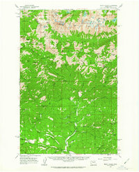 1961 Mount Stuart1963 Print · USGSThe high Cascades at the start of the sixties are detailed here, showing the intersection of alpine wilderness and mountain industry. Trace the locations of the Skookum Mine, lookouts like Stafford Lookout, and high-altitude water at the Lower Enchantment Lakes.3 unique versions available
 - 1961 Map of Hillsboro, 1963 Print
 1961 Hillsboro1963 Print · USGSThe Tualatin Valley and Columbia River bottomlands appear in the early sixties as industrial expansion meets established farm country. Trace old rail lines and family history at Tualatin Plains Cem, North Plains, and the Meeks Land Claim Historical Marker.2 unique versions available
 - 1961 Map of Snoqualmie Pass, 1963 Print
 1961 Snoqualmie Pass1963 Print · USGSSnoqualmie Pass and the surrounding Cascade peaks are shown in the early sixties as the region's rail and water infrastructure matured. Researchers can trace the transcontinental routes of the Northern Pacific RR and locate early mountain outposts like Hyak and Whittier.3 unique versions available
 - 1961 Map of Easton, 1963 Print
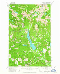
 1961 Easton1963 Print · USGSUpper Kittitas County is captured here in the early sixties, centered on the coal-mining and railroad corridor of the Yakima Valley. Local historians can trace the industrial footprint of Roslyn, Ronald, and the Roslyn-Cascade Mine 4 alongside the Lake Easton shoreline.2 unique versions available
 - 1961 Map of Kachess Lake, 1963 Print
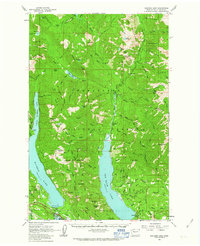 1961 Kachess Lake1963 Print · USGSThe Cascades wilderness of Kittitas County is seen here in the early sixties, centered on the major reservoirs and high forest ridges. Researchers can trace the early layout of Easton, locate the Salmon la Sac Guard Sta, and find legacy sites like the Elsnor Mine.3 unique versions available
Showing maps 1-25 of 518
Top cities of Washington
- Seattle historical maps
- Spokane historical maps
- Tacoma historical maps
- Vancouver historical maps
- Bellevue historical maps
- Kent historical maps
See more
Top counties of Washington
- King County historical maps
- Pierce County historical maps
- Snohomish County historical maps
- Spokane County historical maps
- Clark County historical maps
- Thurston County historical maps
See more
Frequently asked questions
- What are the different types of historical maps available for Washington?
- What is the oldest map of Washington?
- Where can I purchase historical maps of Washington for my home or office?
- Where can I download high-res historical maps of Washington?
- Are there historical topographic maps available for Washington?
- Is there historical aerial imagery available for Washington?
- Where are historical maps of Washington sourced from?