1980s Maps of Washington
Explore 552 historic maps of Washington from the 1980s. These maps offer a rare glimpse into what life looked like during the 1980s — showing old roads, neighborhoods, homes, and landmarks that have changed or disappeared over time.
Whether you're researching your family's past, planning a metal detecting trip, or studying how Washington's landscape evolved across the 1980s, these high-resolution maps are a powerful tool for exploring the history of this region.
- Focus on a specific era: All maps on this page are from the 1980s, giving you a focused view of this time period.
- See what’s changed: Compare century-old streets, trails, and buildings to today's modern landscape using overlays and satellite layers.
- Research with precision: Use these maps for genealogy, historical research, land use analysis, or educational projects.
- View, download, or print: Maps are fully viewable online in high resolution, and can be downloaded or printed for your own records.
Start exploring Washington's history through authentic maps from the 1980s. This is your window into the past.
Washington maps
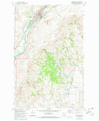
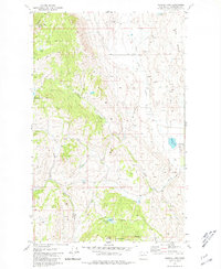
(552)- 1980 Map of Fairfield
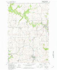 1980 Fairfield1980 Print · USGSThe rolling Palouse landscape of Spokane County is captured here in the late twentieth century as a thriving agricultural corridor. Genealogists can trace family names through the Fairview Cemetery, Mt Hope Church, and the silos of West Fairfield.
 - 1980 Map of Camp Seven
 1980 Camp Seven1980 Print · USGSOkanogan County’s rugged interior is captured here in the early 1980s, detailing a landscape defined by remote springs and upland basins. Researchers can trace the legacy of early camps and transport at Camp Seven (Site) and along the Old Railroad Grade.
 - 1980 Map of Spangle West
 1980 Spangle West1980 Print · USGSSpokane County's agricultural heartland is captured here in the early eighties as the rail-side community of Spangle continued its role as a local center. Researchers can trace family-named landmarks and old routes like Pine Grove Road, the Cem, and the historic Pine Grove PO.
 - 1980 Map of Lyman
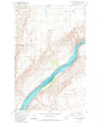
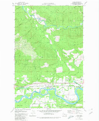 1980 Lyman1980 Print · USGSSkagit County’s timber and rail corridor comes alive in this late-century study of the river valley. Genealogists and local historians can trace family-named landmarks and infrastructure from the Hamilton Cemetery to the Lyman Ferry (Site).2 unique versions available
 - 1980 Map of Cavanaugh Creek
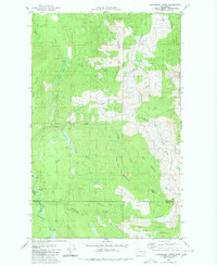 1980 Cavanaugh Creek1980 Print · USGSThe wilderness of the Whatcom and Skagit county line is captured in the late 1970s, showing a landscape defined by timber and forest service access. Trace the remote reaches of Skookum Creek, find high-country landmarks like Dailey Prairie, and follow old pack trails through the Mt Baker National Forest.2 unique versions available
 - 1980 Map of Setters
 1980 Setters1980 Print · USGSAgricultural and timber lands along the Washington-Idaho border are captured here during the 1980s. Local researchers can trace the rail corridor of the Chicago Milwaukee St Paul and Pacific through Setters and find old landmarks like McGowan Butte.
 - 1980 Map of Walla Walla
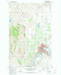
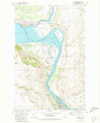
 1980 Walla Walla1980 Print · USGSThe Walla Walla Valley in the early eighties shows a landscape of deep-rooted agriculture and massive hydroelectric development. Researchers can trace the rail junctions at Wallula Junction, visit the historic Fort Walla Walla, or locate old landmarks like the Mountain View Cem.2 unique versions available
 - 1980 Map of Okanogan
 1980 Okanogan1980 Print · USGSThe riverfront town of Okanogan and the northern edge of the Colville Indian Reservation are captured here in the early eighties. Researchers can trace the Burlington Northern rail line and locate local landmarks like Grainger Sch and Jackass Butte.2 unique versions available
 - 1980 Map of Grangeville
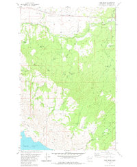
 1980 Grangeville1980 Print · USGSGrangeville and the surrounding Camas Prairie are captured in the late twentieth century as the region balanced agriculture with its deep mining roots. Discover the locations of the Dewey Mine, the remote settlement of Florence, and the winding path of the Salmon River.
 - 1980 Map of Centralia
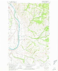
 1980 Centralia1980 Print · USGSThe rail and river corridors of southwestern Washington are captured here in the late twentieth century, showing the region's transition from resource extraction to managed forest land. Researchers can trace the industrial footprint of the Stoker Mine, the rails of the Union Pacific, and the early development of Centralia and Chehalis.
 - 1980 Map of Boot Mountain
 1980 Boot Mountain1980 Print · USGSOkanogan County’s high plateau country is documented here in the early 1980s, revealing a landscape of isolated springs and prominent ridges. Researchers can locate specific water sources like Kartar Spring and geologic landmarks including Balance Rock and Boot Mountain.
 - 1980 Map of Omak
 1980 Omak1980 Print · USGSThe Okanogan River valley comes into focus during the early 1980s, showcasing the development between Omak and Okanogan. Genealogists and historians can trace family sites at Okanogan Memorial Gardens, the Brook Mine, and Wenatchee Valley College.2 unique versions available
 - 1980 Map of Sassin, 1981 Print
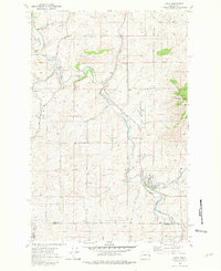
 1980 Sassin1981 Print · USGSLincoln County agriculture and rail transit are captured here in the early eighties. Researchers can locate the settlement of Sassin, the Rocklyn Cem, and trace water sources like Browns Lake and Hampton Spring.
 - 1980 Map of Bridgeport Point, 1981 Print
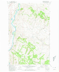
 1980 Bridgeport Point1981 Print · USGSThe Columbia River corridor north of Bridgeport comes alive in the early eighties as it flows through the heart of the region. Genealogists and local historians can trace legacy sites like the Bedard School, the shoreline at Brandts Landing, and Pearl Hill.
 - 1980 Map of Chapman Lake, 1981 Print
 1980 Chapman Lake1981 Print · USGSThe basalt coulees and deep-water lakes of the Channeled Scablands are captured in this 1980s-era study. Researchers can trace the path of the Mullan Road and find old routes like Texas Ferry Road and Cossalman Road.
 - 1980 Map of Latah, 1981 Print
 1980 Latah1981 Print · USGSThe rural borderlands of Spokane and Whitman Counties are captured here during the late twentieth century. Genealogists and local historians can trace family land via Adams Road, locate family plots at Latah Cem, or follow the Union Pacific line through Latah.
 - 1980 Map of Keystone, 1981 Print
 1980 Keystone1981 Print · USGSThe Okanogan River valley in the late 1970s shows a landscape shaped by river transport and high-country ranching. Genealogists and researchers can trace the Burlington Northern line and family landmarks like Figlenski Spring and Bob Neal Lake.
 - 1980 Map of Joe Lake, 1981 Print
 1980 Joe Lake1981 Print · USGSOkanogan County’s high plateau is captured here in the early 1980s, showing a landscape shaped by water and small-scale ranching infrastructure. You can trace the locations of historic rural schoolhouses like Duley Lake School and Long Lake School or find family-named landmarks such as Cunningham Spring.2 unique versions available
 - 1980 Map of Bridgeport, 1981 Print
 1980 Bridgeport1981 Print · USGSThe Columbia River corridor near Bridgeport reflects a decade of resource management and historical preservation in the early eighties. Researchers can trace the river's bend from Old Port Columbia to Downing, identifying Fort Okanogan State Park and the rugged contours of Castle Rock.
 - 1980 Map of White Lakes, 1981 Print
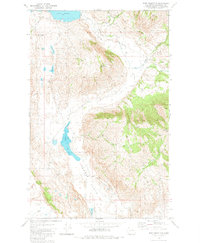
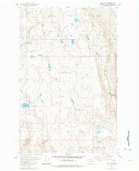
 1980 White Lakes1981 Print · USGSHigh-altitude basins and ranching country are revealed in this early 1980s look at Okanogan County. Researchers can trace land features like Timentwa Flats, Salt Hill, and the remote shores of White Lakes or McDonald Lake.2 unique versions available
 - 1980 Map of Goldendale, 1981 Print
 1980 Goldendale1981 Print · USGSThe Columbia River corridor in the 1980s was a critical junction of rail, water, and highway commerce between Washington and Oregon. Genealogists and historians can trace riverside settlements like Wishram, high-country towns like Bickleton, and the grounds of the Maryhill Museum.
 - 1980 Map of The Pothole, 1981 Print
 1980 The Pothole1981 Print · USGSOkanogan County's river valley and reservation lands are captured here in the mid-1970s. Local researchers can trace the Burlington Northern line past Cherokee and locate historical sites like St Marys Mission and Riverview Cem.2 unique versions available
 - 1980 Map of Omak Mountain, 1981 Print
 1980 Omak Mountain1981 Print · USGSThe Colville Indian Reservation and the high ridges of Okanogan County are captured here during the early eighties. Researchers can trace the drainage of Tunk Creek and locate remote landmarks like Haley, Gordon Butte, and the Radio Facility atop Omak Mountain.
 - 1980 Map of Lance Hills, 1981 Print
 1980 Lance Hills1981 Print · USGSSpokane County in the early eighties exhibits a landscape of basalt coulees and vital conservation lands. Genealogists and historians can trace the rail corridor of the Burlington Northern near Geib or explore the wetlands of the Turnbull National Wildlife Refuge.
 - 1980 Map of Aeneas Lake, 1981 Print
 1980 Aeneas Lake1981 Print · USGSOkanogan County’s high country is captured here during the 1980s, revealing a landscape of steep mountains and isolated mineral claims. Researchers can trace the Indian Allotment Boundary or locate sites like the Silver Mtn Mine and Aeneas Lookout.
Showing maps 1-25 of 552
Top cities of Washington
- Seattle historical maps
- Spokane historical maps
- Tacoma historical maps
- Vancouver historical maps
- Bellevue historical maps
- Kent historical maps
See more
Top counties of Washington
- King County historical maps
- Pierce County historical maps
- Snohomish County historical maps
- Spokane County historical maps
- Clark County historical maps
- Thurston County historical maps
See more
Frequently asked questions
- What are the different types of historical maps available for Washington?
- What is the oldest map of Washington?
- Where can I purchase historical maps of Washington for my home or office?
- Where can I download high-res historical maps of Washington?
- Are there historical topographic maps available for Washington?
- Is there historical aerial imagery available for Washington?
- Where are historical maps of Washington sourced from?