1980s Maps of Okanogan County, Washington
Explore 86 historic maps of Okanogan County from the 1980s. These maps offer a rare glimpse into what life looked like during the 1980s — showing old roads, neighborhoods, homes, and landmarks that have changed or disappeared over time.
Whether you're researching your family's past, planning a metal detecting trip, or studying how Okanogan County's landscape evolved across the 1980s, these high-resolution maps are a powerful tool for exploring the history of this region.
- Focus on a specific era: All maps on this page are from the 1980s, giving you a focused view of this time period.
- See what’s changed: Compare century-old streets, trails, and buildings to today's modern landscape using overlays and satellite layers.
- Research with precision: Use these maps for genealogy, historical research, land use analysis, or educational projects.
- View, download, or print: Maps are fully viewable online in high resolution, and can be downloaded or printed for your own records.
Start exploring Okanogan County's history through authentic maps from the 1980s. This is your window into the past.
Okanogan County, WA maps
(86)- 1980 Map of Camp Seven
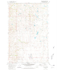
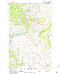
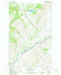
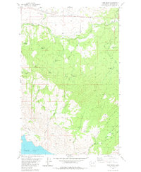 1980 Camp Seven1980 Print · USGSOkanogan County’s rugged interior is captured here in the early 1980s, detailing a landscape defined by remote springs and upland basins. Researchers can trace the legacy of early camps and transport at Camp Seven (Site) and along the Old Railroad Grade.
 - 1980 Map of Okanogan
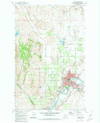
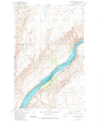
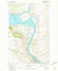
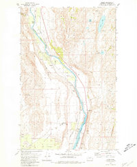
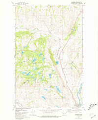
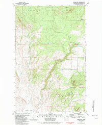
 1980 Okanogan1980 Print · USGSThe riverfront town of Okanogan and the northern edge of the Colville Indian Reservation are captured here in the early eighties. Researchers can trace the Burlington Northern rail line and locate local landmarks like Grainger Sch and Jackass Butte.2 unique versions available
 - 1980 Map of Boot Mountain
 1980 Boot Mountain1980 Print · USGSOkanogan County’s high plateau country is documented here in the early 1980s, revealing a landscape of isolated springs and prominent ridges. Researchers can locate specific water sources like Kartar Spring and geologic landmarks including Balance Rock and Boot Mountain.
 - 1980 Map of Omak
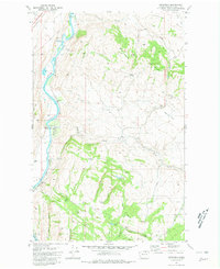
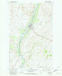
 1980 Omak1980 Print · USGSThe Okanogan River valley comes into focus during the early 1980s, showcasing the development between Omak and Okanogan. Genealogists and historians can trace family sites at Okanogan Memorial Gardens, the Brook Mine, and Wenatchee Valley College.2 unique versions available
 - 1980 Map of Bridgeport Point, 1981 Print
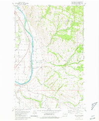
 1980 Bridgeport Point1981 Print · USGSThe Columbia River corridor north of Bridgeport comes alive in the early eighties as it flows through the heart of the region. Genealogists and local historians can trace legacy sites like the Bedard School, the shoreline at Brandts Landing, and Pearl Hill.
 - 1980 Map of Keystone, 1981 Print
 1980 Keystone1981 Print · USGSThe Okanogan River valley in the late 1970s shows a landscape shaped by river transport and high-country ranching. Genealogists and researchers can trace the Burlington Northern line and family landmarks like Figlenski Spring and Bob Neal Lake.
 - 1980 Map of Joe Lake, 1981 Print
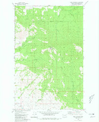
 1980 Joe Lake1981 Print · USGSOkanogan County’s high plateau is captured here in the early 1980s, showing a landscape shaped by water and small-scale ranching infrastructure. You can trace the locations of historic rural schoolhouses like Duley Lake School and Long Lake School or find family-named landmarks such as Cunningham Spring.2 unique versions available
 - 1980 Map of Bridgeport, 1981 Print
 1980 Bridgeport1981 Print · USGSThe Columbia River corridor near Bridgeport reflects a decade of resource management and historical preservation in the early eighties. Researchers can trace the river's bend from Old Port Columbia to Downing, identifying Fort Okanogan State Park and the rugged contours of Castle Rock.
 - 1980 Map of White Lakes, 1981 Print
 1980 White Lakes1981 Print · USGSHigh-altitude basins and ranching country are revealed in this early 1980s look at Okanogan County. Researchers can trace land features like Timentwa Flats, Salt Hill, and the remote shores of White Lakes or McDonald Lake.2 unique versions available
 - 1980 Map of The Pothole, 1981 Print
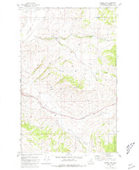
 1980 The Pothole1981 Print · USGSOkanogan County's river valley and reservation lands are captured here in the mid-1970s. Local researchers can trace the Burlington Northern line past Cherokee and locate historical sites like St Marys Mission and Riverview Cem.2 unique versions available
 - 1980 Map of Omak Mountain, 1981 Print
 1980 Omak Mountain1981 Print · USGSThe Colville Indian Reservation and the high ridges of Okanogan County are captured here during the early eighties. Researchers can trace the drainage of Tunk Creek and locate remote landmarks like Haley, Gordon Butte, and the Radio Facility atop Omak Mountain.
 - 1980 Map of Aeneas Lake, 1981 Print
 1980 Aeneas Lake1981 Print · USGSOkanogan County’s high country is captured here during the 1980s, revealing a landscape of steep mountains and isolated mineral claims. Researchers can trace the Indian Allotment Boundary or locate sites like the Silver Mtn Mine and Aeneas Lookout.
 - 1980 Map of Monse, 1981 Print
 1980 Monse1981 Print · USGSThe Okanogan River valley in the early 1980s reveals a rugged landscape where the Burlington Northern line threads between the river and the Colville Indian Reservation Boundary. Genealogists and local historians can locate the Fort Okanogan Memorial Cem and trace the development of Monse and Wakefield.
 - 1980 Map of Blue Goat Mtn, 1981 Print
 1980 Blue Goat Mtn1981 Print · USGSOkanogan County's dramatic valley corridor is documented here in the early 1980s, highlighting the expansive Sinlahekin Wildlife Recreation Area. Researchers can locate the historic Beeman School and trace several Indian Allotment boundaries near Blue Lake.
 - 1980 Map of Trefry Canyon, 1981 Print
 1980 Trefry Canyon1981 Print · USGSThe Columbia River plateau in the early 1980s reveals a landscape of remote springs and deep canyons north of Del Rio. Genealogists and historians can trace family-named sites like Sellers Eddy, Trefry Springs, and the Delrio Grange Hall.
 - 1980 Map of Ruby Hill, 1993 Print
 1980 Ruby Hill1993 Print · USGSOkanogan mining country is documented here in the late twentieth century, showing a landscape shaped by early mineral claims. Trace the heritage of mountain extraction through the First Thought Mine, the settlement of Ruby, and the Clover Cem.
 - 1981 Map of Stubblefield Point
 1981 Stubblefield Point1981 Print · USGSThe Columbia River plateau in Douglas County comes to life in the early 1980s, showing a landscape defined by high-elevation lakes and the canyon of Rufus Woods Lake. Locate the former settlement of Pearl (Site) or trace family landmarks near Nilles Corner and Klinkhammer Lakes.2 unique versions available
 - 1981 Map of Conconully East
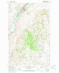
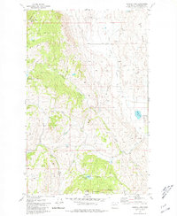
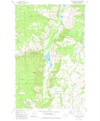
 1981 Conconully East1981 Print · USGSThe mountain valley of Conconully is captured here in the early 1980s, centered on the lakes and forests of the Okanogan. Researchers can locate the Peacock Mine, find family names at Conconully Cem and Ruby Cem, or trace the old Silver Hill Road.
 - 1981 Map of Riverside
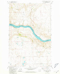
 1981 Riverside1981 Print · USGSThe Okanogan River valley in the early 1980s features a landscape of hidden caves and isolated ranching corrals. Researchers can trace the path of the historic Wagon Road and locate local landmarks such as Albright Cave and the Riverside rail line.
 - 1981 Map of Tonasket
 1981 Tonasket1981 Print · USGSThe Okanogan River valley in the early eighties shows a landscape of river-bottom towns and high-desert peaks. Researchers can locate the Tonasket community center, the Janis Bridge, and family-named landmarks like Duffys Mountain.
 - 1981 Map of Barker Mtn
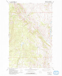
 1981 Barker Mtn1981 Print · USGSOkanogan County in the early eighties was a landscape of high summits and quiet creek valleys. Genealogists can locate the Anglin (Site) and its nearby Cem, or trace water rights through Bonaparte Creek and Fancher Spring.
 - 1981 Map of Malott
 1981 Malott1981 Print · USGSThe Okanogan River valley in the early 1980s reveals a landscape where rail-side commerce and high-desert water management meet. Researchers can trace family ties at Chiliwist Cem or locate the historic siding at Malott along the Burlington Northern line.2 unique versions available
 - 1981 Map of Burge Mtn, 1982 Print
 1981 Burge Mtn1982 Print · USGSThe high ridges of Okanogan County are captured here in the early eighties, showing a landscape defined by timber and drainage networks. Researchers can trace the water sources from Tamarack Spring to Oberg Lake or locate the site of Fanchers Dam and the Prospect on the mountain slopes.
 - 1981 Map of Corral Butte, 1982 Print
 1981 Corral Butte1982 Print · USGSOkanogan National Forest's high backcountry is captured in the early eighties, showcasing a remote network of trails and seasonal camps. Researchers can trace historical routes to high-elevation outposts like Skull Camp, Irene's Camp, and the Thirtymile Shelter.
 - 1981 Map of Horseshoe Basin, 1982 Print
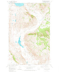
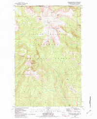 1981 Horseshoe Basin1982 Print · USGSIn the early eighties, this high-country landscape along the British Columbia border remained a wilderness of summits and seasonal camps. Trace remote pathways like the Boundary Trail to find historic backcountry sites such as Two Bear Camp and Hodges Horse Pasture.2 unique versions available
Showing maps 1-25 of 86
Top cities of Okanogan County
- Omak historical maps
- Okanogan historical maps
- Brewster historical maps
- Oroville historical maps
- Tonasket historical maps
- Twisp historical maps
See more
Frequently asked questions
- What are the different types of historical maps available for Okanogan County?
- What is the oldest map of Okanogan County?
- Where can I purchase historical maps of Okanogan County for my home or office?
- Where can I download high-res historical maps of Okanogan County?
- Are there historical topographic maps available for Okanogan County?
- Is there historical aerial imagery available for Okanogan County?
- Where are historical maps of Okanogan County sourced from?