1960s Maps of Okanogan County, Washington
Explore 49 historic maps of Okanogan County from the 1960s. These maps offer a rare glimpse into what life looked like during the 1960s — showing old roads, neighborhoods, homes, and landmarks that have changed or disappeared over time.
Whether you're researching your family's past, planning a metal detecting trip, or studying how Okanogan County's landscape evolved across the 1960s, these high-resolution maps are a powerful tool for exploring the history of this region.
- Focus on a specific era: All maps on this page are from the 1960s, giving you a focused view of this time period.
- See what’s changed: Compare century-old streets, trails, and buildings to today's modern landscape using overlays and satellite layers.
- Research with precision: Use these maps for genealogy, historical research, land use analysis, or educational projects.
- View, download, or print: Maps are fully viewable online in high resolution, and can be downloaded or printed for your own records.
Start exploring Okanogan County's history through authentic maps from the 1960s. This is your window into the past.
Okanogan County, WA maps
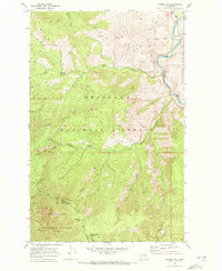
(49)- 1962 Map of Concrete
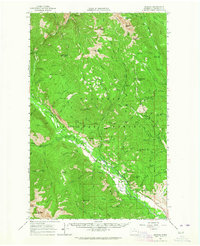
 1962 Concrete1962 Print · USGSThe Northern Cascades in the early sixties reveal a landscape of high alpine peaks and deep river valleys before the modern park era. Genealogists and historians can trace rail-and-river towns like Concrete, Darrington, and Stehekin, alongside industry at the Holden Mine.
 - 1962 Map of Mazama, 1964 Print
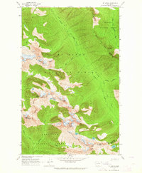
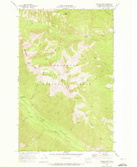
 1962 Mazama1964 Print · USGSThe Methow Valley high country is captured here in the early sixties, showing a landscape defined by forest service outposts and early recreation. Search for vanished trails and historic sites like the Early Winters Ranger Station, Lost River Landing Strip, and Billy Goat Corral.
 - 1963 Map of Washington Pass, 1964 Print
 1963 Washington Pass1964 Print · USGSHigh Cascades mountain passes and national forest boundaries appear in detail during the early 1960s. Hikers and historians can trace the early Cascade Crest Trail (Alternate) and Early Winters Trail past Liberty Bell Mtn and Washington Pass.3 unique versions available
 - 1963 Map of Azurite Peak, 1964 Print
 1963 Azurite Peak1964 Print · USGSThe North Cascades high country appears in the early sixties at a peak of alpine mining and forest management. Geologists and historians can trace the foundations of the Azurite Mine, the Gold Hill Mine, and the route of the Cascade Crest Trail.2 unique versions available
 - 1963 Map of Slate Peak, 1964 Print
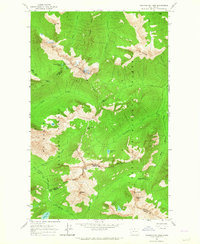
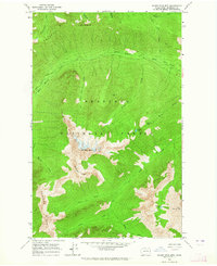
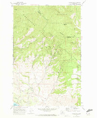
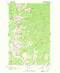
 1963 Slate Peak1964 Print · USGSThe high Cascades of Okanogan County are captured here during the early 1960s, showcasing a landscape of remote mines and forest service outposts. Genealogists and researchers can locate historic mining sites like Goat Mine and base camps such as Deer Park Camp or Harts Pass Guard Station.4 unique versions available
 - 1963 Map of Mt. Arriva, 1964 Print
 1963 Mt. Arriva1964 Print · USGSThe high Cascade crest at the Skagit and Okanogan county lines is documented here in the early sixties. Hikers and historians can trace the original Cascade Crest Trail as it passes Silent Lakes and the Lewis Glacier.3 unique versions available
 - 1963 Map of Silver Star Mtn., 1964 Print
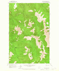
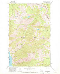
 1963 Silver Star Mtn.1964 Print · USGSOkanogan County’s high peaks were documented in detail during the early sixties, showing the vast backcountry of the Okanogan National Forest. Trace historic access routes like the Early Winters Trail past Silver Star Mtn and the remote Shelokum Lake.4 unique versions available
 - 1963 Map of Robinson Mtn., 1965 Print
 1963 Robinson Mtn.1965 Print · USGSThe Okanogan wilderness in the early sixties is shown here at its most remote, centered on the high peaks and river forks. Backcountry travelers and local historians can trace early recreational footprints at Ballard Campground, the Lost River Landing Strip, and the Monument Creek Trail.2 unique versions available
 - 1963 Map of Doe Mountain, 1965 Print
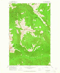
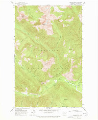
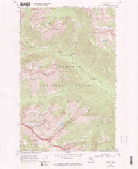
 1963 Doe Mountain1965 Print · USGSOkanogan County’s rugged mountain interior comes into focus in the early sixties as recreational and conservation efforts expanded. Researchers can trace the mid-century wilderness infrastructure through Eightmile Guard Station, Buck Lake, and the camps along the Chewack River.2 unique versions available
 - 1965 Map of Ritzville
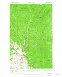
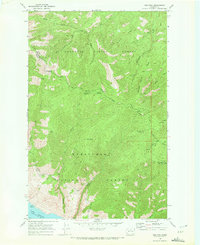
 1965 Ritzville1965 Print · USGSCentral Washington during the mid-sixties shows a landscape shaped by massive irrigation projects and the Cold War. Genealogists and historians can trace rail-town life and military presence through Ephrata Air Base, the Telford Station, and local schools.
 - 1968 Map of Chief Joseph Dam, 1971 Print
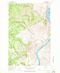
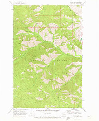
 1968 Chief Joseph Dam1971 Print · USGSThe Columbia River corridor near the Douglas-Okanogan county line comes into focus in the late sixties, just after the completion of major hydroelectric projects. Local historians can trace the topography of Sourdough Flats and locate family landmarks like Sharyer Spring or McClain Lake alongside the Chief Joseph Dam.
 - 1968 Map of Wells Dam, 1971 Print
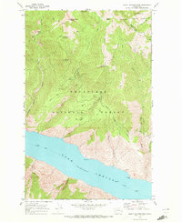
 1968 Wells Dam1971 Print · USGSThe Columbia River was undergoing a massive transformation in the late sixties as Wells Dam reshaped the valley. Researchers can trace historic sites like Dyer (Site) and Azwell alongside family-named landmarks like Pattie Big Spring and Landingham Hill.2 unique versions available
 - 1968 Map of Coleman Hill, 1971 Print
 1968 Coleman Hill1971 Print · USGSHigh plateau country in Douglas County comes alive in the late sixties, showing the transition from the Columbia River to arid uplands. Researchers can trace historic water sources and landmarks like Buckingham Flats, Peaceful Valley, and Ruben Blue Spring.
 - 1968 Map of Azwell, 1971 Print
 1968 Azwell1971 Print · USGSThe Columbia River corridor north of Chelan comes alive in the late sixties as a center of rail transport and forest management. Researchers can trace the Burlington Northern line through Azwell or locate remote camps like Evergreen Camp.3 unique versions available
 - 1968 Map of South Navarre Peak, 1972 Print
 1968 South Navarre Peak1972 Print · USGSThe northern reaches of Lake Chelan and the surrounding national forests are captured here in the late sixties. Researchers can trace the engineering of an old flume and aqueduct or locate remote spots like South Navarre Campground and Limekiln Point.2 unique versions available
 - 1968 Map of Cooper Ridge, 1972 Print
 1968 Cooper Ridge1972 Print · USGSThe high ridges and deep canyons of Chelan County are captured here in the late sixties as the forest road network expanded. Researchers can trace historic family-named routes and landmarks like Purtteman Road, Goff Peak, and Union Valley.4 unique versions available
 - 1968 Map of Methow, 1972 Print
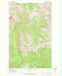
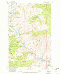 1968 Methow1972 Print · USGSThe Methow Valley in the late 1960s was a landscape of riverside settlements and forest interior. Researchers can trace the river-centered economy through features like the Footbridge near Carlton and mining sites like the Mine near Cow Creek.
 - 1968 Map of Cooper Mtn, 1972 Print
 1968 Cooper Mtn1972 Print · USGSThe Methow Valley and high Okanogan ridges are captured here in the late sixties, showing a landscape of forest service trails and remote camps. Locate family-named landmarks and high-country routes including the Methow Cemetery, Cooper Corral, and Hunter Mtn.2 unique versions available
 - 1968 Map of Oss Peak, 1972 Print
 1968 Oss Peak1972 Print · USGSHigh ridges and the northern reaches of Lake Chelan define this landscape during the late sixties. Trace the early infrastructure of the Siphon Aqueduct or find old landing points like Dutch Harbor and remote spots such as Camp Four.4 unique versions available
 - 1968 Map of Hungry Mtn, 1973 Print
 1968 Hungry Mtn1973 Print · USGSThe Okanogan wilderness is captured here in the late sixties, showing a landscape defined by forest management and backcountry trails. Genealogists and historians can trace old routes like the Pack Trail to remote spots such as Bear Camp and Foggy Dew Campground.2 unique versions available
 - 1969 Map of Skagit Peak, 1972 Print
 1969 Skagit Peak1972 Print · USGSThe North Cascades along the Canadian border are captured in the late sixties, showing the rugged backcountry just as new wilderness protections were established. Hikers and historians can trace the network of Pack Trail routes connecting remote outposts like Nightmare Camp, Deer Lick Cabin, and Little Fish Shelter.2 unique versions available
 - 1969 Map of Midnight Mtn., 1972 Print
 1969 Midnight Mtn.1972 Print · USGSThe Okanogan high country is captured here in the late sixties, showcasing a landscape of alpine lakes and pack trails. Researchers can trace historic access routes to Gardner Meadows, locate the secluded Slate Lake, and find early recreation sites like Mystery Campground.2 unique versions available
 - 1969 Map of Martin Peak, 1972 Print
 1969 Martin Peak1972 Print · USGSThe high divide between Okanogan and Chelan counties is captured here in the late sixties, showing a wilderness landscape accessible only by trail. Trace old high-country routes through Hoodoo Pass to alpine waters like Upper Eagle Lake and Boiling Lake.2 unique versions available
 - 1969 Map of Prince Creek, 1972 Print
 1969 Prince Creek1972 Print · USGSThe Lake Chelan wilderness comes into focus in the late sixties, showing the intersection of the Wenatchee and Okanogan forests. Researchers can trace historic pack routes and find remote landmarks like Skookum Puss Mountain, Devils Kitchen, and the Prince Creek Campground at the water's edge.2 unique versions available
 - 1969 Map of Gilbert, 1972 Print
 1969 Gilbert1972 Print · USGSHigh in the Cascades during the late sixties, this area centered on the remote outpost of Gilbert and its surrounding mineral claims. Researchers can trace historic mountain access via the PACK TRAIL network to sites like the Crescent Mine and Roads End Campground.2 unique versions available
Showing maps 1-25 of 49
Top cities of Okanogan County
- Omak historical maps
- Okanogan historical maps
- Brewster historical maps
- Oroville historical maps
- Tonasket historical maps
- Twisp historical maps
See more
Frequently asked questions
- What are the different types of historical maps available for Okanogan County?
- What is the oldest map of Okanogan County?
- Where can I purchase historical maps of Okanogan County for my home or office?
- Where can I download high-res historical maps of Okanogan County?
- Are there historical topographic maps available for Okanogan County?
- Is there historical aerial imagery available for Okanogan County?
- Where are historical maps of Okanogan County sourced from?