1990s Maps of Okanogan County, Washington
Explore 14 historic maps of Okanogan County from the 1990s. These maps offer a rare glimpse into what life looked like during the 1990s — showing old roads, neighborhoods, homes, and landmarks that have changed or disappeared over time.
Whether you're researching your family's past, planning a metal detecting trip, or studying how Okanogan County's landscape evolved across the 1990s, these high-resolution maps are a powerful tool for exploring the history of this region.
- Focus on a specific era: All maps on this page are from the 1990s, giving you a focused view of this time period.
- See what’s changed: Compare century-old streets, trails, and buildings to today's modern landscape using overlays and satellite layers.
- Research with precision: Use these maps for genealogy, historical research, land use analysis, or educational projects.
- View, download, or print: Maps are fully viewable online in high resolution, and can be downloaded or printed for your own records.
Start exploring Okanogan County's history through authentic maps from the 1990s. This is your window into the past.
Okanogan County, WA maps
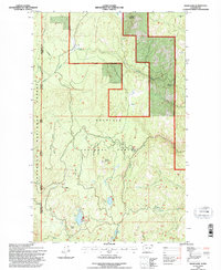
(14)- 1991 Map of Rendevous Mountain
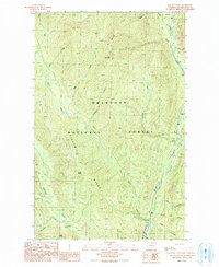
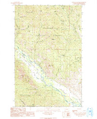 1991 Rendevous Mountain1991 Print · USGSThe Methow River Valley and the Okanogan National Forest are shown in detail in the early 1990s. Researchers can locate the Montana Mine, trace the historic Weeman Bridge, and explore the high Sawtooth Wilderness boundary.
 - 1991 Map of Mazama
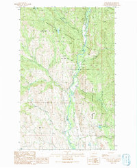
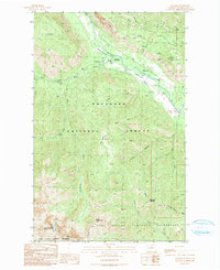 1991 Mazama1991 Print · USGSMazama and the upper Methow Valley are shown here in the early nineties, revealing a landscape of high-mountain recreation and legacy mining. Historians can trace late-century land use through labels like Early Winters Campground, numerous Prospect sites, and Cedar Falls.
 - 1991 Map of Mc Leod Mountain
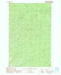
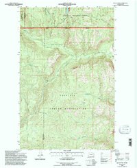
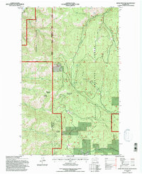
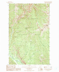 1991 Mc Leod Mountain1991 Print · USGSOkanogan County's high country is captured here during the early nineties, showing the transition from the Pasayten Wilderness to the valley floor. Trace backcountry routes like the Monument Trail and find the Goat Peak Lookout overlooking the Methow River.
 - 1991 Map of Sweetgrass Butte
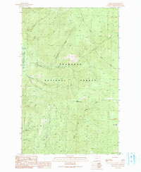
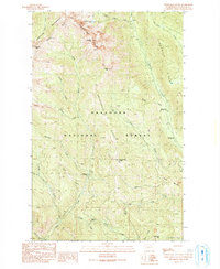 1991 Sweetgrass Butte1991 Print · USGSOkanogan National Forest in the early nineties is a landscape of high ridgelines and backcountry stream crossings. Researchers can trace remote routes through Pasayten Wilderness, locating landmarks like Sweetgrass Butte and the Vanderpool Crossing.
 - 1991 Map of Doe Mountain
 1991 Doe Mountain1991 Print · USGSThe Okanogan highlands in the early nineties reveal a network of forest camps and mountain trails centered on the Chewuch River. Researchers can trace the drainage of Eightmile Creek and locate sites like Nice Campground and the Gravel Pit.
 - 1991 Map of Lewis Butte
 1991 Lewis Butte1991 Print · USGSThe Chewuch River valley in the early nineties shows a landscape of forest management and protected wildlife areas. Researchers can trace land use through the Eightmile Ranch FS Station, high-elevation Quarries, and landmarks like Lewis Butte.
 - 1991 Map of Pearrygin Peak
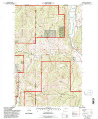
 1991 Pearrygin Peak1991 Print · USGSThe Okanogan highlands are captured here in the early nineties, showing a landscape of lookouts and wildlife areas. Trace the terrain around Pearrygin Peak and Tripod Peak, or locate the First Butte L O Lookout Tower and Gravel Pit.
 - 1991 Map of Spur Peak
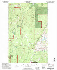
 1991 Spur Peak1991 Print · USGSOkanogan County’s high country is captured in the early nineties, showing a landscape defined by the Chewuch River and steep peaks. Trace the primitive drainage networks of No July Creek, Honeymoon Creek, and Twentymile Creek.
 - 1992 Map of Swan Lake, 1996 Print
 1992 Swan Lake1996 Print · USGSFerry County, Washington, is shown in the early nineties as a high-country landscape defined by national forest boundaries and scattered alpine lakes. Trace the drainages of Scatter Creek and Tenmile Creek or locate landmarks like Swan Butte and the Quarry near Ferry Lake.
 - 1992 Map of Bald Knob, 1996 Print
 1992 Bald Knob1996 Print · USGSThe Colville Indian Reservation and surrounding national forest land are shown here in the early 1990s. Trace old mining operations like the Bungalow Mine and remote Prospects near the summit of Bald Knob.
 - 1992 Map of Toroda, 1996 Print
 1992 Toroda1996 Print · USGSNorthern Washington's international borderlands and river valleys come into focus in the early nineties. Genealogists and historians can trace the small settlements of Toroda and Ferry, and locate the Ranald MacDonald Historical Site along the Kettle River.
 - 1992 Map of Storm King Mountain, 1997 Print
 1992 Storm King Mountain1997 Print · USGSThe high divide between Ferry and Okanogan counties is captured here in the early nineties as a landscape of remote forests and industrial mining. Local history researchers can trace the footprint of the Tom Thumb Mine, Flagstaff Mine, and the elevations of Storm King Mountain.
 - 1992 Map of Bodie Mountain, 1997 Print
 1992 Bodie Mountain1997 Print · USGSThe high ridges of northeastern Washington come into focus in the early 1990s as the Forest Service managed the timber and mineral lands of the Kettle River Range. Researchers can trace historical mining activity through Mineshifts and Prospects near Bodie Mountain and Hardscrabble Mountain.
 - 1993 Map of Monse
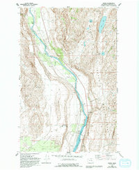 1993 Monse1993 Print · USGSOkanogan County’s river valley and high plateaus are seen here in the early nineties, showing the landscape before recent decades of development. Genealogists and historians can trace Monse, the Fort Okanogan Memorial Cem, and the unique Brewster Flat Earth Station.
End of results
Showing maps 1-14 of 14
Top cities of Okanogan County
- Omak historical maps
- Okanogan historical maps
- Brewster historical maps
- Oroville historical maps
- Tonasket historical maps
- Twisp historical maps
See more
Frequently asked questions
- What are the different types of historical maps available for Okanogan County?
- What is the oldest map of Okanogan County?
- Where can I purchase historical maps of Okanogan County for my home or office?
- Where can I download high-res historical maps of Okanogan County?
- Are there historical topographic maps available for Okanogan County?
- Is there historical aerial imagery available for Okanogan County?
- Where are historical maps of Okanogan County sourced from?