1960s Maps of Logan County, West Virginia
Explore 20 historic maps of Logan County from the 1960s. These maps offer a rare glimpse into what life looked like during the 1960s — showing old roads, neighborhoods, homes, and landmarks that have changed or disappeared over time.
Whether you're researching your family's past, planning a metal detecting trip, or studying how Logan County's landscape evolved across the 1960s, these high-resolution maps are a powerful tool for exploring the history of this region.
- Focus on a specific era: All maps on this page are from the 1960s, giving you a focused view of this time period.
- See what’s changed: Compare century-old streets, trails, and buildings to today's modern landscape using overlays and satellite layers.
- Research with precision: Use these maps for genealogy, historical research, land use analysis, or educational projects.
- View, download, or print: Maps are fully viewable online in high resolution, and can be downloaded or printed for your own records.
Start exploring Logan County's history through authentic maps from the 1960s. This is your window into the past.
Logan County, WV maps
(20)- 1960 Map of Jenkins
 1960 Jenkins1960 Print · USGSEastern Kentucky and the West Virginia borderlands are captured at a mid-century peak of the coal and rail era. Trace the industrial corridors of the Chesapeake and Ohio RR through mountain hubs like Hazard and Jenkins.
 - 1960 Map of Huntington
 1960 Huntington1960 Print · USGSThe tri-state river valley thrived in the late fifties as a hub of heavy industry and Appalachian rail transit. Genealogists and historians can trace the connection between river towns like Ashland and Portsmouth or locate family homesteads near Coleman Ridge.
 - 1961 Map of Charleston
 1961 Charleston1961 Print · USGSWest Virginia's capital region and the highlands to the east are shown in detail during the early sixties. Genealogists and historians can trace rail networks like the Baltimore and Ohio RR and find early state parks such as Watoga State Park.
 - 1961 Map of Bluefield
 1961 Bluefield1961 Print · USGSThe coalfields and mountain ridges of southern West Virginia and southwest Virginia are captured in the early sixties. Genealogists can trace family ties through rail-linked towns like Princeton and Richlands or along the shores of Bluestone Reservoir.
 - 1962 Map of Big Creek, 1963 Print
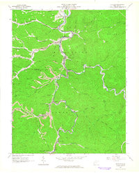
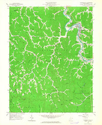
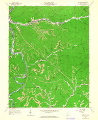
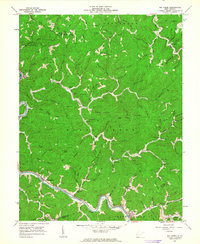 1962 Big Creek1963 Print · USGSIn the early 1960s, the hollows and river bends along the Logan and Lincoln county line remained centered on the railroad and local timber and mining interests. Genealogists can locate family landmarks like Spears Cem or Justice Cem and old community hubs including Ferrellsburg and Pea Ridge Sch.2 unique versions available
 - 1962 Map of Mud, 1964 Print
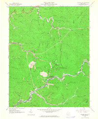
 1962 Mud1964 Print · USGSBoone County and its neighboring hollows are shown during the early 1960s, a time when coal and gas extraction deeply shaped the mountain landscape. Genealogists can locate family landmarks like Stanley Cem and Vickers Cem, or trace early community sites such as Mud Sch and North Fork Ch.2 unique versions available
 - 1963 Map of Henlawson, 1964 Print
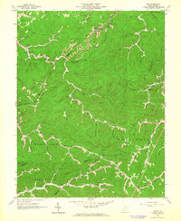
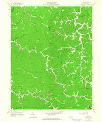
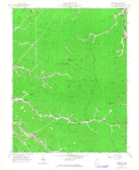
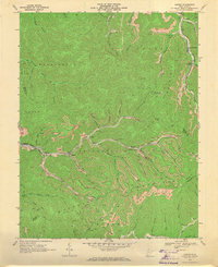
 1963 Henlawson1964 Print · USGSCoal mining and rail commerce define the Logan County landscape during the early 1960s, as the Chesapeake and Ohio follows the Guyandotte River. Researchers can locate family-named landmarks like Miller Cem, Justice Addition, and the Lane Sch.3 unique versions available
 - 1963 Map of Logan, 1964 Print
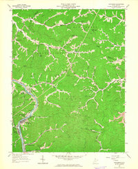
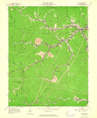
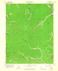
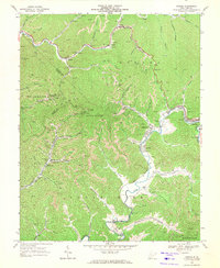
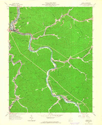 1963 Logan1964 Print · USGSSouthern West Virginia's coal-heavy river valleys are captured here in the early sixties, showing the tight relationship between industry and settlement. Genealogists and historians can trace the foundations of Logan and Omar, alongside landmarks like Gore Cem and McDonald Airport.4 unique versions available
 - 1963 Map of Clothier, 1964 Print
 1963 Clothier1964 Print · USGSThe coal-river valleys of Boone and Logan Counties are captured here during the peak of the mid-century mining era. Genealogists and historians can trace family plots like Browning Cem and Ferrell Cem alongside rail-side towns like Clothier and Sharples.3 unique versions available
 - 1963 Map of Holden, 1964 Print
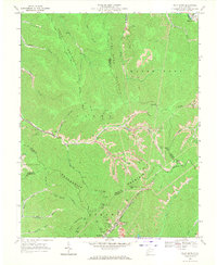
 1963 Holden1964 Print · USGSMid-century Logan County coal country is meticulously documented here as industry and community life centered on the narrow valleys. Genealogists and historians can locate family cemeteries such as Mounts Cemetery, local schools like Whitman School, and several churches including Number 21 Ch.3 unique versions available
 - 1963 Map of Trace, 1964 Print
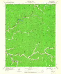
 1963 Trace1964 Print · USGSSouthern West Virginia’s hollows and ridgelines are captured here in the early sixties, showing the remote communities along Twelvepole Creek. Family historians can trace local roots through numerous landmarks like Mullins Cem, Hugh Dingess Sch, and McCloud Ch.2 unique versions available
 - 1963 Map of Myrtle, 1964 Print
 1963 Myrtle1964 Print · USGSMingo County is shown in the early sixties as a landscape of deep hollows and rail-connected coal towns. Researchers can trace family sites like Lackey Cem or follow the path of the Norfolk and Western railroad through Dingess.2 unique versions available
 - 1963 Map of Chapmanville, 1964 Print
 1963 Chapmanville1964 Print · USGSLogan County life in the early sixties centers on the winding Guyandotte River and the bustling Chesapeake and Ohio rail line. Genealogists can trace family landmarks like Highland Memory Gardens, Morning Star Ch, and the Stone Branch Mine.3 unique versions available
 - 1963 Map of Amherstdale, 1964 Print
 1963 Amherstdale1964 Print · USGSLogan County coal country is shown here in the early 1960s, documenting the dense network of mining towns along Buffalo Creek. Researchers can locate family sites and industrial history at Amherstdale, Accoville, and the Riley Cemetery near Becco.4 unique versions available
 - 1963 Map of Barnabus, 1965 Print
 1963 Barnabus1965 Print · USGSMingo and Logan counties in the early sixties reveal a landscape of deep hollows and active coal mining operations. Researchers can trace the rail-driven economy through Red Jacket and Barnabus, identifying old family burial sites like Hatfield Cem and Varney Cem.2 unique versions available
 - 1963 Map of Man, 1965 Print
 1963 Man1965 Print · USGSThe coal country of Logan and Mingo Counties is shown here in the early 1960s as industrial hollows and family homesteads line the creeks. Researchers can trace ancestral sites like Hatfield Cem or explore the rail hubs of Man and Stirrat.3 unique versions available
 - 1963 Map of Mallory, 1965 Print
 1963 Mallory1965 Print · USGSLogan and Wyoming counties come alive in this mid-century survey of the West Virginia coalfields and the winding Guyandotte River. Genealogists and historians can trace the foundations of local life through labels for the Drive-in Theater, Slabtown, and McDonald Cem.2 unique versions available
 - 1968 Map of Lorado, 1971 Print
 1968 Lorado1971 Print · USGSCoal towns and industrial rail lines dominate the West Virginia mountains in the late sixties. Genealogists and historians can trace families and operations in Lorado, Lundale, and Pardee along the winding Buffalo Creek.3 unique versions available
 - 1968 Map of Oceana, 1971 Print
 1968 Oceana1971 Print · USGSSouthern West Virginia’s coal and gas country is captured here in the late sixties, showing the tight-knit valley communities and mountain industry. You can trace early school sites like Road Branch School or locate family-named features along Huff Creek and the Norfolk and Western line.4 unique versions available
 - 1968 Map of Pilot Knob, 1971 Print
 1968 Pilot Knob1971 Print · USGSThe West Virginia coalfields are in full operation during the late sixties, showing a landscape defined by ridgeline mining and deep hollow settlements. Genealogists and historians can trace rail infrastructure and local landmarks like Kopperston, Ringwood Ch, and Pettry Bottom.3 unique versions available
End of results
Showing maps 1-20 of 20
Top cities of Logan County
- Mallory historical maps
- Logan historical maps
- Chapmanville historical maps
- Holden historical maps
- Man historical maps
- Accoville historical maps
See more
Frequently asked questions
- What are the different types of historical maps available for Logan County?
- What is the oldest map of Logan County?
- Where can I purchase historical maps of Logan County for my home or office?
- Where can I download high-res historical maps of Logan County?
- Are there historical topographic maps available for Logan County?
- Is there historical aerial imagery available for Logan County?
- Where are historical maps of Logan County sourced from?