Old Maps of Cheyenne, Wyoming for Academic Research
Study the evolution of Cheyenne with 17 high-resolution historic maps. Whether you're teaching, researching, or modeling changes in land use, these maps provide essential visual documentation of urban, environmental, and geographic change.
- Analyze long-term change: Track patterns in development, transportation, and natural features.
- Ideal for environmental or urban studies: Support academic projects with primary historical map data.
- Use in the classroom or lab: Educators and researchers rely on these maps to bring historical context to life.
These maps are a powerful tool for teaching, research, and visualizing how Cheyenne has changed over the decades.
Cheyenne, WY maps
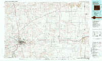
(17)- 1911 Map of Cheyenne, 1961 Print
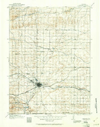 1911 Cheyenne1961 Print · USGSCheyenne was a bustling rail and military center in the years before the Great War. Genealogists and historians can trace the footprint of Fort D.A. Russell and find early rural sites like Campstool and Paola.
 - 1914 Map of Cheyenne
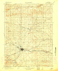 1914 Cheyenne1914 Print · USGSCheyenne stands at the crossroads of three major railroads in the years before the Great War. Researchers can trace the layout of the Fort D.A. Russell Military Reservation and find local landmarks like Ridley School and Campstool.3 unique versions available
 - 1950 Map of Cheyenne
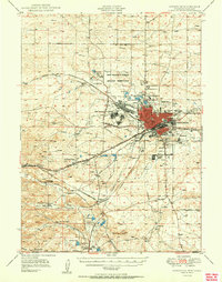 1950 Cheyenne1950 Print · USGSCheyenne and its surrounding high plains are captured here during a period of post-war expansion and military prominence. Researchers can trace the layout of the Fort Francis E Warren Military Reservation or locate family ranch sites like Rees Brothers Ranch and Diamond Camp.
 - 1954 Map of Cheyenne, 1963 Print
 1954 Cheyenne1963 Print · USGSSoutheastern Wyoming's high plains and the capital city's mid-century expansion are documented here during the early Cold War. Genealogists and historians can trace rail-aligned settlements like Pine Bluffs and Hillsdale, or explore landmarks like the Ames Monument and Francis E. Warren Air Force Base.3 unique versions available
 - 1958 Map of Cheyenne
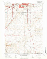
 1958 Cheyenne1958 Print · USGSSoutheast Wyoming and the Nebraska border appear in the late 1950s as a hub of military defense and rail commerce. Genealogists can trace the Union Pacific through Cheyenne or locate the Horse Creek Oil Field and the State Capitol.2 unique versions available
 - 1961 Map of Cheyenne South, 1963 Print
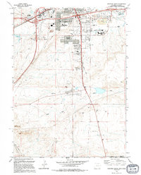
 1961 Cheyenne South1963 Print · USGSThe southern outskirts of Cheyenne in the early sixties reveal a landscape of emerging neighborhoods and essential rail hubs. Genealogists and historians can trace the foundations of Orchard Valley and locate landmarks like the Full Gospel Tabernacle and Intermountain Speedway.3 unique versions available
 - 1961 Map of Cheyenne, 1964 Print
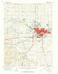 1961 Cheyenne1964 Print · USGSCheyenne and its surrounding high plains are captured here in the early sixties, showing a period of significant military and rail infrastructure. Genealogists and historians can locate old landmarks like Lakeview Cem, the USDA Horticultural Field Station, and early settlements such as Borie and Speer.
 - 1961 Map of Cheyenne North, 1964 Print
 1961 Cheyenne North1964 Print · USGSCheyenne expanded north across the high plains in the early sixties as military and aviation infrastructure matured. Genealogists and historians can trace neighborhood growth through dozens of local schools and churches, from St Marys Sch to the Beth El Cem.3 unique versions available
 - 1963 Map of Archer, 1967 Print
 1963 Archer1967 Print · USGSEast of Cheyenne in the early 1960s, this area reflects the intersection of cattle ranching and modern rail infrastructure. Researchers can locate the Wyoming Hereford Ranch, the Dildine Sch, and the Univ of Wyoming Experimental Station along the Union Pacific line.2 unique versions available
 - 1963 Map of Altvan, 1978 Print
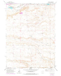 1963 Altvan1978 Print · USGSThe Wyoming and Colorado borderlands in the early sixties reveal a complex landscape of ranching and water rights. Researchers can trace historical property boundaries and livestock infrastructure through Altvan and along the Burlington Northern line, identifying named landmarks like the Century Windmill and Stewart DITCH.
 - 1981 Map of Cheyenne
 1981 Cheyenne1981 Print · USGSCheyenne and the surrounding high plains are captured here in the early eighties, showcasing the intersection of major rail lines and interstate highways. Genealogists and historians can trace the development of outlying ranching communities like Carpenter, Arcola, and the border town of Pine Bluffs.2 unique versions available
 - 1994 Map of Cheyenne South
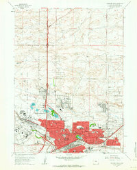
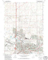
 1994 Cheyenne South1994 Print · USGSCheyenne and its southern suburbs are captured in the mid-1990s as the city expanded toward the Colorado line. Genealogists and historians can locate Orchard Valley, the Athol Camp, and numerous local landmarks like Goins Sch and the Intermountain Speedway.2 unique versions available
 - 1994 Map of Cheyenne North
 1994 Cheyenne North1994 Print · USGSNorth Cheyenne in the mid-nineties shows the city's steady expansion toward the high plains. Researchers can trace the layout of Francis E Warren Air Force Base and locate community landmarks like Frontier Park (Rodeo Ground) and Sloan Lake.
 - 2021 Map of Cheyenne South, 2021 Print
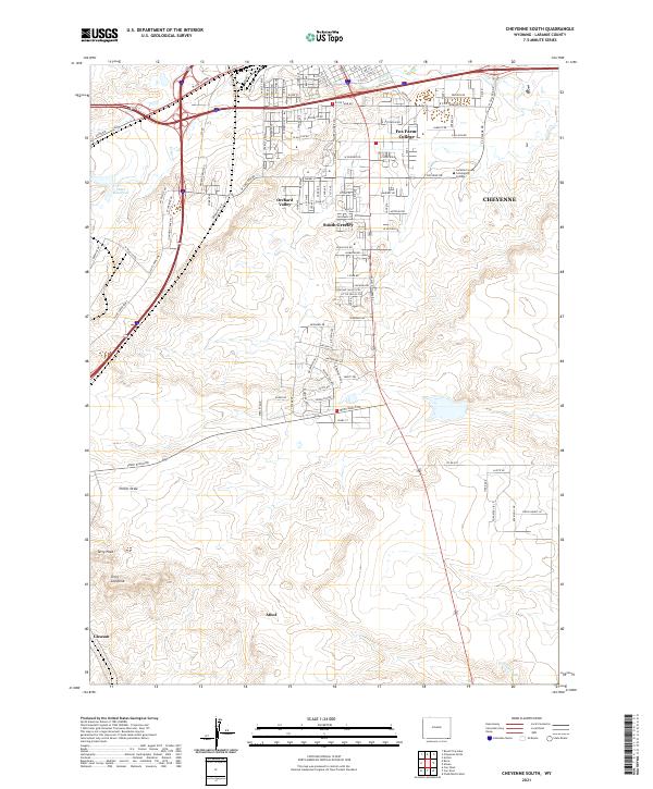 2021 Cheyenne South2021 Print · USGSThe southern fringes of the state capital take shape during this modern period as suburban growth meets the open Wyoming plains. Genealogists and local historians can trace the development of Orchard Valley, the campus of Laramie County Community College, and geological markers like Terry Peak.
 - 2021 Map of Altvan, 2021 Print
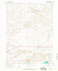
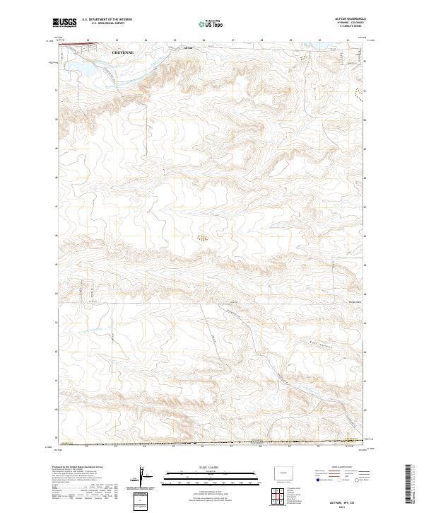 2021 Altvan2021 Print · USGSThe high plains south of Cheyenne at the start of the 2020s reveal a landscape deeply shaped by historic irrigation and ranching. Trace the path of the Wyoming Hereford Ranch Ditch Number 1 or find landmarks like Altvan and Bull Canyon.
 - 2021 Map of Archer, 2021 Print
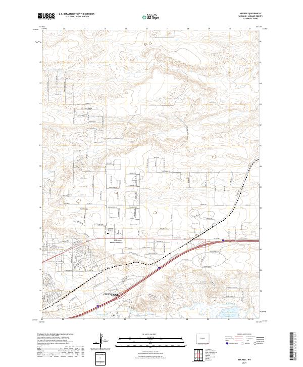 2021 Archer2021 Print · USGSEastern Wyoming at the height of its modern growth shows the expansion of Cheyenne into the surrounding ranchlands. Genealogists and local historians can trace the development of new neighborhoods near Sloan Airport and the historic Wyoming Hereford Ranch Reservoir Number Two.
 - 2021 Map of Cheyenne North, 2021 Print
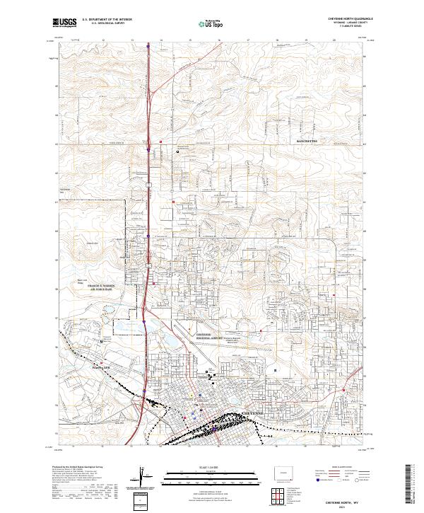 2021 Cheyenne North2021 Print · USGSCheyenne and the sprawling plains of Laramie County are seen here during their twenty-first-century growth. Researchers can trace the military and civic footprint of Warren AFB alongside several historic burial sites like Beth El Cem and Olivet Cem.
End of results
Showing maps 1-17 of 17
Top cities near Cheyenne
- Ranchettes historical maps
- South Greeley historical maps
- Fox Farm–College historical maps
- Warren Air Force Base historical maps
Frequently asked questions
- What are the different types of historical maps available for Cheyenne?
- What is the oldest map of Cheyenne?
- Where can I purchase historical maps of Cheyenne for my home or office?
- Where can I download high-res historical maps of Cheyenne?
- Are there historical topographic maps available for Cheyenne?
- Is there historical aerial imagery available for Cheyenne?
- Where are historical maps of Cheyenne sourced from?