1980s Maps of Natrona County, Wyoming
Explore 14 historic maps of Natrona County from the 1980s. These maps offer a rare glimpse into what life looked like during the 1980s — showing old roads, neighborhoods, homes, and landmarks that have changed or disappeared over time.
Whether you're researching your family's past, planning a metal detecting trip, or studying how Natrona County's landscape evolved across the 1980s, these high-resolution maps are a powerful tool for exploring the history of this region.
- Focus on a specific era: All maps on this page are from the 1980s, giving you a focused view of this time period.
- See what’s changed: Compare century-old streets, trails, and buildings to today's modern landscape using overlays and satellite layers.
- Research with precision: Use these maps for genealogy, historical research, land use analysis, or educational projects.
- View, download, or print: Maps are fully viewable online in high resolution, and can be downloaded or printed for your own records.
Start exploring Natrona County's history through authentic maps from the 1980s. This is your window into the past.
Natrona County, WY maps
(14)- 1981 Map of Midwest
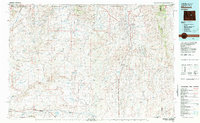 1981 Midwest1981 Print · USGSThe energy-rich plains of central Wyoming are mapped here during the early eighties, highlighting the massive Salt Creek Oil Field. Local historians can trace the rail lines of the Burlington Northern Railroad and locate landmarks like Teapot Rock and the town of Midwest.
 - 1981 Map of Rattlesnake Hills
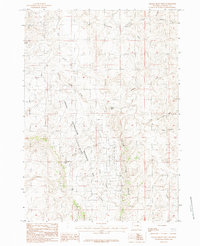
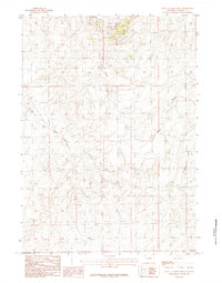
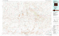 1981 Rattlesnake Hills1981 Print · USGSThe high central Wyoming desert comes into focus in the early 1980s, revealing a landscape defined by the Beaver Divide and the Granite Mountains. Genealogists and researchers can locate the remote Lucky Mac Camp, industrial mines, and seasonal landmarks like Buffalo Wallows or Puddle Springs.
 - 1981 Map of Shirley Basin
 1981 Shirley Basin1981 Print · USGSThe high Wyoming desert comes alive in this early 1980s survey of Carbon County, where massive reservoirs meet rugged mountain ranges. Researchers can trace the industrial activity at Shirley Basin and Mine Dumps or explore early shoreline footprints at Seminoe State Park.
 - 1982 Map of Lysite
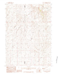
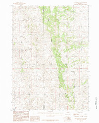
 1982 Lysite1982 Print · USGSCentral Wyoming's high plains and mountain foothills are captured here in the early 1980s, centered on the ranching and rail outposts of Natrona and Fremont Counties. Genealogists and historians can trace the paths of the Burlington Northern and the Old Railroad Grade through Lysite, Lost Cabin, and Arminto.
 - 1984 Map of Edgerton
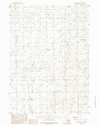
 1984 Edgerton1984 Print · USGSThe high plains of Natrona County come into focus in the 1980s, centered on the settlement of Edgerton. Researchers can trace the complex network of arid-land drainage systems like Coal Draw, Dead Ford Draw, and the meandering Salt Creek.
 - 1984 Map of Gillam Draw West
 1984 Gillam Draw West1984 Print · USGSNatrona County's high plains are defined by resource extraction and distinct geology in the mid-1980s. Trace the boundaries of the Naval Petroleum (Teapot Dome) Reserve No 3 and find landmarks like Castle Rock or Conley Res.
 - 1984 Map of Seven L Creek East
 1984 Seven L Creek East1984 Print · USGSThe Converse and Natrona County borderlands are captured here in the mid-1980s, showcasing a landscape of high-plains draws and seasonal creeks. Researchers can trace the drainage patterns of Seven L Creek and locate landmarks like Pine Ridge and Sand Spring Creek.
 - 1984 Map of Sawmill Canyon
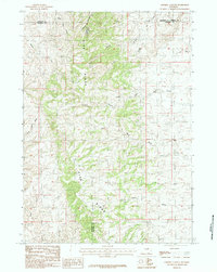 1984 Sawmill Canyon1984 Print · USGSThe high ranching country of east-central Wyoming is shown here in the mid-1980s as it spans four county lines. Researchers can trace the rugged drainage systems of the Pine Ridge including Sawmill Canyon, Wind Creek, and the North Fork Powder R.
 - 1984 Map of Mc Kenzie Flat
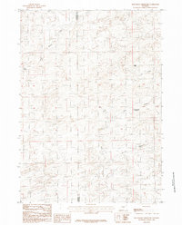
 1984 Mc Kenzie Flat1984 Print · USGSNatrona County's high plains appear in detail during the late seventies and early eighties, showing a landscape defined by vital water sources. Researchers can trace the drainages of Mc Kenzie Creek and Meyers Draw, or locate landmarks such as Mud Lake and Sand Springs.2 unique versions available
 - 1984 Map of Seven L Creek West
 1984 Seven L Creek West1984 Print · USGSThe high plains of Natrona County are captured in the mid-1980s, centered on a site of major national energy and political history. Researchers can map the industrial footprint of Naval Petroleum Reserve No 3 and trace drainages like Little Teapot Creek and Seven L Creek.
 - 1984 Map of Gillam Draw East
 1984 Gillam Draw East1984 Print · USGSThe rugged divide of Pine Ridge defines this Wyoming landscape during the mid-1980s. Researchers can trace the county line and the intricate network of watercourses including Big Bull Creek, Antelope Creek, and Holmes Draw.
 - 1984 Map of Beauchamp Reservoir
 1984 Beauchamp Reservoir1984 Print · USGSThe high plains of Converse and Natrona counties are captured here in the mid-1980s, showcasing a landscape defined by vital water management and livestock grazing. Genealogists and land historians can trace family-named landmarks like Beauchamp Reservoir, Eagle Point, and the remote Sand Springs.
 - 1984 Map of Ervay Basin SW, 1985 Print
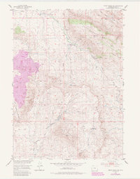 1984 Ervay Basin SW1985 Print · USGSThe high desert of Natrona County is captured here in the mid-twentieth century, showing a landscape defined by the Rattlesnake Hills and Beaver Rim. Genealogists and historians can trace old homesteading efforts at the Holiday Homestead (Aband) and follow the path of the historic Freight Road.
 - 1988 Map of Casper
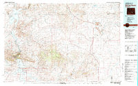
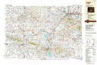 1988 Casper1988 Print · USGSHigh plains and mountain ranges define Central Wyoming in the late eighties, centered on the growth of the Casper urban corridor. Genealogists and researchers can trace the rail lines of the Chicago and North Western RR or locate small outposts like Jeffrey City and Bairoil.
End of results
Showing maps 1-14 of 14
Top cities of Natrona County
- Casper historical maps
- Mills historical maps
- Bar Nunn historical maps
- Evansville historical maps
- Vista West historical maps
- Hartrandt historical maps
See more
Frequently asked questions
- What are the different types of historical maps available for Natrona County?
- What is the oldest map of Natrona County?
- Where can I purchase historical maps of Natrona County for my home or office?
- Where can I download high-res historical maps of Natrona County?
- Are there historical topographic maps available for Natrona County?
- Is there historical aerial imagery available for Natrona County?
- Where are historical maps of Natrona County sourced from?