Old Maps of Natrona County, Wyoming for Academic Research
Study the evolution of Natrona County with 270 high-resolution historic maps. Whether you're teaching, researching, or modeling changes in land use, these maps provide essential visual documentation of urban, environmental, and geographic change.
- Analyze long-term change: Track patterns in development, transportation, and natural features.
- Ideal for environmental or urban studies: Support academic projects with primary historical map data.
- Use in the classroom or lab: Educators and researchers rely on these maps to bring historical context to life.
These maps are a powerful tool for teaching, research, and visualizing how Natrona County has changed over the decades.
Natrona County, WY maps
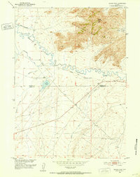
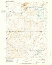
(270)- 1949 Map of Brookhurst, 1958 Print
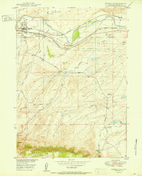
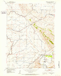
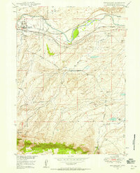 1949 Brookhurst1958 Print · USGSNatrona County in the late 1940s shows a landscape shaped by the river and the rail, just as the regional oil industry was maturing. Researchers can trace family ranch lands like Jones Ranch, locate the rural Muddy Sch, and follow the Burlington and Quincy railroad through Brookhurst.
 - 1949 Map of Campbell Hill, 1958 Print
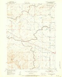
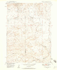 1949 Campbell Hill1958 Print · USGSThe high plains of the Converse and Natrona county line are shown here in the late 1940s as petroleum development took hold. Researchers can locate early oil infrastructure at the Cole Creek Oil Field and trace legacy family holdings like the K Lazy S Ranch or the Dewitt Ranch.3 unique versions available
 - 1949 Map of Pratts Soda Lakes, 1975 Print
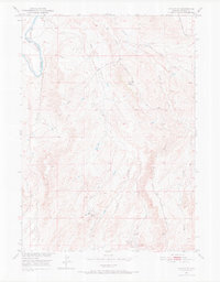
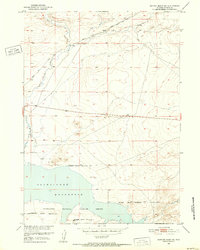
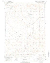 1949 Pratts Soda Lakes1975 Print · USGSNatrona County at the end of the 1940s shows a landscape where historic pioneer paths meet modern industry. Trace the route of the Emigrant Trail past the Blue Rock Coal Mine and the distinctive Pratts Soda Lakes.2 unique versions available
 - 1950 Map of Campbell Hill
 1950 Campbell Hill1950 Print · USGSConverse and Natrona counties are captured here at mid-century, where the burgeoning oil industry meets traditional high-plains ranching. Local historians can trace family landholdings like the K Lazy S Ranch or the legacy of the Big Muddy Coal Mine (Abandoned).
 - 1950 Map of Lockett
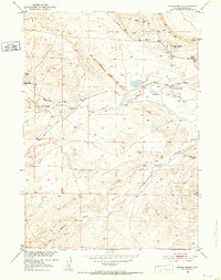
 1950 Lockett1950 Print · USGSThe North Platte River valley at the mid-century shows a distinct mix of Wyoming ranching and energy production. Genealogists and historians can trace family land at the Old Webble Ranch and Lamb Ranch or explore the early infrastructure of the Big Muddy Oil Field.
 - 1950 Map of Brookhurst
 1950 Brookhurst1950 Print · USGSMid-century Natrona County is documented here as ranching traditions and railroad industry converged along the North Platte River. Researchers can trace early rural infrastructure through the Muddy Sch, Mystery Bridge, and family holdings like Hat Six Ranch.
 - 1950 Map of Pratts Soda Lakes
 1950 Pratts Soda Lakes1950 Print · USGSNatrona County's mid-century landscape is defined by the energy and mining industries, showing a vast network of infrastructure. Trace old energy routes and mining sites like the Swigart Coal Mine, Cole Creek Oil Field, and Suicide Soda Lake.
 - 1950 Map of Emigrant Gap, 1952 Print
 1950 Emigrant Gap1952 Print · USGSThe central Wyoming plains meet the river's edge in 1950, showing a landscape defined by pioneer history and modern water management. Researchers can locate the historic Oregon Trail and its marker, the Old Goose Egg Ranch House (Ruins), and the rural Bessemer School.2 unique versions available
 - 1950 Map of Goose Egg, 1952 Print
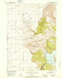
 1950 Goose Egg1952 Print · USGSMid-century Natrona County comes to life at the foot of the mountains as rail and river networks converge. Genealogists and historians can trace the foundations of Mountain View and find rural landmarks like Sageglen Sch and the local Cem.
 - 1950 Map of Emigrant Gap NE, 1952 Print
 1950 Emigrant Gap NE1952 Print · USGSMid-century Natrona County is captured here during the expansion of the Missouri River Basin project. Trace early irrigation and navigation infrastructure including the Casper Canal, the Radio Range Station, and Thirtythree Mile Road.
 - 1950 Map of Alcova SE, 1971 Print
 1950 Alcova SE1971 Print · USGSMid-century Natrona County was a landscape of oil exploration and livestock grazing south of Casper. Genealogists and historians can trace the footprint of early energy production at the Spindle Top Oil Field or follow the Stock Trail through Bates Hole.
 - 1950 Map of Alcova, 1985 Print
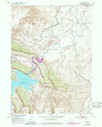 1950 Alcova1985 Print · USGSThe North Platte River corridor near Alcova is captured here at mid-century during the expansion of the Missouri River Basin project. Genealogists and researchers can locate the River Bend School, the Alcova PO, and the engineering of the Alcova Dam.
 - 1951 Map of The Reefs
 1951 The Reefs1951 Print · USGSThe high plains of Natrona County appear in detail in the early fifties, showcasing the region's evolving industrial and aviation landscape. Researchers can trace the layout of the Wardwell Airport, the Oil Tank Farm (Abandoned), and landmarks like The Reefs.
 - 1951 Map of Savage Peak, 1952 Print
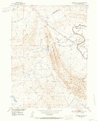
 1951 Savage Peak1952 Print · USGSThe high-desert terrain along the Natrona and Carbon county line is captured here in the early fifties. You can trace the historic route of the Oregon Trail and locate landmarks like the Historical Marker and Savage Peak.3 unique versions available
 - 1951 Map of Pine Mountain SW, 1952 Print
 1951 Pine Mountain SW1952 Print · USGSNatrona County was a landscape of remote ranching and emerging oil interests during the early fifties. Genealogists and historians can trace the specific locations of West Poison Spider Camp, Dodds Ranch, and the path of the Poison Spider Road.3 unique versions available
 - 1951 Map of Oil Mountain, 1952 Print
 1951 Oil Mountain1952 Print · USGSNatrona County's rugged oil country and historic migration corridors are captured here just after mid-century. Researchers can trace the legendary Oregon Trail past an Oil Well (Inactive) and the waters of Poison Spider Creek.3 unique versions available
 - 1951 Map of Clarkson Hill, 1952 Print
 1951 Clarkson Hill1952 Print · USGSCentral Wyoming's high plains are documented here in the early 1950s, showing the intersection of pioneer routes and modern energy infrastructure. You can trace the historic Oregon Trail past Clarkson Ranch and locate mid-century industrial markers like Willow Creek Pumping Sta No 7.3 unique versions available
 - 1951 Map of Benton Basin SW, 1952 Print
 1951 Benton Basin SW1952 Print · USGSBenton Basin and the northern reaches of the Pathfinder Reservoir are captured here in the early fifties. Researchers can trace the historical route of the Oregon Trail as it passes near a solitary Windmill and the Pipe Line Road.3 unique versions available
 - 1951 Map of Emigrant Gap NW, 1952 Print
 1951 Emigrant Gap NW1952 Print · USGSNatrona County's high plains are captured here in the early fifties, dominated by the ridge of Emigrant Gap Ridge. Trace local landmarks and water systems like the Casper Canal, Hot Springs, and the Box C Reservoir.3 unique versions available
 - 1951 Map of Benton Basin, 1952 Print
 1951 Benton Basin1952 Print · USGSThe high basins and canyonlands of Natrona County are captured here in the early 1950s as the Missouri River Basin project reshaped the local landscape. Researchers can trace early ranching sites like the Childers Place and the emergence of the Casper Boat Club on the Alcova Reservoir.3 unique versions available
 - 1951 Map of Poison Spider, 1952 Print
 1951 Poison Spider1952 Print · USGSNatrona County's high plains reveal a landscape of energy extraction and ranching life in the early fifties. Local historians can trace the Poison Spider Oil Field and West Poison Spider Camp, alongside the Empire School and early family ranches.4 unique versions available
 - 1951 Map of Bucklin Reservoirs, 1952 Print
 1951 Bucklin Reservoirs1952 Print · USGSCentral Wyoming's high desert reveals its ranching and migration history in the early fifties, before modern developments altered the trail corridors. Genealogists and historians can trace the Oregon California Trail past the Turkey Track Ranch and Bucklin Reservoirs.3 unique versions available
 - 1951 Map of Casper, 1952 Print
 1951 Casper1952 Print · USGSCasper at the midpoint of the century is a bustling energy and transit hub along the North Platte River. Genealogists and historians can locate family-owned holdings like C Y Ranch, industrial landmarks like the Oil Tank Farms, and local institutions including the State Childrens Home.2 unique versions available
 - 1951 Map of Bessemer Mountain, 1952 Print
 1951 Bessemer Mountain1952 Print · USGSThe North Platte River corridor south of Casper comes alive in the early fifties, showing a landscape of high-plains ranching and early irrigation. Researchers can locate the Oregon Trail Historical Marker, the Bates Creek School, and family operations like Spear Ranch.3 unique versions available
 - 1951 Map of Bear Mountain, 1953 Print
 1951 Bear Mountain1953 Print · USGSThe high plains of the Natrona and Carbon County line are captured here in the early fifties, showcasing a landscape of high summits and deep creek beds. Researchers can trace the drainages of Stinking Creek, Bear Creek, and the slopes of Bear Mountain.3 unique versions available
Showing maps 1-25 of 270
Top cities of Natrona County
- Casper historical maps
- Mills historical maps
- Bar Nunn historical maps
- Evansville historical maps
- Vista West historical maps
- Hartrandt historical maps
See more
Frequently asked questions
- What are the different types of historical maps available for Natrona County?
- What is the oldest map of Natrona County?
- Where can I purchase historical maps of Natrona County for my home or office?
- Where can I download high-res historical maps of Natrona County?
- Are there historical topographic maps available for Natrona County?
- Is there historical aerial imagery available for Natrona County?
- Where are historical maps of Natrona County sourced from?