1960s Maps of Natrona County, Wyoming
Explore 49 historic maps of Natrona County from the 1960s. These maps offer a rare glimpse into what life looked like during the 1960s — showing old roads, neighborhoods, homes, and landmarks that have changed or disappeared over time.
Whether you're researching your family's past, planning a metal detecting trip, or studying how Natrona County's landscape evolved across the 1960s, these high-resolution maps are a powerful tool for exploring the history of this region.
- Focus on a specific era: All maps on this page are from the 1960s, giving you a focused view of this time period.
- See what’s changed: Compare century-old streets, trails, and buildings to today's modern landscape using overlays and satellite layers.
- Research with precision: Use these maps for genealogy, historical research, land use analysis, or educational projects.
- View, download, or print: Maps are fully viewable online in high resolution, and can be downloaded or printed for your own records.
Start exploring Natrona County's history through authentic maps from the 1960s. This is your window into the past.
Natrona County, WY maps
(49)- 1960 Map of Emigrant Gap, 1963 Print
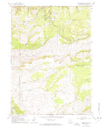
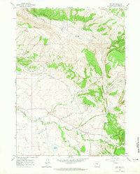
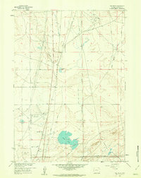
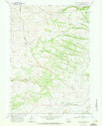
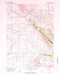 1960 Emigrant Gap1963 Print · USGSCentral Wyoming's overland trails and river bends are captured here in the early 1960s. Genealogists and historians can trace the historic Oregon Trail past the Old Goose Egg Ranchhouse and the distinctive Red Buttes.3 unique versions available
 - 1960 Map of Bishop, 1963 Print
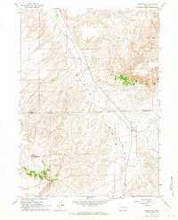
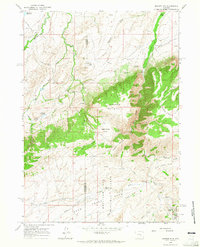
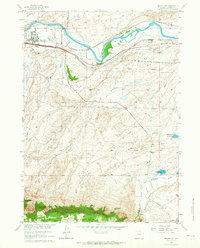
 1960 Bishop1963 Print · USGSNatrona County in the early sixties showcases a landscape shaped by military aviation and major rail lines. Researchers can trace local development at Air Base Acres or locate the historic Thirtythree Mile Sch and the abandoned Oil Tank Farm.4 unique versions available
 - 1960 Map of Emigrant Gap NE, 1963 Print
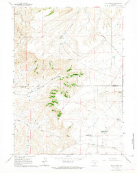
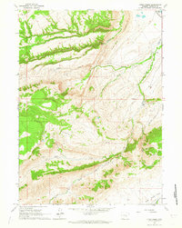
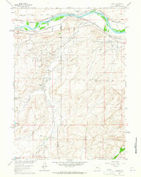
 1960 Emigrant Gap NE1963 Print · USGSCentral Wyoming ranching and water management are the focus of this mid-century survey. Trace the cattle-country landscape through Thirtythree Mile Ranch, the winding Casper Canal, and the high terrain of Emigrant Gap Ridge.2 unique versions available
 - 1960 Map of Twin Buttes, 1964 Print
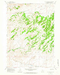
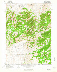
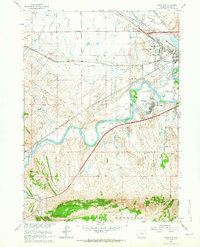
 1960 Twin Buttes1964 Print · USGSNatrona County ranching country is captured here in the early sixties, showing a landscape defined by livestock movement and water management. You can trace the Bates Hole Stock Trail past family landmarks like Garret Ranch and Posvars Windmill.
 - 1960 Map of Crimson Dawn, 1964 Print
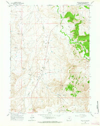
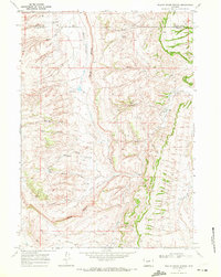
 1960 Crimson Dawn1964 Print · USGSHigh on the plateaus south of Casper in the early sixties, this map documents a landscape of mountain recreation and ranching outposts. Researchers can find the old Eadsville mining site, the Hogadon Basin Ski Area, and Crimson Dawn.2 unique versions available
 - 1960 Map of Horse Peak, 1964 Print
 1960 Horse Peak1964 Print · USGSHigh ranching country along the border of Natrona and Carbon Counties comes into focus in this early 1960s study. Researchers can trace the legacy of remote homesteads like Body Ranch and Kirk Ranch situated near the waters of Stinking Creek.2 unique versions available
 - 1960 Map of Sheep Creek, 1964 Print
 1960 Sheep Creek1964 Print · USGSThe high plains of Natrona County are captured here in the early sixties, showing a landscape shaped by ranching and early travel routes. Researchers can trace the Old Casper Medicine Bow Highway past Milne Ranch and the settlement of Holin.
 - 1960 Map of Mud Springs, 1964 Print
 1960 Mud Springs1964 Print · USGSThe high plains of Natrona and Carbon Counties are shown just as the modern highway system was solidifying in the early sixties. Researchers can trace the water-dependent ranching economy through names like Cronberg Pit Reservoir, Mud Springs, and the Stock Trail.2 unique versions available
 - 1960 Map of Ice Cave Mountain, 1964 Print
 1960 Ice Cave Mountain1964 Print · USGSThe high country of Natrona County is captured here in the early 1960s, showing a remote landscape defined by the Deer Creek Range. Historians and hikers can trace old routes to Miles Cabin or locate the specific Ice Cave on the slopes of Ice Cave Mountain.3 unique versions available
 - 1960 Map of Freeland, 1965 Print
 1960 Freeland1965 Print · USGSHigh ranching country south of Casper is documented here in the early sixties as the local economy revolved around family homesteads and high-plateau grazing. Genealogists and historians can trace property boundaries and civic landmarks like the Freeland Cemetery, Nall Ranch, and the Freeland School.2 unique versions available
 - 1960 Map of Banner Mtn, 1965 Print
 1960 Banner Mtn1965 Print · USGSHighland ranching and forest lands define this Wyoming territory at the start of the 1960s. Researchers can trace remote family outposts like Rissler Ranch and Kimball Ranch or locate the Banner Landing Strip tucked near the peaks.2 unique versions available
 - 1960 Map of Otter Creek, 1965 Print
 1960 Otter Creek1965 Print · USGSNatrona County ranching country is captured here during the early sixties, showing a landscape of high ridges and managed water. Genealogists and historians can locate legacy operations like Brooks Ranch and the isolated Cow Camp near the Hogback.2 unique versions available
 - 1960 Map of Reno Hill, 1965 Print
 1960 Reno Hill1965 Print · USGSHigh ranching country along the Natrona and Converse county line is captured here at the dawn of the 1960s. Researchers can trace the layout of early livestock operations like the Old Tobin Place and find isolated Ruins or the Barker Sheep Camp.3 unique versions available
 - 1961 Map of The Reefs, 1962 Print
 1961 The Reefs1962 Print · USGSNatrona County was an evolving hub of Wyoming’s energy industry in the early sixties, shaped by oil fields and desert pipelines. Genealogists and researchers can trace the footprint of Wardwell Airport, the homes at Richardson Acres, and the old Tank Farm.4 unique versions available
 - 1961 Map of Brookhurst, 1965 Print
 1961 Brookhurst1965 Print · USGSCentral Wyoming at the start of the 1960s shows a landscape defined by the North Platte River and its industrial hubs. Genealogists can trace family holdings like Hat Six Ranch and Jones Ranch alongside the historic Emigrant Trail.3 unique versions available
 - 1961 Map of Lockett, 1965 Print
 1961 Lockett1965 Print · USGSThe industrial and ranching heart of Converse County is captured in the early 1960s, showing the intersection of energy production and pioneer roots. Trace the historic Emigrant Trail alongside the Big Muddy Oil Field and family holdings like Old Wobble Ranch.4 unique versions available
 - 1961 Map of Goose Egg, 1965 Print
 1961 Goose Egg1965 Print · USGSThe outskirts of Casper come into focus in the early sixties, showing where old frontier routes met modern industrial growth. Trace the historic Emigrant Trail past the Custard Massacre Site or locate early neighborhoods like Mountain View.4 unique versions available
 - 1961 Map of Casper, 1965 Print
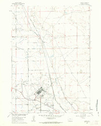
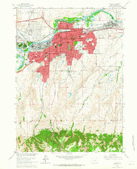 1961 Casper1965 Print · USGSCasper and its neighbors developed rapidly during the mid-century energy boom, bordered by the river and the mountain. Researchers can trace the layout of Evansville, the sprawling Oil Tank Farm, and neighborhood anchors like Casper College.3 unique versions available
 - 1962 Map of Arminto
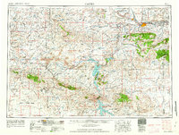
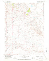
 1962 Arminto1962 Print · USGSCentral Wyoming in the early sixties reveals a landscape shaped by the Chicago and North Western railroad and early energy development. Trace the history of the region through remote outposts like Arminto, the US Naval Petroleum Reserve, and the geologic landmark at Hells Half Acre.
 - 1962 Map of Casper
 1962 Casper1962 Print · USGSCentral Wyoming during the early sixties was a landscape of expanding energy production and massive water projects. Researchers can trace the mid-century footprint of the Lost Soldier Oil Field, the development of Casper Air Terminal, and the irrigation network of Pathfinder Reservoir.
 - 1967 Map of Gordon Creek, 1971 Print
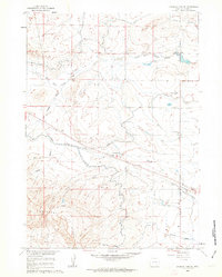
 1967 Gordon Creek1971 Print · USGSHigh-country Wyoming terrain in the late sixties reveals the intricate drainage network of the Middle Fork Powder River. Genealogists and historians can trace remote landmarks like the Corral near Sullivan Creek and winding tracks like the Jeep Trail.2 unique versions available
 - 1968 Map of Big Gulch, 1972 Print
 1968 Big Gulch1972 Print · USGSNatrona County ranch lands are documented here in the late sixties, showing the vital water networks of the High Plains. You can trace the Old Railroad Grade past Big Gulch and locate the historic Shepperson Ranch near the local draws and creeks.2 unique versions available
 - 1968 Map of First Water Draw, 1972 Print
 1968 First Water Draw1972 Print · USGSNatrona and Johnson counties are captured here in the late sixties, showing a landscape of high-plains ranching and remote drainage systems. Researchers can trace historic access routes like Thirtythree Mile Road and find named landmarks like Beaton Basin and Clapp Spring.2 unique versions available
 - 1968 Map of Willow Creek School, 1972 Print
 1968 Willow Creek School1972 Print · USGSNatrona and Johnson County ranchlands are documented here in the late sixties, showcasing a landscape defined by the towering Red Wall. Researchers can locate the Willow Creek Sch, trace the path of Thirtythree Mile Road, and find early aviation infrastructure at the Landing Strip.
 - 1968 Map of Notches Dome, 1972 Print
 1968 Notches Dome1972 Print · USGSNatrona County's oil and ranching lands are captured here in the late sixties, centered on the prominent Notches Dome. Researchers can trace old stock routes like the Cottonwood Stock Trail and identify specific petroleum sites across the OIL FIELD.
Showing maps 1-25 of 49
Top cities of Natrona County
- Casper historical maps
- Mills historical maps
- Bar Nunn historical maps
- Evansville historical maps
- Vista West historical maps
- Hartrandt historical maps
See more
Frequently asked questions
- What are the different types of historical maps available for Natrona County?
- What is the oldest map of Natrona County?
- Where can I purchase historical maps of Natrona County for my home or office?
- Where can I download high-res historical maps of Natrona County?
- Are there historical topographic maps available for Natrona County?
- Is there historical aerial imagery available for Natrona County?
- Where are historical maps of Natrona County sourced from?