Old Maps of Sheridan County, Wyoming for Metal Detecting
Plan your next treasure hunt with 390 historic maps of Sheridan County. Find old homesites, ghost towns, trails, and gathering spots that may be lost to time — perfect for identifying promising metal detecting locations.
- Locate forgotten sites: Uncover places like long-lost settlements, abandoned rail lines, or gathering spots.
- Plan better hunts: Use map overlays combined with LiDAR or satellite views to narrow in on historically rich areas.
- Made for detectorists: Thousands of hobbyists use these maps to discover relics, coins, and hidden history.
Use these historic maps to boost your research and find new opportunities beneath the surface of Sheridan County.
Sheridan County, WY maps
(390)- 1894 Map of Rosebud
 1894 Rosebud1894 Print · USGSThe Big Horn Basin and the Crow Indian Reservation are captured in the late nineteenth century as early cattle outposts began to dot the river valleys. Genealogists and local historians can trace early holdings like Forty Mile Ranch, Hams Ranch, and the Sand Hills Ranch.
 - 1894 Map of St. Xavier
 1894 St. Xavier1894 Print · USGSThe Crow Indian Reservation in the 1890s is captured here just as the frontier era was closing. Researchers can trace the path of the Old Bozeman Military Road past St. Xavier Mission and the Site of Old Fort C. F. Smith.
 - 1895 Map of Dayton
 1895 Dayton1895 Print · USGSSheridan County and the Bighorn foothills are captured here in the late nineteenth century as ranching and transit began to define the region. Genealogists and researchers can trace the early road networks connecting Dayton, Ohlman, and the ranching hub at Beckton.
 - 1898 Map of Bald Mountain, 1957 Print
 1898 Bald Mountain1957 Print · USGSThe northern Bighorn Mountains appear in the 1890s as a frontier of high-altitude ranching and mining. Trace the early trails leading to the Fortunatus Mill, remote landmarks like Sheldons Ranch, and the isolated settlement of Cloverly.2 unique versions available
 - 1901 Map of Rosebud
 1901 Rosebud1901 Print · USGSSouthern Montana ranching and rail life are documented here during the final decade of the nineteenth century. Genealogists and historians can trace early holdings like Yellow Weasel Ranch and Sand Hills Ranch along the Burlington and Missouri River R. R.4 unique versions available
 - 1901 Map of Dayton
 1901 Dayton1901 Print · USGSSheridan County and the Montana borderlands are captured here at the turn of the century as the railroad reshapes the valley. Researchers can trace early settlements and ranching outposts like Slack, Beckton, and the Morrow Ranch along the Tongue River.5 unique versions available
 - 1901 Map of St. Xavier
 1901 St. Xavier1901 Print · USGSBig Horn County at the turn of the century shows a frontier landscape shaped by military history and the early years of the Crow Reservation. Researchers can trace the path of the Old Bozeman Military Road past the Site of Old Fort C. F. Smith and the St. Xavier Mission.4 unique versions available
 - 1901 Map of Bald Mountain
 1901 Bald Mountain1901 Print · USGSNorthern Wyoming's high peaks and timber reserves are captured here at the turn of the century. Researchers can trace early industrial sites like Fortunatus Mill and the isolated settlement of Cloverly near the Shell Creek drainage.4 unique versions available
 - 1909 Map of Sheridan, 1954 Print
 1909 Sheridan1954 Print · USGSSheridan and the surrounding northern Wyoming ranchlands are captured here in the first decade of the twentieth century. Genealogists can trace family holdings at Wagoner Ranch or Big Red Ranch, and locate early rail stations like Verona and Ulm.2 unique versions available
 - 1911 Map of Sheridan
 1911 Sheridan1911 Print · USGSSheridan and the surrounding northern Wyoming ranchlands are captured here during a period of rapid railroad expansion. Researchers can trace the Chicago Burlington and Quincy RR through Dietz and Verona, or locate early homesteads like Wagoner Ranch.2 unique versions available
 - 1954 Map of Hardin, 1964 Print
 1954 Hardin1964 Print · USGSSoutheastern Montana is documented here during the mid-fifties, showing the vast tribal lands and historic battle sites before modern highway expansion. Researchers can trace the Chicago Burlington and Quincy rail line through Hardin or locate the Custer National Cemetery and Museum.2 unique versions available
 - 1955 Map of Sheridan, 1973 Print
 1955 Sheridan1973 Print · USGSThe Bighorn Mountains meet the Powder River Basin in the 1950s, a period when cattle ranching and coal mining defined the regional economy. Genealogists and historians can trace local landmarks like the Fort Mackenzie Veteran Hospital, the Monarch Coal Mine, and legacy operations such as the Beckton Stock Farm.2 unique versions available
 - 1957 Map of Hardin
 1957 Hardin1957 Print · USGSSoutheastern Montana in the mid-fifties reveals a landscape shaped by tribal lands and the historic Bighorn river valleys. Researchers can trace the Chicago Burlington and Quincy RR through Hardin and locate the National Cemetery and Custer Battlefield Monument.
 - 1958 Map of Hardin
 1958 Hardin1958 Print · USGSSoutheastern Montana in the mid-fifties presents a landscape defined by significant tribal lands and national monuments. Researchers can trace the geography of the Little Bighorn at Custer Battlefield National Monument and locate settlements like Lame Deer and Birney.
 - 1958 Map of Sheridan
 1958 Sheridan1958 Print · USGSThe Bighorn Mountains meet the high plains in the mid-1950s, revealing a landscape of large-scale ranching and mineral extraction. Trace the legacy of early settlements and industry through the Kleenburn Coal Tipple, Beckton Stock Farm, and the Hidden Dome Oil & Gas Field.2 unique versions available
 - 1960 Map of Boyd Ridge, 1962 Print
 1960 Boyd Ridge1962 Print · USGSHigh in the northern Bighorns during the late fifties, this area was a landscape of remote resource extraction and steep drainages. Researchers can trace the industrial footprint of the Marble Quarry and follow the high-country paths of Boyd Ridge and Wagon Box Creek.3 unique versions available
 - 1960 Map of Mexican Hill, 1962 Print
 1960 Mexican Hill1962 Print · USGSThe high country of the Big Horn Mountains comes alive in this early 1960s survey of the county line. Trace remote footpaths and landmarks like Cow Camp, Bucking Mule Falls, and the steep terrain of Devils Canyon.2 unique versions available
 - 1960 Map of Granite Pass, 1962 Print
 1960 Granite Pass1962 Print · USGSHigh in the Bighorn Mountains during the early sixties, this terrain shows the divide between Sheridan and Big Horn counties. Trace high-altitude landmarks and water sources like Granite Pass, Copemans Tomb, and Three Springs.2 unique versions available
 - 1960 Map of Hidden Tepee Creek, 1962 Print
 1960 Hidden Tepee Creek1962 Print · USGSHigh in the Big Horn Mountains during the early sixties, this terrain showcases a landscape defined by livestock grazing and forest management. Researchers can find seasonal outposts like Horse Creek Cow Camp and trace the winding paths of Hunt Mountain Road and Hidden Tepee Creek.2 unique versions available
 - 1960 Map of Bald Mountain, 1962 Print
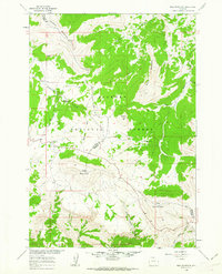 1960 Bald Mountain1962 Print · USGSThe high Bighorn Mountains at the start of the 1960s reveal a landscape of remote ranger stations and alpine camps. Researchers can locate the historic Bald Mountain City (Site) or trace the Sheep Mountain Road past Rooster Hill and Bald Mountain.3 unique versions available
 - 1960 Map of Leavitt Reservoir, 1963 Print
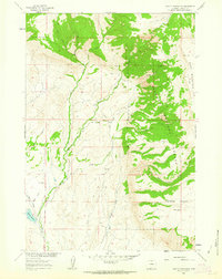 1960 Leavitt Reservoir1963 Print · USGSBig Horn County at the start of the 1960s showcases a high-desert landscape managed for ranching and water storage. Researchers can locate the Leavitt Ranch, trace the path of the London Ditch, and explore the terrain of Hunt Mountain and Horse Creek Mesa.3 unique versions available
 - 1962 Map of Sheridan
 1962 Sheridan1962 Print · USGSThe Big Horn Mountains and Powder River country are captured here in the early sixties as energy production and ranching shaped northern Wyoming. Researchers can locate specific sites like the Kleenburn Coal Tipple, Eaton Bros Ranch, and the Fort McKenzie Veteran Hospital.
 - 1964 Map of Burgess Junction, 1967 Print
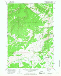 1964 Burgess Junction1967 Print · USGSBighorn National Forest in the mid-1960s showcases a high-country landscape of ranching camps and early mountain tourism. Local historians can trace the sites of Wolfe Cow Camp, the Burgess Ranger Station, and the industrial footprint of a local Sawmill.3 unique versions available
 - 1964 Map of Wolf, 1967 Print
 1964 Wolf1967 Print · USGSSheridan County ranching and the mountain front are captured here in the mid-1960s. Genealogists and local historians can trace family-named sites like P K Ranch, the Wolf Creek Sch, and the high forest boundary at Windy Canyon.
 - 1964 Map of Ranchester, 1967 Print
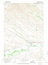 1964 Ranchester1967 Print · USGSRanchester and the surrounding Tongue River valley are shown in the mid-1960s, where the railroad and irrigation systems define the local landscape. Researchers can trace the path of the Chicago Burlington and Quincy railroad and find local landmarks like Mikado, City Park, and the complex Wolf Ditch network.2 unique versions available
Showing maps 1-25 of 390
Top cities of Sheridan County
Frequently asked questions
- What are the different types of historical maps available for Sheridan County?
- What is the oldest map of Sheridan County?
- Where can I purchase historical maps of Sheridan County for my home or office?
- Where can I download high-res historical maps of Sheridan County?
- Are there historical topographic maps available for Sheridan County?
- Is there historical aerial imagery available for Sheridan County?
- Where are historical maps of Sheridan County sourced from?