1970s Maps of Sheridan County, Wyoming
Explore 27 historic maps of Sheridan County from the 1970s. These maps offer a rare glimpse into what life looked like during the 1970s — showing old roads, neighborhoods, homes, and landmarks that have changed or disappeared over time.
Whether you're researching your family's past, planning a metal detecting trip, or studying how Sheridan County's landscape evolved across the 1970s, these high-resolution maps are a powerful tool for exploring the history of this region.
- Focus on a specific era: All maps on this page are from the 1970s, giving you a focused view of this time period.
- See what’s changed: Compare century-old streets, trails, and buildings to today's modern landscape using overlays and satellite layers.
- Research with precision: Use these maps for genealogy, historical research, land use analysis, or educational projects.
- View, download, or print: Maps are fully viewable online in high resolution, and can be downloaded or printed for your own records.
Start exploring Sheridan County's history through authentic maps from the 1970s. This is your window into the past.
Sheridan County, WY maps
(27)- 1970 Map of O T O Ranch, 1973 Print
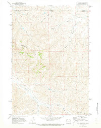 1970 O T O Ranch1973 Print · USGSThe Montana and Wyoming state line bisects this ranching landscape during the early 1970s, showing the high-country drainages of the Badger Hills. Researchers can trace the boundaries of the 77 Ranch and OTO Ranch near Spring Creek.2 unique versions available
 - 1970 Map of Horse Hill, 1973 Print
 1970 Horse Hill1973 Print · USGSSheridan and Johnson counties are revealed during the early 1970s as a landscape of remote ranching and essential water engineering. Genealogists and historians can trace family-named landmarks and irrigation systems like Horse Hill, Belus No 1 Res, and the Sturdevant Ditch.2 unique versions available
 - 1970 Map of Verona, 1973 Print
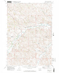
 1970 Verona1973 Print · USGSSheridan County ranch lands in the early seventies centered on the rail-and-creek corridor. Genealogists and local historians can trace family-named landmarks and rural infrastructure like Verona, the Dutch Creek Sch, and Tibbets.
 - 1970 Map of Ulm, 1973 Print
 1970 Ulm1973 Print · USGSSheridan County, Wyoming, is captured here in the early seventies as a hub of ranching and rail. Genealogists and historians can trace the Burlington Northern line through Ulm and across many named landmarks like Lone Tree Creek and Pinhead Reservoir.
 - 1970 Map of Cedar Canyon, 1973 Print
 1970 Cedar Canyon1973 Print · USGSThe high plains along the Montana-Wyoming border appear here in the early seventies, detailing a landscape defined by ranching and resource extraction. Researchers can locate remote landmarks like X Bar Ranch, trace the path of Cedar Canyon, or find early mineral exploration sites like the Drill Hole.
 - 1970 Map of Ucross, 1973 Print
 1970 Ucross1973 Print · USGSThe confluence of Clear and Piney Creeks in the 1970s shows a landscape transformed by sophisticated ranching irrigation. Genealogists and local historians can trace the legacy of water rights through the Pratt and Ferris Ditch and the Athorpe Rogers Ditch near the settlement of Ucross.2 unique versions available
 - 1970 Map of S R Springs, 1973 Print
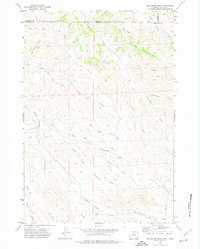
 1970 S R Springs1973 Print · USGSSheridan County ranching country is captured here during the early 1970s, showcasing the intricate drainage systems of the eastern Bighorn Basin. Genealogists and local historians can trace the paths of S R Creek, locate the settlement at Whitmeyer, and find historic water points like Barrel Spring.
 - 1970 Map of Jones Draw, 1973 Print
 1970 Jones Draw1973 Print · USGSSheridan County ranching country is captured here during the early seventies as the railroad and seasonal creeks shaped the landscape. Genealogists and historians can trace the Burlington Northern line and locate local landmarks like the Landing Field and Dutch Creek.
 - 1970 Map of Burgess Junction, 1979 Print
 1970 Burgess Junction1979 Print · USGSThe Bighorn Mountains meet the Tongue River valley in the late 1970s, showcasing a landscape of high-altitude forest and foothill settlements. Genealogists and historians can trace the rail towns of Monarch and Ranchester or locate old mountain landmarks like Steamboat Point and Burgess Junction.
 - 1971 Map of Shuler Draw, 1974 Print
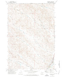
 1971 Shuler Draw1974 Print · USGSNorthern Wyoming’s high plains and drainage networks are captured in the early seventies, showing a landscape defined by seasonal water. Researchers can trace intricate terrain features and early industrial markers like Shuler Draw, Dead Mans Draw, and scattered Drill Hole sites.
 - 1971 Map of Clearmont, 1974 Print
 1971 Clearmont1974 Print · USGSClearmont and the surrounding Sheridan County ranchlands are documented here in the early seventies as the railroad era continued to shape the valley. Researchers can trace the Burlington Northern line and irrigation features like the Pratt and Ferris Ditch.
 - 1971 Map of Roundup Draw, 1974 Print
 1971 Roundup Draw1974 Print · USGSThe high plains along the Montana-Wyoming border appear here in the early 1970s, showcasing a remote ranching landscape defined by seasonal draws and ridges. Researchers can trace land use through features like Antelope Res and family-named landmarks such as David Tiner Draw and Weltner Prong.
 - 1971 Map of Cabin Creek NW, 1974 Print
 1971 Cabin Creek NW1974 Print · USGSThe Montana and Wyoming borderlands are frozen in time here during the early seventies ranching and energy exploration era. Genealogists and historians can trace the intricate drainage of Cabin Creek and locate landmarks like Squaw Butte and Schoolhouse Prong.
 - 1971 Map of Cabin Creek SE, 1974 Print
 1971 Cabin Creek SE1974 Print · USGSThe Powder River valley at the Sheridan and Campbell County line is shown here in the early seventies, during a period of active ranching and water management. You can locate family-named landmarks like K Ranch, trace the Kendrick Canal, and explore the terrain of the Quarter Circle Hills.
 - 1971 Map of Cabin Creek NE, 1974 Print
 1971 Cabin Creek NE1974 Print · USGSThe Montana-Wyoming border comes alive in the early seventies, showcasing a period of active energy exploration along the Powder River. You can trace the infrastructure of the Fence Creek Oil Field and remote landmarks like Hells Half Acre Canyon.
 - 1971 Map of Arvada, 1974 Print
 1971 Arvada1974 Print · USGSSheridan County's high plains meet the Powder River in the early 1970s, showcasing the area's rail and water reliance. Trace the lineage of riverside settlements like Arvada and Kendrick along the Burlington Northern line.
 - 1971 Map of Gardner Gulch, 1975 Print
 1971 Gardner Gulch1975 Print · USGSSheridan County in the early seventies shows a landscape of wide-open ranching terrain and intricate drainage networks. Researchers can trace land use through named features like Olsen, Foster Buttes, and the numerous cattle tanks and wells dotting the draws.
 - 1971 Map of Fawn Draw, 1975 Print
 1971 Fawn Draw1975 Print · USGSSheridan County ranching country is captured in the early seventies, showing a landscape defined by its vital water sources and vast grazing lands. Genealogists and researchers can trace family land boundaries and landmarks like Clear Creek, Olsen Draw, and Chaffee Gulch.
 - 1971 Map of Leiter, 1975 Print
 1971 Leiter1975 Print · USGSSheridan County ranching country is documented here in the early 1970s as the rail and irrigation networks shaped the land. Genealogists and historians can trace the Burlington Northern line through Leiter or locate landmarks like Big Corral and the Pratt and Ferris Ditch No 3.
 - 1971 Map of Box Elder Draw, 1975 Print
 1971 Box Elder Draw1975 Print · USGSAlong the Montana and Wyoming border in the early seventies, this landscape reveals a complex network of seasonal ranching drainages. Genealogists and historians can trace family-named landmarks like Dooley Draw, Grenell Draw, and Seventysix Creek.2 unique versions available
 - 1971 Map of Arvada NE, 1975 Print
 1971 Arvada NE1975 Print · USGSThe Powder River Basin comes into focus during the early 1970s, showing the intersection of heavy rail and ranching life. Genealogists and local historians can locate the Arvada Cemetery and trace the Burlington Northern tracks as they follow Wild Horse Creek.
 - 1971 Map of Julio Draw, 1975 Print
 1971 Julio Draw1975 Print · USGSNorthern Wyoming plains and cattle country are captured in the early seventies, centered on the Sheridan and Johnson county line. Trace historical water rights along the Pratt and Ferris Ditch No 1 and the meandering path of Clear Creek.
 - 1972 Map of Lariat, 1975 Print
 1972 Lariat1975 Print · USGSSheridan County and its neighbors in the early 1970s remained a landscape of cattle ranching and vast drainage systems along the Powder River. Researchers can trace the rail-and-water network near Lariat and find family-named landmarks like Rossnecker Draw and Mickelberry Draw.
 - 1972 Map of Jewell Draw, 1975 Print
 1972 Jewell Draw1975 Print · USGSSheridan and Johnson counties at the start of the 1970s show a landscape shaped by water and ranching. Trace named landmarks like Jewell Draw, The Lake, and Cates Draw across this high plains terrain.
 - 1972 Map of Arpan Butte, 1975 Print
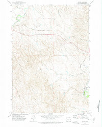
 1972 Arpan Butte1975 Print · USGSThe high plains along the Sheridan and Johnson County line come into focus during the early seventies. Geologists and local historians can trace the intricate drainage systems of Thompson Creek and landmarks like Arpan Butte and Bill Yates Reservoir.
Showing maps 1-25 of 27
Top cities of Sheridan County
Frequently asked questions
- What are the different types of historical maps available for Sheridan County?
- What is the oldest map of Sheridan County?
- Where can I purchase historical maps of Sheridan County for my home or office?
- Where can I download high-res historical maps of Sheridan County?
- Are there historical topographic maps available for Sheridan County?
- Is there historical aerial imagery available for Sheridan County?
- Where are historical maps of Sheridan County sourced from?