1990s Maps of Sheridan County, Wyoming
Explore 28 historic maps of Sheridan County from the 1990s. These maps offer a rare glimpse into what life looked like during the 1990s — showing old roads, neighborhoods, homes, and landmarks that have changed or disappeared over time.
Whether you're researching your family's past, planning a metal detecting trip, or studying how Sheridan County's landscape evolved across the 1990s, these high-resolution maps are a powerful tool for exploring the history of this region.
- Focus on a specific era: All maps on this page are from the 1990s, giving you a focused view of this time period.
- See what’s changed: Compare century-old streets, trails, and buildings to today's modern landscape using overlays and satellite layers.
- Research with precision: Use these maps for genealogy, historical research, land use analysis, or educational projects.
- View, download, or print: Maps are fully viewable online in high resolution, and can be downloaded or printed for your own records.
Start exploring Sheridan County's history through authentic maps from the 1990s. This is your window into the past.
Sheridan County, WY maps
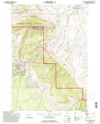
- 1993 Map of Hidden Tepee Creek, 1997 Print
 1993 Hidden Tepee Creek1997 Print · USGSHigh in the Bighorn Mountains during the early nineties, this survey documents the rugged cattle country and high-altitude trails on the county line. Trace the path of the Medicine Wheel Passage Scenic Byway and find remote landmarks like Horse Creek Cow Camp and Sunlight Mesa.
 - 1993 Map of Skull Ridge, 1997 Print
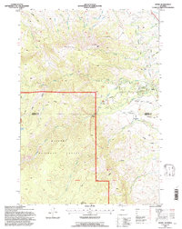
 1993 Skull Ridge1997 Print · USGSSheridan County high country is documented here in the early nineties, showing a landscape defined by forest management and mountain recreation. Trace the routes to Arrowhead Lodge, Sibley Lake, and the remote Yankee Cow Camp.
 - 1993 Map of Mexican Hill, 1997 Print
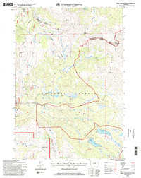
 1993 Mexican Hill1997 Print · USGSThe high wilderness of Big Horn County is captured here in the early 1990s, showcasing the dramatic drainage systems and alpine basins. Researchers can trace seasonal land use at Cow Camp and find landmarks like Bucking Mule Falls and Mexican Hill.
 - 1993 Map of Columbus Peak, 1997 Print
 1993 Columbus Peak1997 Print · USGSThe eastern front of the Bighorn Mountains in Sheridan County shows a landscape defined by ranching and wildlife management. Trace the historic Slack Sch, the Church Ditch, and seasonal drainages like West Pass Creek and Columbus Creek.
 - 1993 Map of Beckton, 1997 Print
 1993 Beckton1997 Print · USGSSheridan County at the edge of the mountains in the early nineties shows a landscape of essential water engineering. Trace the historic route to Beckton or locate the Sheridan Filtration Plant and early irrigation works like Alliance Ditch.2 unique versions available
 - 1993 Map of Ice Creek, 1997 Print
 1993 Ice Creek1997 Print · USGSThe Bighorn Mountains in the early nineties were a landscape of primitive roads and river headwaters near the county line. Researchers can trace the path of the Medicine Wheel Passage Scenic Byway past Burgess Overlook and the Tongue River.
 - 1993 Map of Wolf, 1997 Print
 1993 Wolf1997 Print · USGSSheridan County ranching and forest lands are captured in the early nineties, showing a landscape defined by irrigation and mountain trails. Genealogists and local historians can locate the Wolf Creek Sch, the historic P K Ranch, and the settlement of Wolf.
 - 1993 Map of Bull Elk Park, 1997 Print
 1993 Bull Elk Park1997 Print · USGSThe Bighorn Mountains in the early nineties serve as a backdrop for high-altitude grazing and wildlife management. Genealogists and historians can trace routes like the Marble Quarry Road and locate remote outposts such as Cow Camp and Bull Elk Park.
 - 1993 Map of Granite Pass, 1997 Print
 1993 Granite Pass1997 Print · USGSThe high ridges of the Bighorn Mountains come into focus in the early 1990s as this survey documents the boundary between Sheridan and Big Horn Counties. Researchers can trace the path of the Bighorn Scenic Byway and locate high-altitude landmarks like Granite Pass and Cedar Mountain.
 - 1993 Map of Bald Mountain, 1997 Print
 1993 Bald Mountain1997 Print · USGSBighorn National Forest's high peaks and ancient landmarks are surveyed here in the early nineties, straddling the line between Big Horn and Sheridan Counties. Researchers can locate the Bald Mountain City (Site) and the Medicine Wheel, or trace old roads to Cow Camp and Sheep Camp.
 - 1993 Map of Dayton South, 1997 Print
 1993 Dayton South1997 Print · USGSThe foothills of the Bighorn Mountains come into sharp focus in the early nineties, showing where the mountain canyons meet the irrigation-fed valley near Dayton. You can trace the historic water rights of the South Side Ditch and find the IXL Ranch and Fallen City.2 unique versions available
 - 1993 Map of Boyd Ridge, 1997 Print
 1993 Boyd Ridge1997 Print · USGSThe high ridges of the Bighorn Mountains come into focus in the 1990s as this survey traces the rugged boundary of Sheridan and Big Horn Counties. Researchers can locate remote high-country infrastructure including the Marble Quarry, a lone mountain Cem, and seasonal outposts like Cow Camp.
 - 1993 Map of West Pass, 1997 Print
 1993 West Pass1997 Print · USGSThe Bighorn Mountains during the early nineties show a landscape defined by seasonal grazing and wildlife management. Researchers can trace historic ranching sites like Fuller Ranch and XX Ranch, or locate specialized zones such as the Kerns Winter Range.
 - 1993 Map of Dome Lake, 1997 Print
 1993 Dome Lake1997 Print · USGSHigh-altitude watersheds and granite peaks of the Bighorn Mountains are documented here in the early nineties. Researchers can trace historic water management at Dome Lake Reservoir and Weston Reservoir, or locate landmarks like Saddle Mountain and Preacher Rock.
 - 1993 Map of Beaver Creek Hills, 1997 Print
 1993 Beaver Creek Hills1997 Print · USGSThe foothills of the Bighorn Mountains come alive in the early nineties, revealing a landscape of high-country access and irrigation. Researchers can trace the path of Red Grade Road past the Polo Field and Landing Strip and the winding course of Big Goose Creek.
 - 1993 Map of Burgess Junction, 1997 Print
 1993 Burgess Junction1997 Print · USGSHigh in the Bighorn Mountains during the early nineties, this survey captures a landscape of forestry operations and alpine grazing. Researchers can trace forest management sites like Burgess Work Center and family-named landmarks such as Schuler Park.
 - 1993 Map of Leavitt Reservoir, 1997 Print
 1993 Leavitt Reservoir1997 Print · USGSHigh-country ranching and forest management are central to this part of the Bighorn Mountains in the early nineties. Researchers can trace historic access routes like the Beaver Creek Trail and locate family-named landmarks such as the Leavitt Ranch and Leavitt Reservoir.
 - 1993 Map of Story, 1997 Print
 1993 Story1997 Print · USGSThe foothills of the Bighorn Mountains come alive in the 1990s, where historical sites meet federal forest lands. Researchers can trace the Wagon Box Battle Monument and nearby Ruins, or locate landmarks like the State Fish Hatchery and Thorn Rider Camp near Story.
 - 1993 Map of Woodrock, 1997 Print
 1993 Woodrock1997 Print · USGSBighorn National Forest at the start of the 1990s reveals a high-altitude landscape of timber heritage and remote mountain camps. Genealogists and historians can locate old sites like Woodrock, the Taylor Mine, and the unique Tie Flum logging relic.2 unique versions available
 - 1993 Map of Walker Mountain, 1997 Print
 1993 Walker Mountain1997 Print · USGSSheridan County is seen here during the early 1990s, when resource extraction and forest recreation shaped this high-country terrain. Researchers can locate the Taylor Mine, Quartz Creek Cow Camp, and landmarks like Sawmill Reservoir.2 unique versions available
 - 1993 Map of Shell Reservoir, 1997 Print
 1993 Shell Reservoir1997 Print · USGSBighorn National Forest remains a wild landscape of high peaks and alpine lakes in the early nineties. Researchers can trace the Adelaide Trail to Shell Reservoir or locate the remote Ranger Creek Ranch and Dome Peak.2 unique versions available
 - 1993 Map of Park Reservoir, 1997 Print
 1993 Park Reservoir1997 Print · USGSHigh in the Big Horn Mountains during the 1990s, this area shows a landscape defined by alpine water storage and wilderness retreats. Researchers can trace historic mountain sites like Spear-O-Wigwam Resort, Tepee Lodge, and the remote Bishop Mine.
 - 1993 Map of Little Goose Peak, 1997 Print
 1993 Little Goose Peak1997 Print · USGSHigh in the Big Horn Mountains during the 1990s, this survey captures the intersection of wilderness and historic ranching history. Researchers can locate the Gen Crooks Camp, the Penrose Guard Station, and remote landmarks like Bosin Rock.
End of results
Showing maps 1-23
Top cities of Sheridan County
Frequently asked questions
- What are the different types of historical maps available for Sheridan County?
- What is the oldest map of Sheridan County?
- Where can I purchase historical maps of Sheridan County for my home or office?
- Where can I download high-res historical maps of Sheridan County?
- Are there historical topographic maps available for Sheridan County?
- Is there historical aerial imagery available for Sheridan County?
- Where are historical maps of Sheridan County sourced from?