1960s Maps of Sheridan County, Wyoming
Explore 42 historic maps of Sheridan County from the 1960s. These maps offer a rare glimpse into what life looked like during the 1960s — showing old roads, neighborhoods, homes, and landmarks that have changed or disappeared over time.
Whether you're researching your family's past, planning a metal detecting trip, or studying how Sheridan County's landscape evolved across the 1960s, these high-resolution maps are a powerful tool for exploring the history of this region.
- Focus on a specific era: All maps on this page are from the 1960s, giving you a focused view of this time period.
- See what’s changed: Compare century-old streets, trails, and buildings to today's modern landscape using overlays and satellite layers.
- Research with precision: Use these maps for genealogy, historical research, land use analysis, or educational projects.
- View, download, or print: Maps are fully viewable online in high resolution, and can be downloaded or printed for your own records.
Start exploring Sheridan County's history through authentic maps from the 1960s. This is your window into the past.
Sheridan County, WY maps
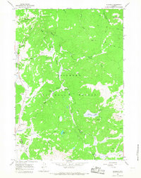
(42)- 1960 Map of Boyd Ridge, 1962 Print
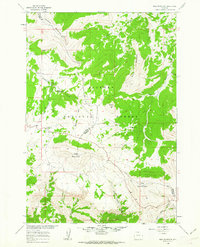
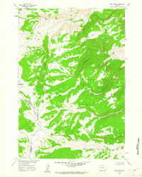 1960 Boyd Ridge1962 Print · USGSHigh in the northern Bighorns during the late fifties, this area was a landscape of remote resource extraction and steep drainages. Researchers can trace the industrial footprint of the Marble Quarry and follow the high-country paths of Boyd Ridge and Wagon Box Creek.3 unique versions available
 - 1960 Map of Mexican Hill, 1962 Print
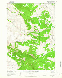 1960 Mexican Hill1962 Print · USGSThe high country of the Big Horn Mountains comes alive in this early 1960s survey of the county line. Trace remote footpaths and landmarks like Cow Camp, Bucking Mule Falls, and the steep terrain of Devils Canyon.2 unique versions available
 - 1960 Map of Granite Pass, 1962 Print
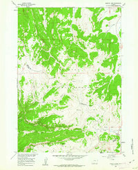 1960 Granite Pass1962 Print · USGSHigh in the Bighorn Mountains during the early sixties, this terrain shows the divide between Sheridan and Big Horn counties. Trace high-altitude landmarks and water sources like Granite Pass, Copemans Tomb, and Three Springs.2 unique versions available
 - 1960 Map of Hidden Tepee Creek, 1962 Print
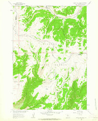 1960 Hidden Tepee Creek1962 Print · USGSHigh in the Big Horn Mountains during the early sixties, this terrain showcases a landscape defined by livestock grazing and forest management. Researchers can find seasonal outposts like Horse Creek Cow Camp and trace the winding paths of Hunt Mountain Road and Hidden Tepee Creek.2 unique versions available
 - 1960 Map of Bald Mountain, 1962 Print
 1960 Bald Mountain1962 Print · USGSThe high Bighorn Mountains at the start of the 1960s reveal a landscape of remote ranger stations and alpine camps. Researchers can locate the historic Bald Mountain City (Site) or trace the Sheep Mountain Road past Rooster Hill and Bald Mountain.3 unique versions available
 - 1960 Map of Leavitt Reservoir, 1963 Print
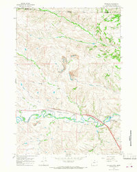
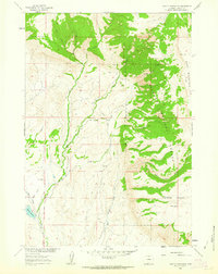 1960 Leavitt Reservoir1963 Print · USGSBig Horn County at the start of the 1960s showcases a high-desert landscape managed for ranching and water storage. Researchers can locate the Leavitt Ranch, trace the path of the London Ditch, and explore the terrain of Hunt Mountain and Horse Creek Mesa.3 unique versions available
 - 1962 Map of Sheridan
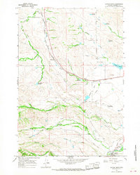
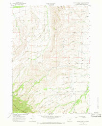
 1962 Sheridan1962 Print · USGSThe Big Horn Mountains and Powder River country are captured here in the early sixties as energy production and ranching shaped northern Wyoming. Researchers can locate specific sites like the Kleenburn Coal Tipple, Eaton Bros Ranch, and the Fort McKenzie Veteran Hospital.
 - 1964 Map of Burgess Junction, 1967 Print
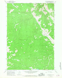
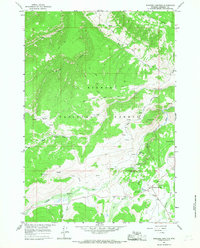 1964 Burgess Junction1967 Print · USGSBighorn National Forest in the mid-1960s showcases a high-country landscape of ranching camps and early mountain tourism. Local historians can trace the sites of Wolfe Cow Camp, the Burgess Ranger Station, and the industrial footprint of a local Sawmill.3 unique versions available
 - 1964 Map of Wolf, 1967 Print
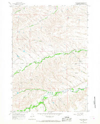
 1964 Wolf1967 Print · USGSSheridan County ranching and the mountain front are captured here in the mid-1960s. Genealogists and local historians can trace family-named sites like P K Ranch, the Wolf Creek Sch, and the high forest boundary at Windy Canyon.
 - 1964 Map of Ranchester, 1967 Print
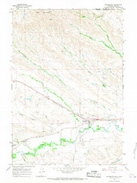 1964 Ranchester1967 Print · USGSRanchester and the surrounding Tongue River valley are shown in the mid-1960s, where the railroad and irrigation systems define the local landscape. Researchers can trace the path of the Chicago Burlington and Quincy railroad and find local landmarks like Mikado, City Park, and the complex Wolf Ditch network.2 unique versions available
 - 1964 Map of Dayton North, 1967 Print
 1964 Dayton North1967 Print · USGSSheridan County ranching and rail infrastructure are on full display in the mid-1960s, just south of the Montana border. Researchers can trace the Chicago Burlington and Quincy rail line and local landmarks like Bear Claw Ranch and Padlock Ranch.2 unique versions available
 - 1964 Map of Monarch, 1967 Print
 1964 Monarch1967 Print · USGSThe Tongue River valley in the 1960s serves as a hub of Wyoming mining and rail activity. Researchers can trace the industrial footprint of the Strip Mine workings and locate the Monarch Cem near the company towns of Monarch and Kleenburn.2 unique versions available
 - 1964 Map of Dayton South, 1968 Print
 1964 Dayton South1968 Print · USGSSheridan County's mountain front is captured here in the mid-sixties, where the town of Dayton meets the high peaks. Local researchers can trace family lands such as the IXL Ranch, locate the Cemetery, or find the old Tongue River Cave.
 - 1964 Map of Skull Ridge, 1968 Print
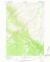
 1964 Skull Ridge1968 Print · USGSSheridan County's high-country terrain in the 1960s reveals a landscape shaped by forest service camps and cattle ranching. Trace early mountain recreation and industry at Sibley Lake, the Yonkee Cow Camp, and along the historic Eureka Ditch Trail.
 - 1964 Map of Walker Mountain, 1968 Print
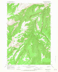
 1964 Walker Mountain1968 Print · USGSThe Bighorn Mountains in the mid-sixties were a landscape of remote trails and high-country industry. Researchers can trace the routes of the Bear Trail and Game or Pack Trail to find old sites like the Taylor Mine and Quartz Creek Cow Camp.3 unique versions available
 - 1964 Map of Beckton, 1968 Print
 1964 Beckton1968 Print · USGSThe foothills and high forests of Sheridan County are captured here in the mid-1960s, showing the high-country trails and water infrastructure of the day. Researchers can trace the Tepee Trail and Pack Trail through the Bighorn National Forest or locate the Historical Marker near Beckton.2 unique versions available
 - 1964 Map of Woodrock, 1968 Print
 1964 Woodrock1968 Print · USGSBighorn National Forest territory at the Sheridan and Big Horn county line was a landscape of ranching camps and forest service outposts in the mid-1960s. Researchers can trace high-country life through sites like Padlock Cow Camp, the Taylor Mine, and the Woodrock Guard Sta.2 unique versions available
 - 1964 Map of Dome Lake, 1968 Print
 1964 Dome Lake1968 Print · USGSThe high Bighorn Mountains are documented in the mid-1960s, showing a landscape of reservoirs, alpine lakes, and early forest service infrastructure. Researchers can trace historic access routes like the Pack Trail and locate sites like Preacher Rock and the Ranger Creek Campground.
 - 1964 Map of Columbus Peak, 1968 Print
 1964 Columbus Peak1968 Print · USGSIn the mid-1960s, this portion of Sheridan County was a landscape of high forest peaks and foothill ranching. You can trace early travel and utility routes through the Bighorn National Forest by locating the Stock Driveway, Ditch No 1, and the rural community at Slack.
 - 1964 Map of Ice Creek, 1968 Print
 1964 Ice Creek1968 Print · USGSThe high country of the Bighorn Mountains is captured in the mid-1960s, showing a landscape defined by seasonal cattle ranching and deep drainage basins. Researchers can locate the Kane Cow Camp and trace remote paths like the Jeep Trail through Dayton Gulch.
 - 1964 Map of Bull Elk Park, 1968 Print
 1964 Bull Elk Park1968 Print · USGSSheridan County high country comes into focus in the mid-1960s, showing a landscape defined by the Little Bighorn River and the high basins of the Bighorn National Forest. Trace the old Pack Trail and Jeep Trail routes past Bull Elk Park, Leaky Mountain, and seasonal Cow Camps.2 unique versions available
 - 1964 Map of Hultz Draw, 1968 Print
 1964 Hultz Draw1968 Print · USGSSheridan County's high-plains landscape was defined by its intricate water systems and rural outposts in the 1960s. Genealogists and researchers can trace local landmarks like the Big Goose Sch, the Alliance Ditch, and the namesake Hultz Draw.3 unique versions available
 - 1964 Map of Shell Reservoir, 1968 Print
 1964 Shell Reservoir1968 Print · USGSHigh in the Bighorn Mountains during the mid-sixties, this survey documents the rugged wilderness and high-altitude water systems of Northern Wyoming. Researchers can trace remote alpine trails and early ranching sites like Ranger Creek Ranch, Shell Reservoir, and Adelaide Lake.3 unique versions available
 - 1964 Map of West Pass, 1968 Print
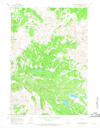
 1964 West Pass1968 Print · USGSSheridan County ranching and mountain terrain are captured here in the mid-1960s, showing a landscape defined by cattle ranges and wilderness trails. Genealogists and local historians can locate early homesteads like Fuller Ranch, X X Ranch, and remote outposts such as Cow Camp.
 - 1964 Map of Beaver Creek Hills, 1968 Print
 1964 Beaver Creek Hills1968 Print · USGSSheridan County ranch land meets the mountains in the mid-1960s, showing the high-country transitions of the Beaver Creek Hills. Researchers can trace old mountain routes like Red Grade Road or locate specialized landmarks such as the Polo Field and Landing Strip.3 unique versions available
Showing maps 1-25 of 42
Top cities of Sheridan County
Frequently asked questions
- What are the different types of historical maps available for Sheridan County?
- What is the oldest map of Sheridan County?
- Where can I purchase historical maps of Sheridan County for my home or office?
- Where can I download high-res historical maps of Sheridan County?
- Are there historical topographic maps available for Sheridan County?
- Is there historical aerial imagery available for Sheridan County?
- Where are historical maps of Sheridan County sourced from?